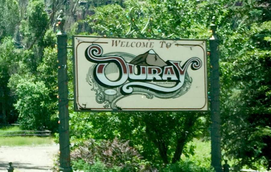
Day 39-42 Sat-Tue, July 11-14, 2015 Ouray, CO

Hip Hip Ouray!

We love Ouray, Colorado!!

It is pronounced “you-ray;” self-proclaimed Jeep capital of the World and Little Switzerland because of the towering jagged snow-covered mountain peaks.

Welcome to ouray

Day 1 Saturday:

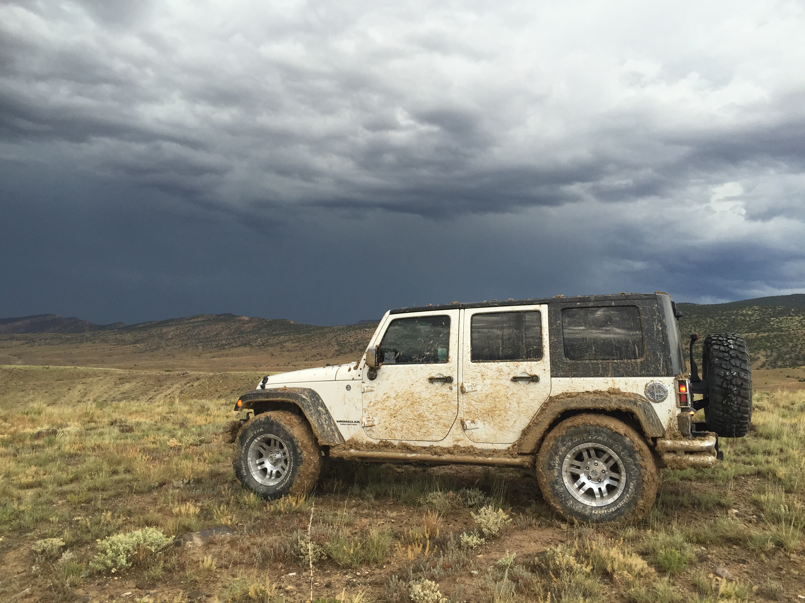
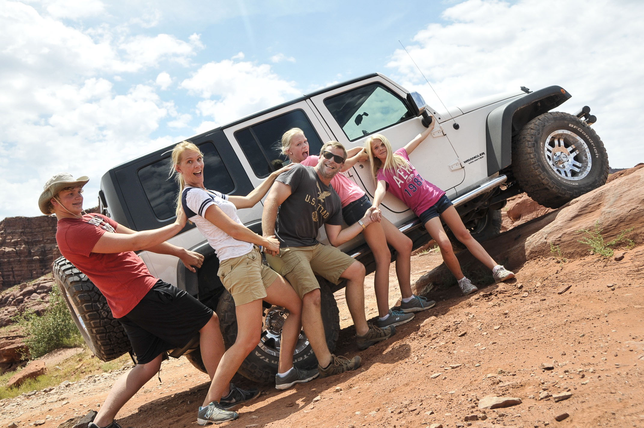
We arrived into town after lunch and wasted no time hitting the trails.

Photo Jul 11, 4 24 18 PM

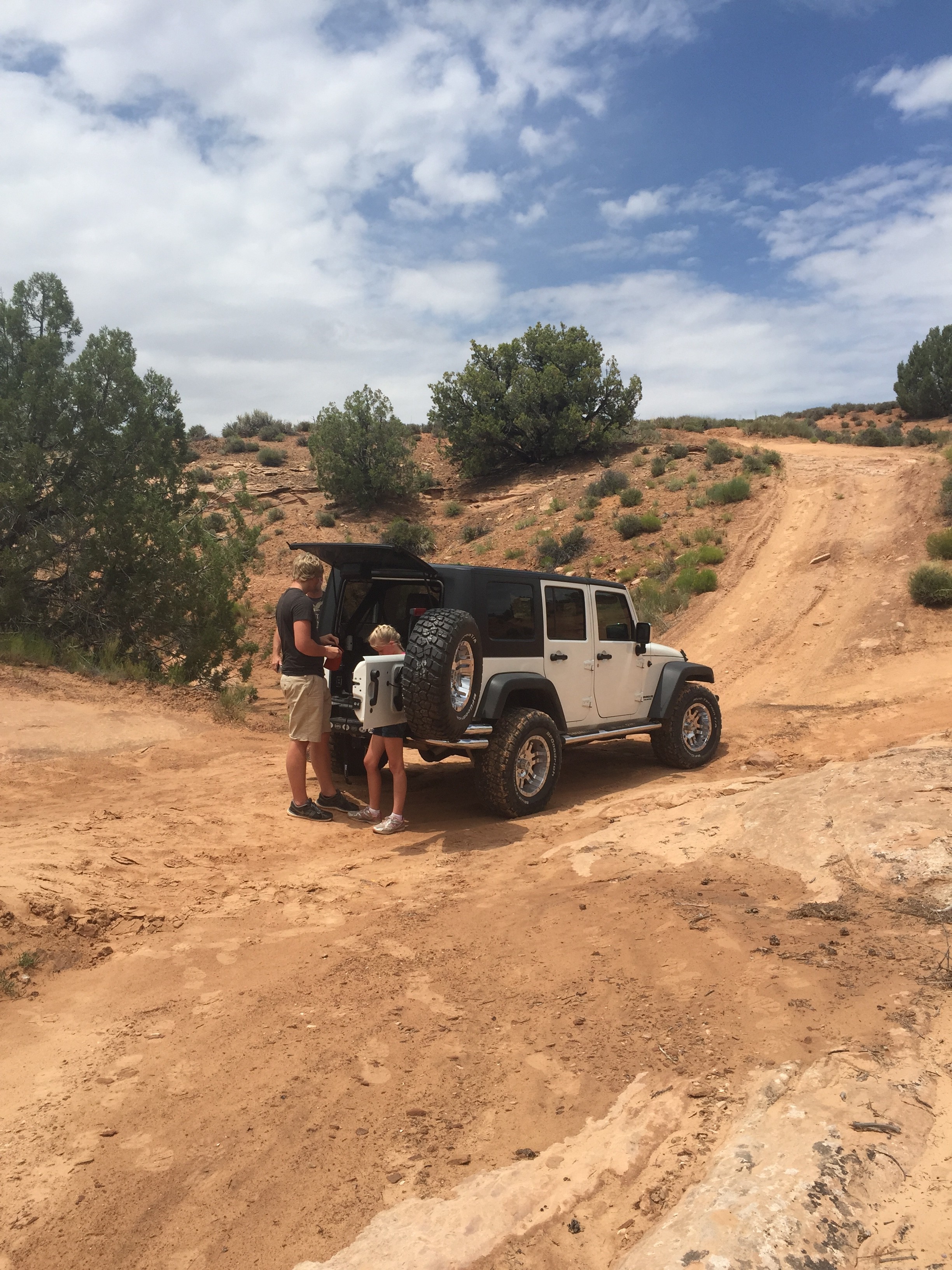
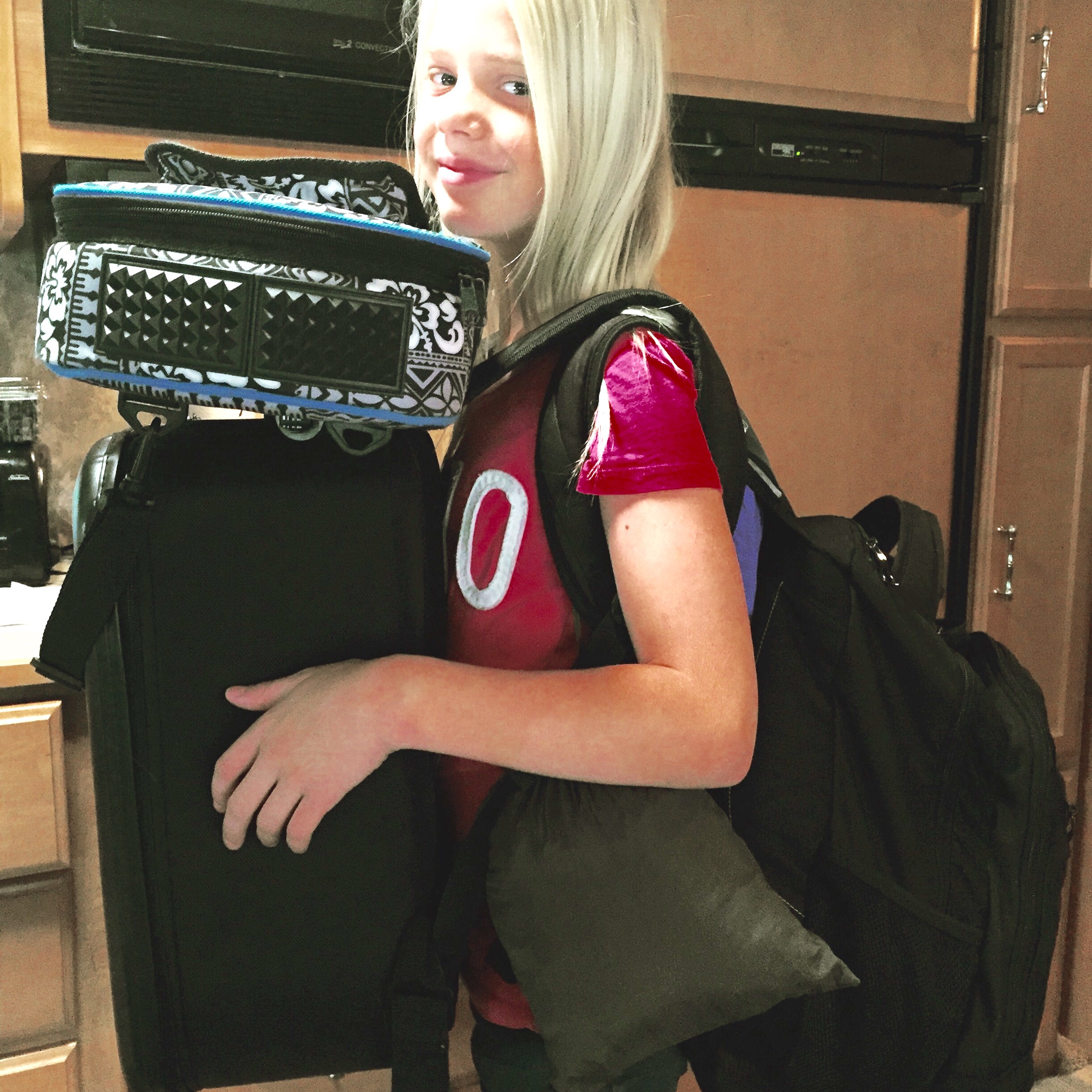
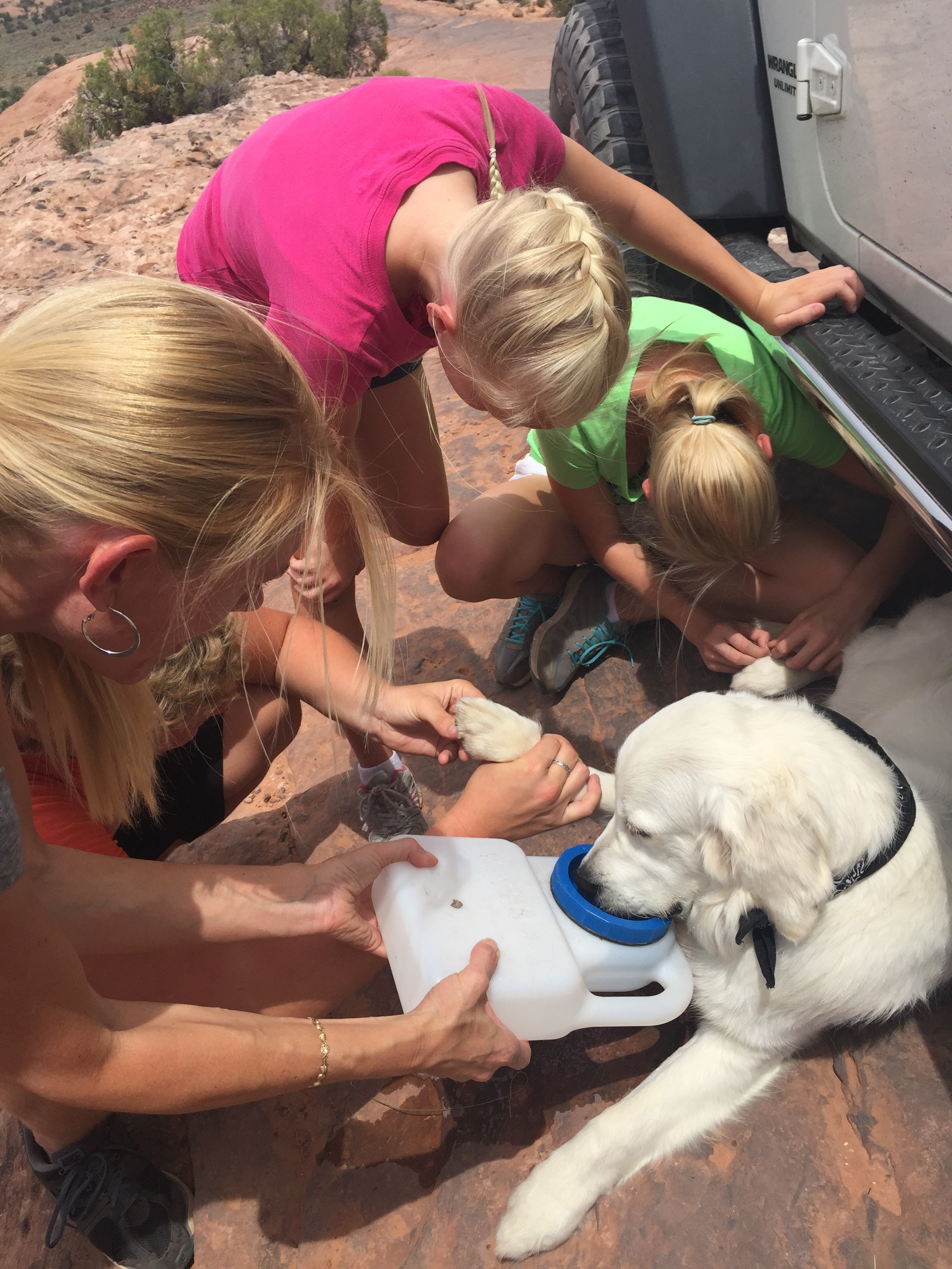
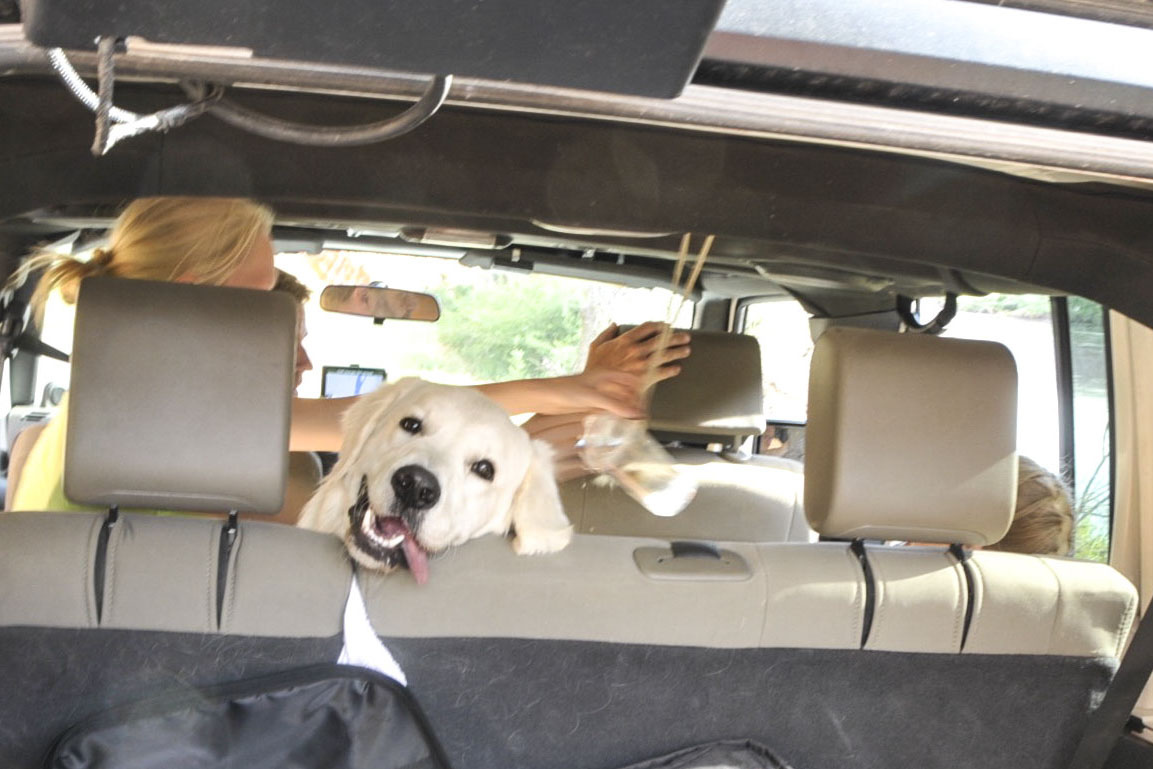
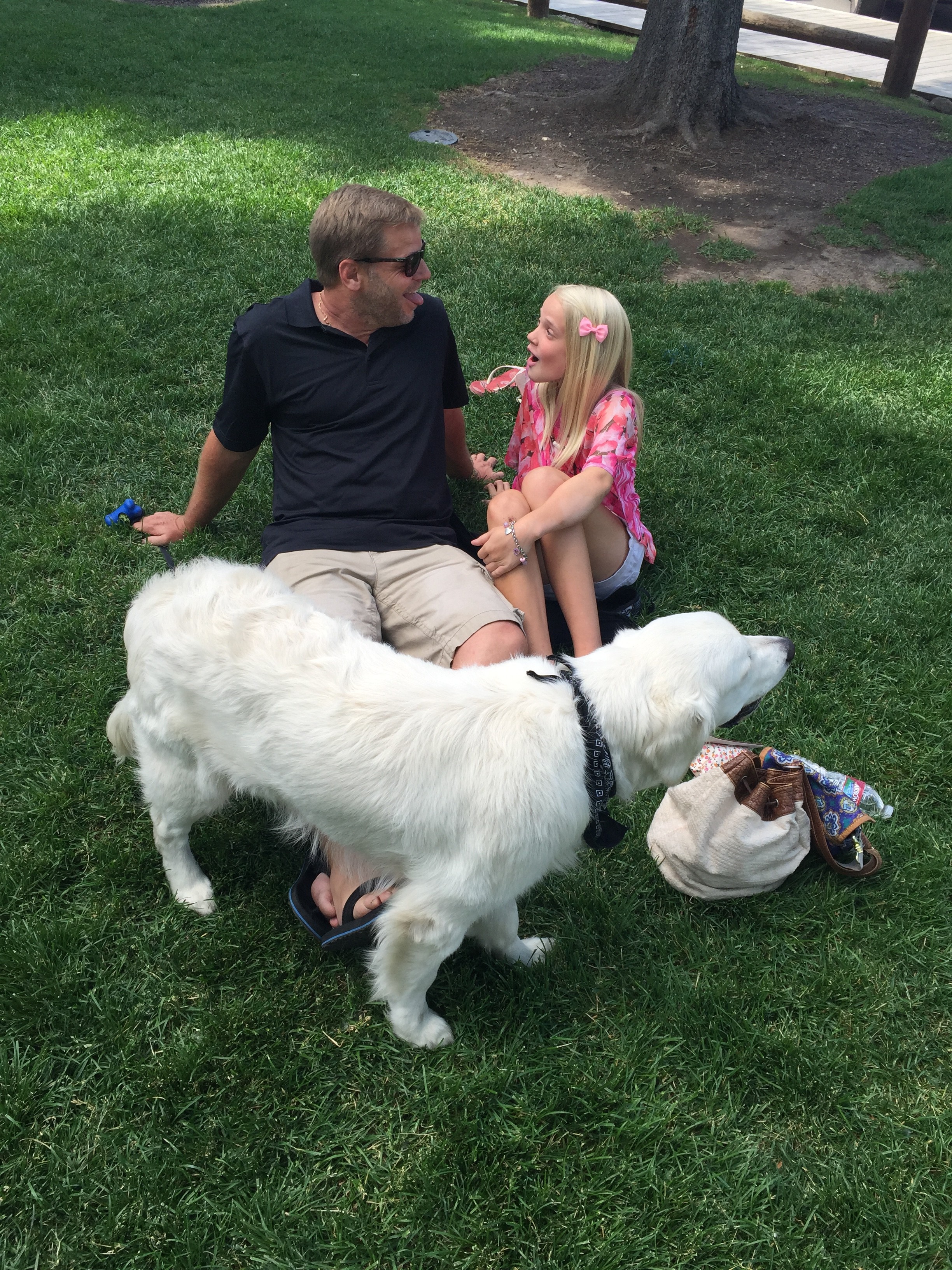
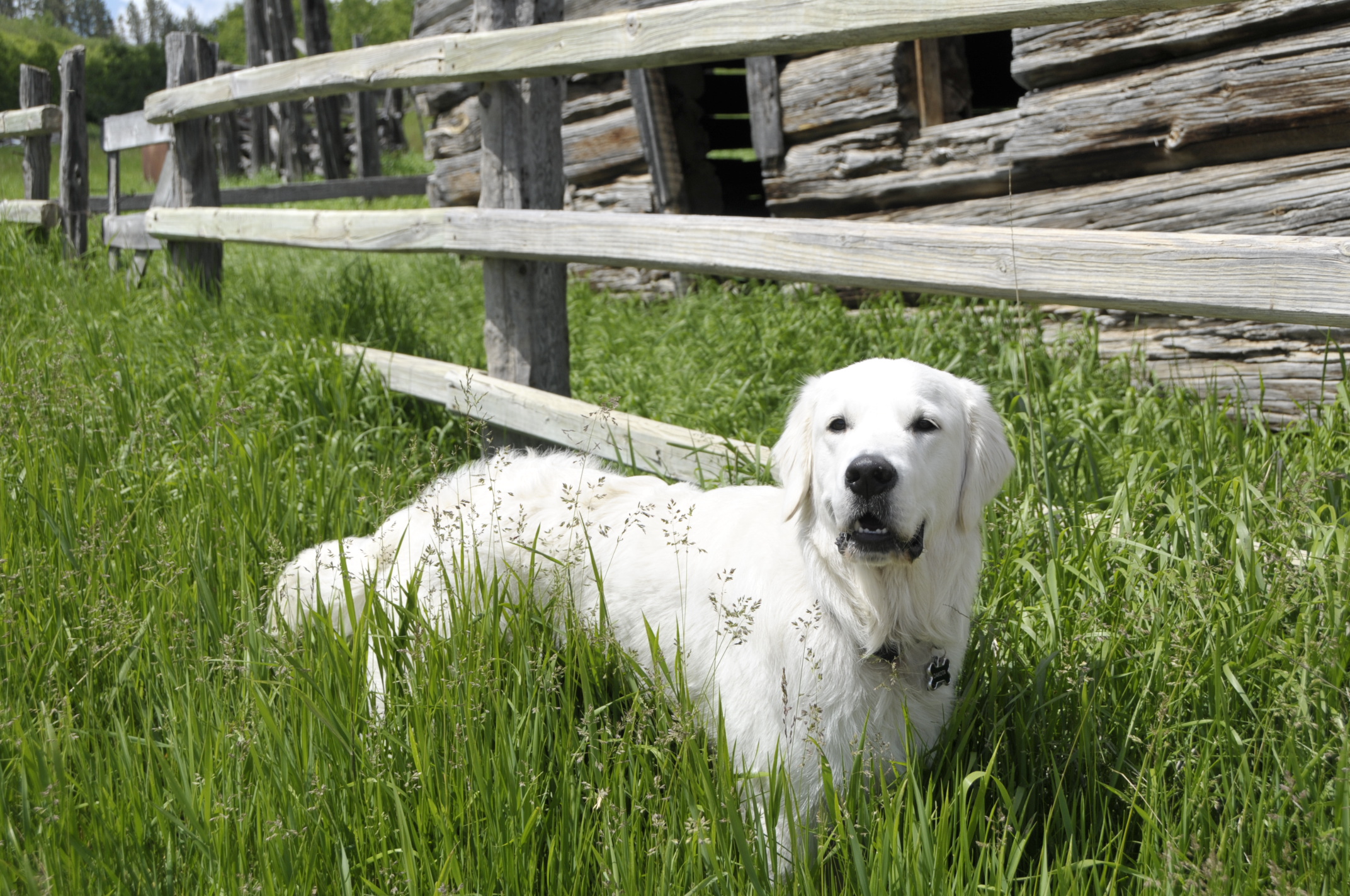
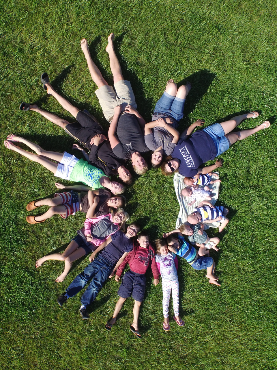
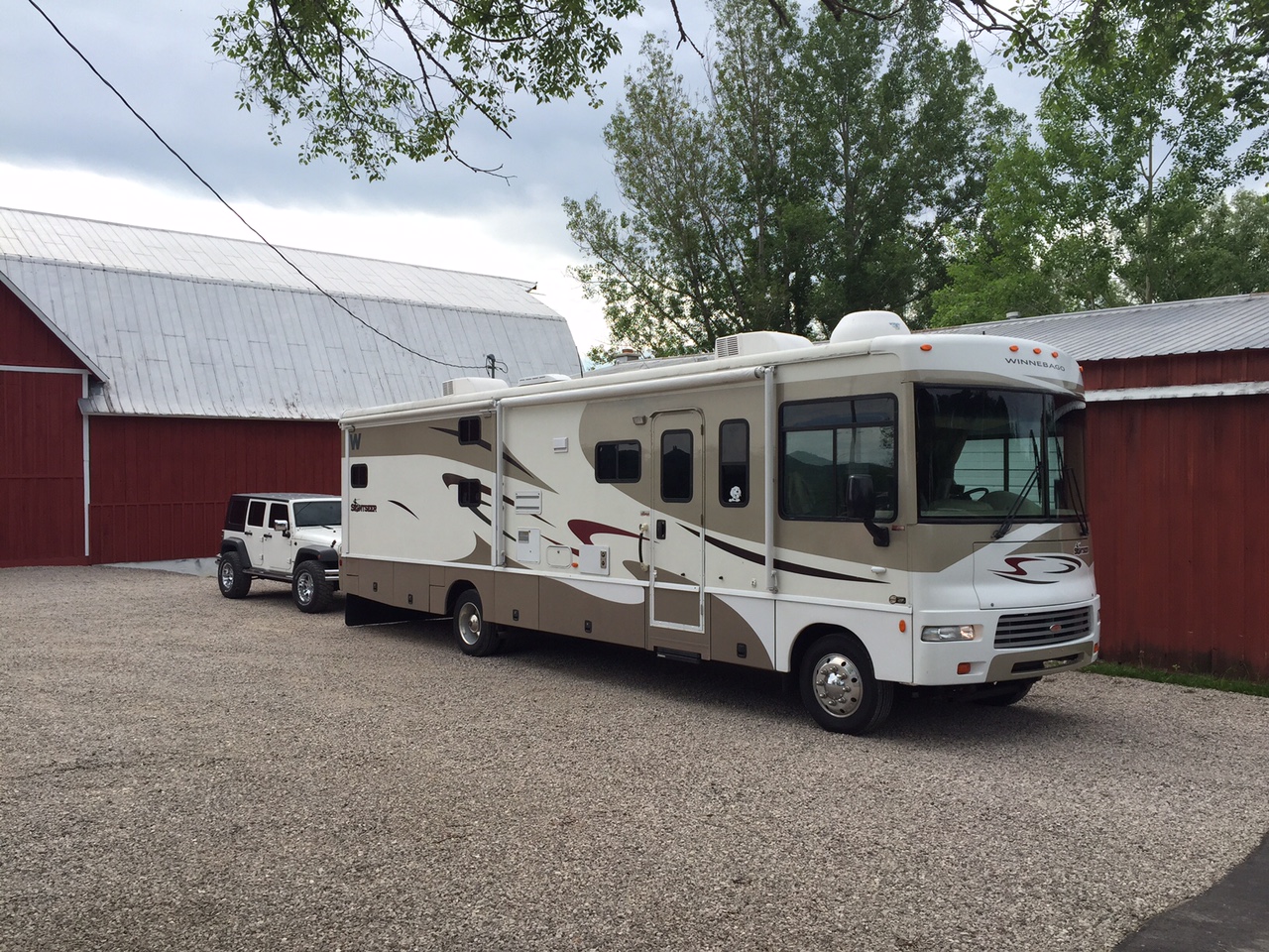
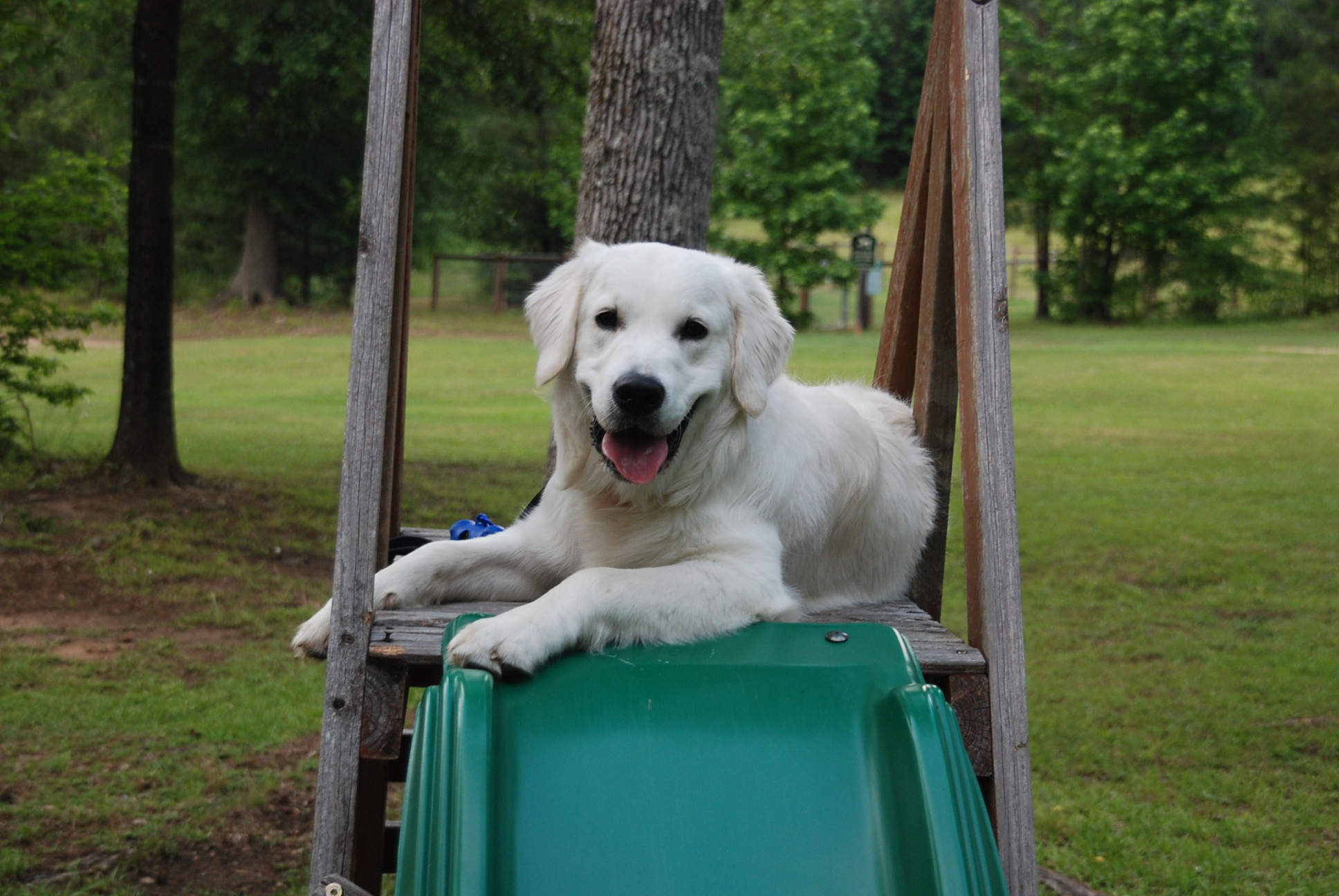
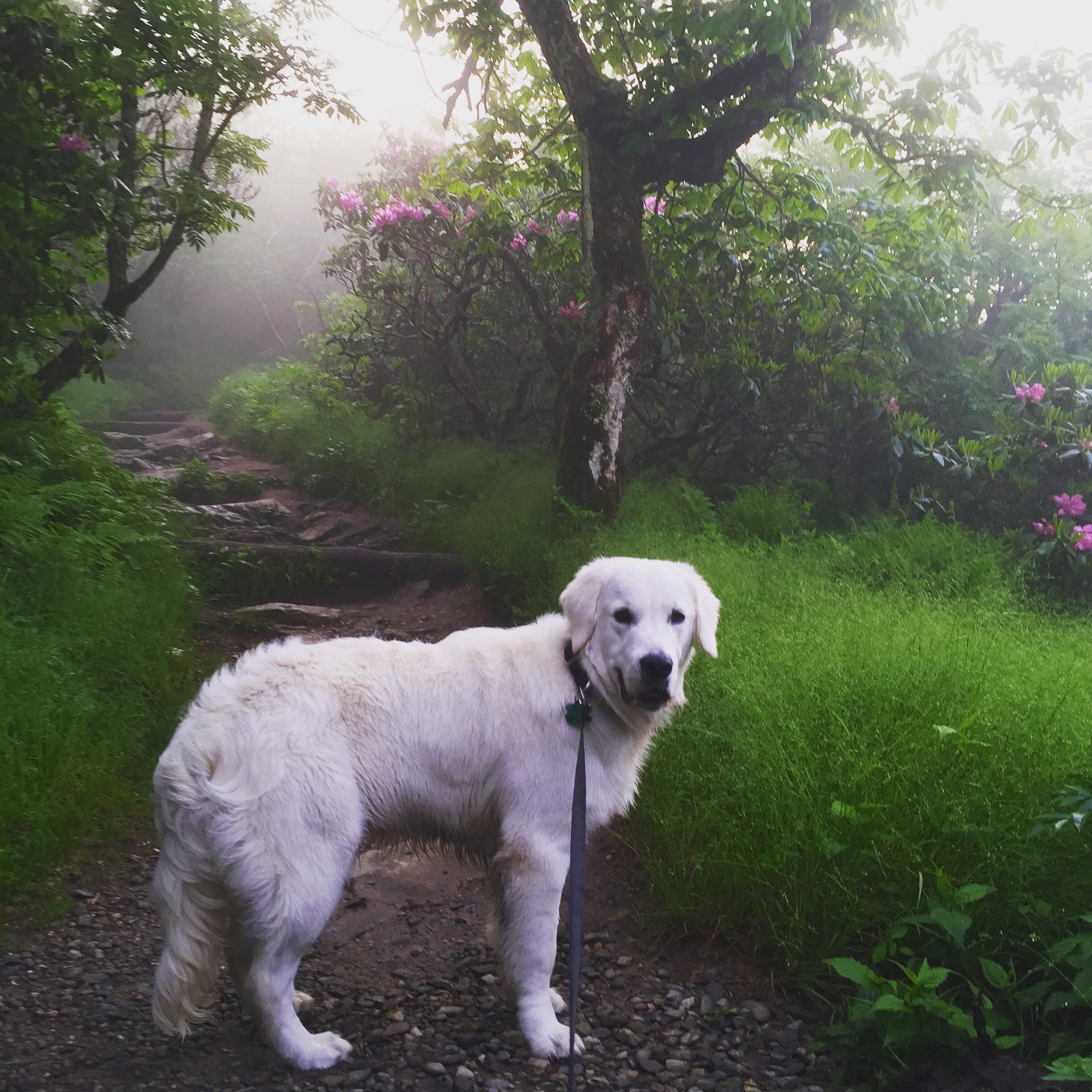
Dakota knows what the open trunk means! He is 9 months old now and finally figured out he could jump into the trunk all by himself. 🙂


Day 1 - YB 1-a  Day 1 - YB 3

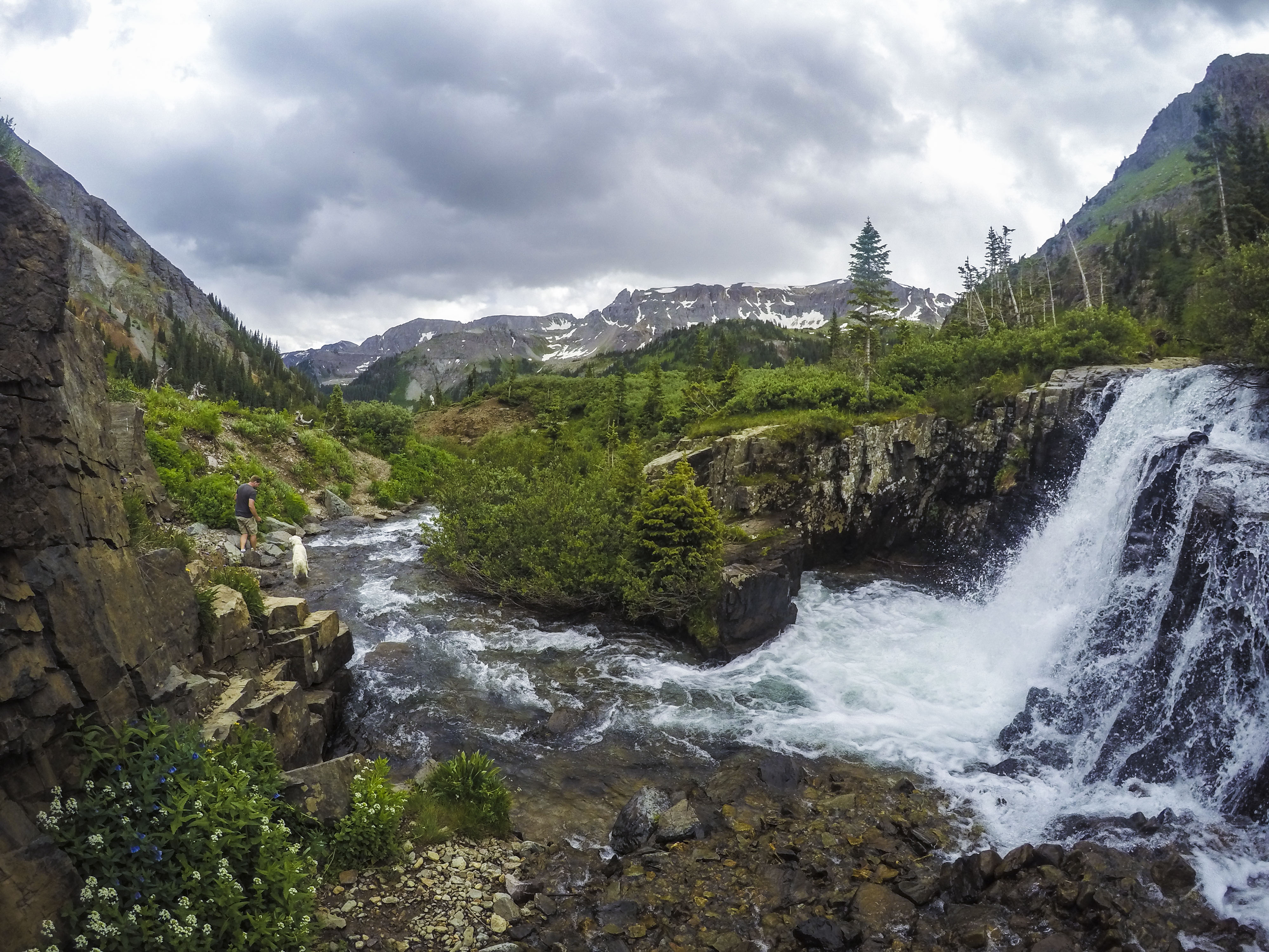
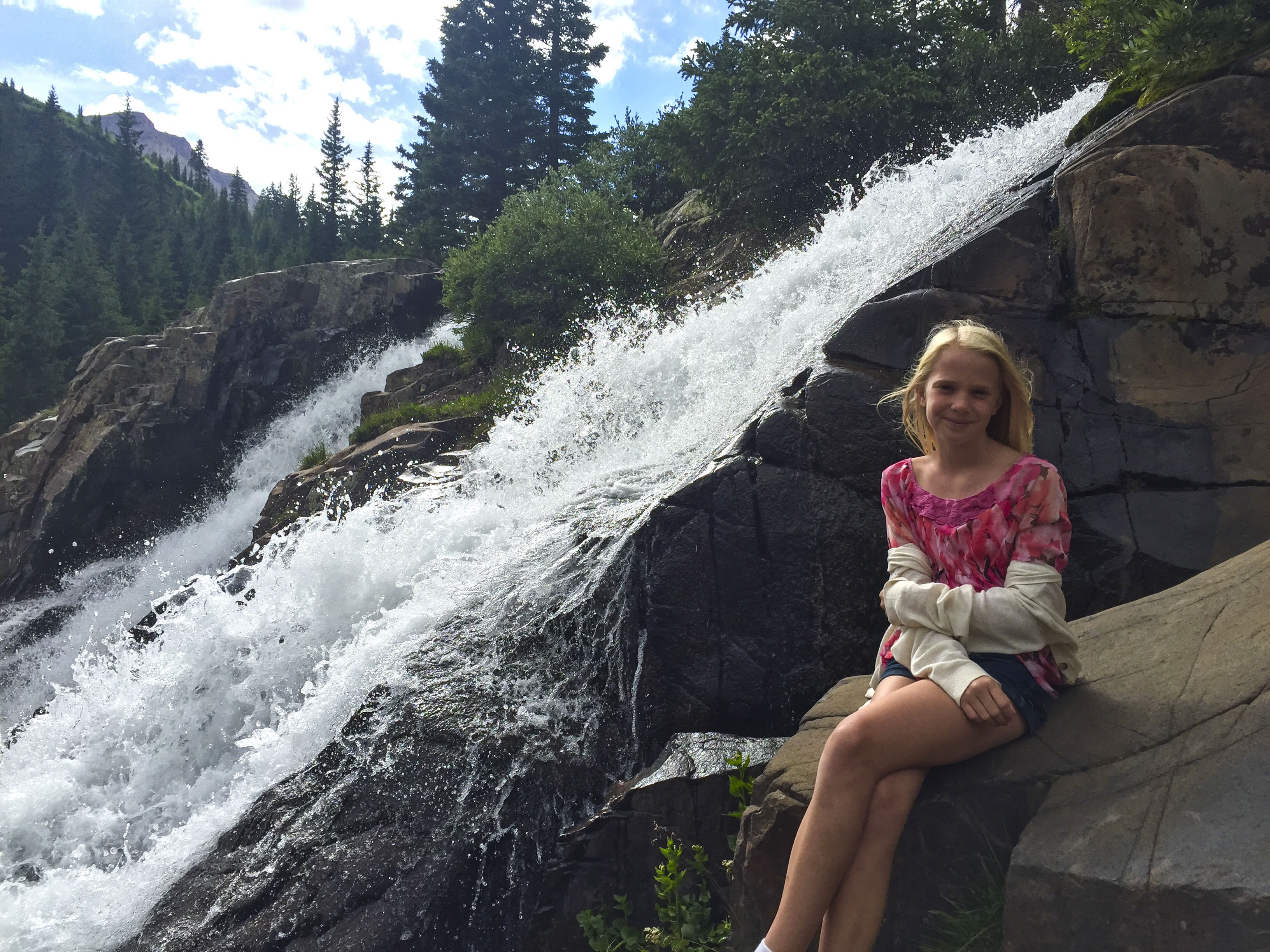
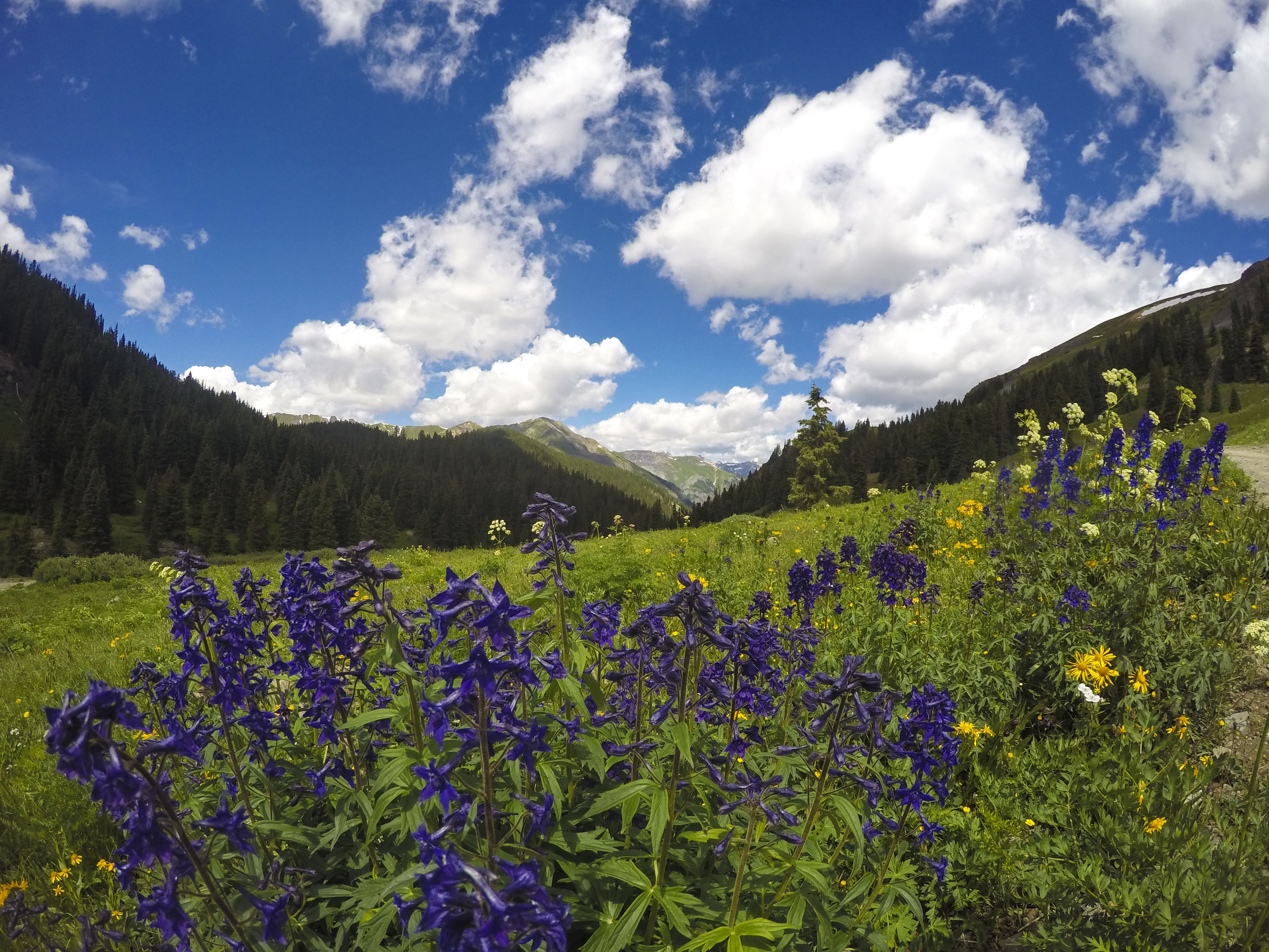
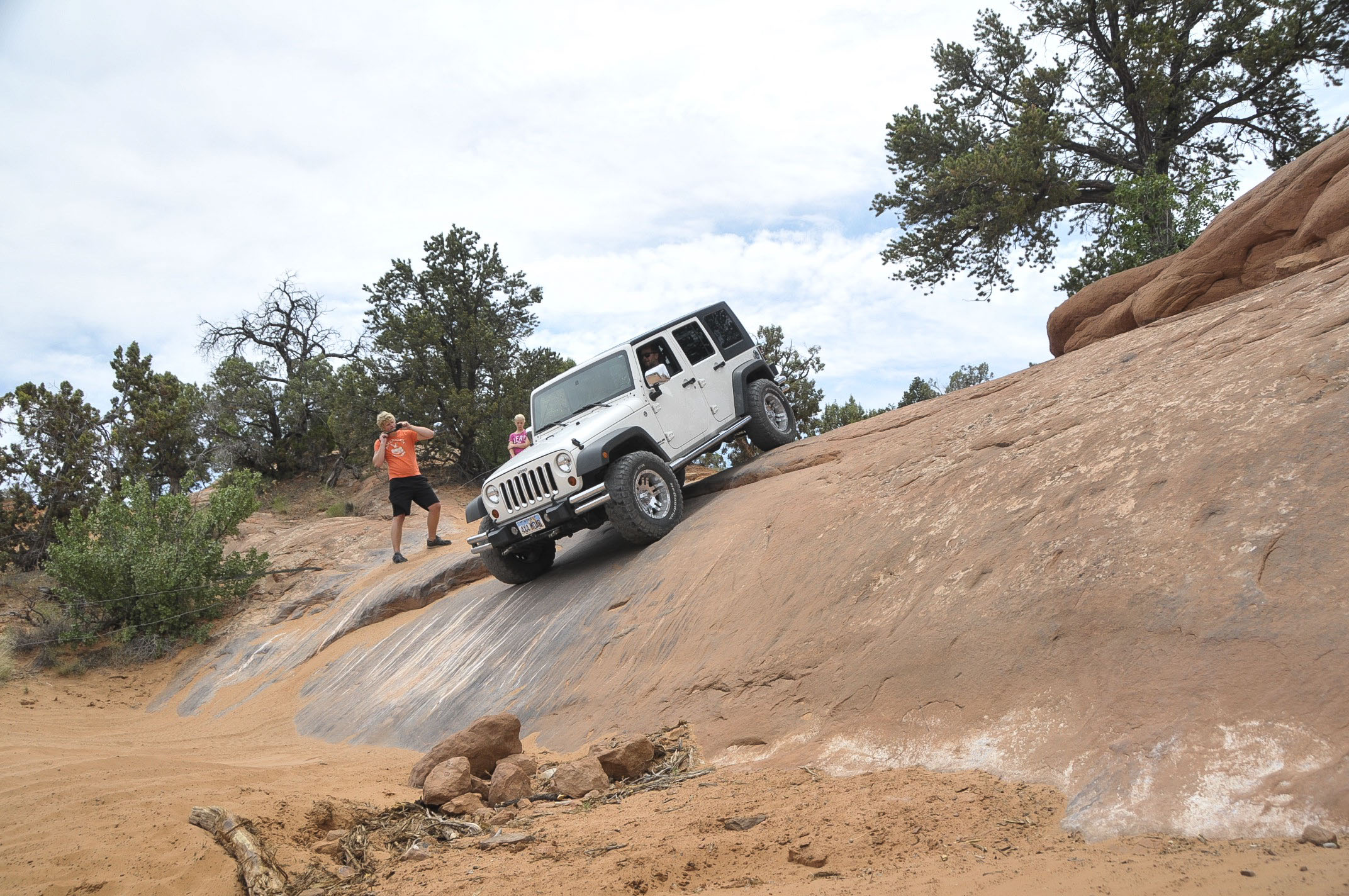
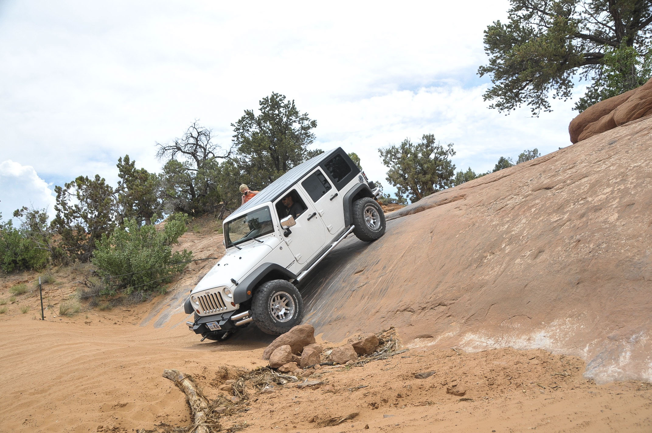
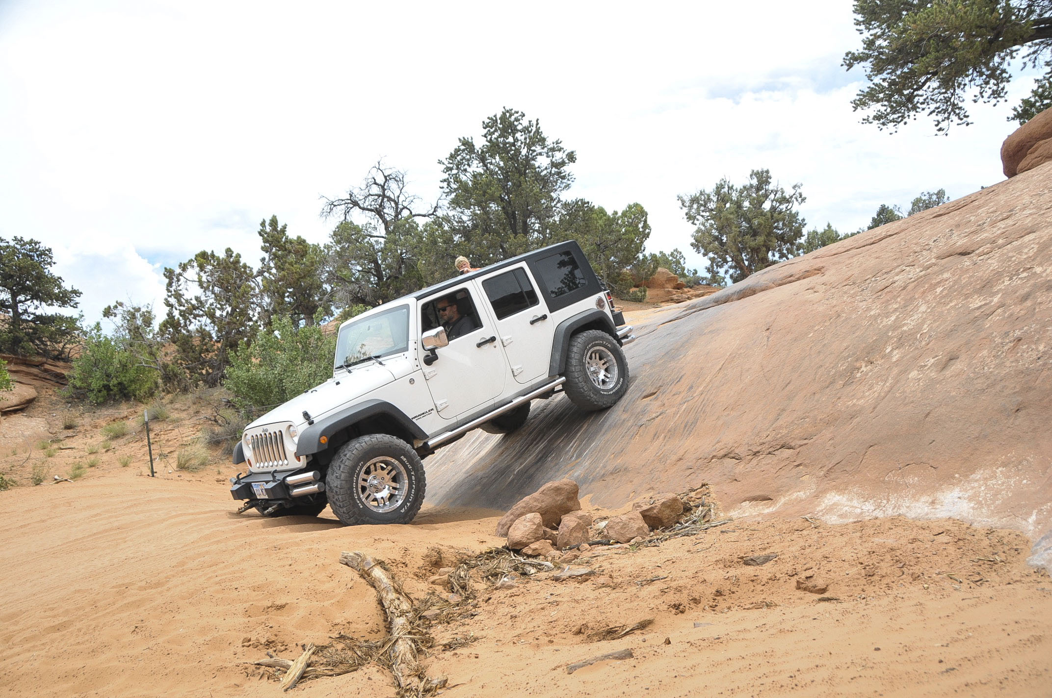
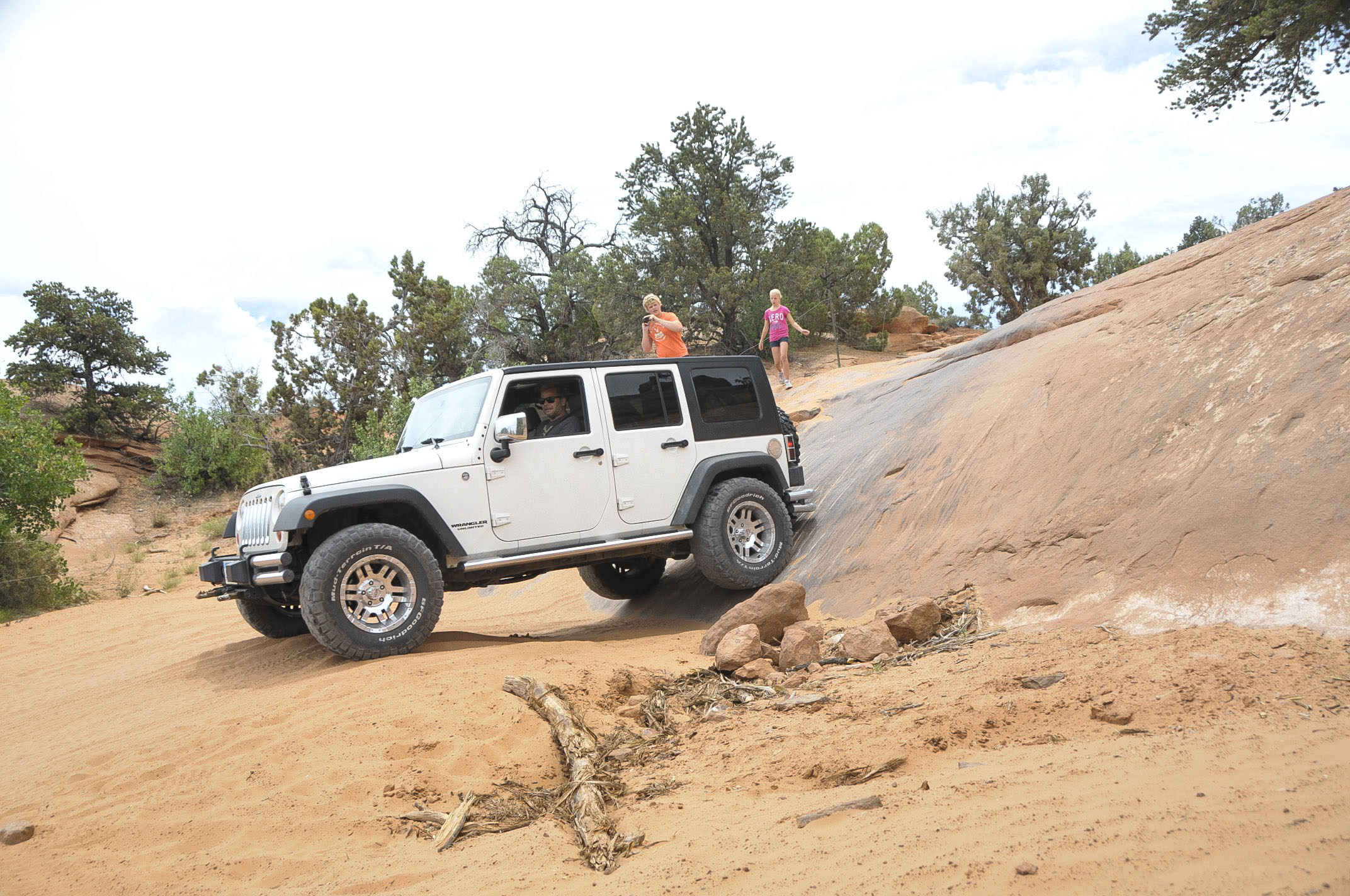
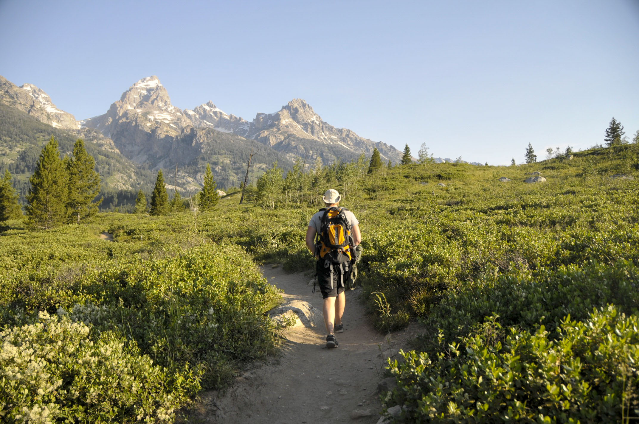
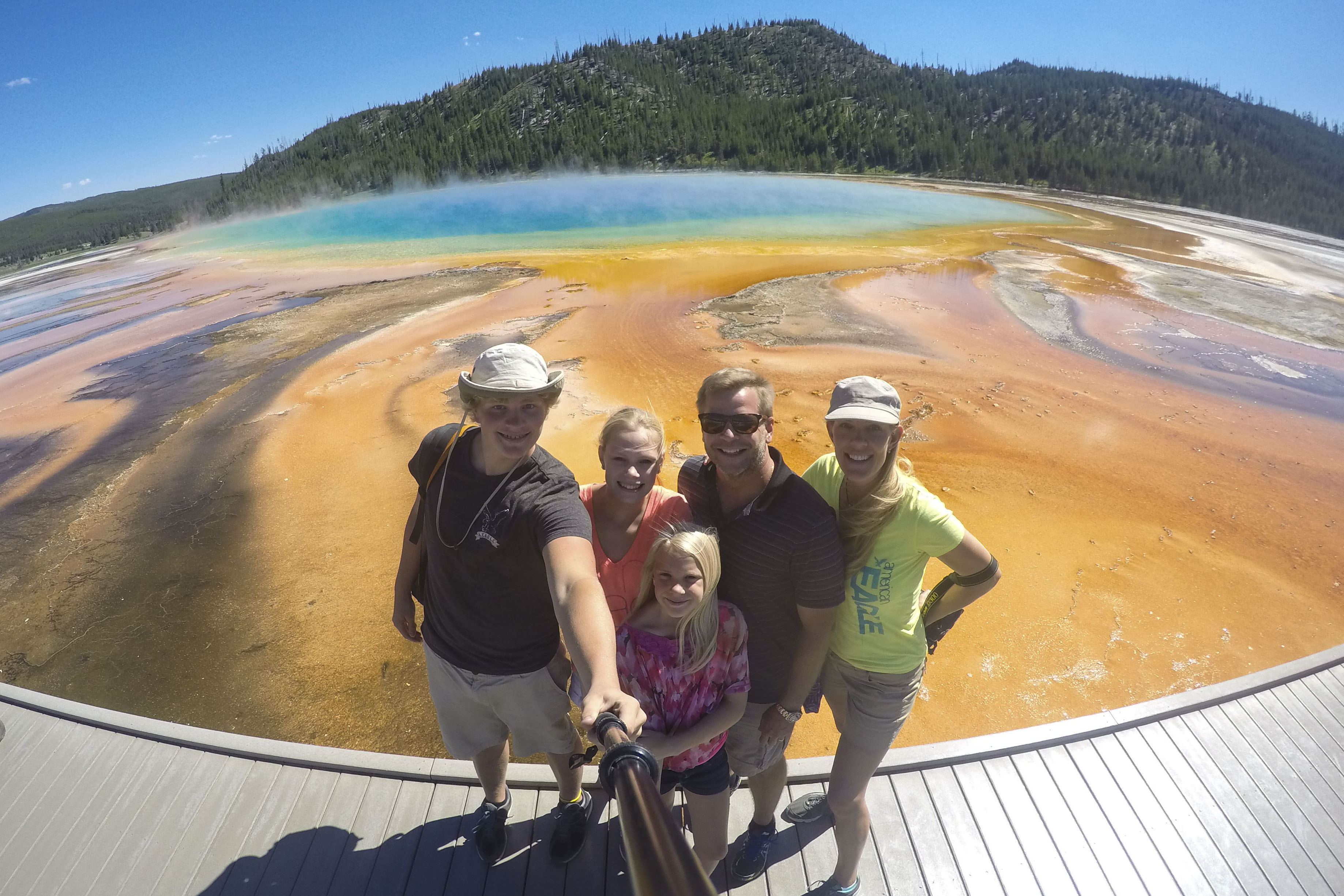
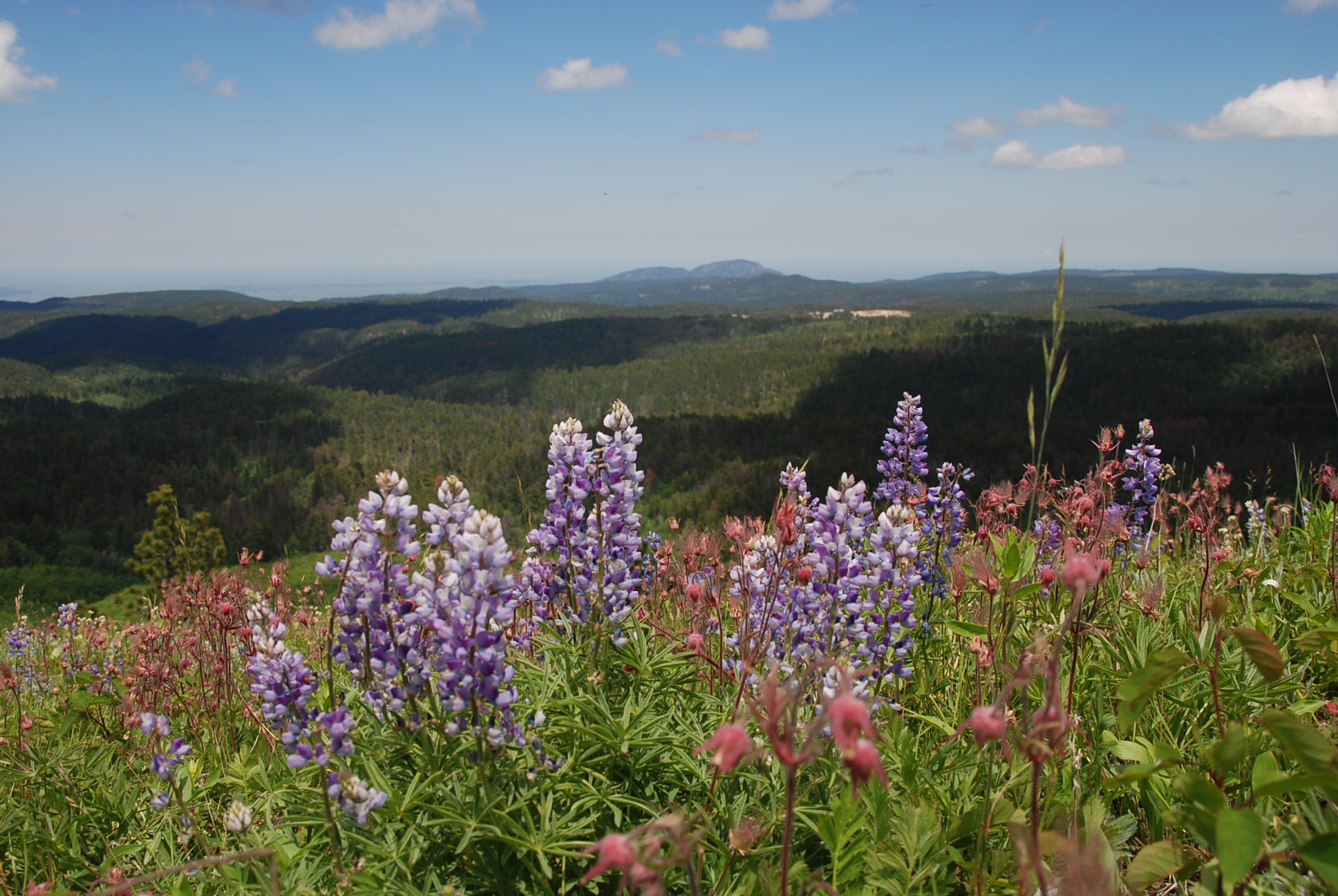
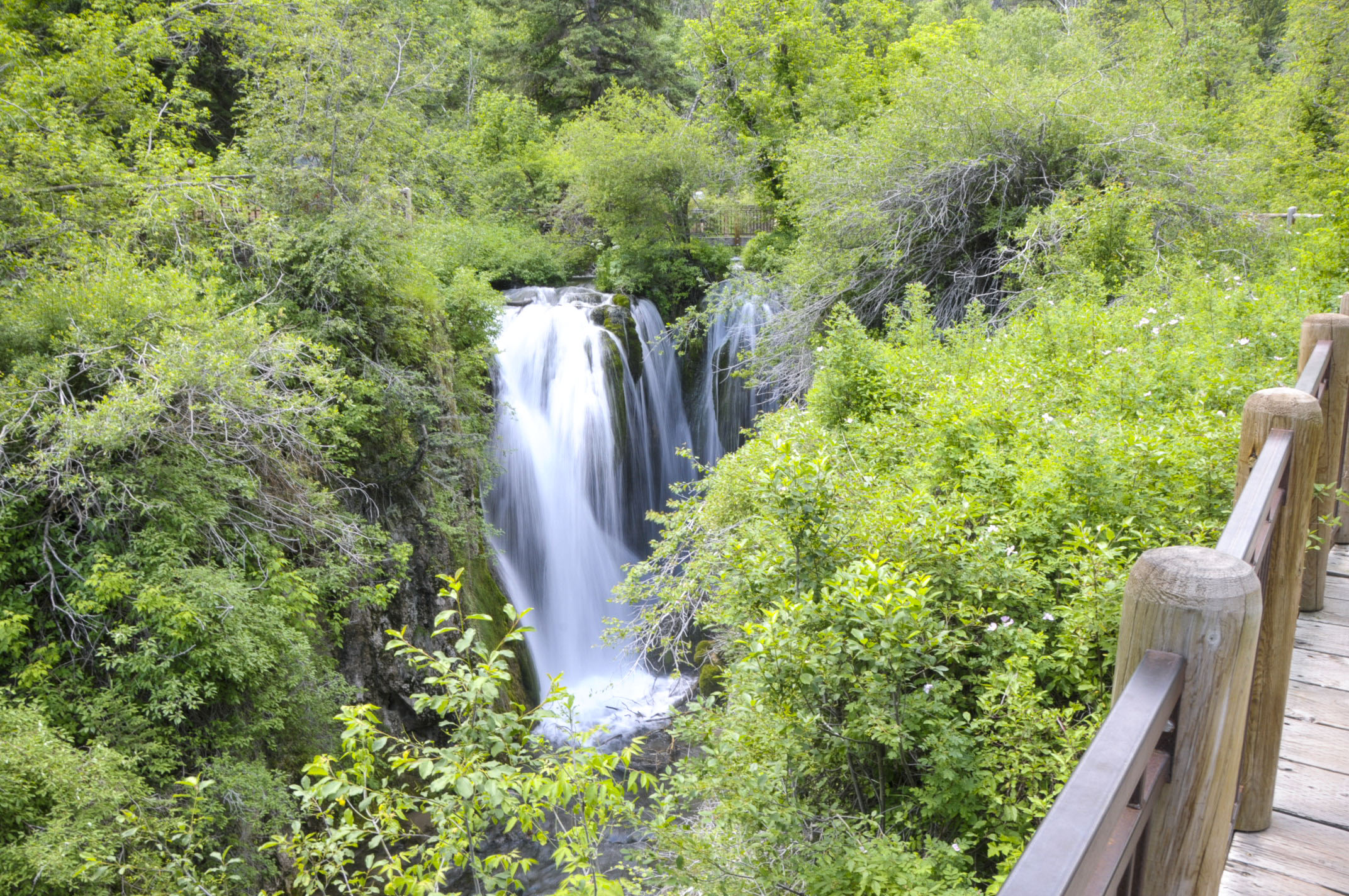
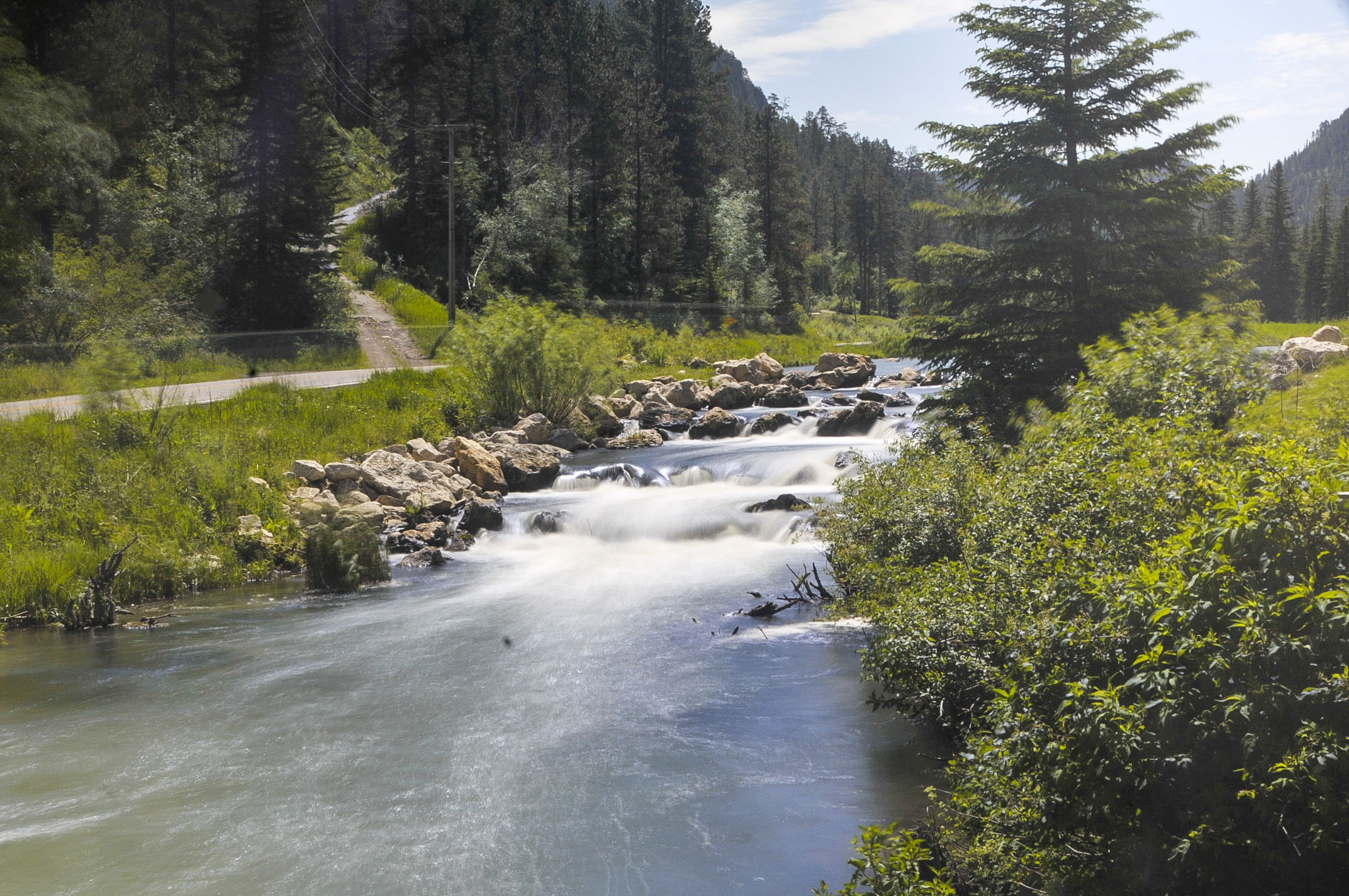
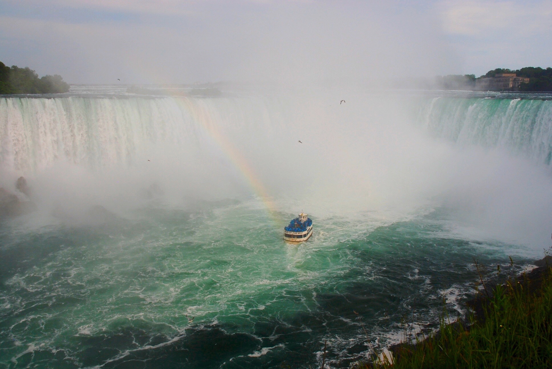
Just 45 minutes up the nearest mountain lies “Yankee Boy Basin,” a very popular site for piture-taking because of the abundant wild-flowers and pretty swiss models. (Actually, the twin waterfalls are the main attraction for most of the explorers.)

Photo Jul 11, 5 11 26 PM-a

This is where Coors filmed their beverage commercial. Recognize it?


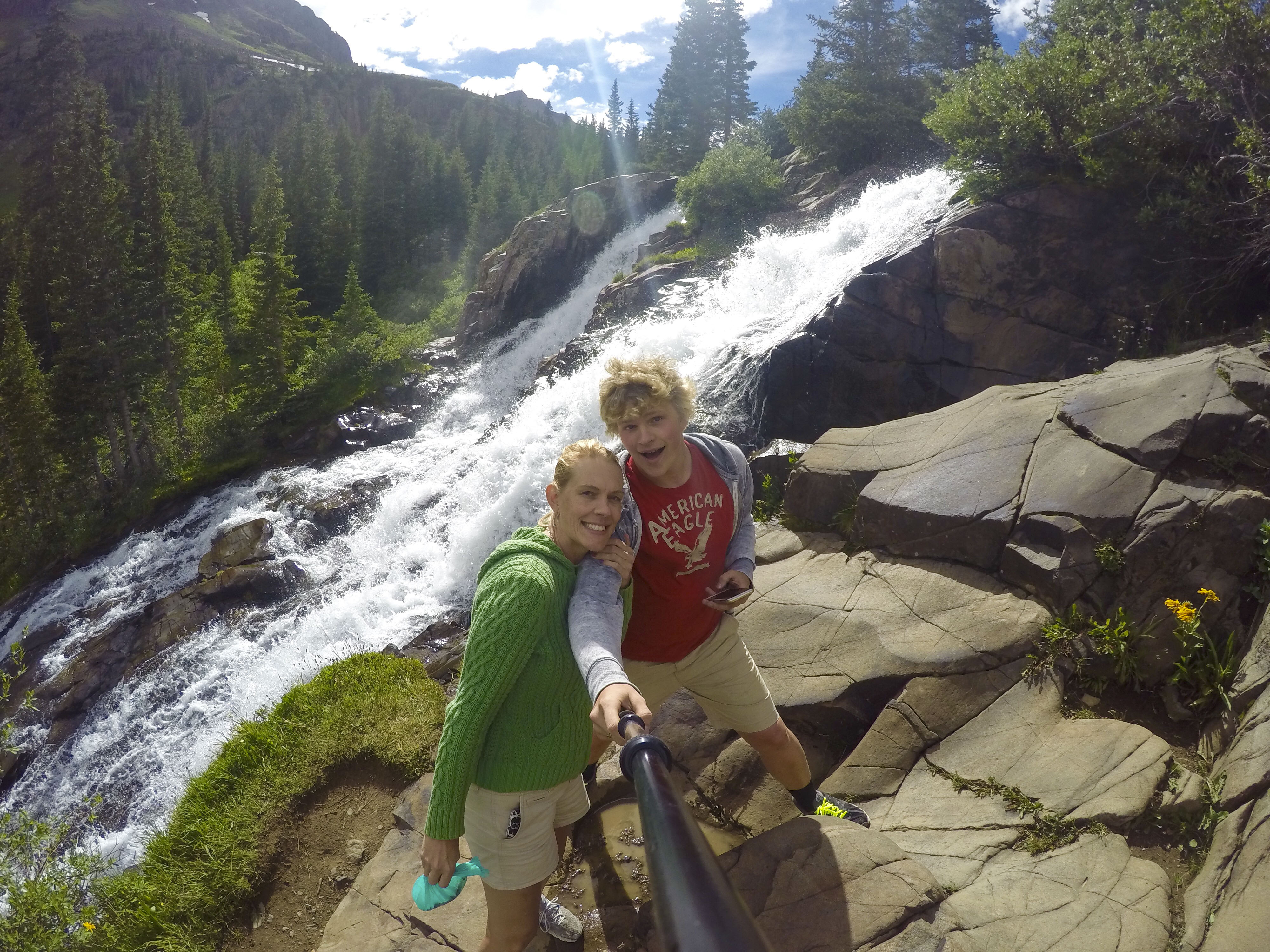
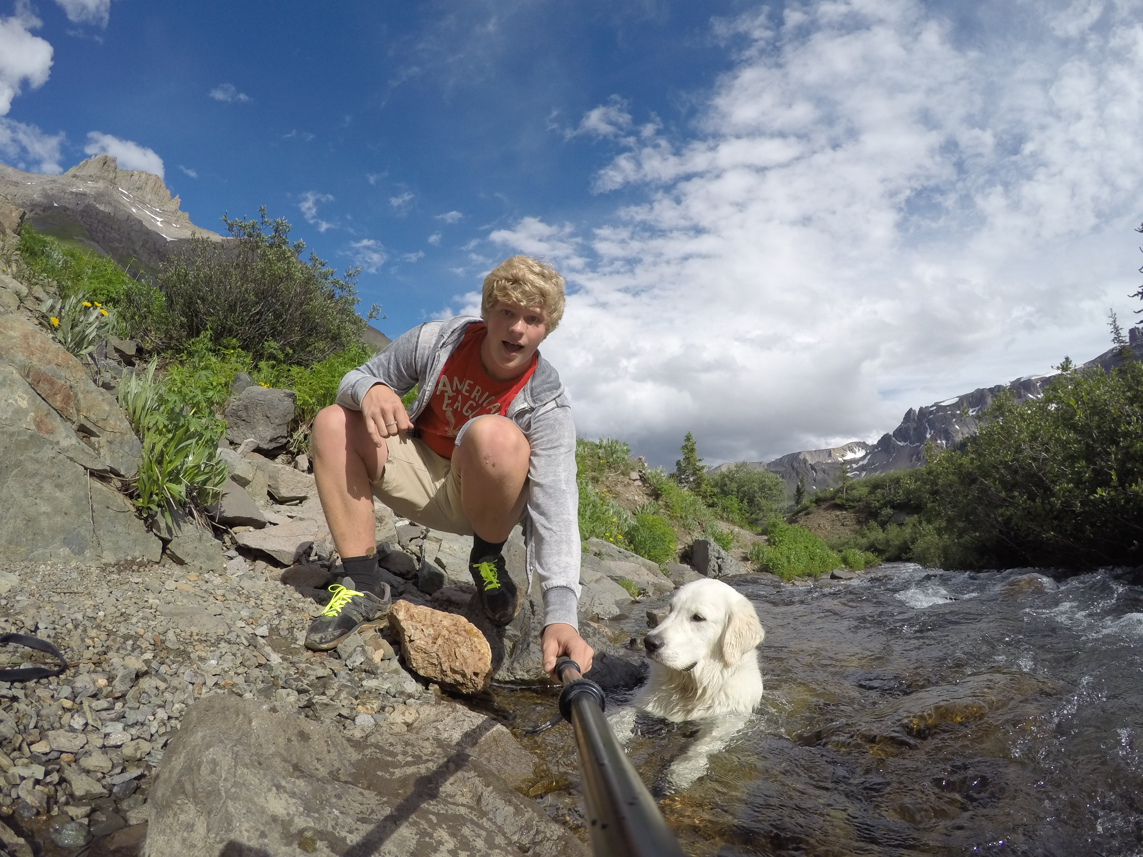
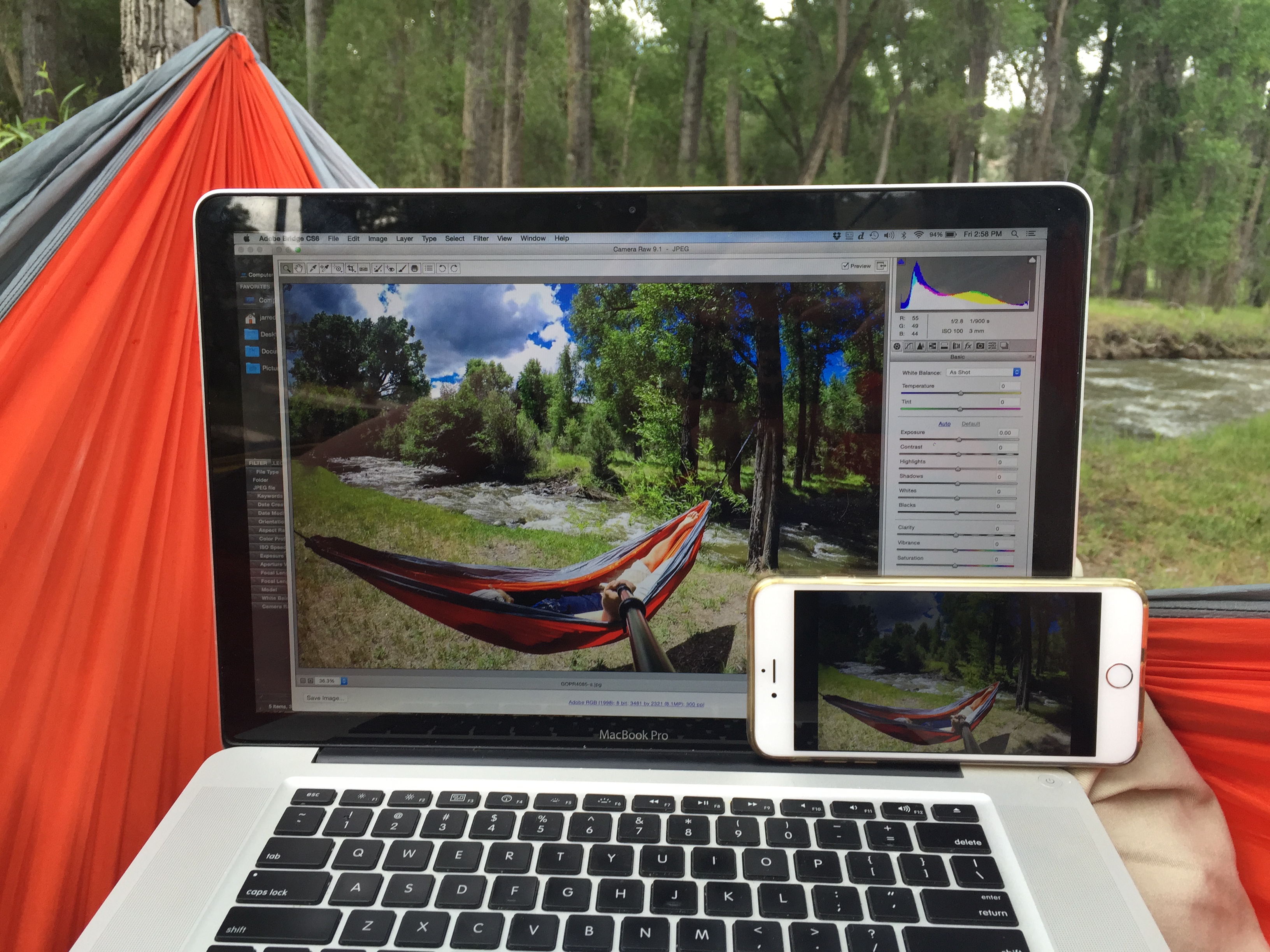
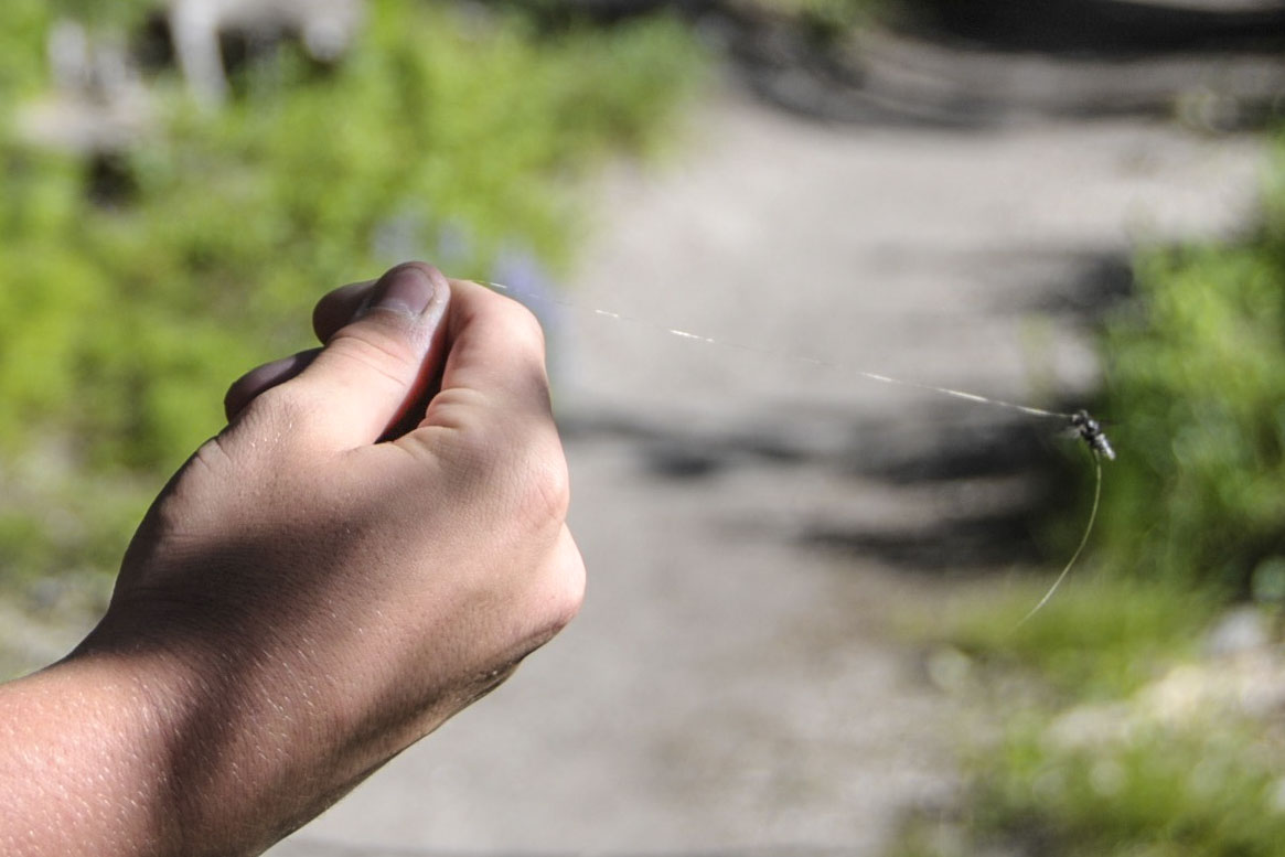
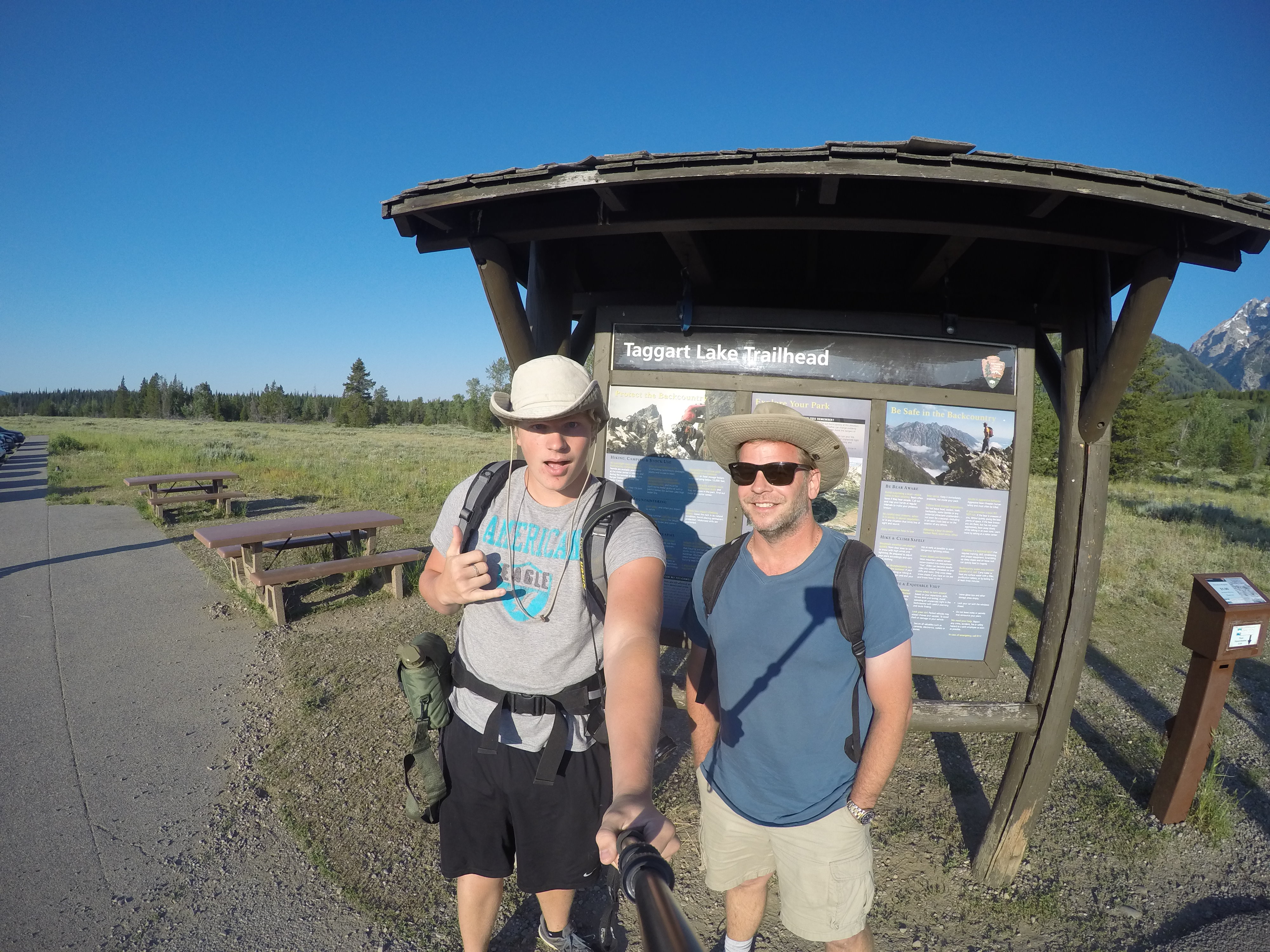
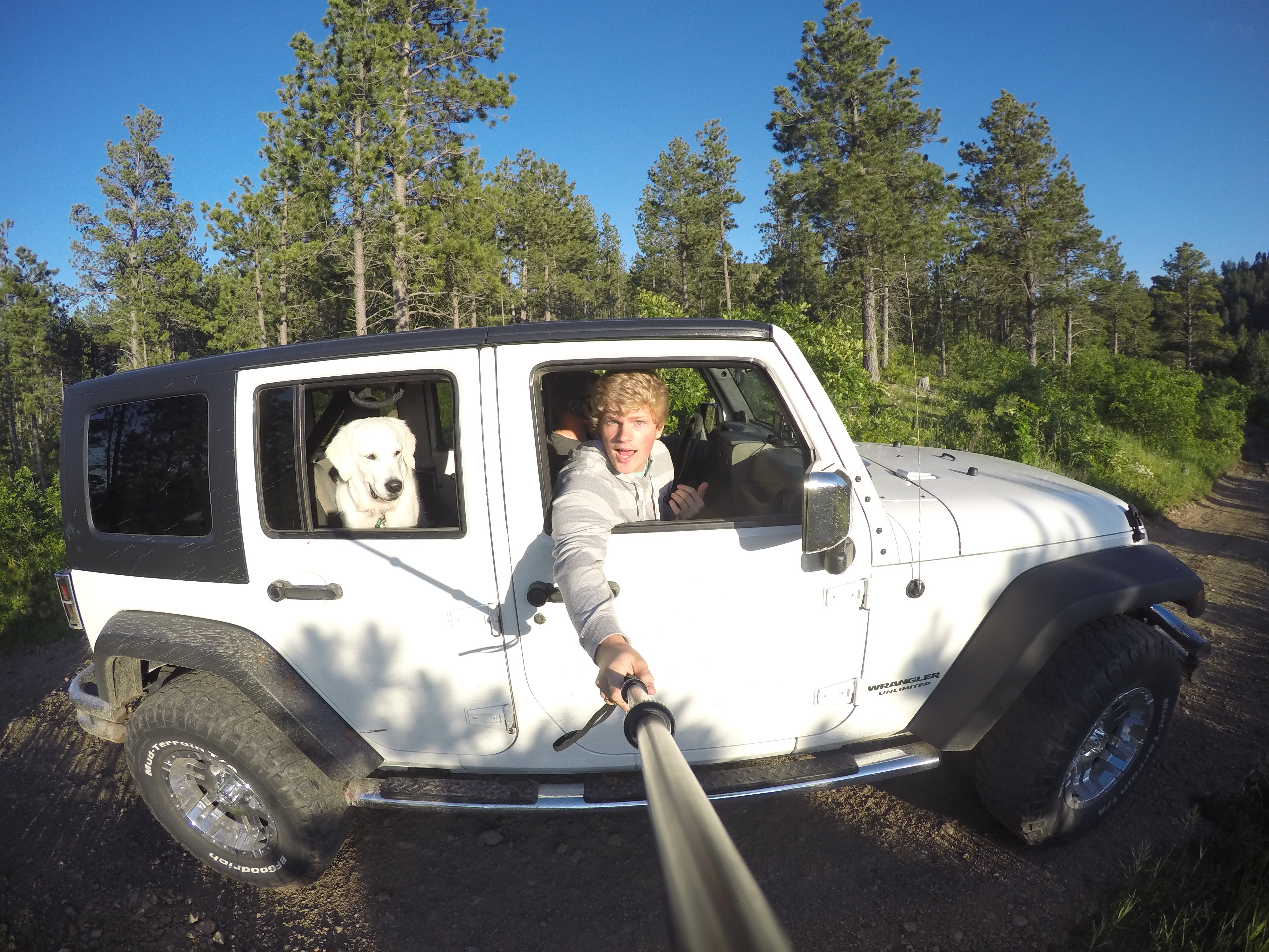
Jordan’s GoPro & GoRad pole have been great tools capturing memories this summer.


Jeep river ouray-a

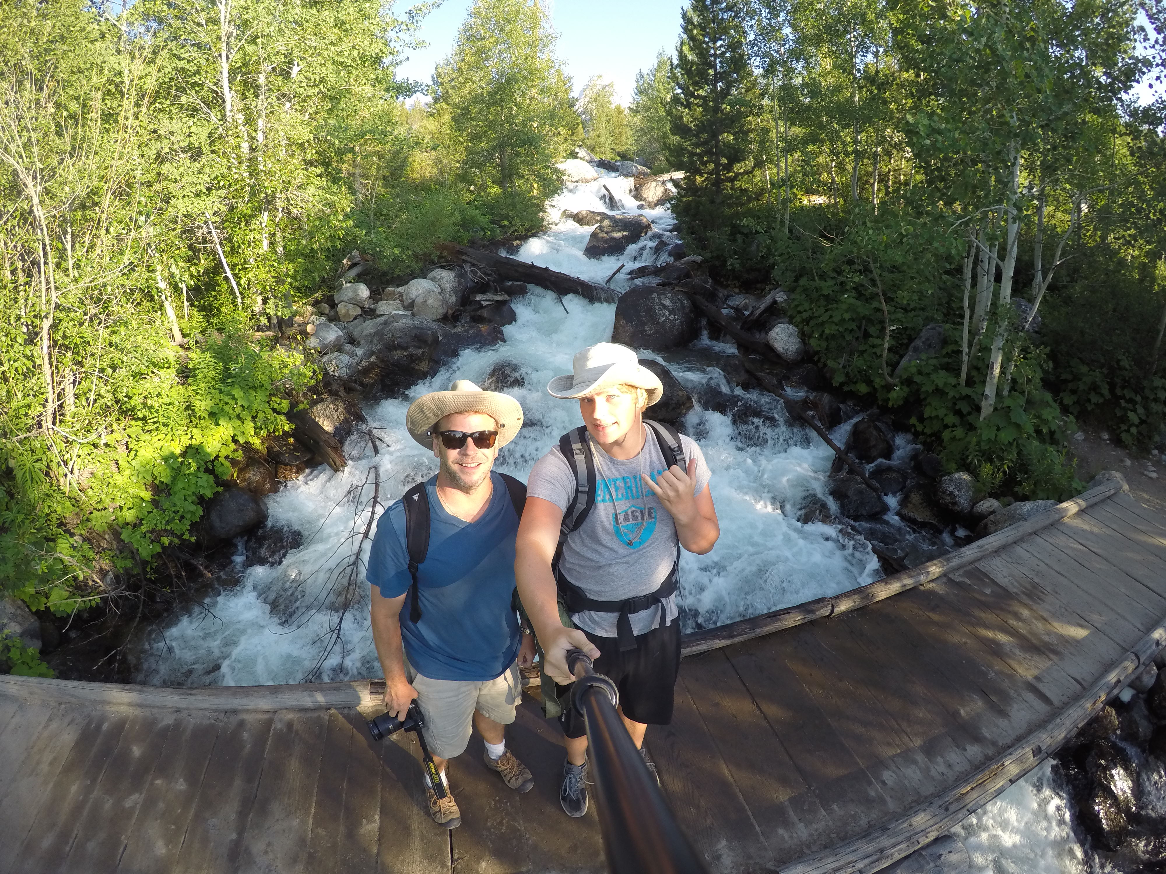
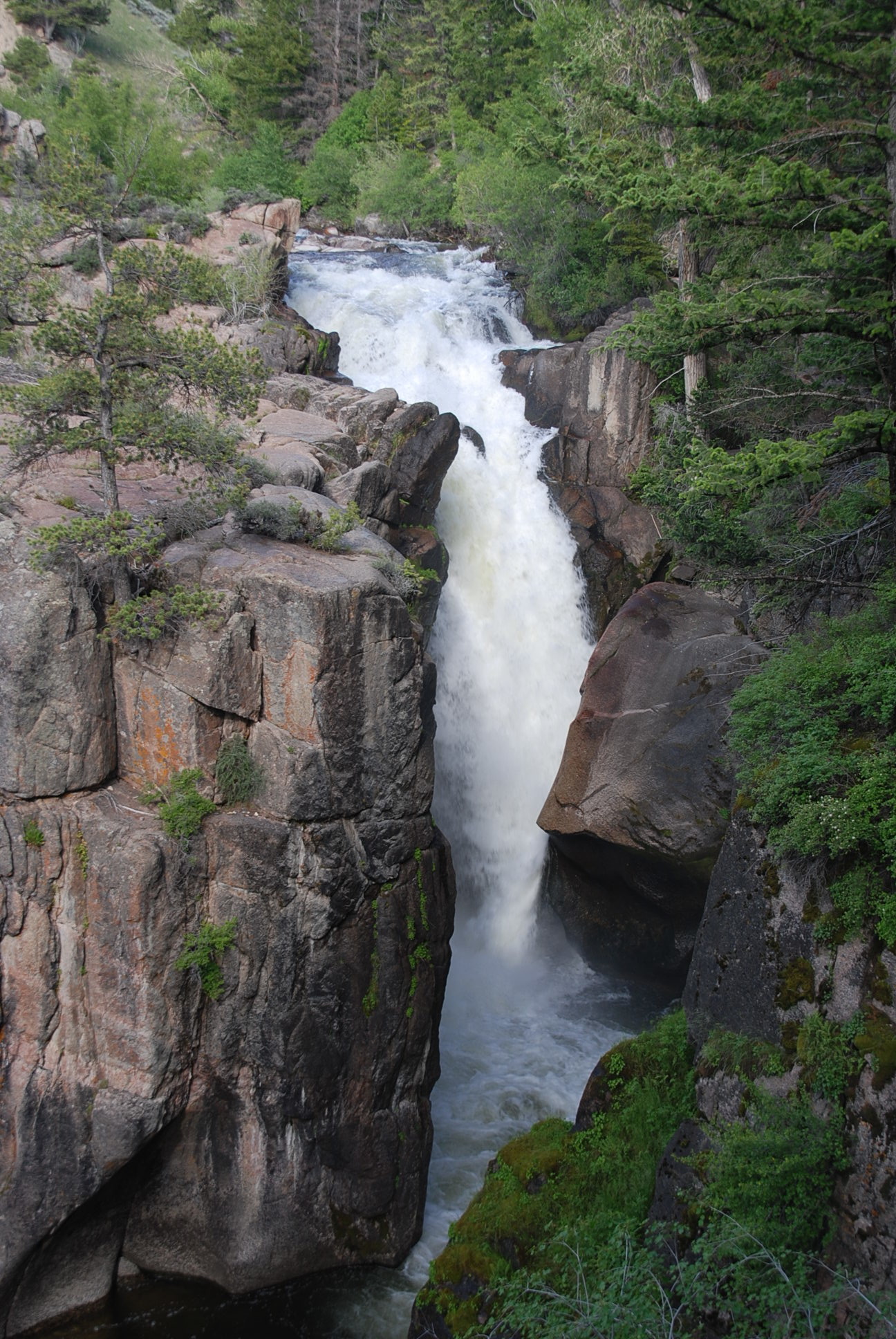
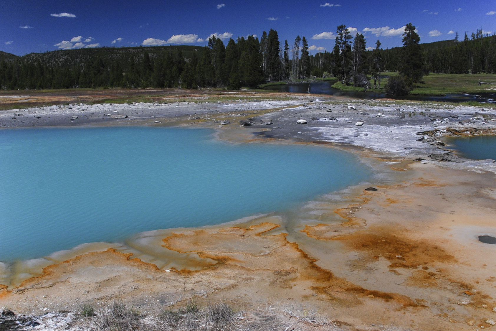
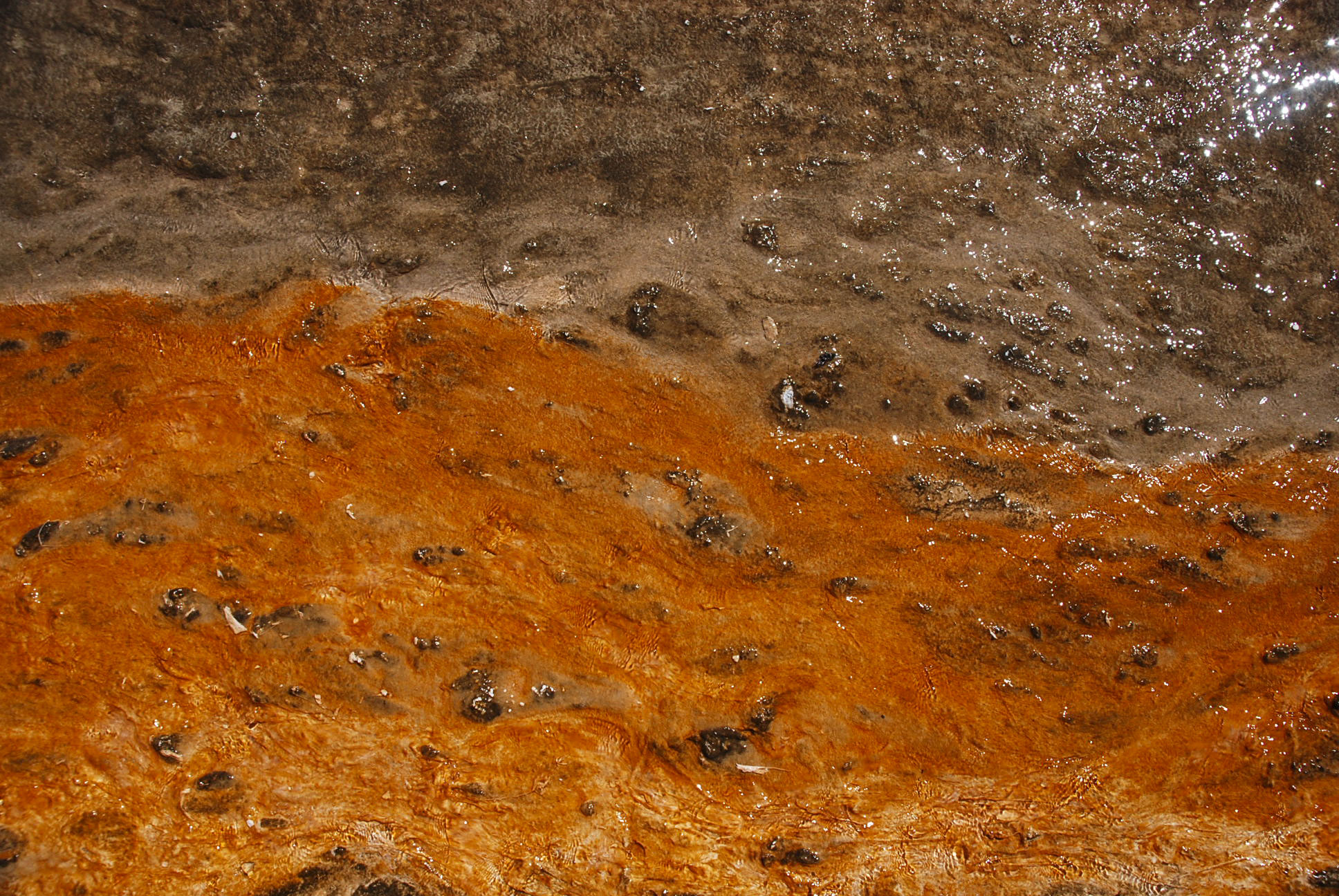
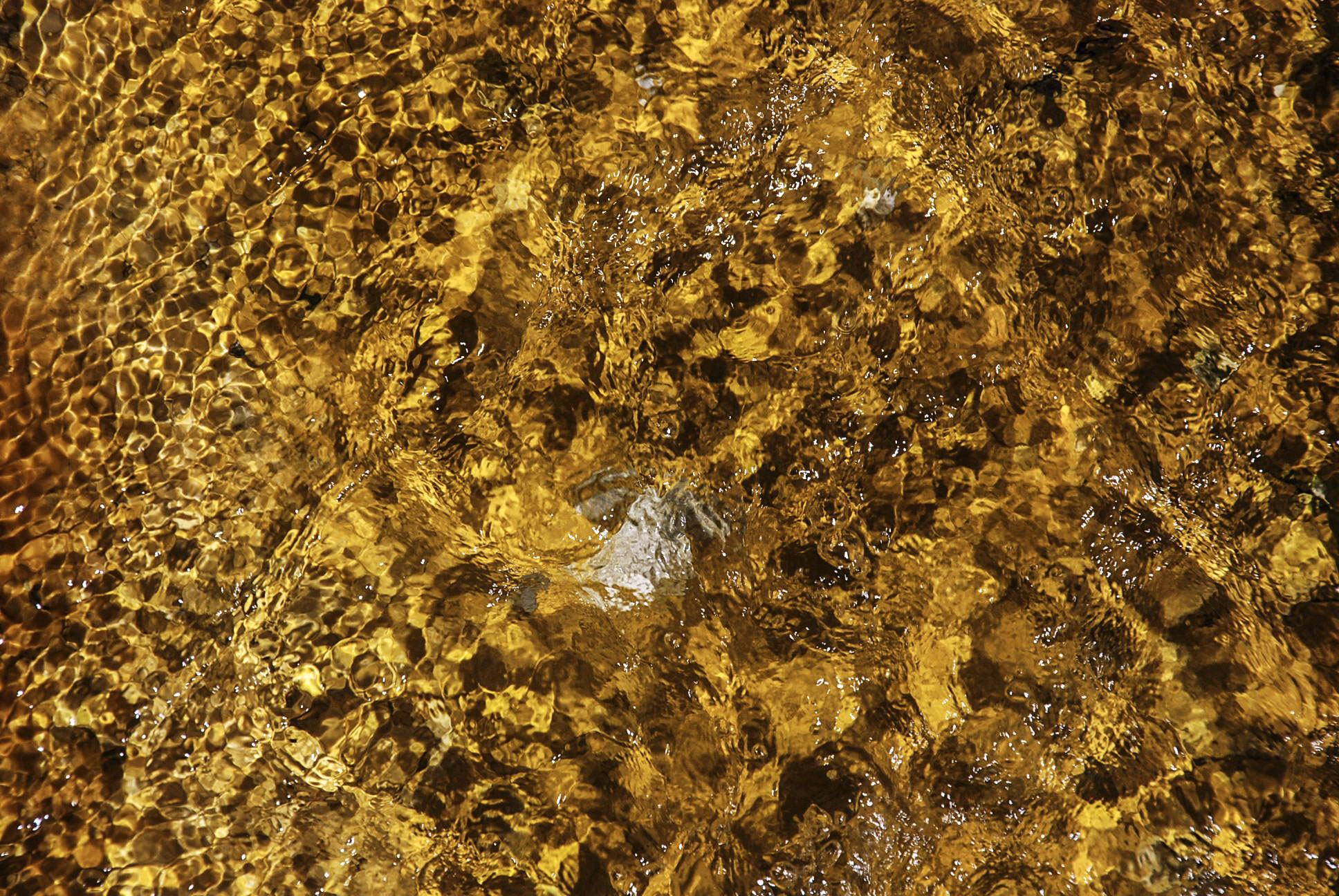
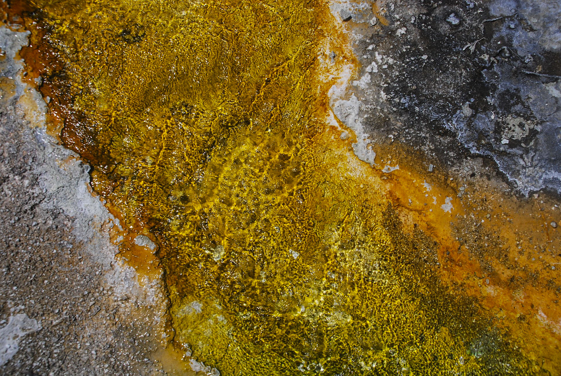
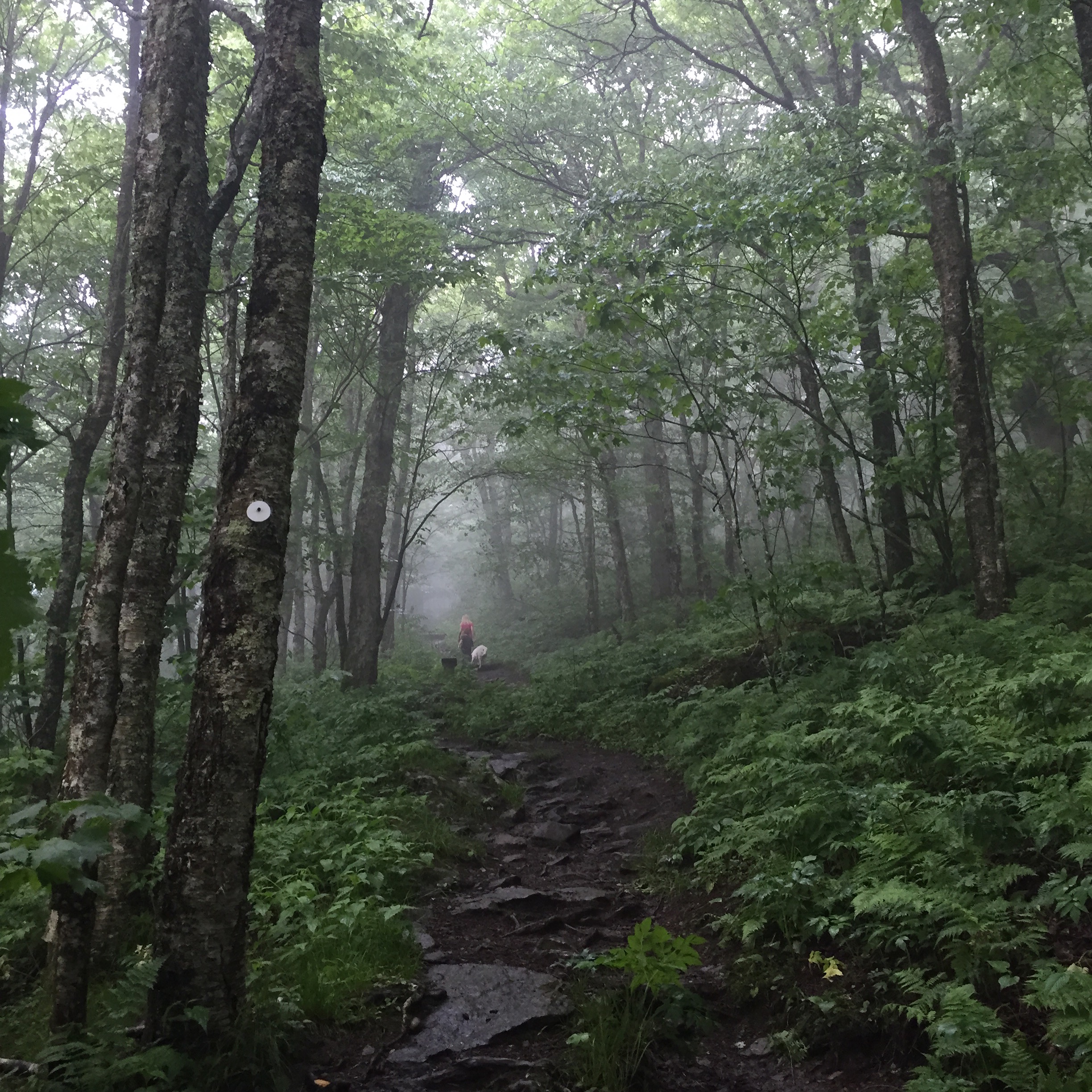
Waterfalls are everywhere up here in Little Switzerland. But not everyone can get this close. #JeepLife


flowers3  Flowers1-a

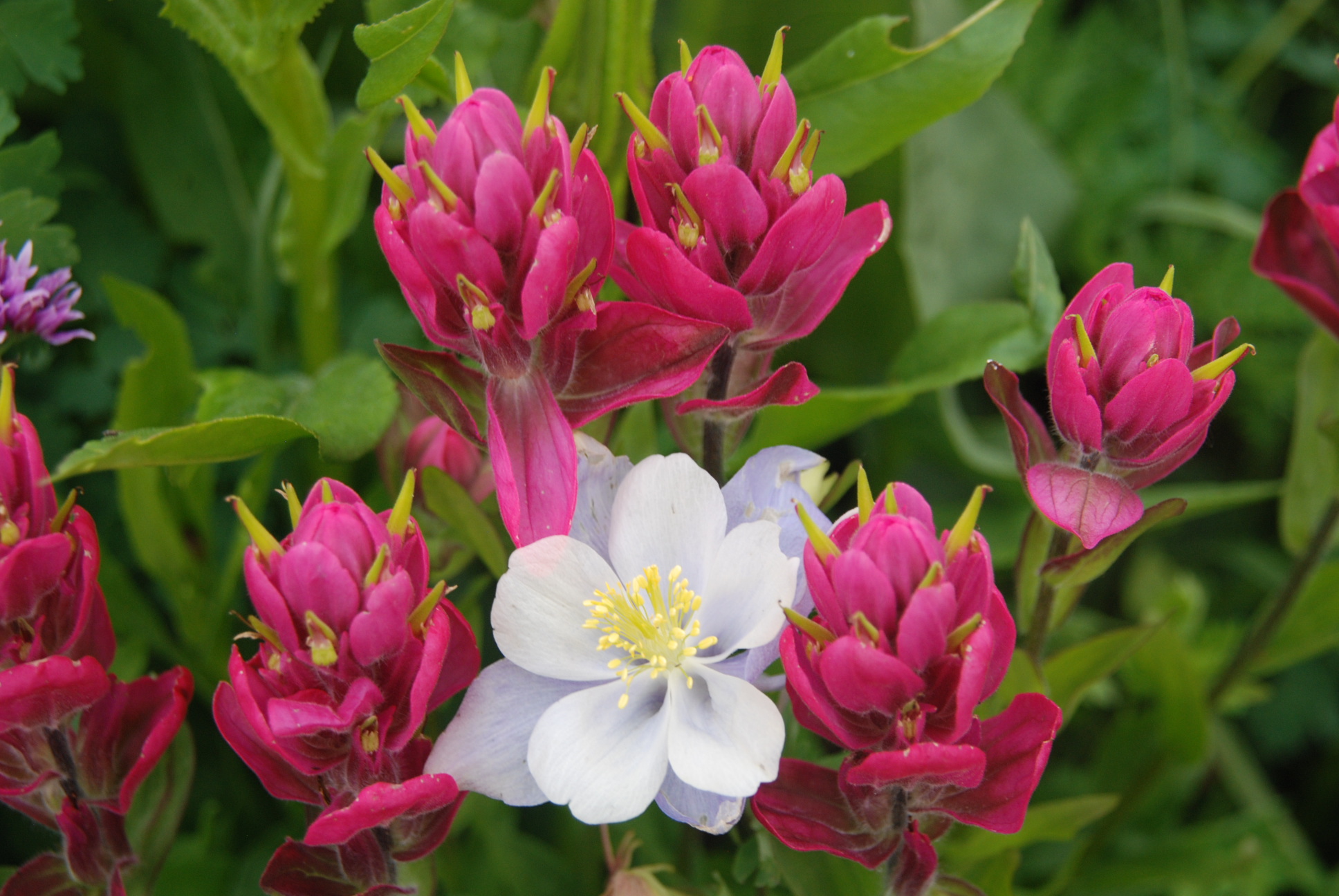
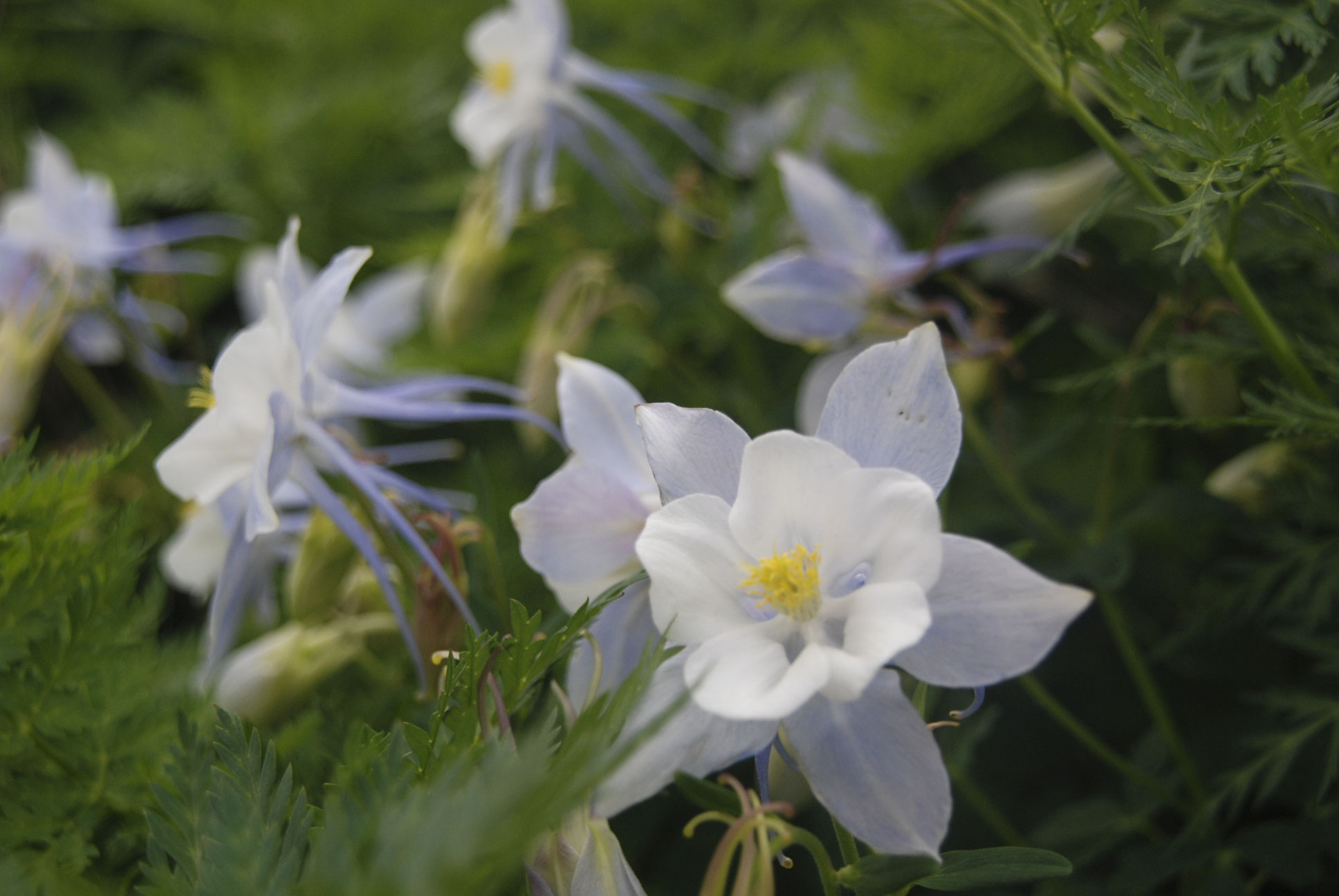
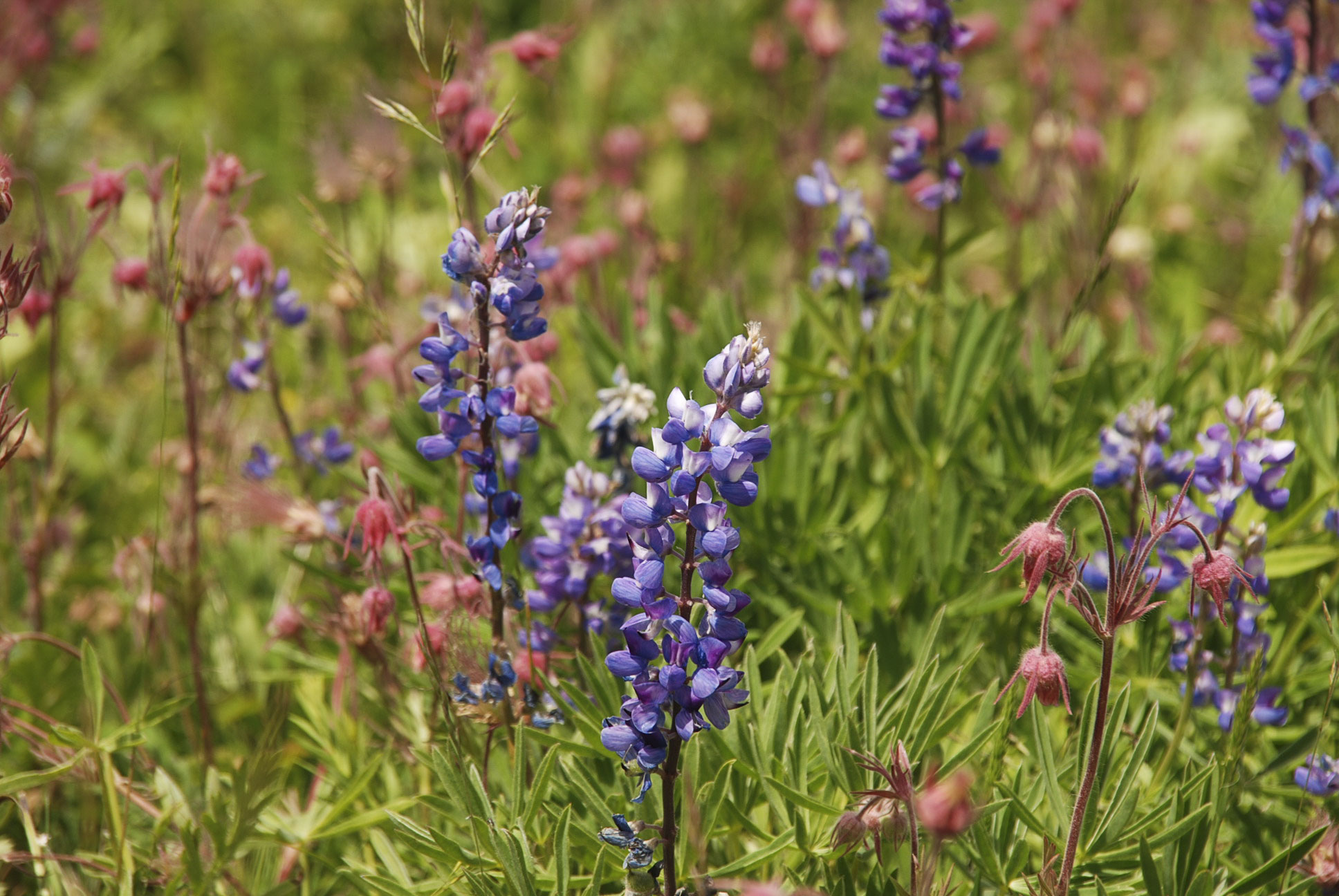
The state flower is this lilac-colored Columbine. It is totally illegal to pick one; the motto “Leave only footprints; take only pictures” is taken very seriously here.

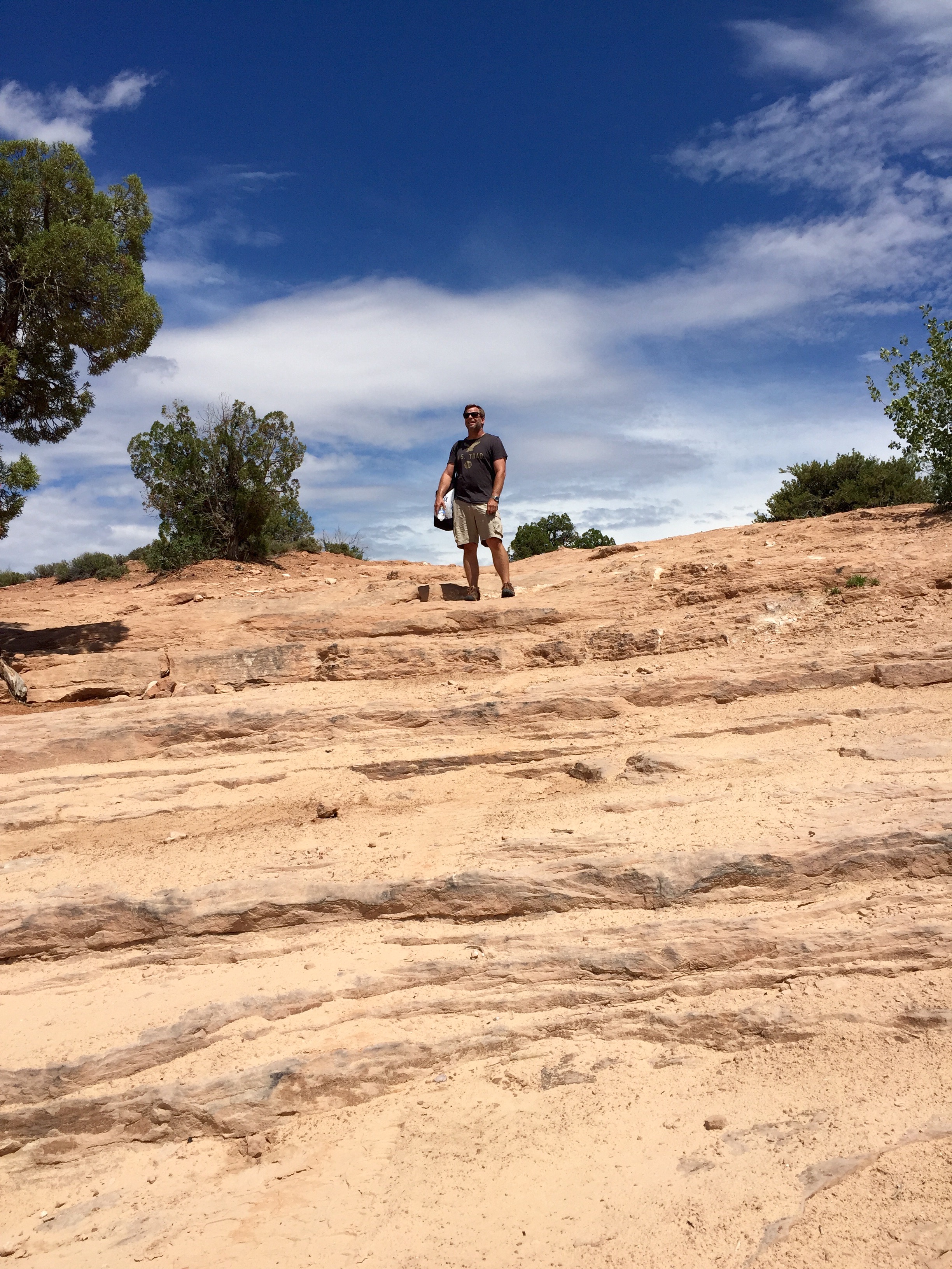
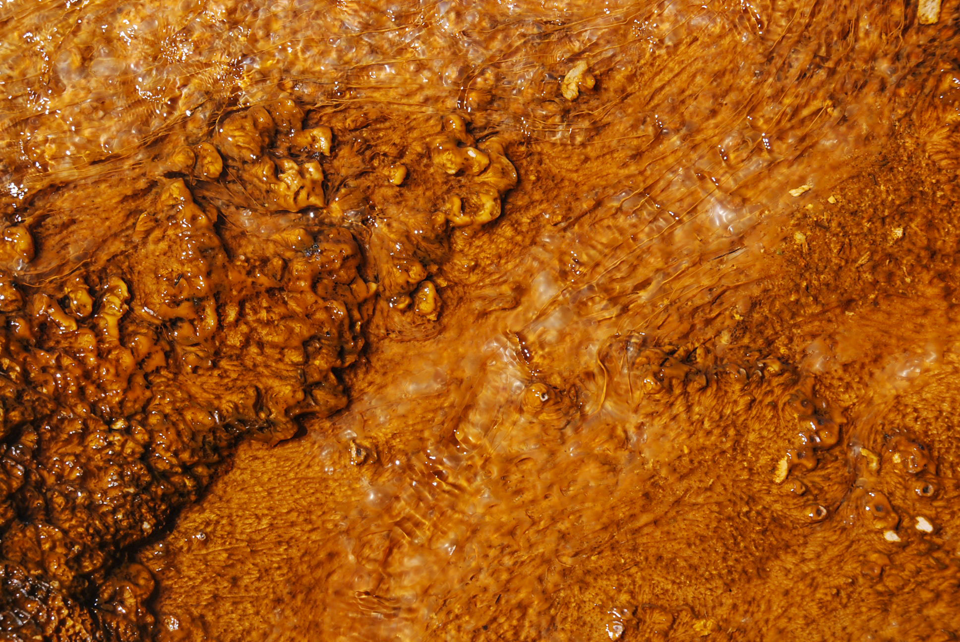
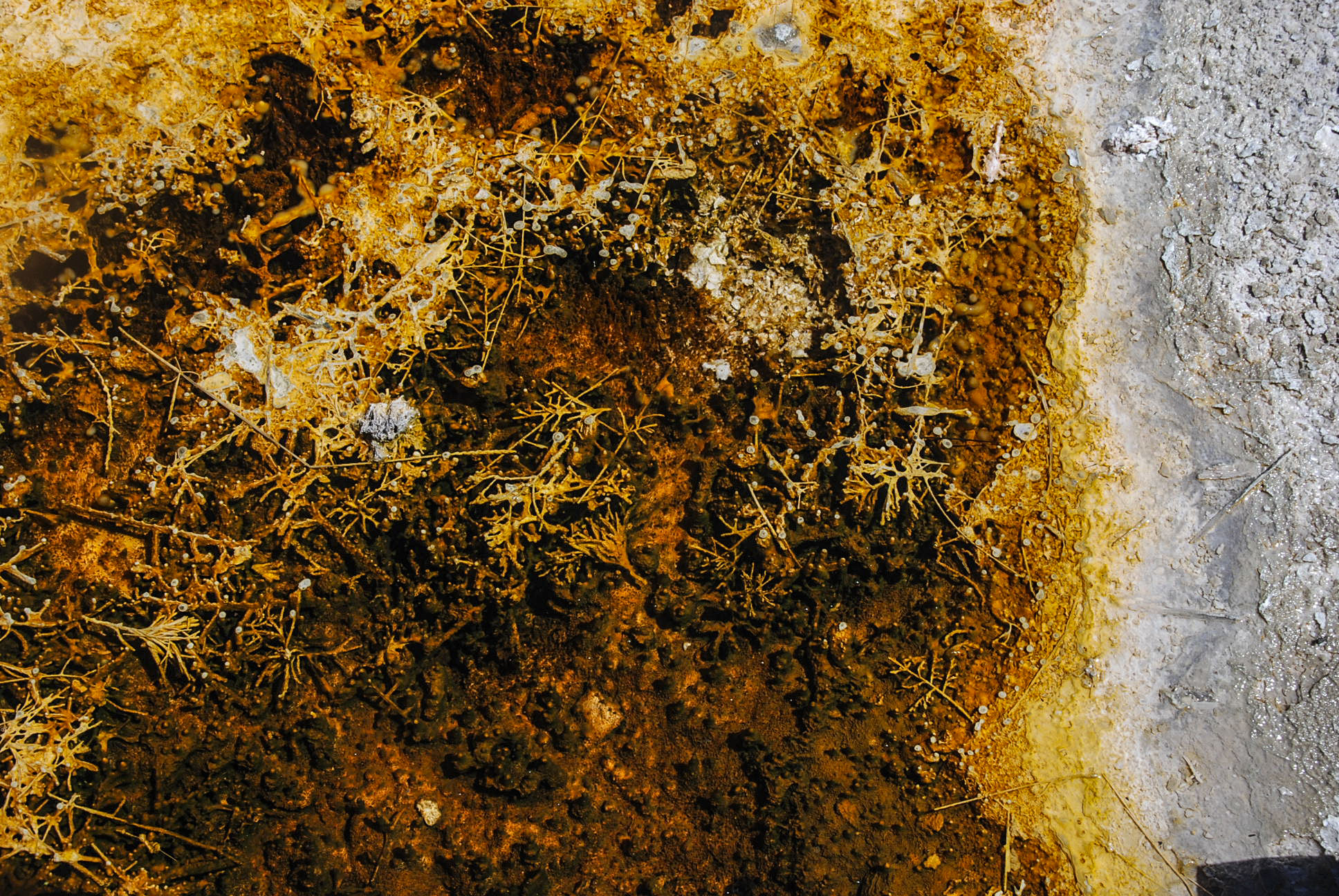
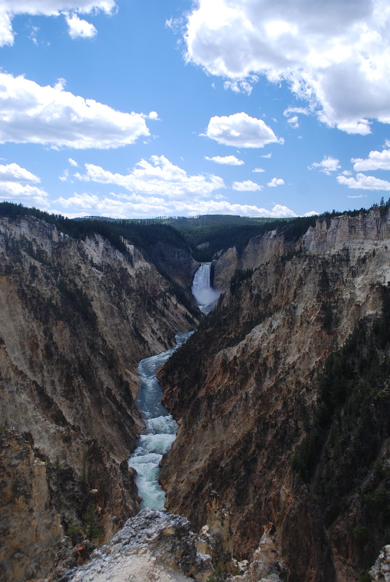
This waterfall where we ate lunch is not so popular because few will brave the super rocky slick trail to get here. In years past, we’ve not been able to get here for all the snow that sticks around until July. (photo credit: Jordan Fenlason)


Photo Jul 11, 8 48 01 PM

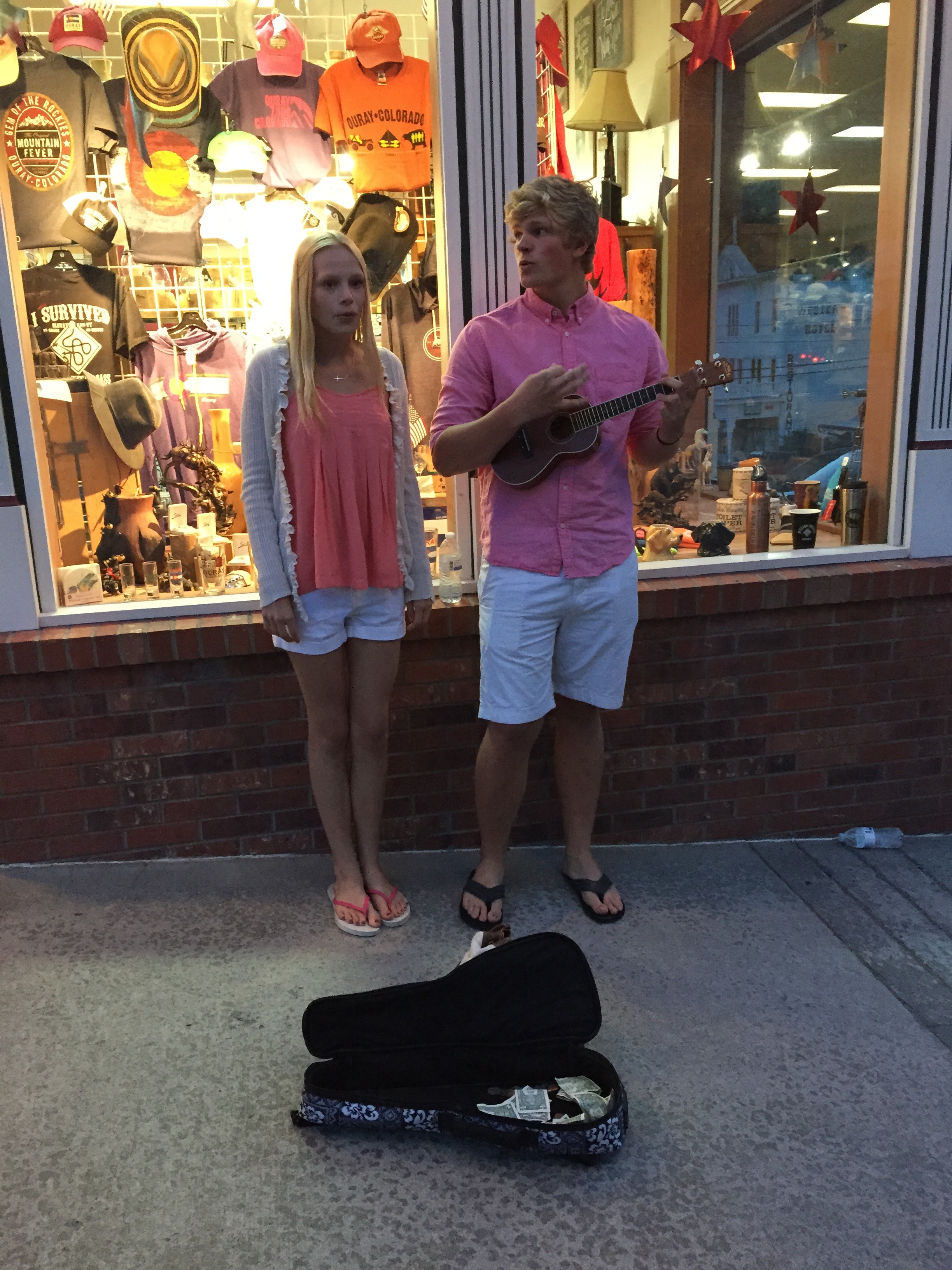
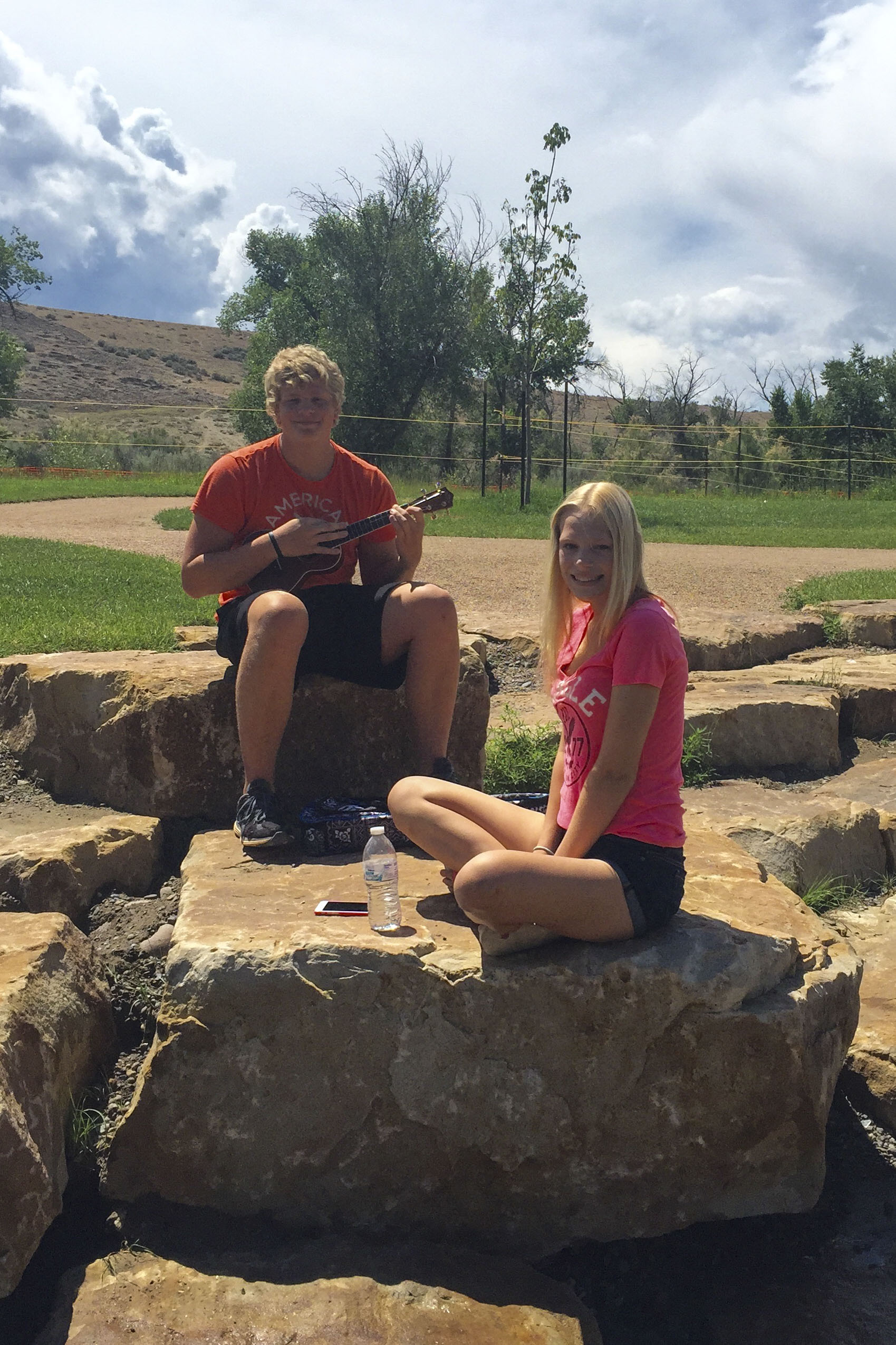
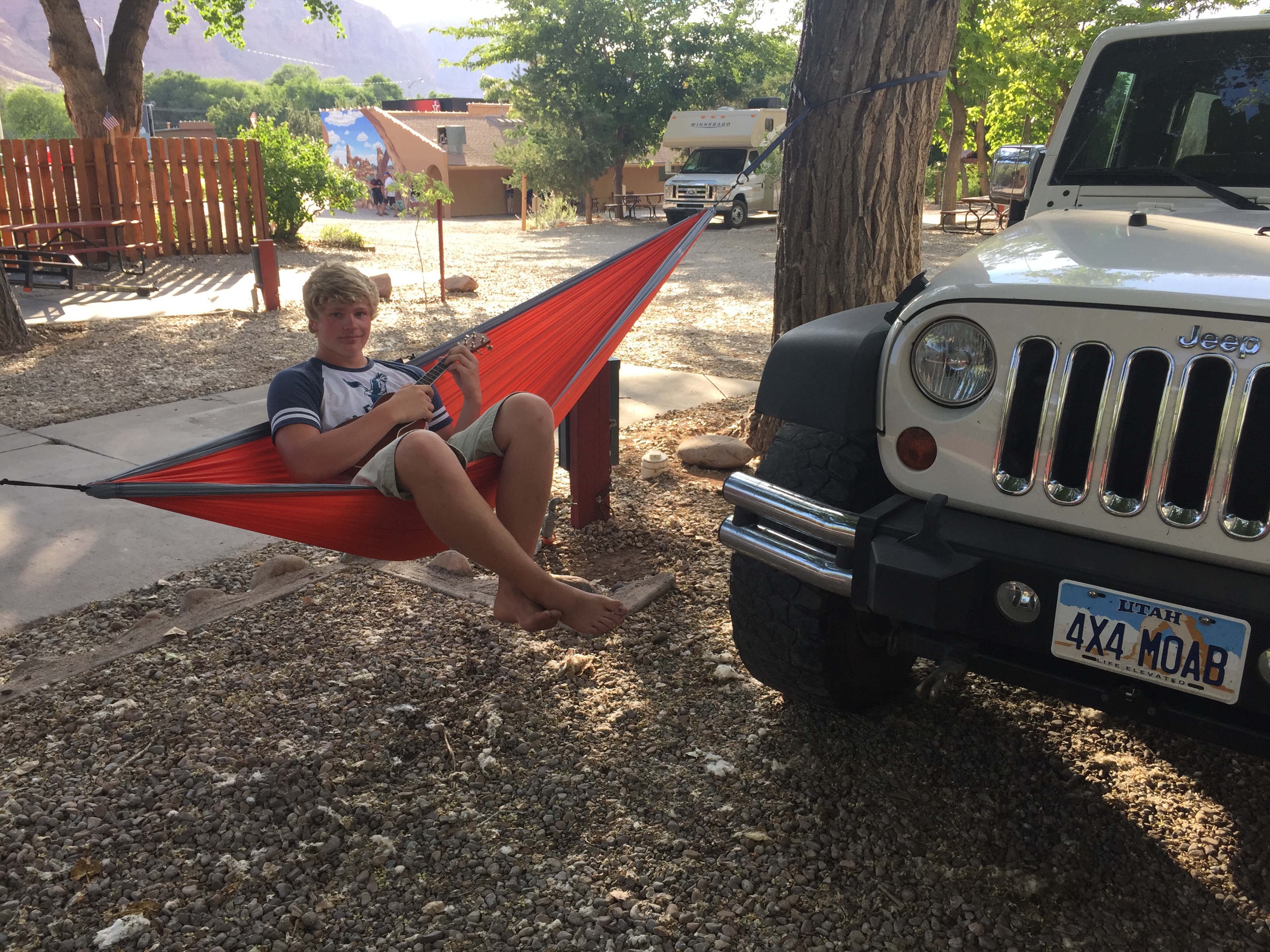
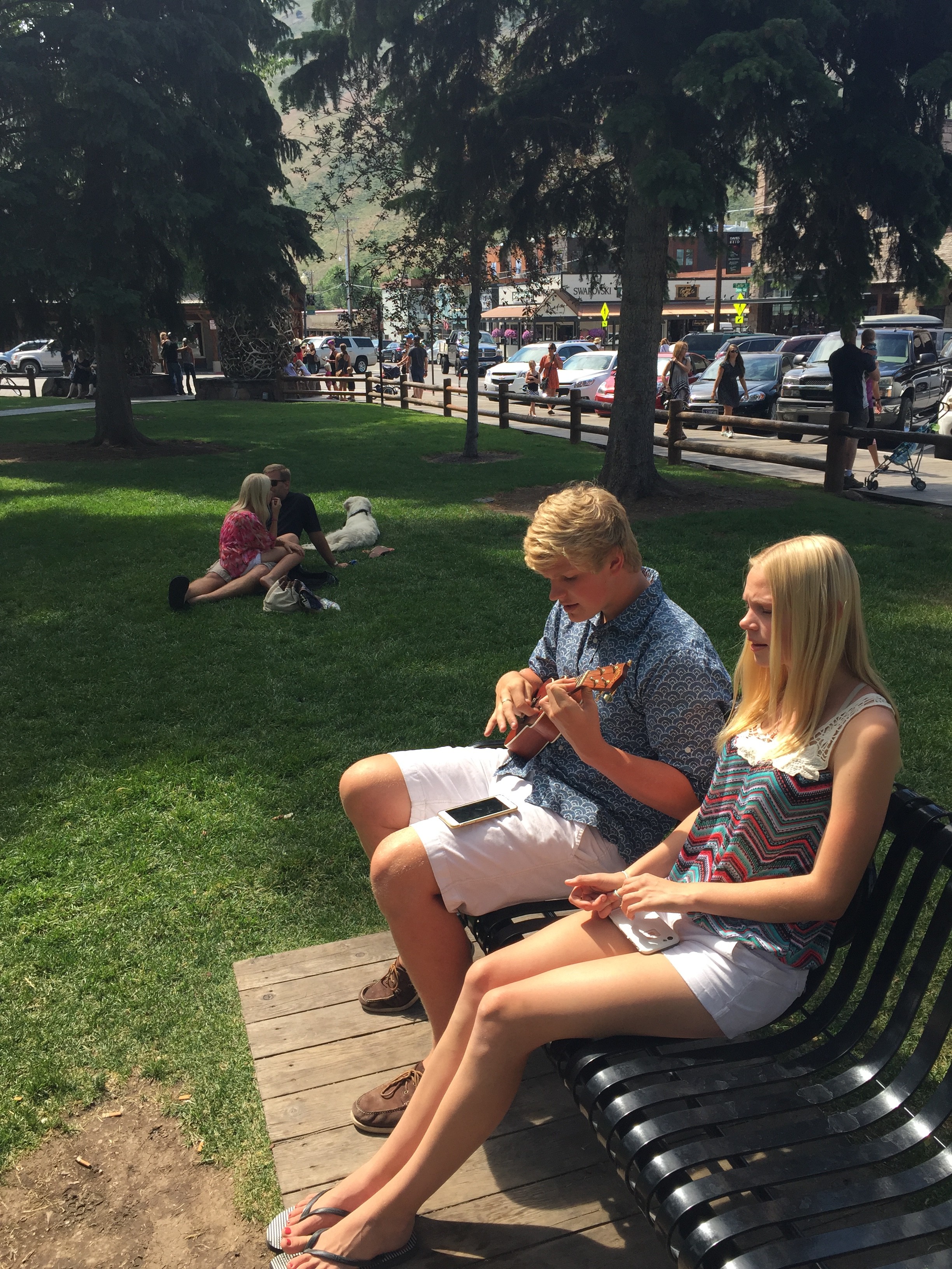
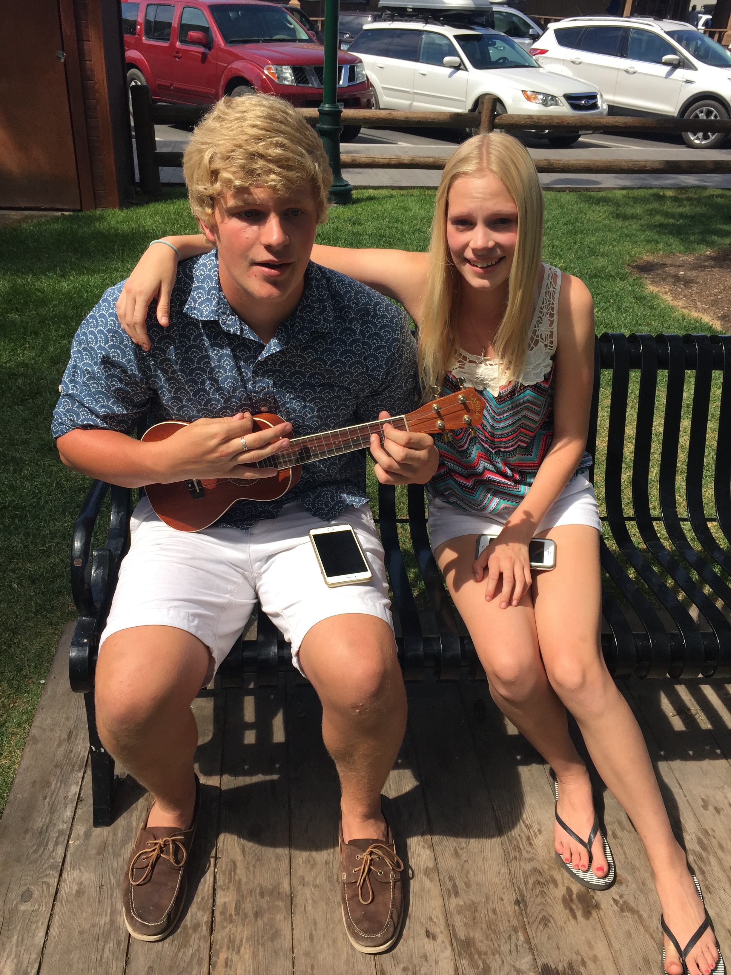
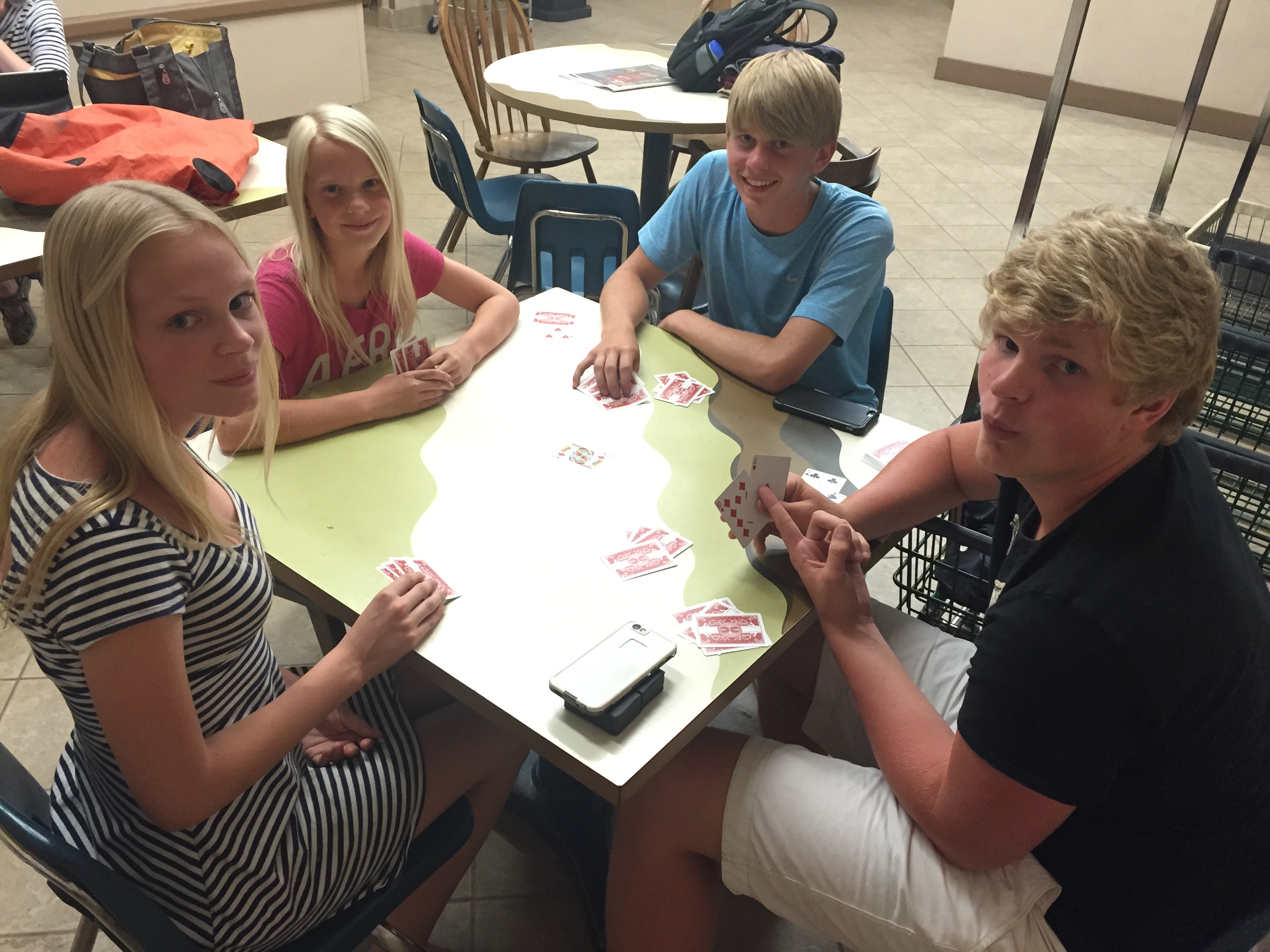
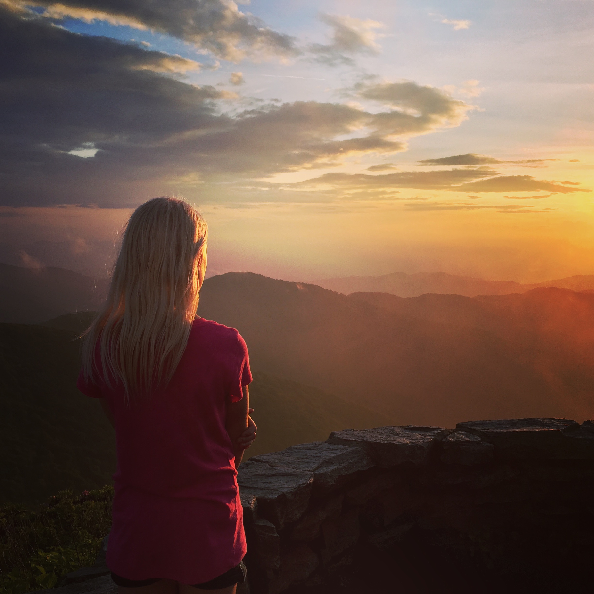
It was 57º when we arrived back to basecamp and headed downtown. Jordan & Carlye have been practicing their act during the long-drive days in the RV and it really paid off 🙂 One passer-by put in some money in the open Uke case and said to Jordan, “Buy her a coat!” (for video footage of such events, text Rochelle privately :-)).

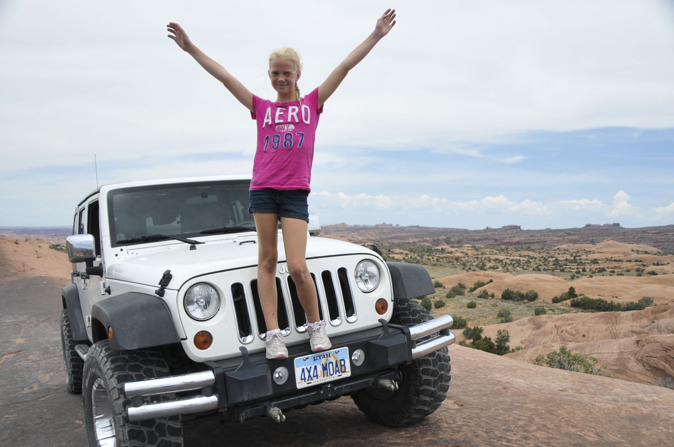
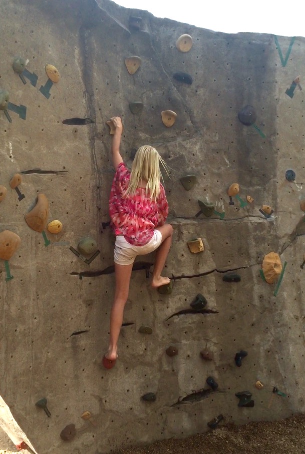
Ah . . . those Florida kids and their white shorts . . . !


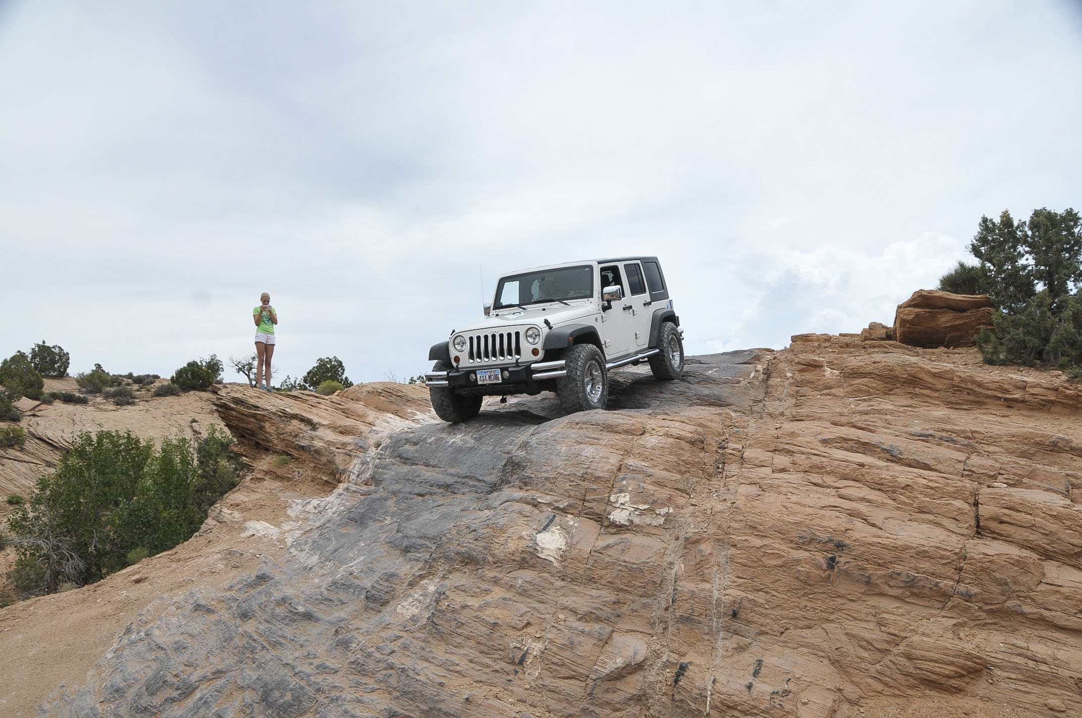
Day 2: Big Day of Jeeping tough trails

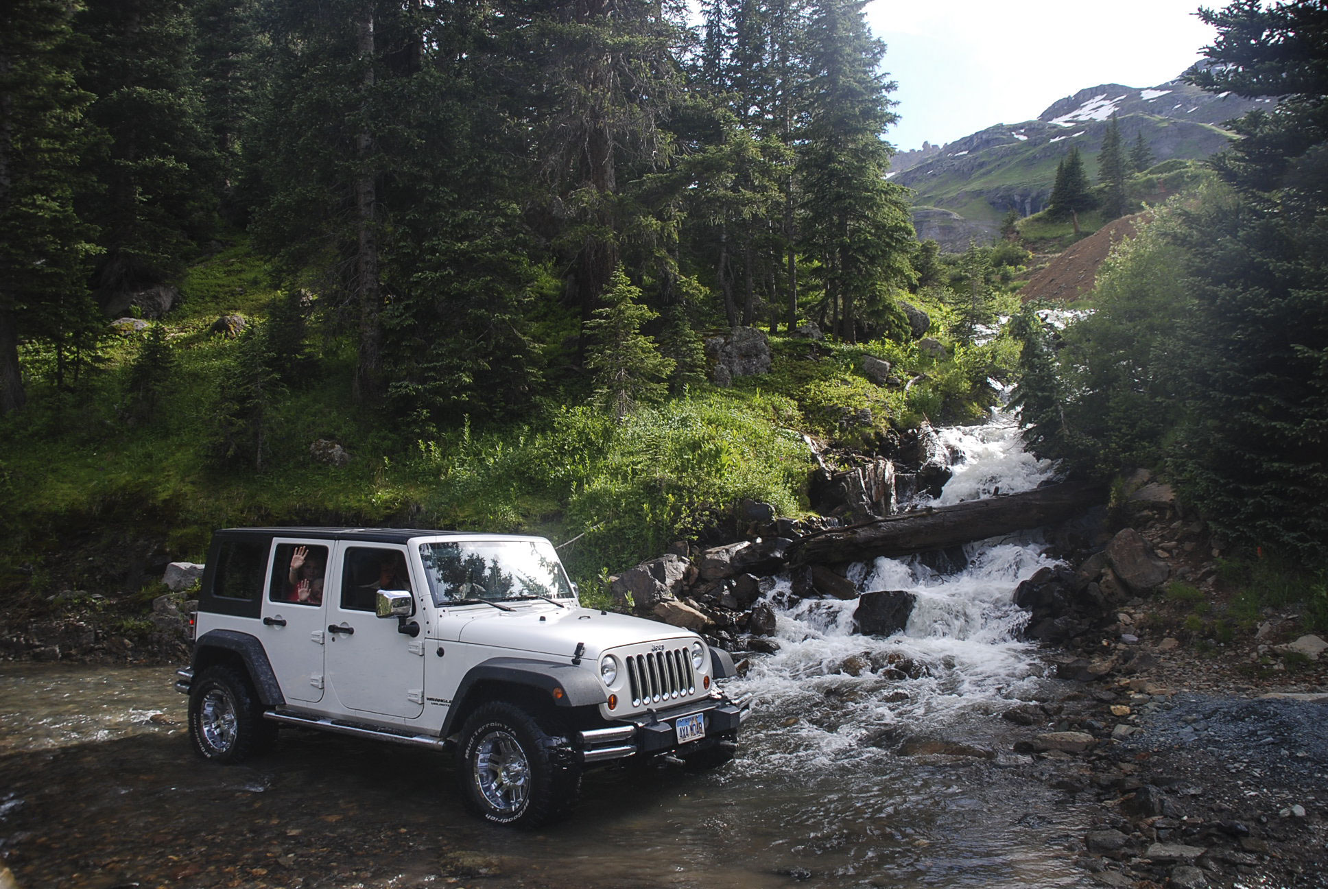
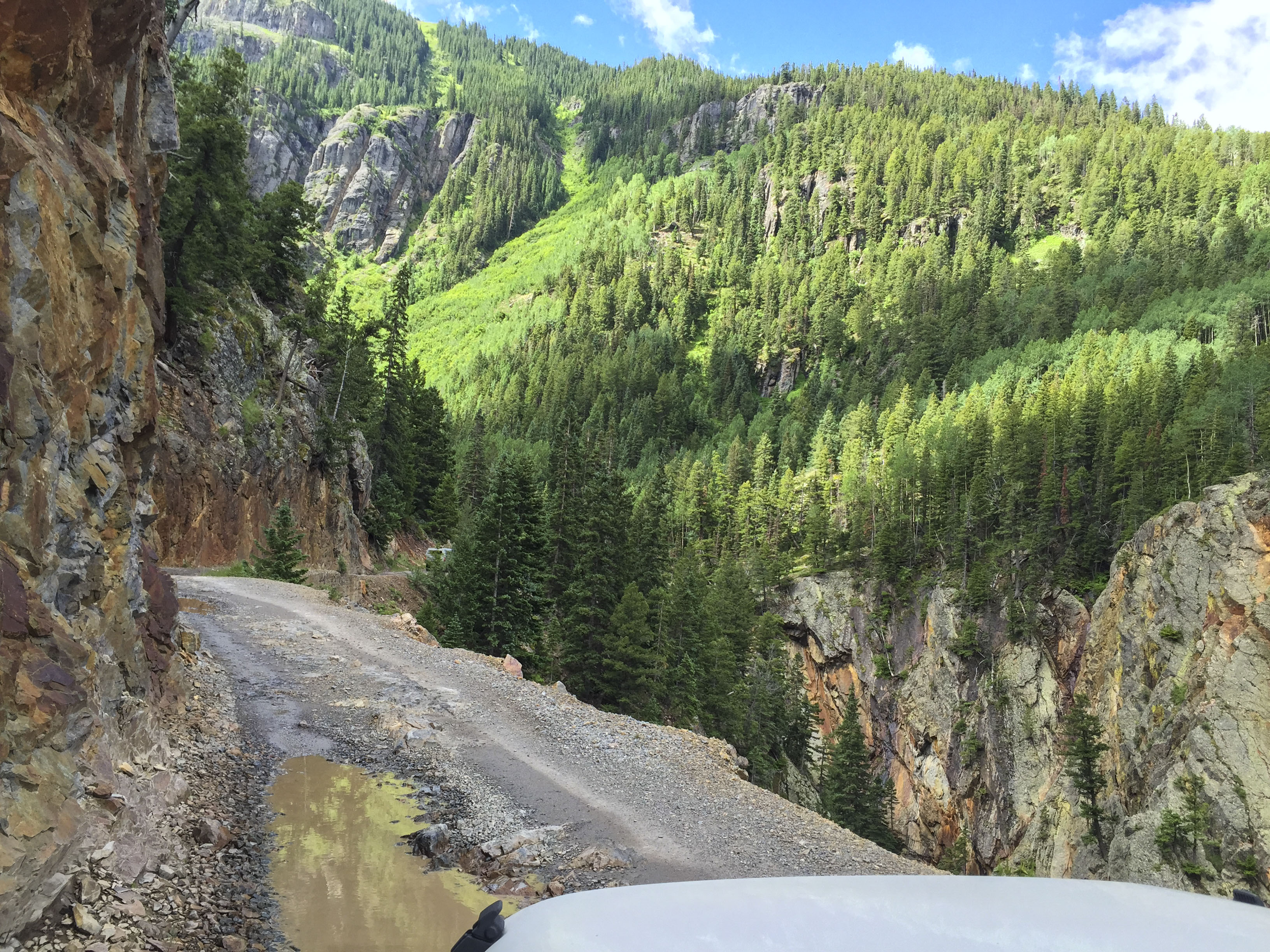
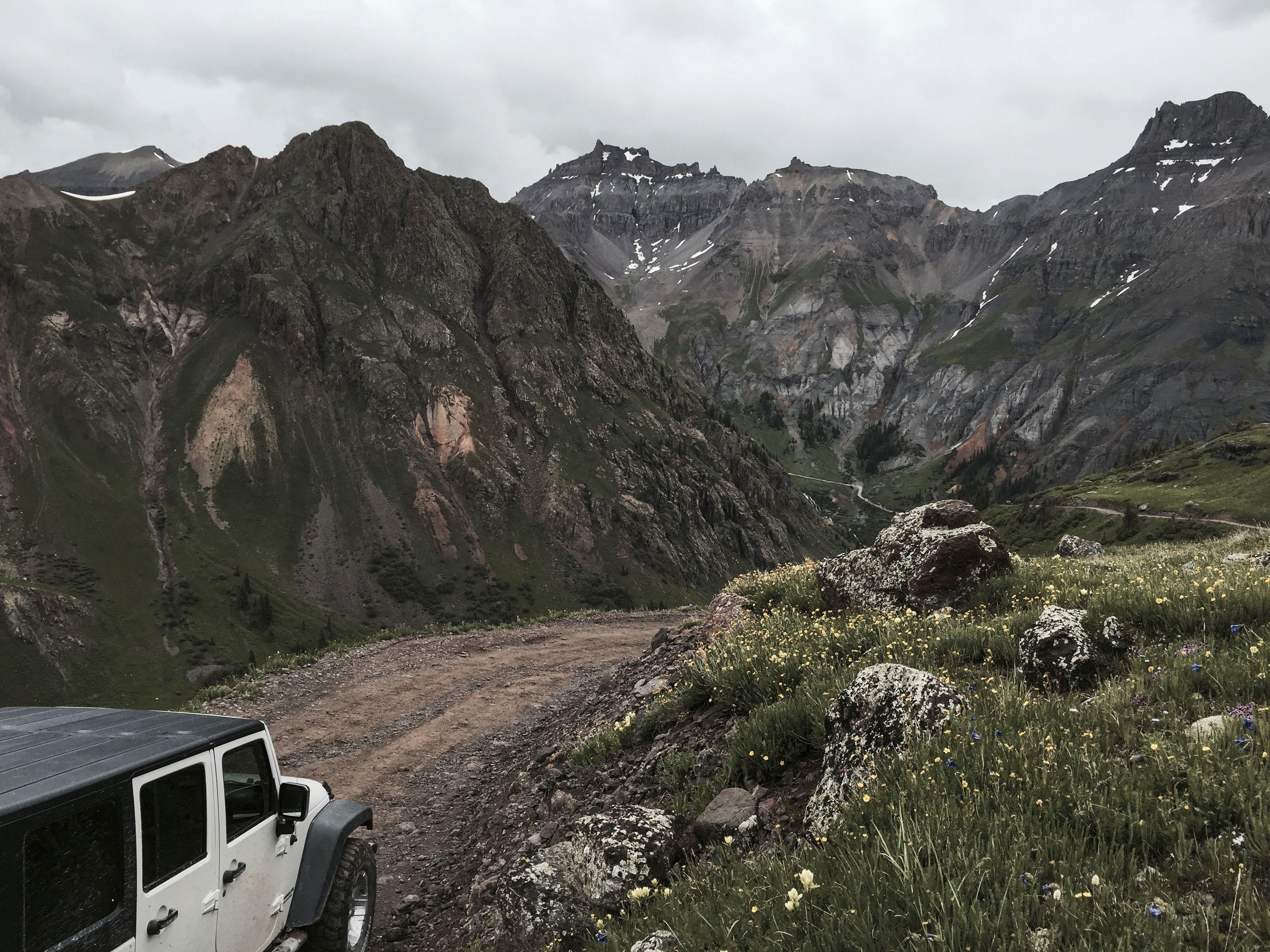
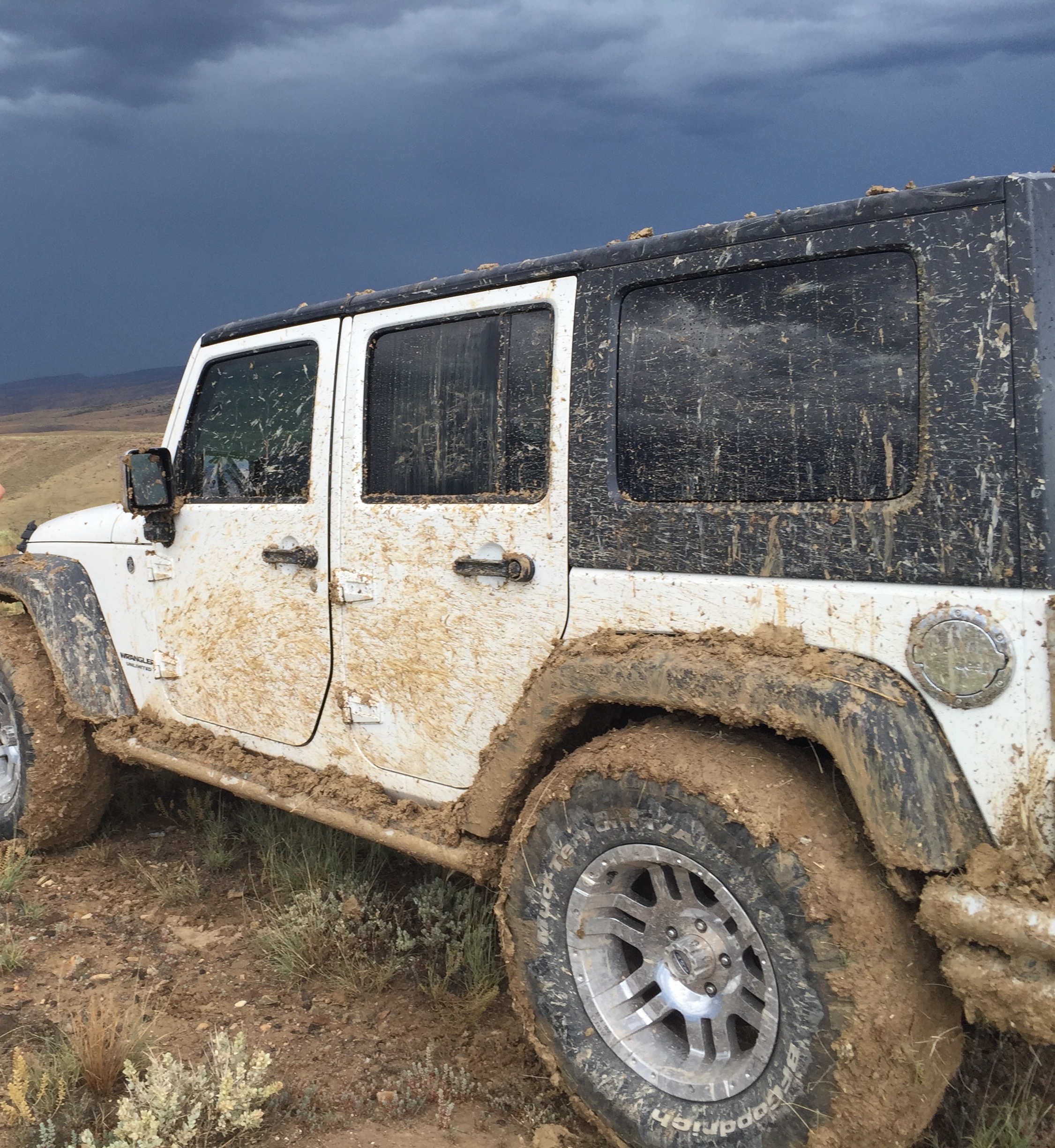
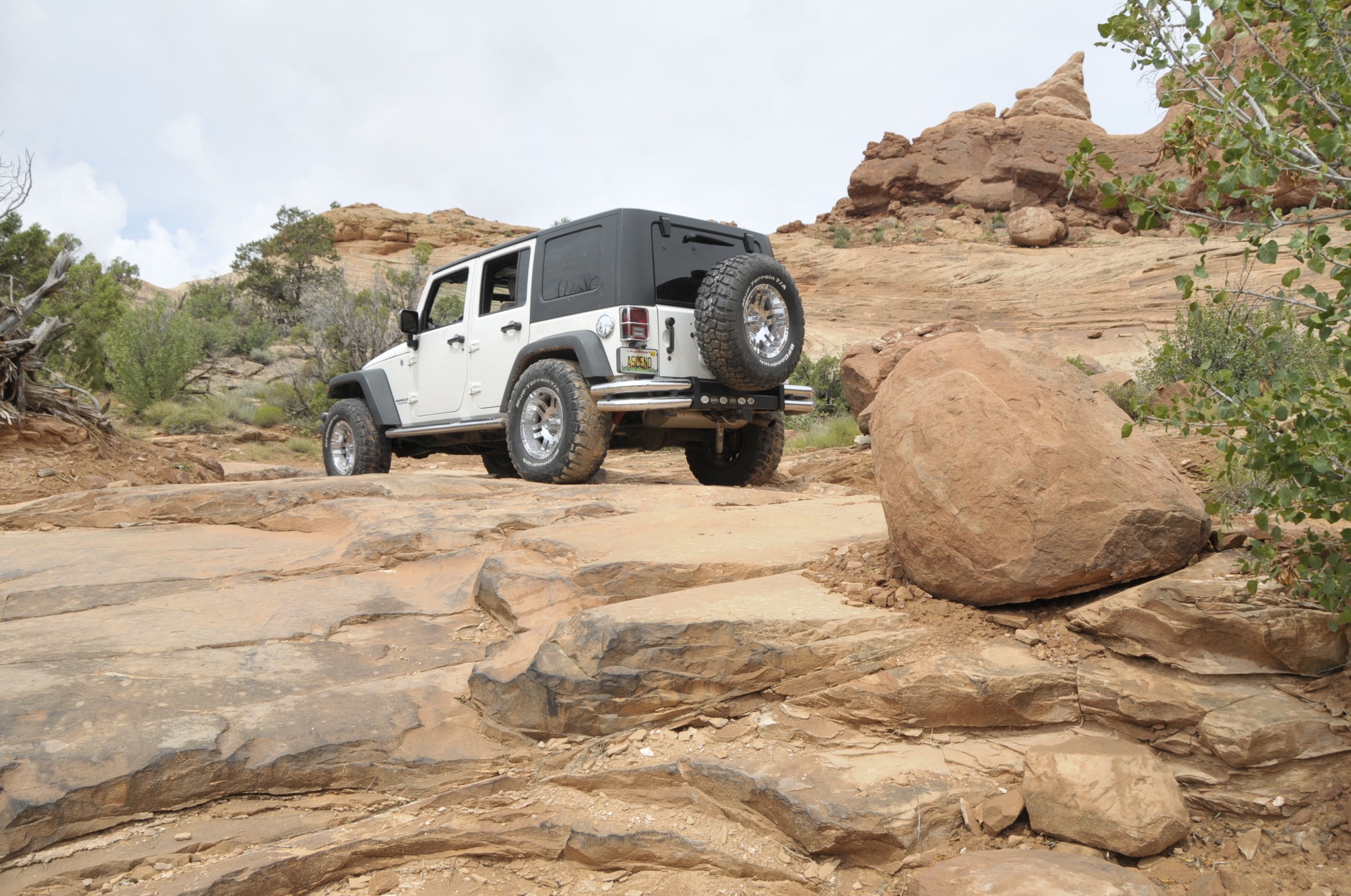
All the trails have names so that when we roll back into town and down to the Jeep Wash you can answer the questions like, “How high did ya get?” Today’s adventure: “Mineral Creek Trail” to OH Point, through the Ghost mining town of Animas Forks, and finally Hurricane Pass.

Alpine Loop map

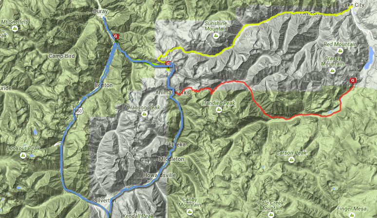
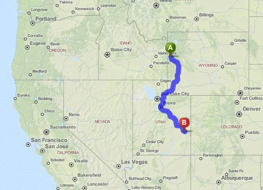
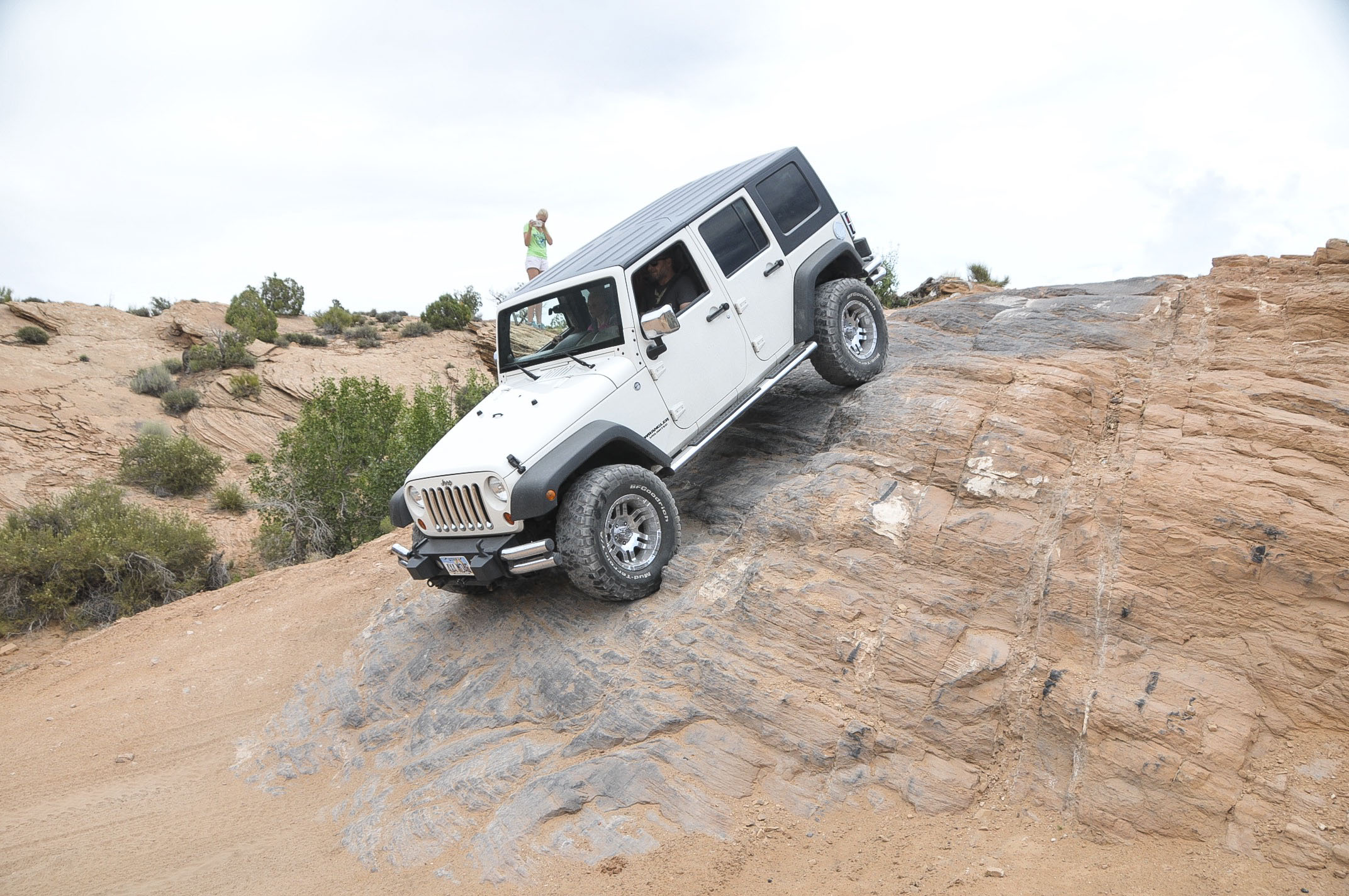
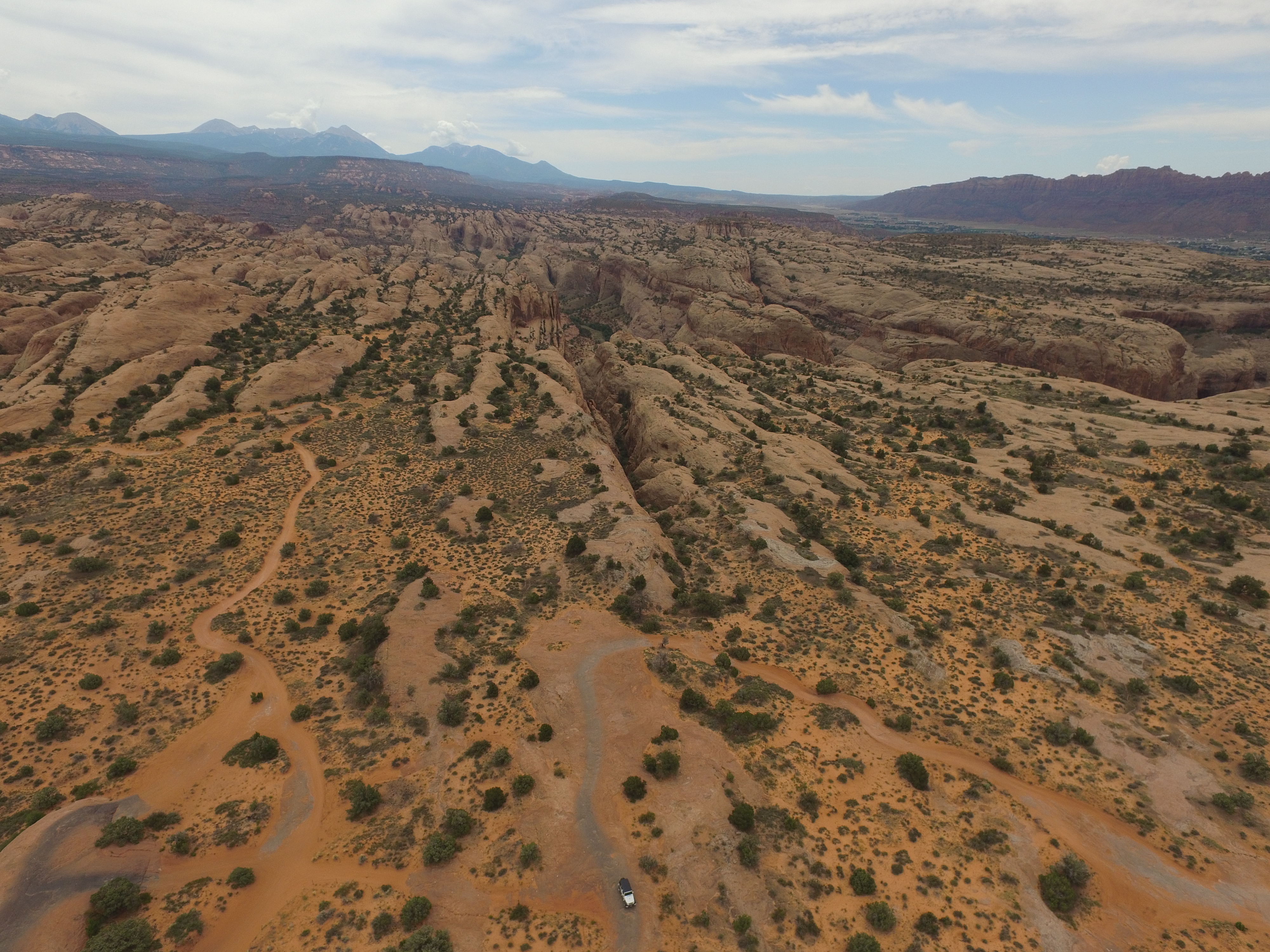
This map show the Alpine Loop. We took the blue round-trip route today. The first part of the trail on Mineral Creek leads along a narrow ledge with the creek far below. It’s relatively flat and safe unless the driver decides to enjoy the view.

Photo Jul 12, 10 33 48 AM-a


If a picture is worth a 1,000 words, what is a video worth??

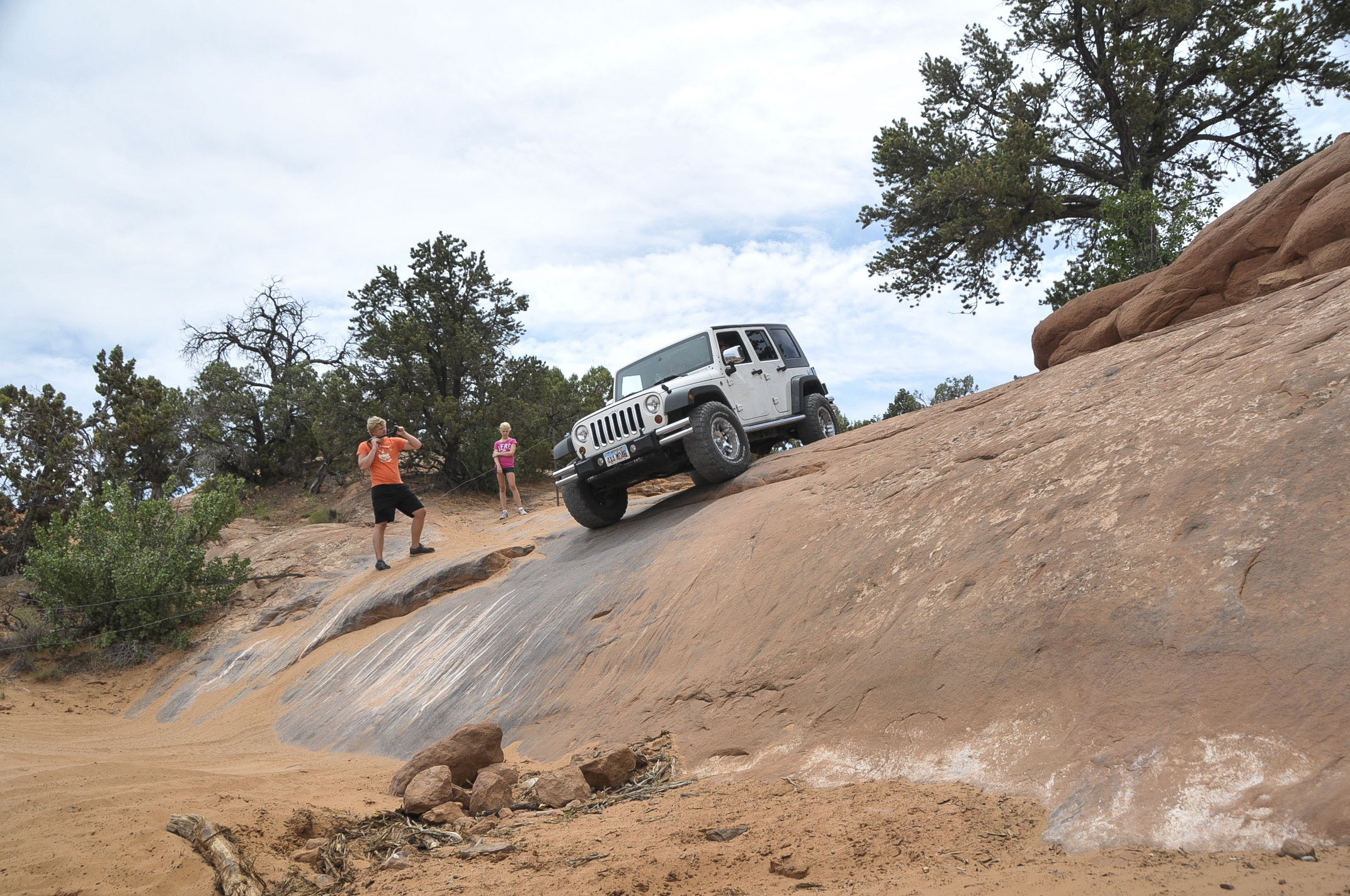
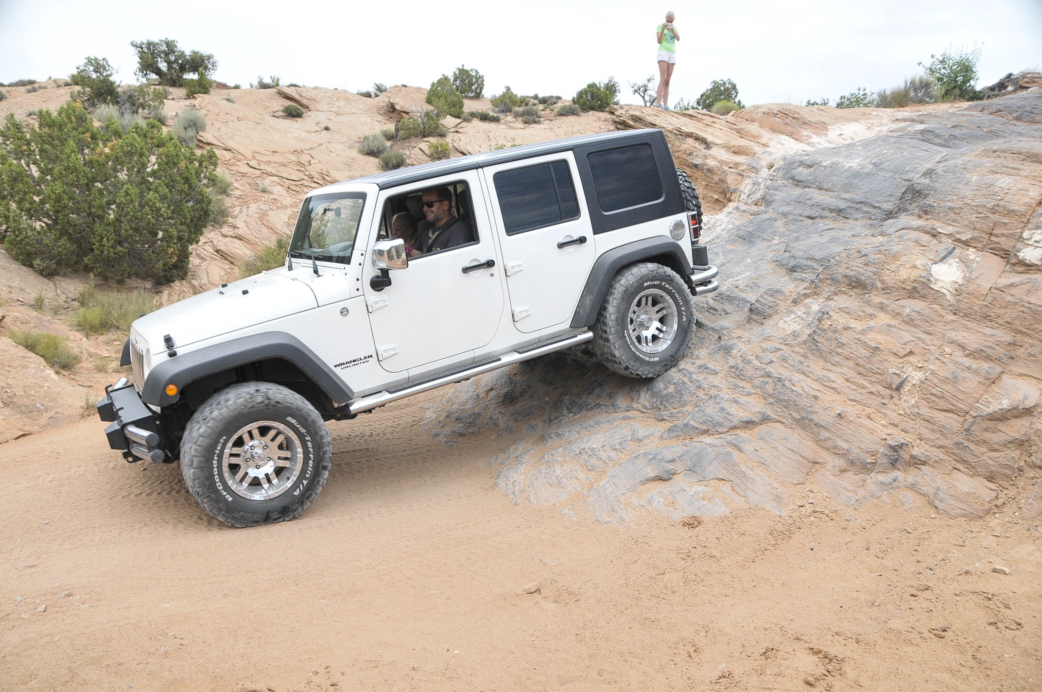
Each turn holds a surprise! Sometimes it’s, “Surprise! A whole caravan of Jeeps is coming down!” It’s part of the fun—-a challenge to back down a steep trail until there’s enough room to let others pass literally centimeters along your side.


Photo Jul 12, 11 12 06 AM-a

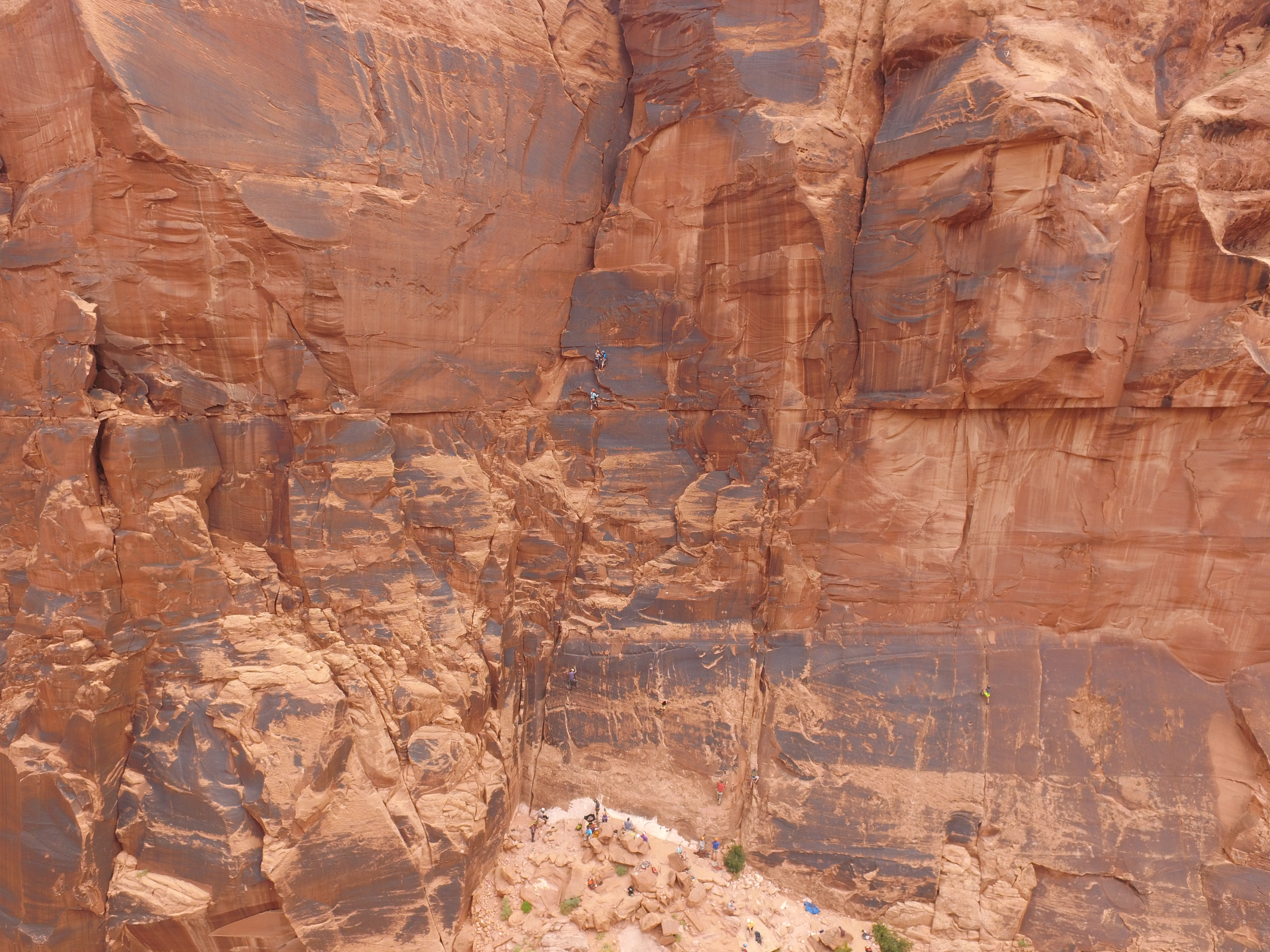
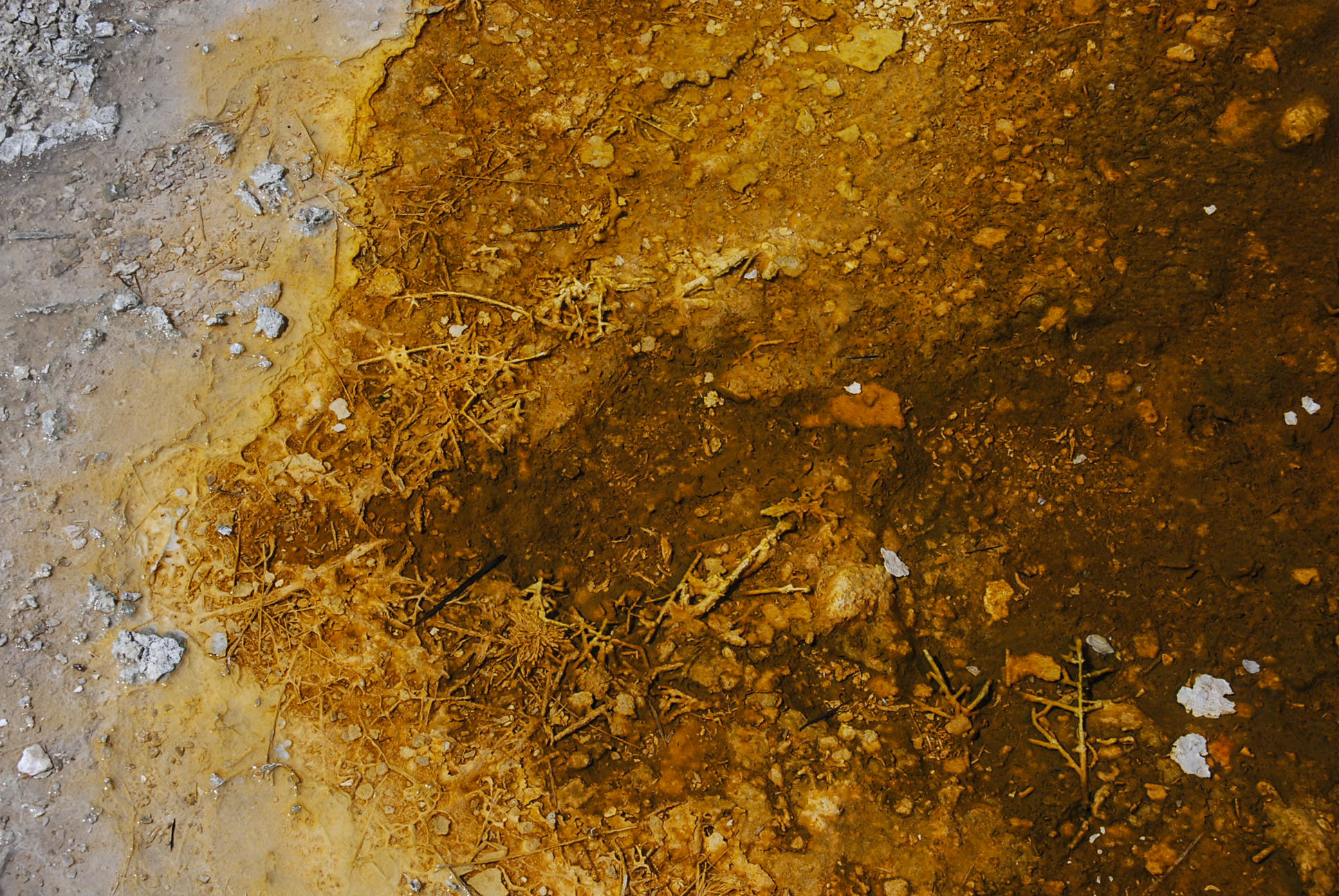
Dilapitated mines, boarding houses, and rusted equipment litter the roadside as memorial to the gold & silver rushes that created Ouray and the surrounding towns in the late 1800’s.


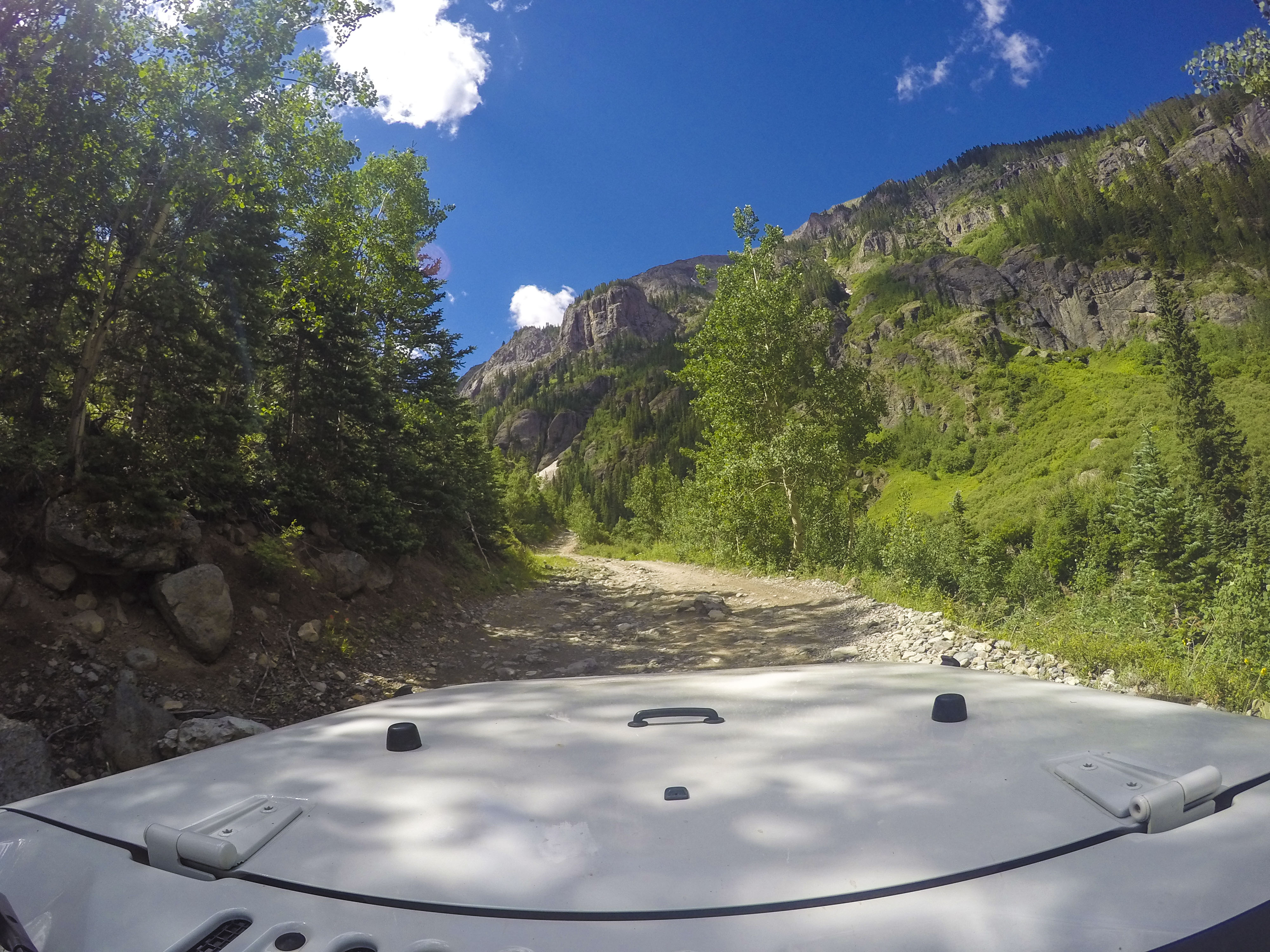
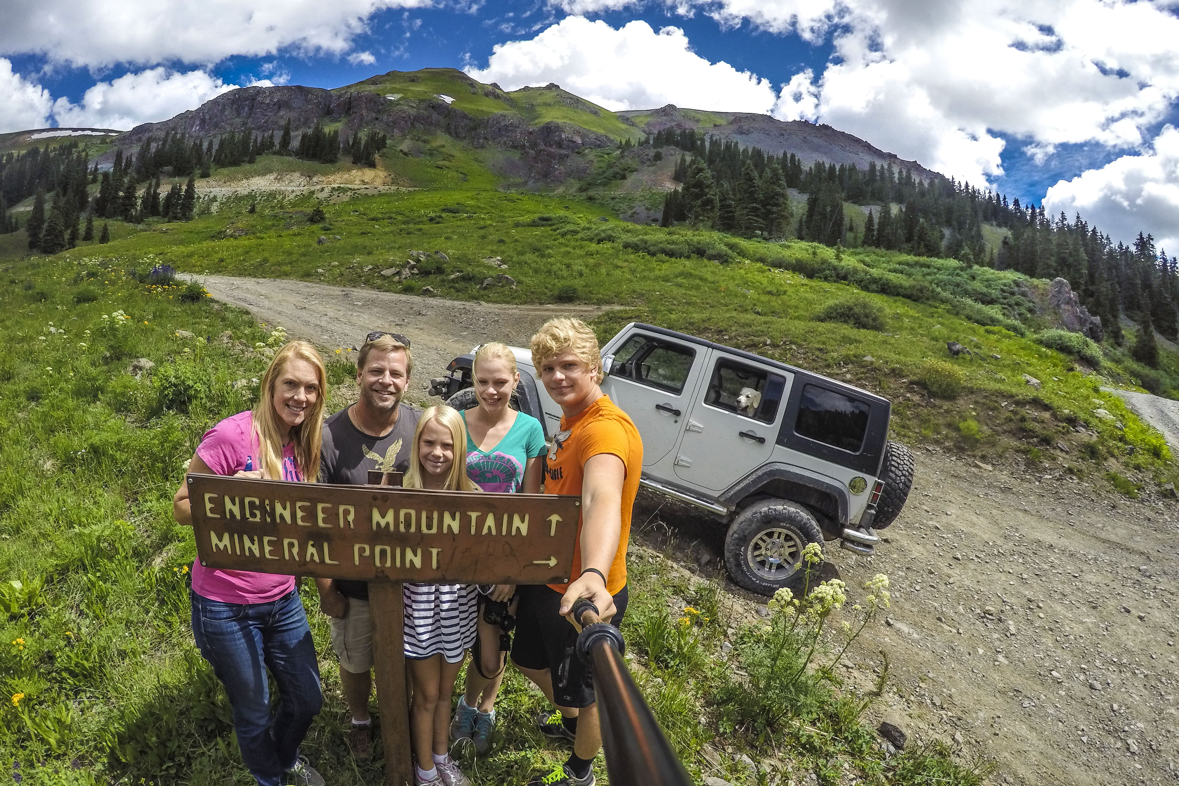
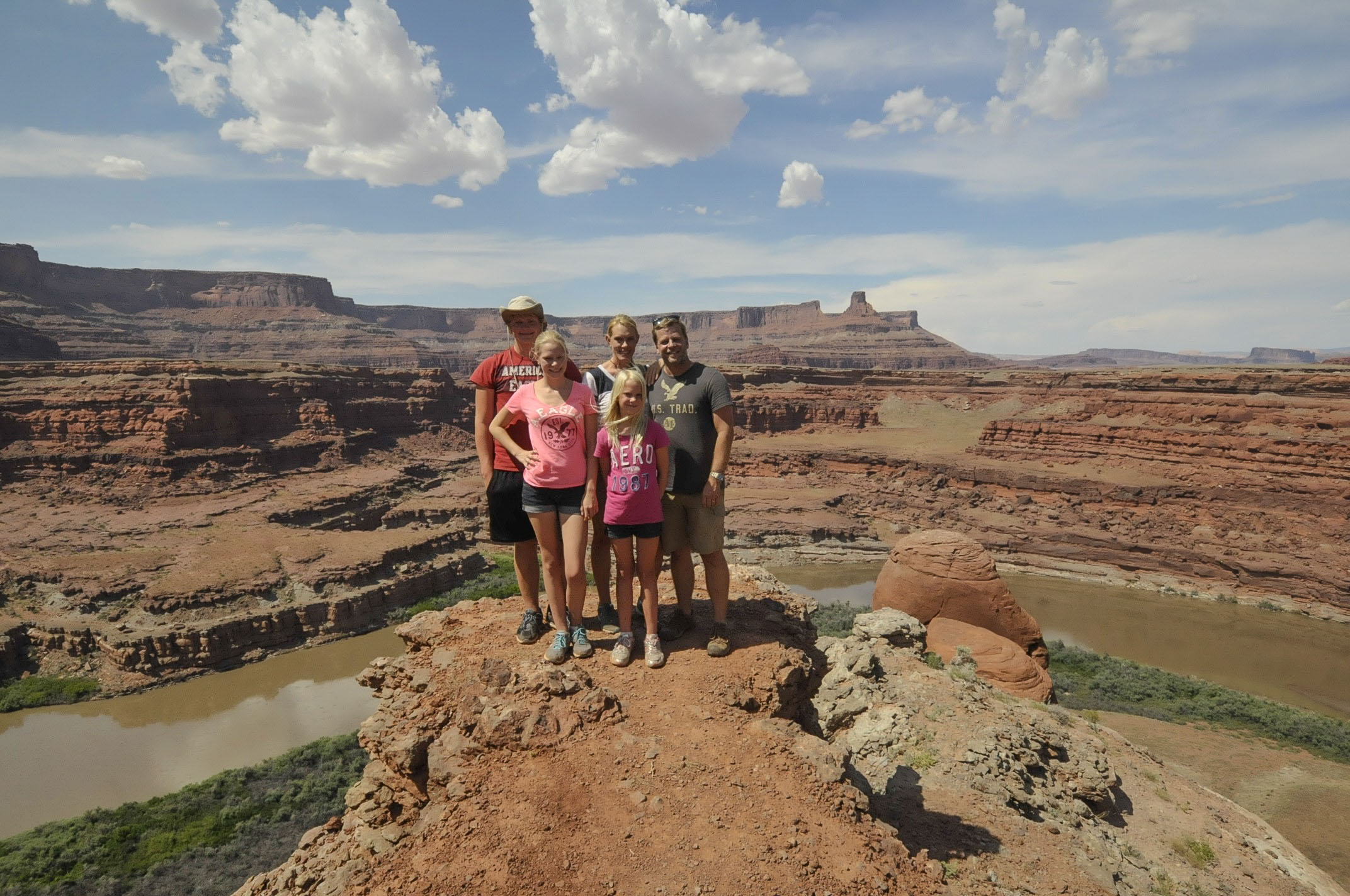
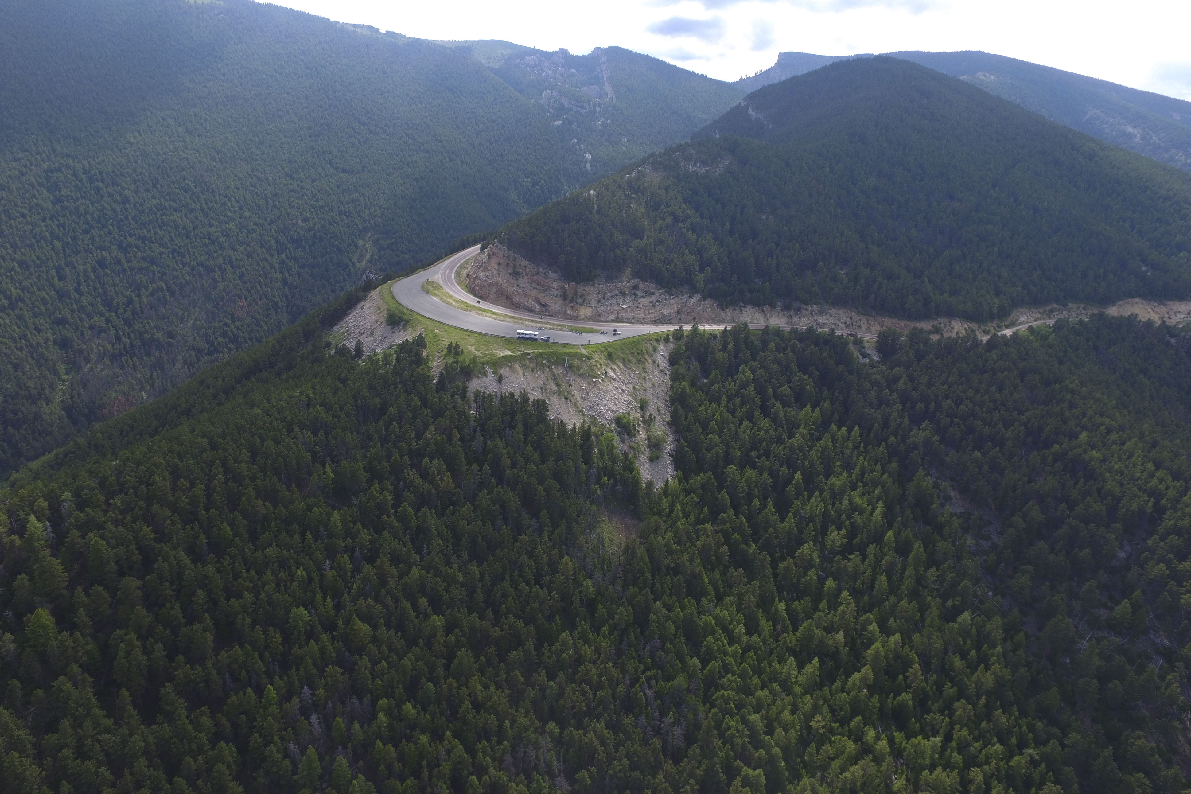
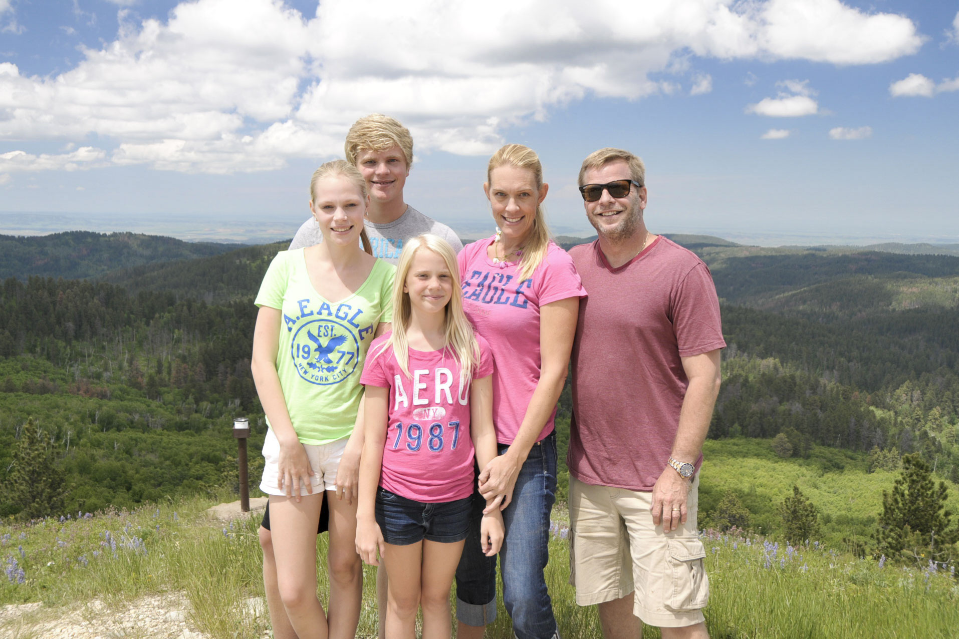
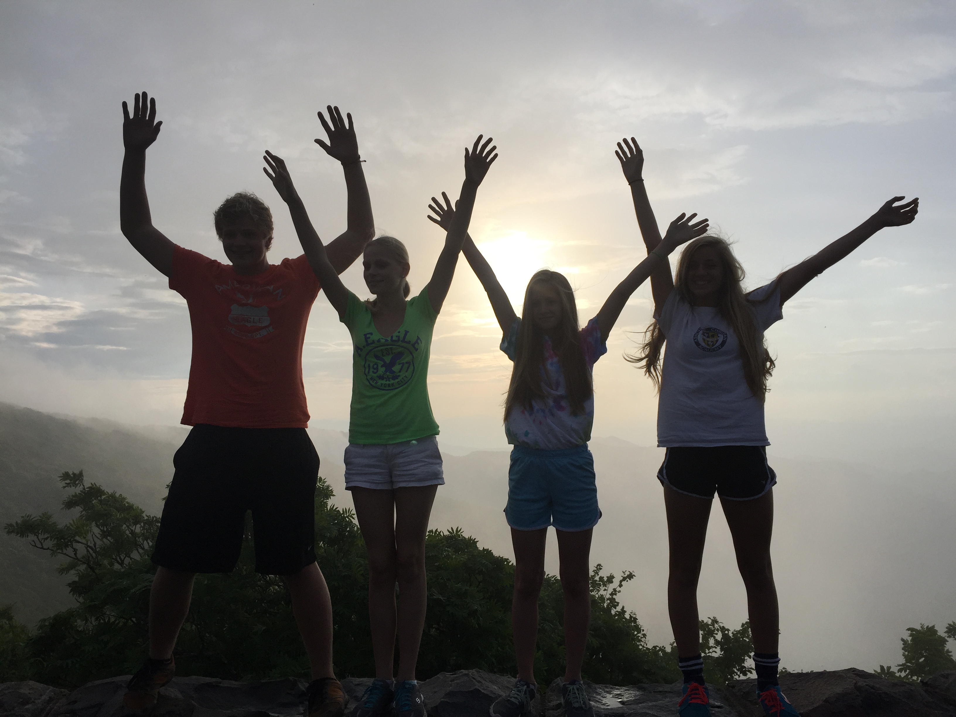
Hmm . . . choices. We first went up Engineer Mountain to “Oh Point” where it feels like the top of the world!

Photo Jul 12, 12 11 01 PM-a

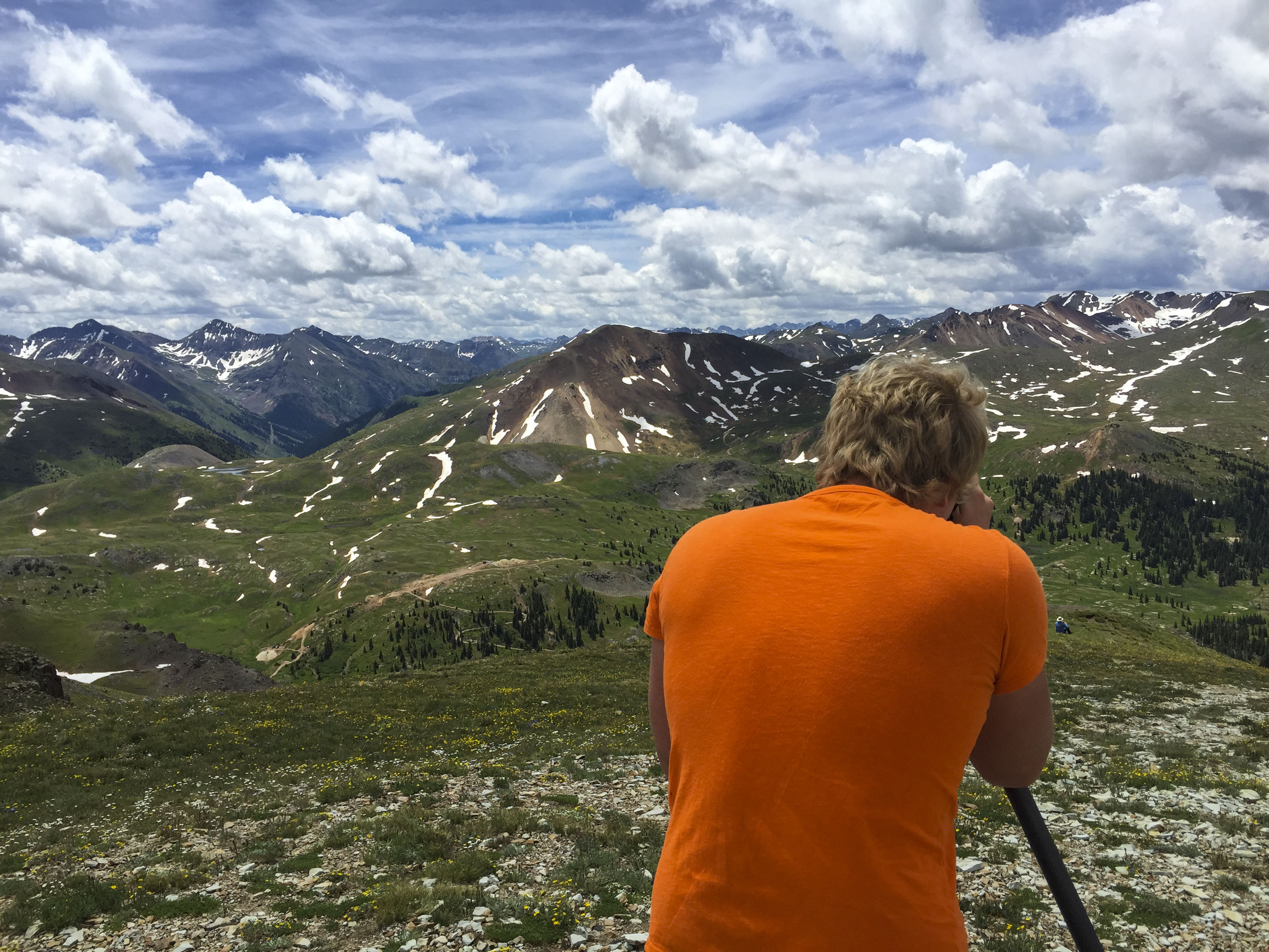
This plateau among the peaks provides 360º views of the surrounding summits. Mount Sneffels is the highest one around at 14,158 ft. (almost 3 miles above sea level!)


oh point ouray-a

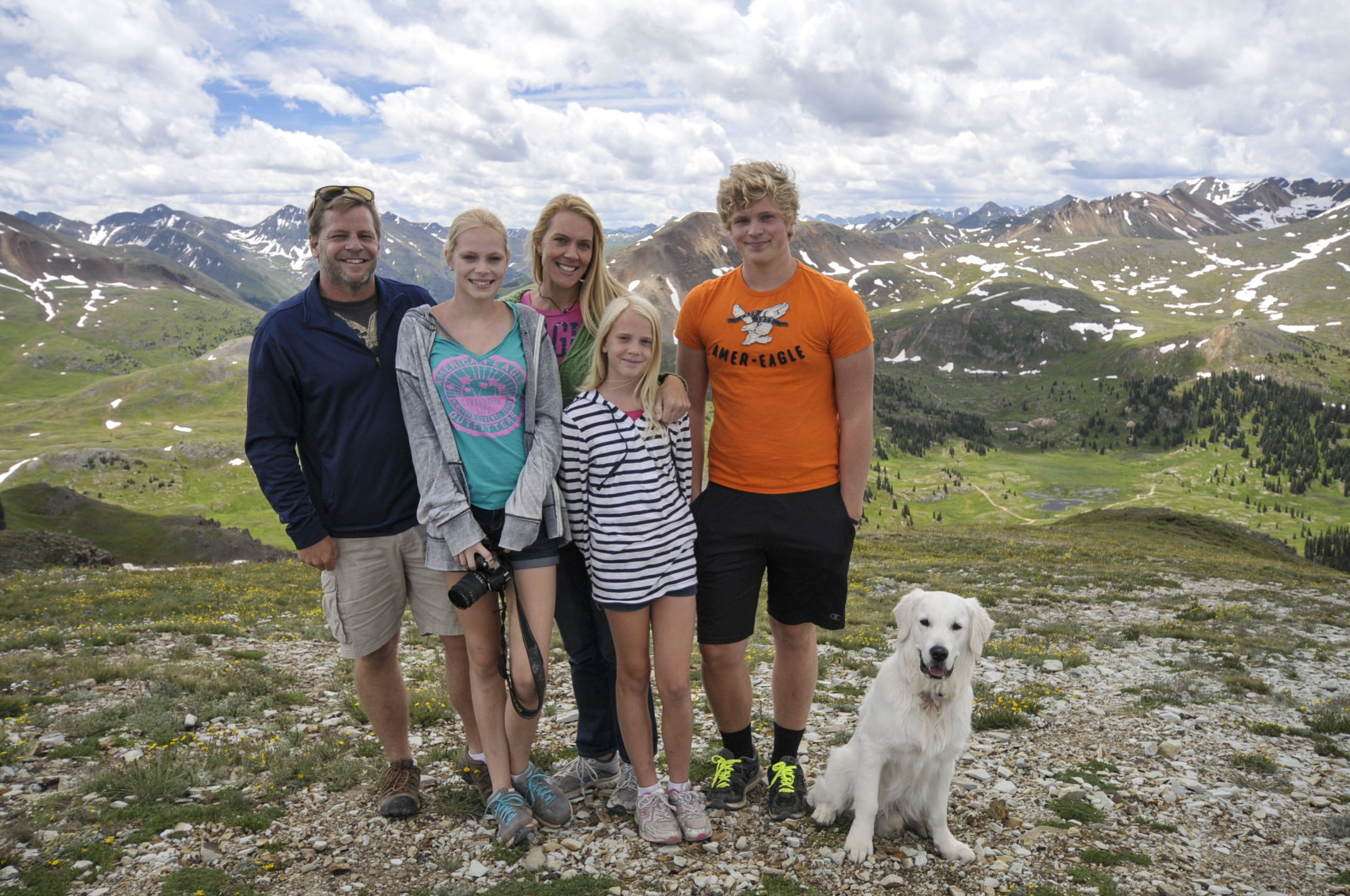
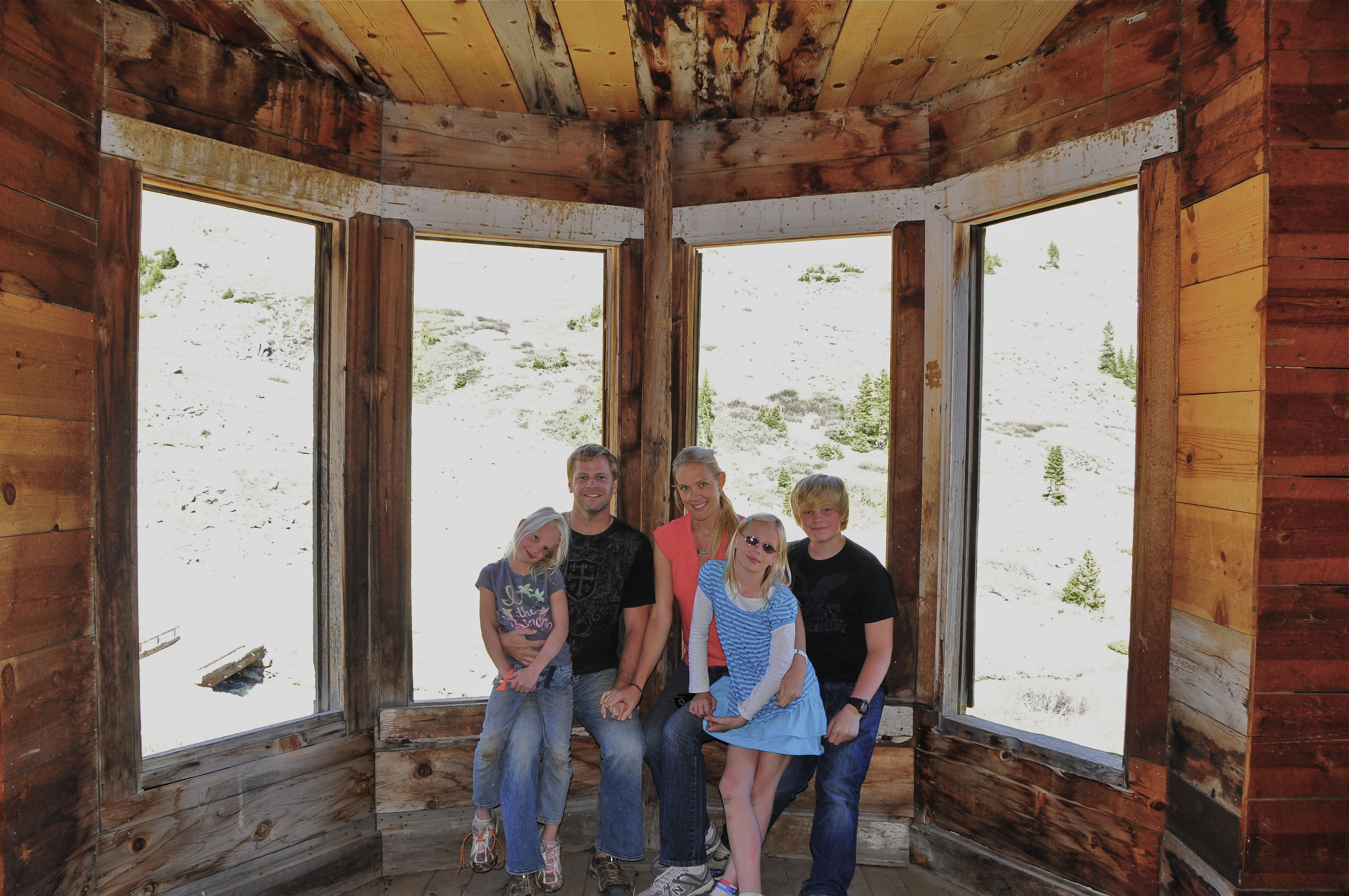
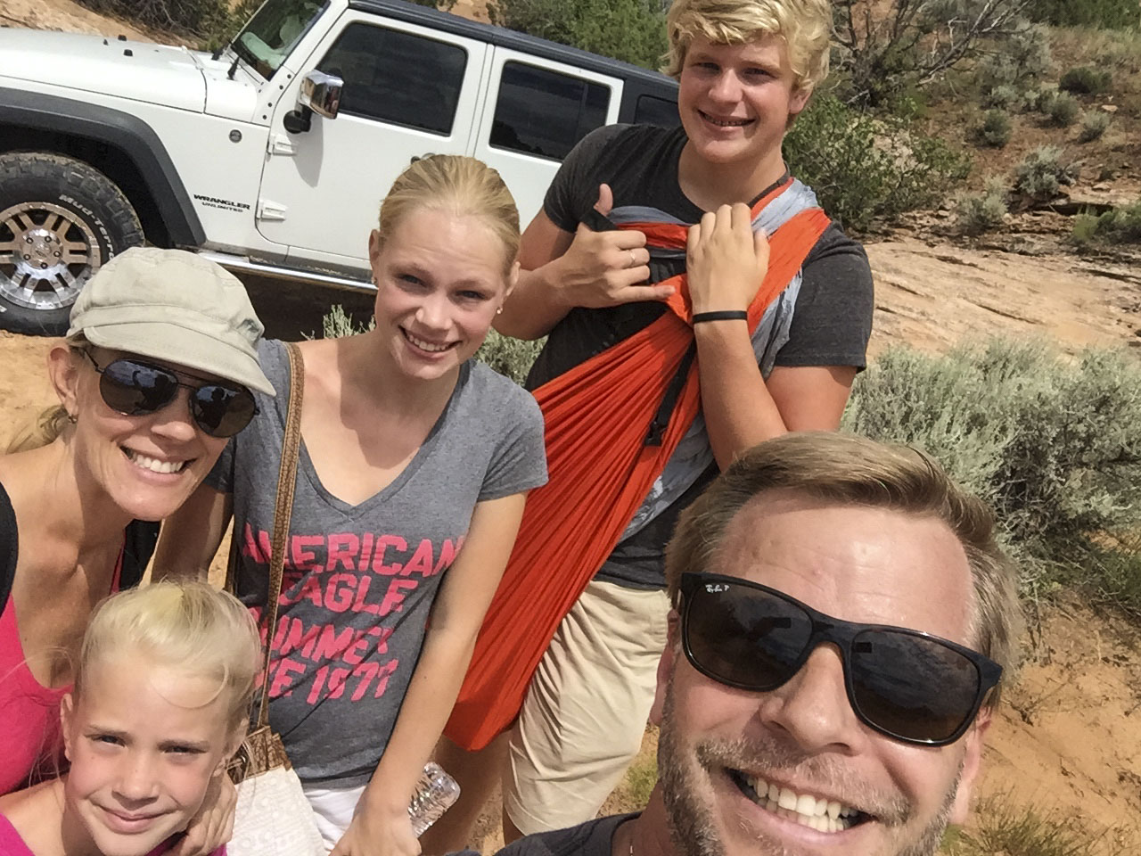
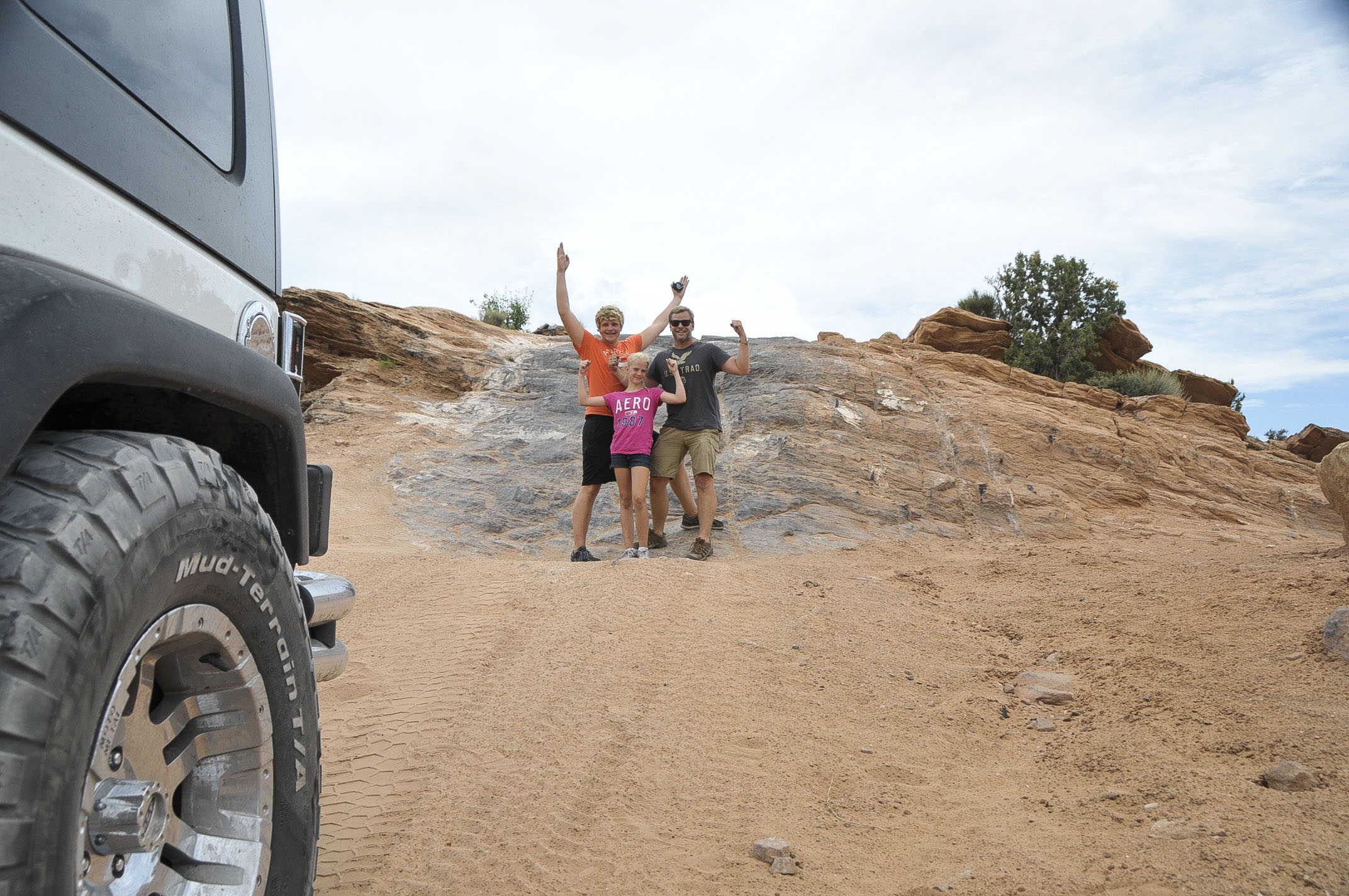
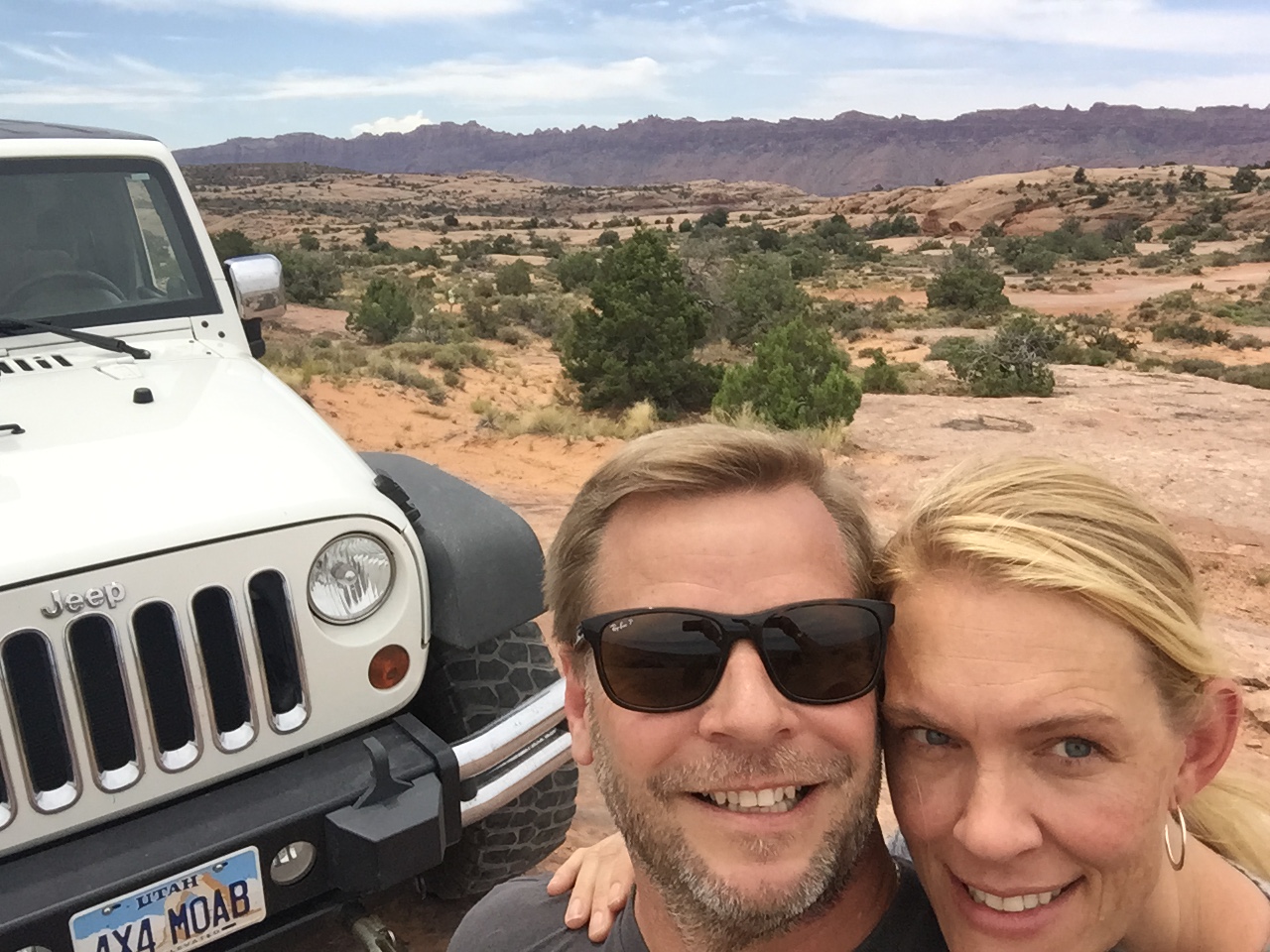
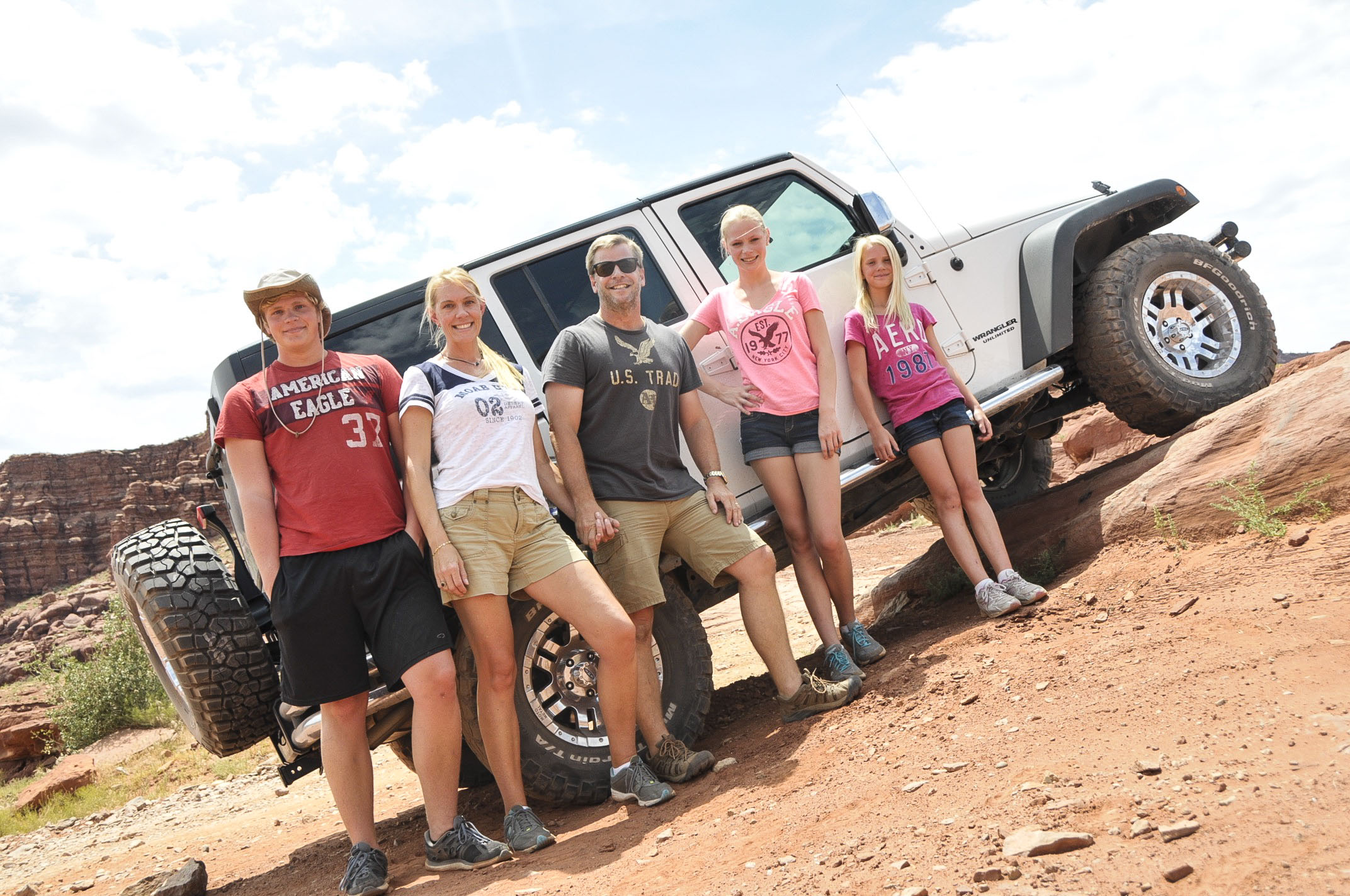
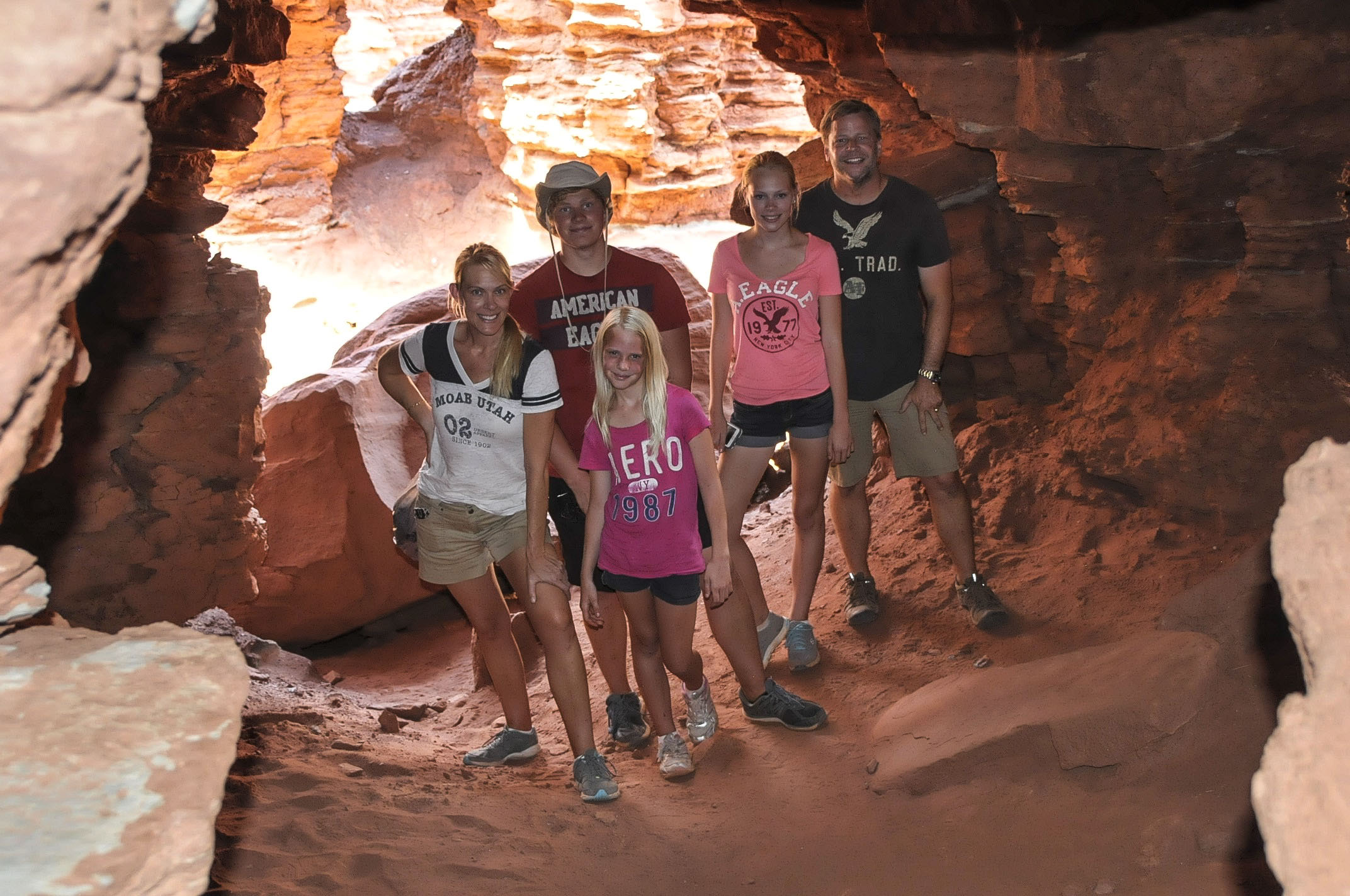
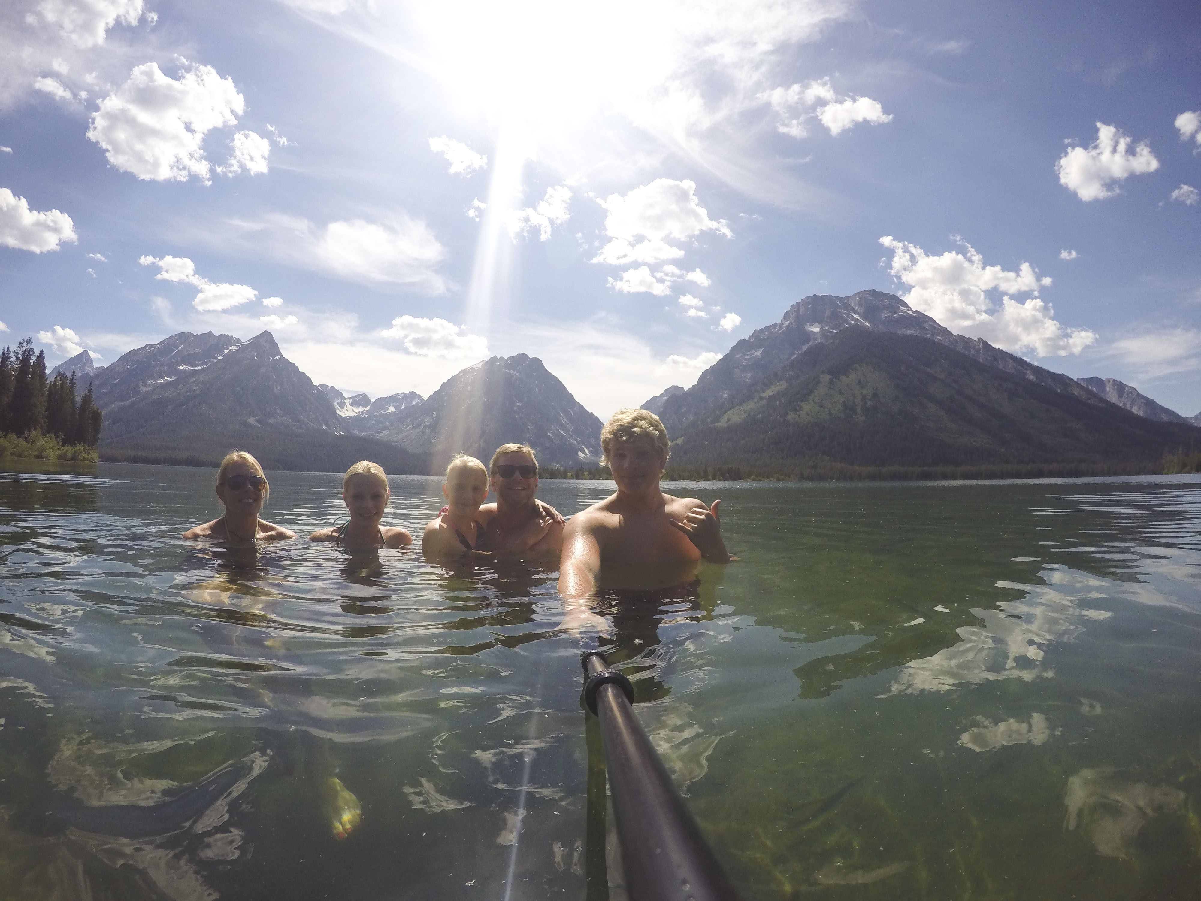
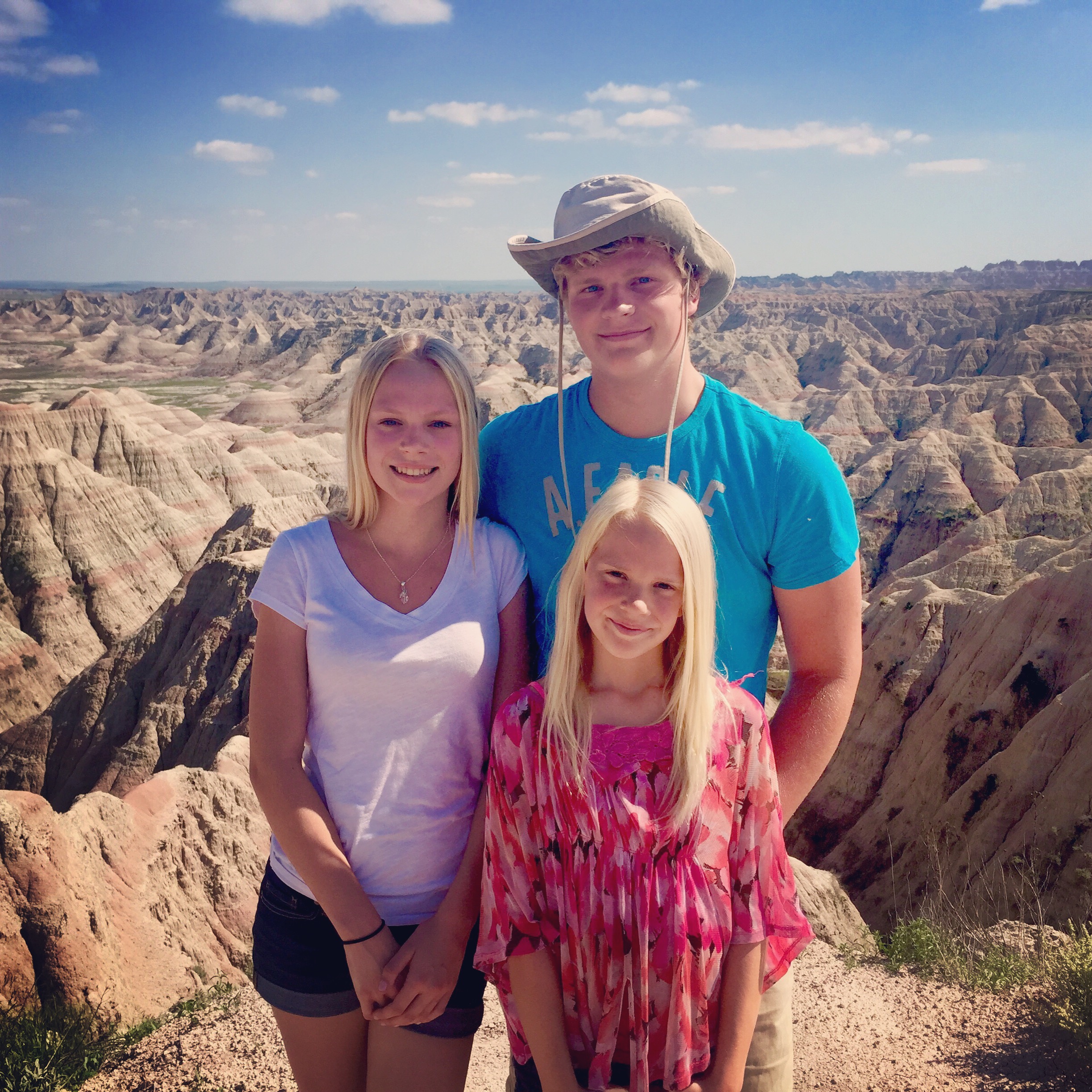
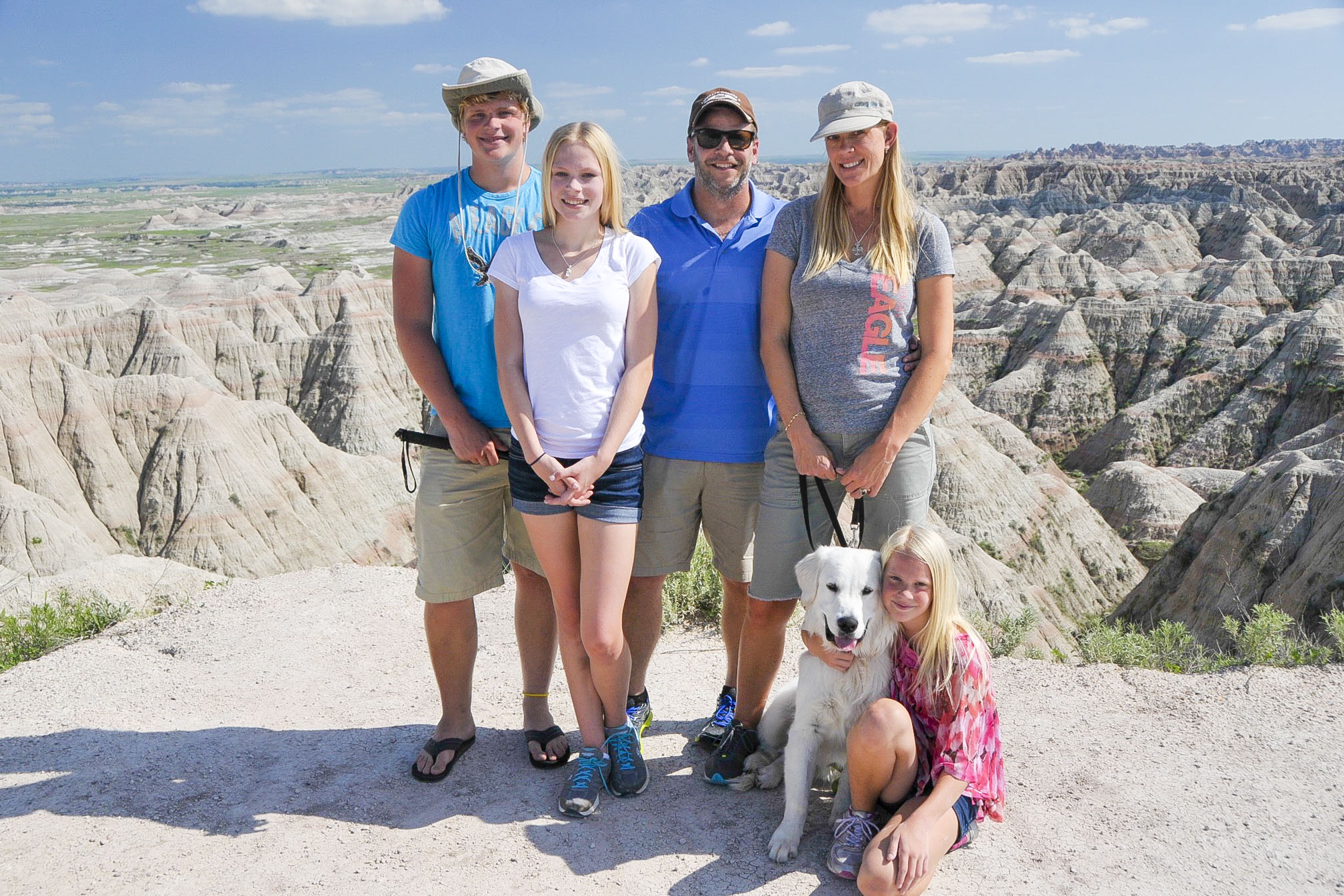
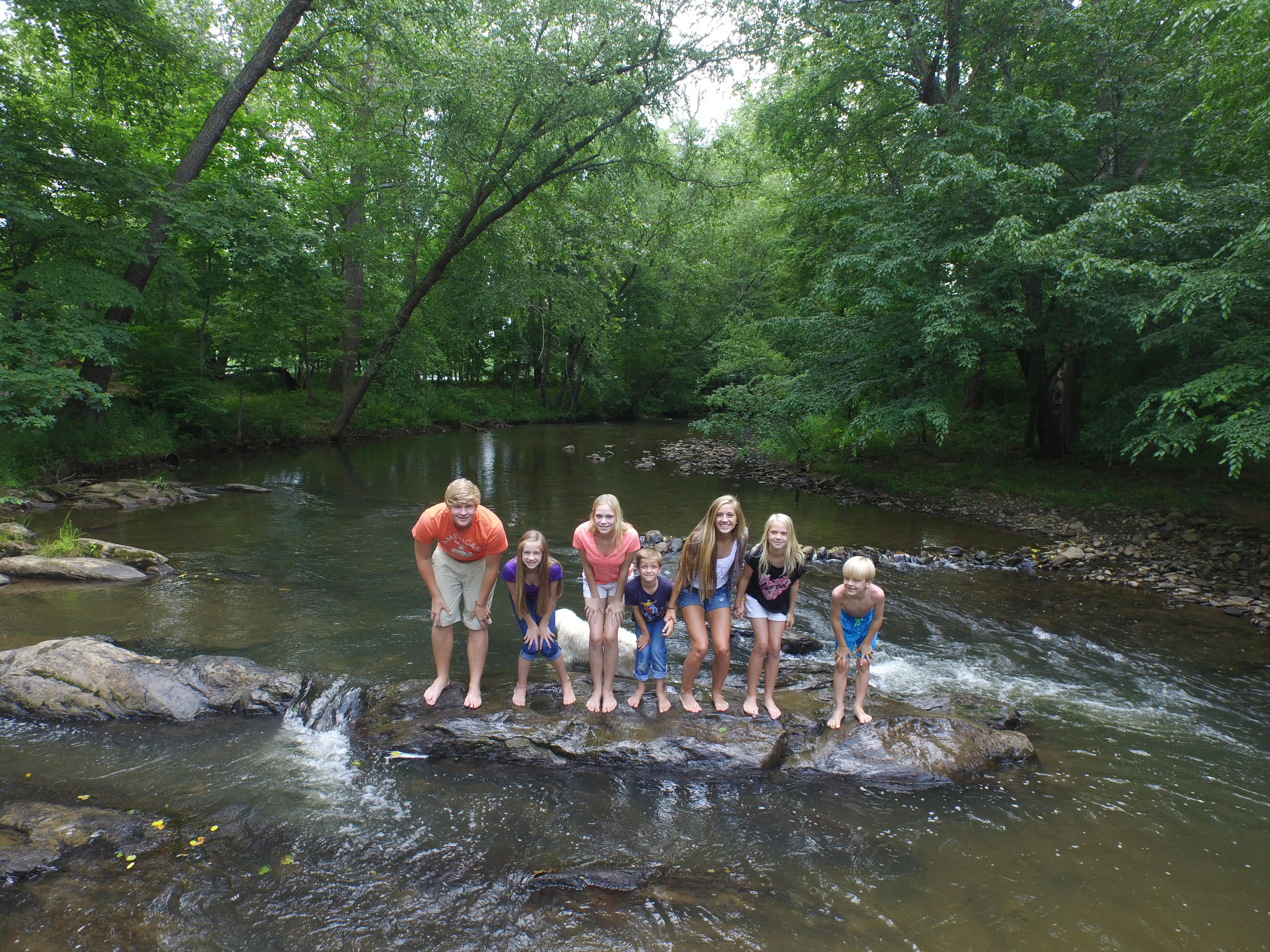
Family pic atop OH POINT! #topoftheworld


Dakota Oh Point  JeeponOHpoint

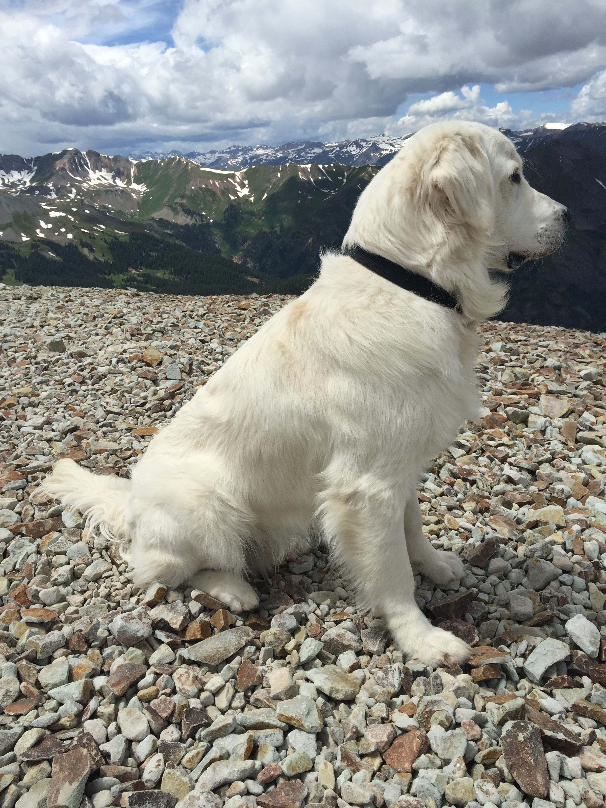
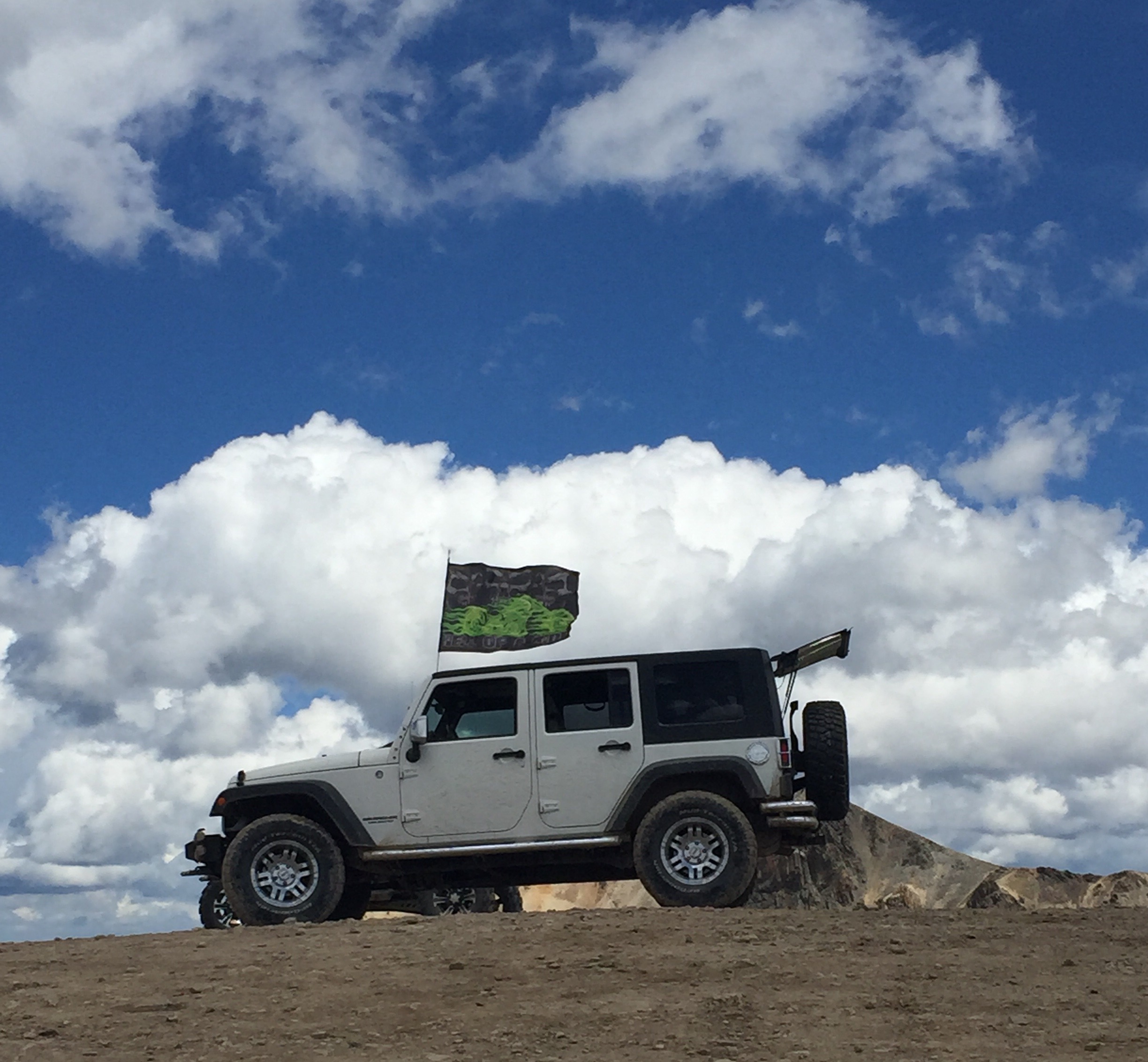
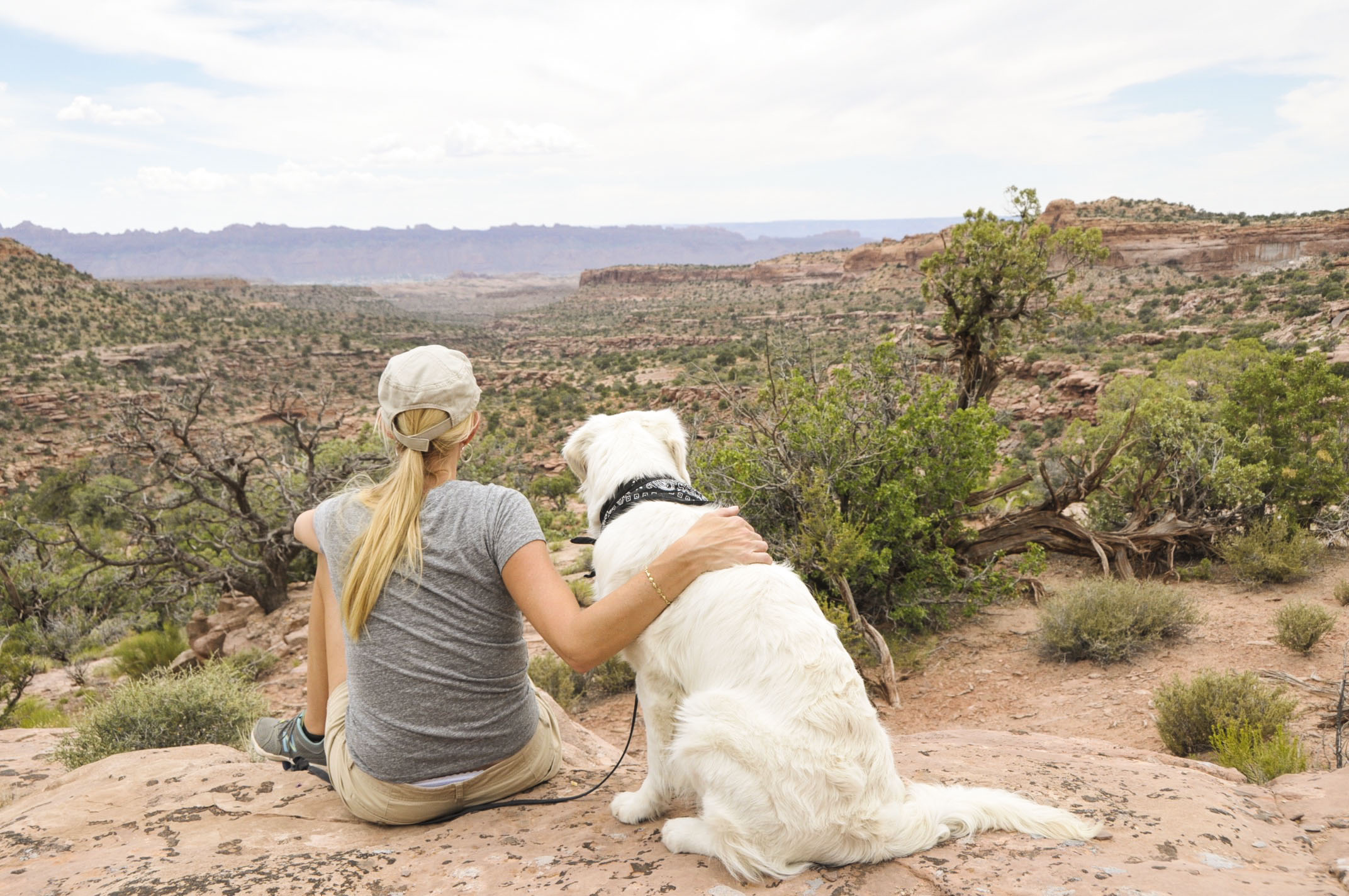
Dakota enjoying the views and posing like a model dog! The Jeep looked so cool with this ATV-ers flag fluttering behind it (don’t click to enlarge photo–flag is from the dark side).


DSC_4284-a  

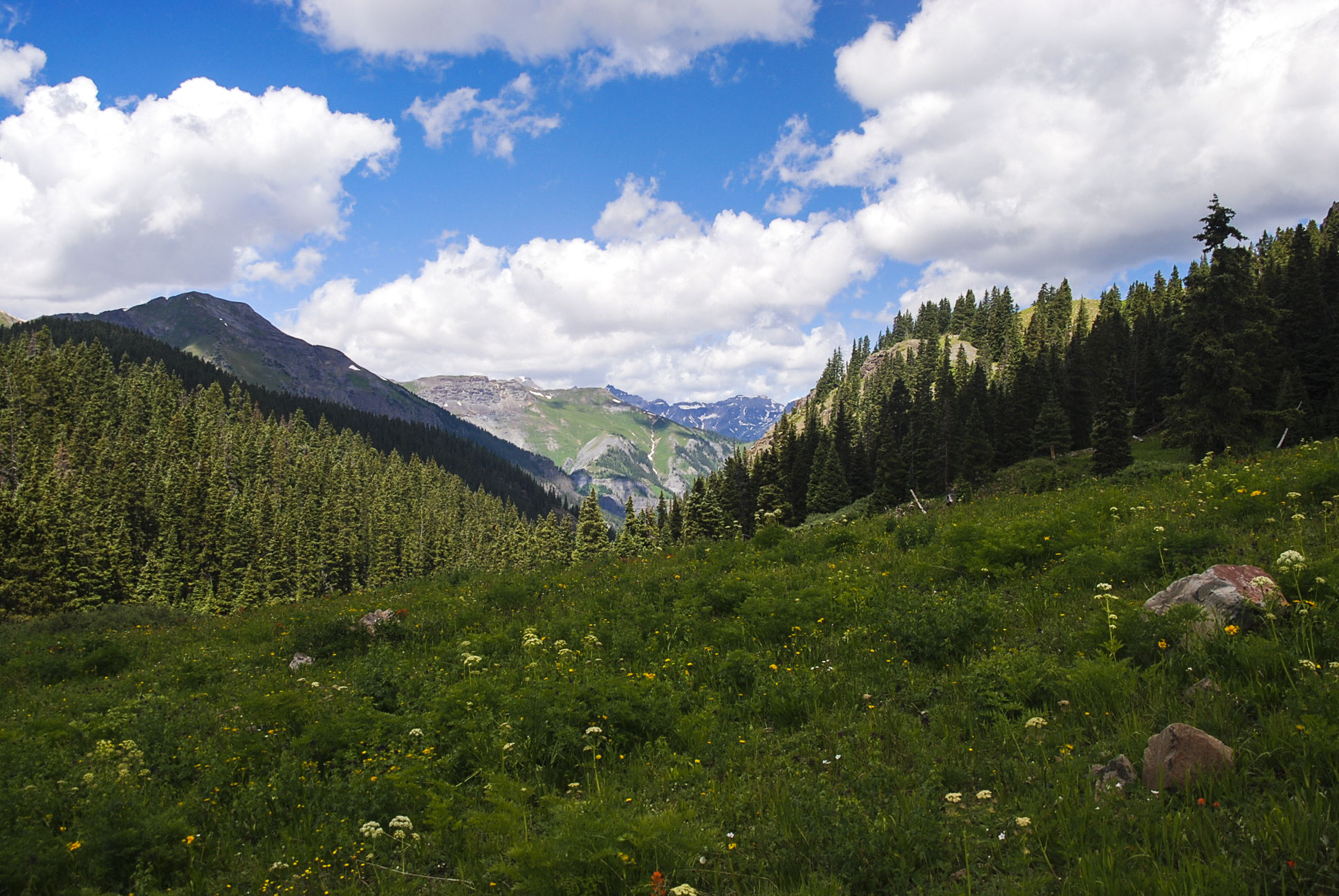
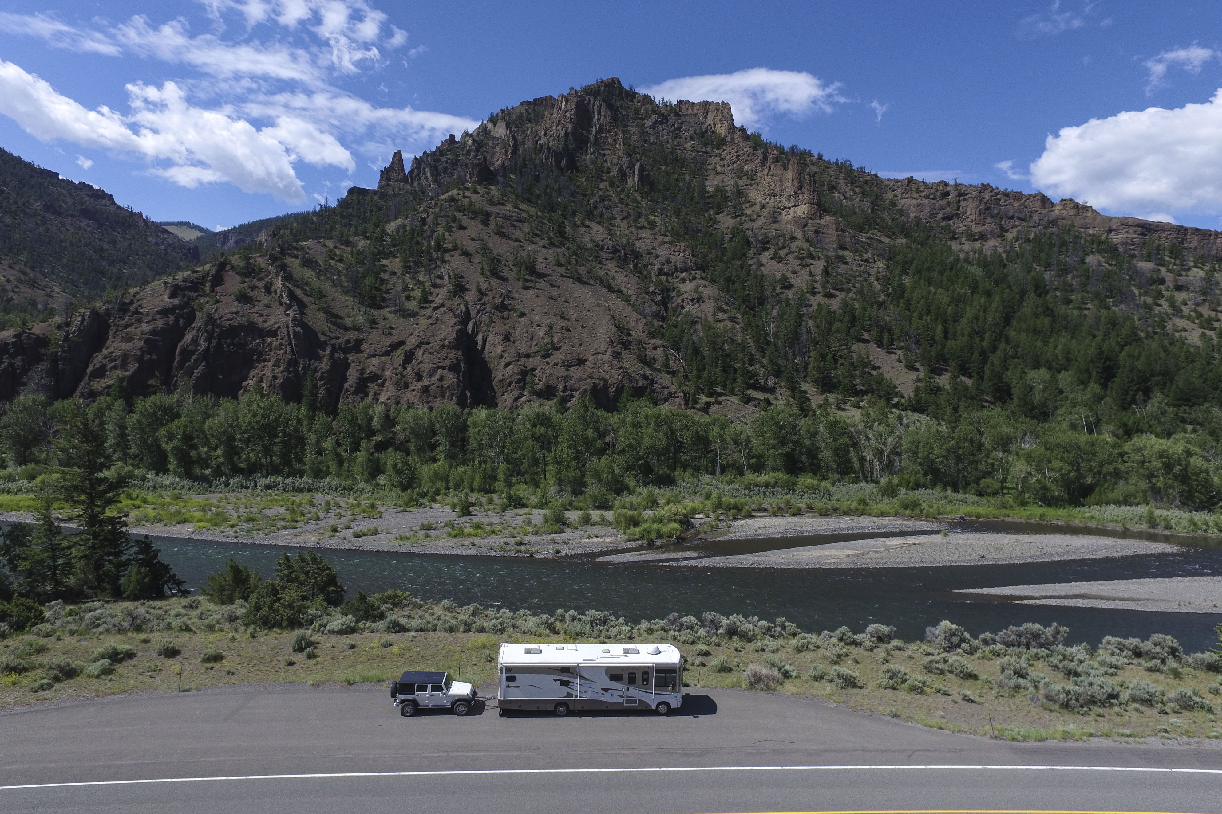
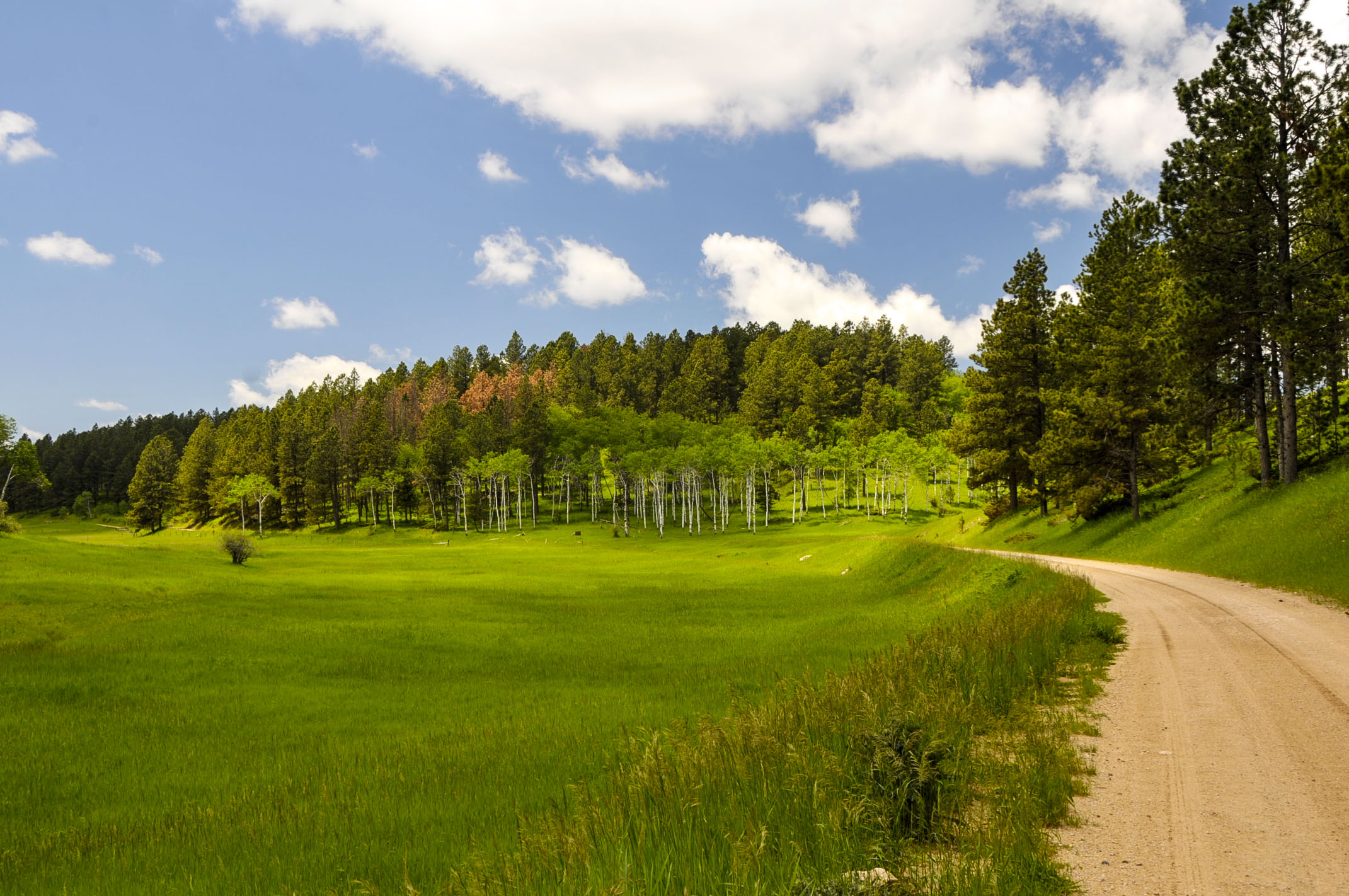
Heading back down to Mineral Point (the other choice on the previous sign) shows lush green valleys and more wildflowers.

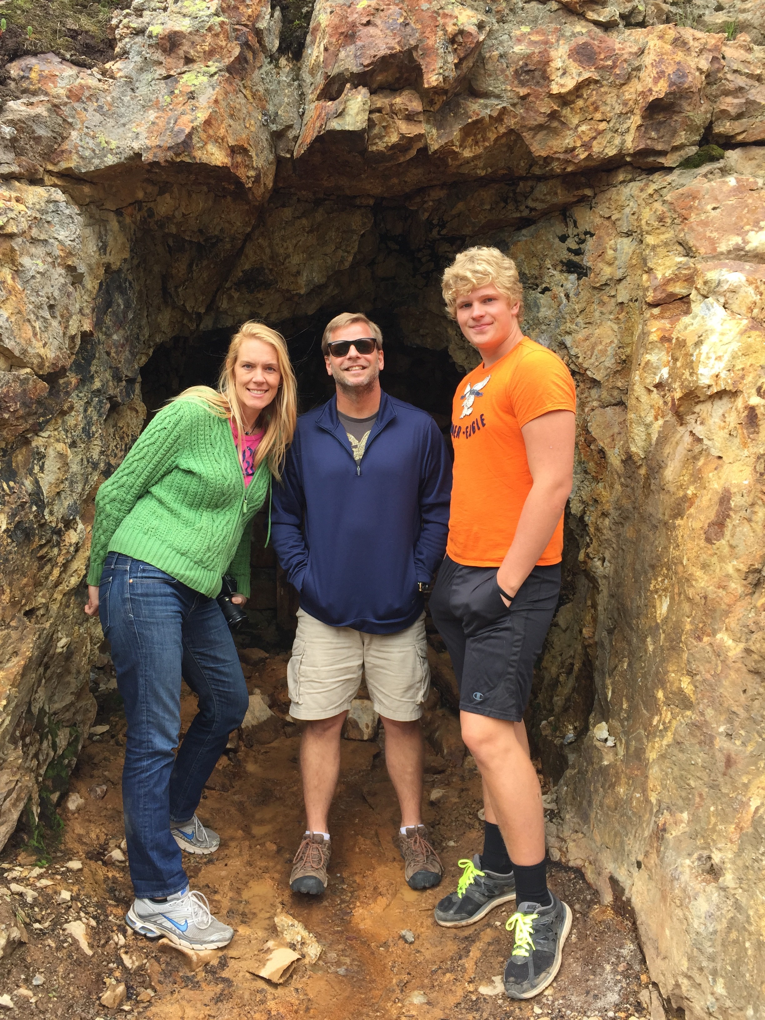
Today’s lunch stop: Camp Bird Mine

kids mine 2015-2007-a  old mine kids 2007

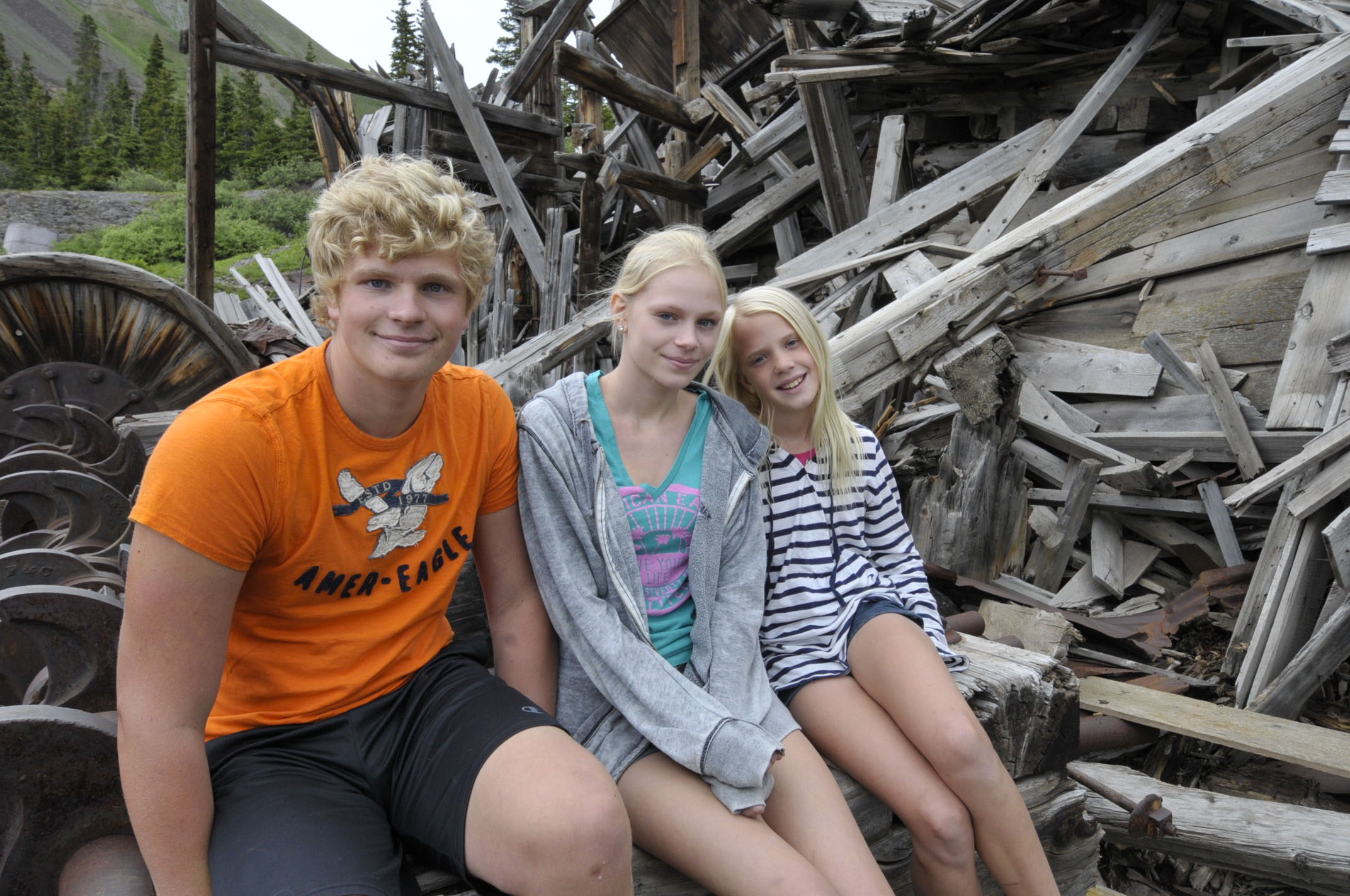
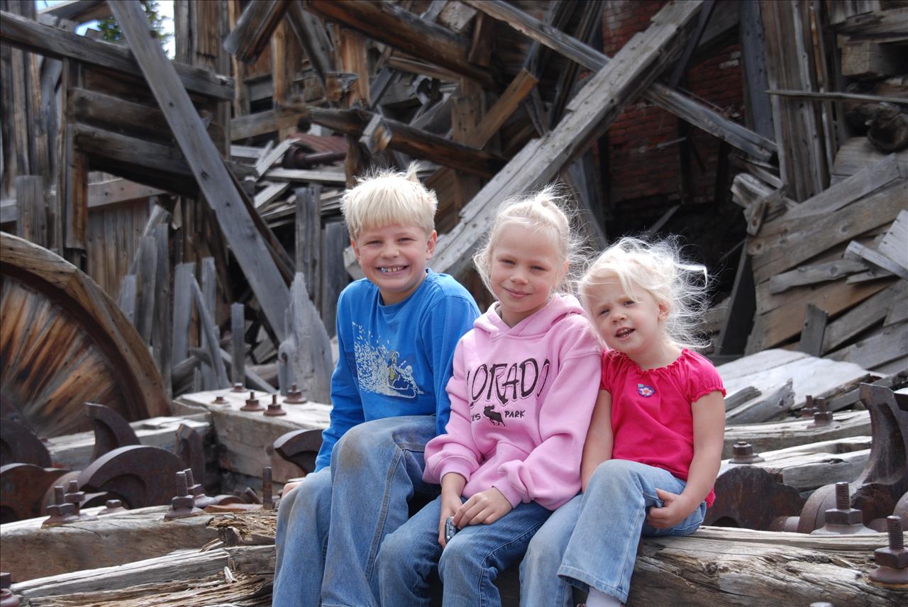
2015 and 2007 . . . Not only the kids have changed. The structure has aged as well.


jordan climbing frisco mine-a  jarred frisco  mine-a

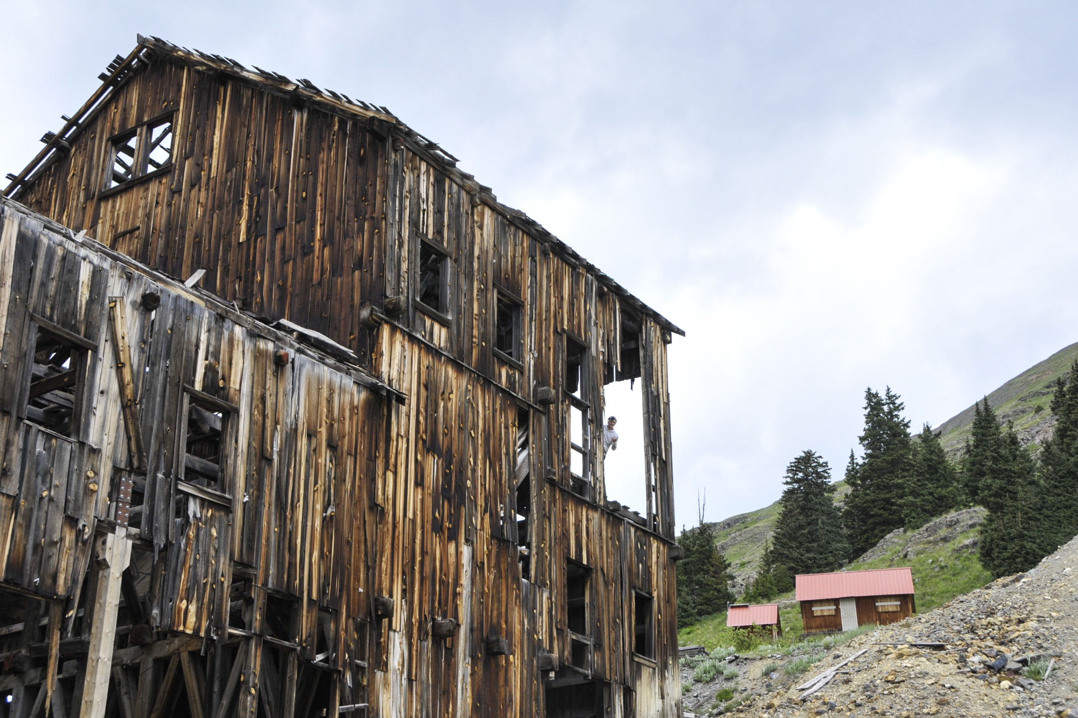
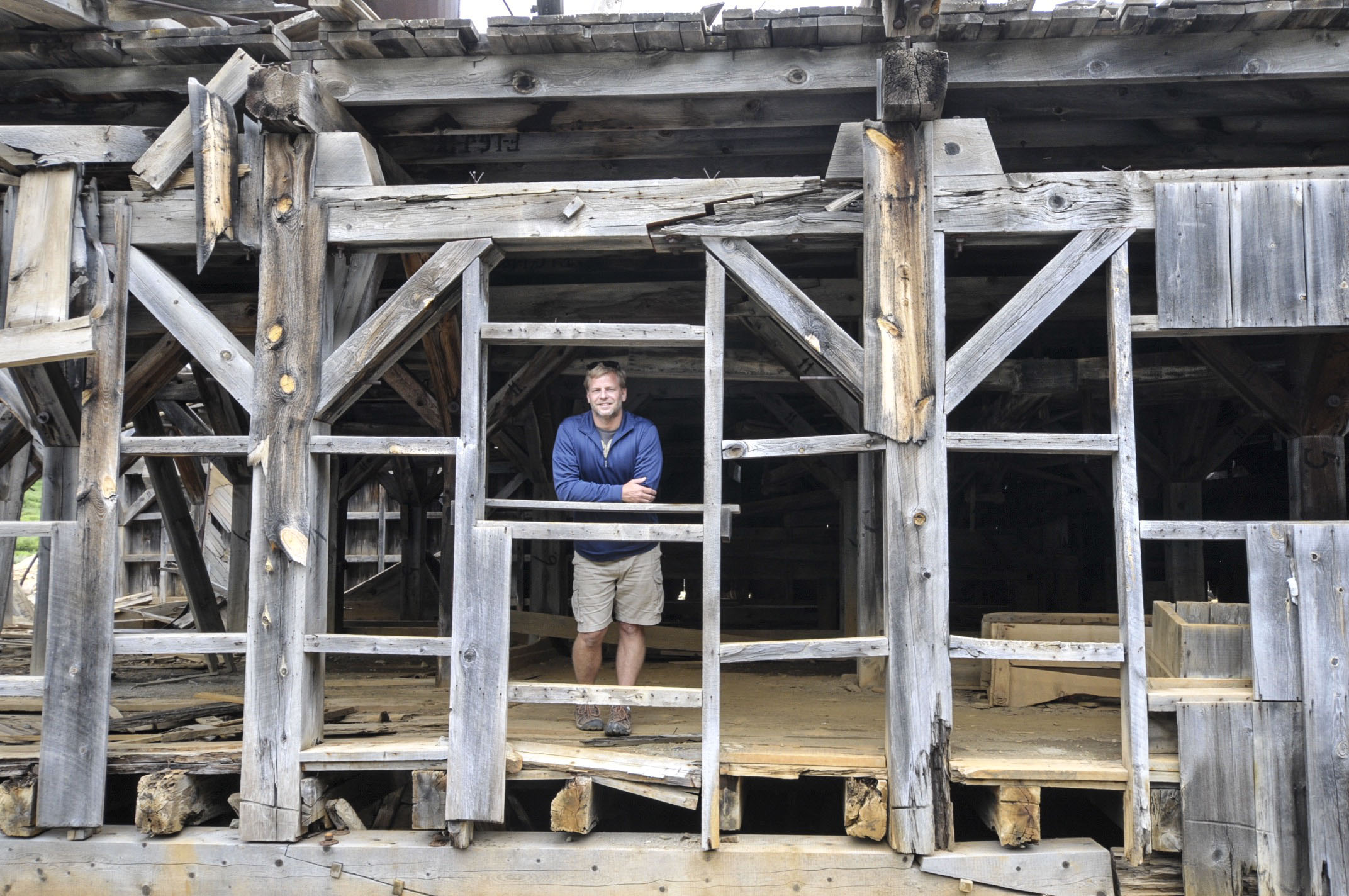
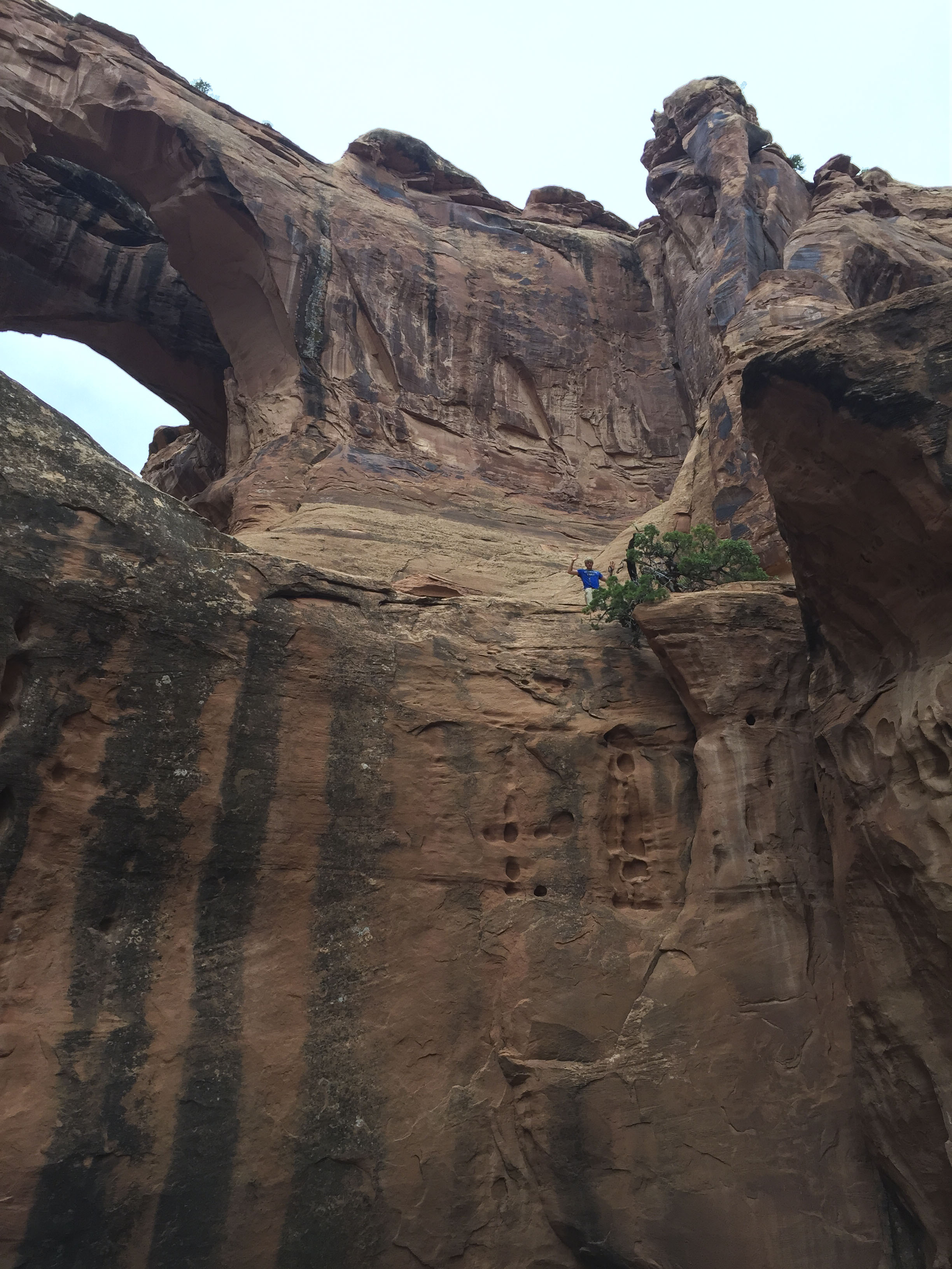
See Jordan in left pic way up hight? This property in the middle of nowhere is actually for sale. Any investors want to go in with us to create a coffee shop & wifi hotspot out here for all these Jeepers? As remote as it is, 250,000 visitors make this trek each summer.

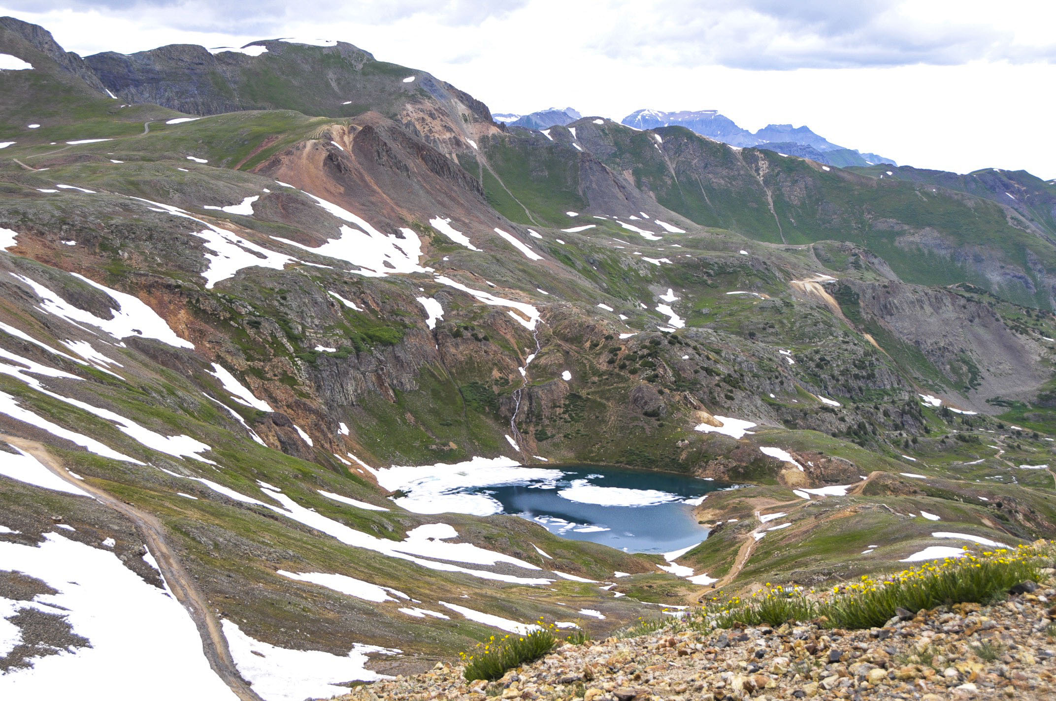
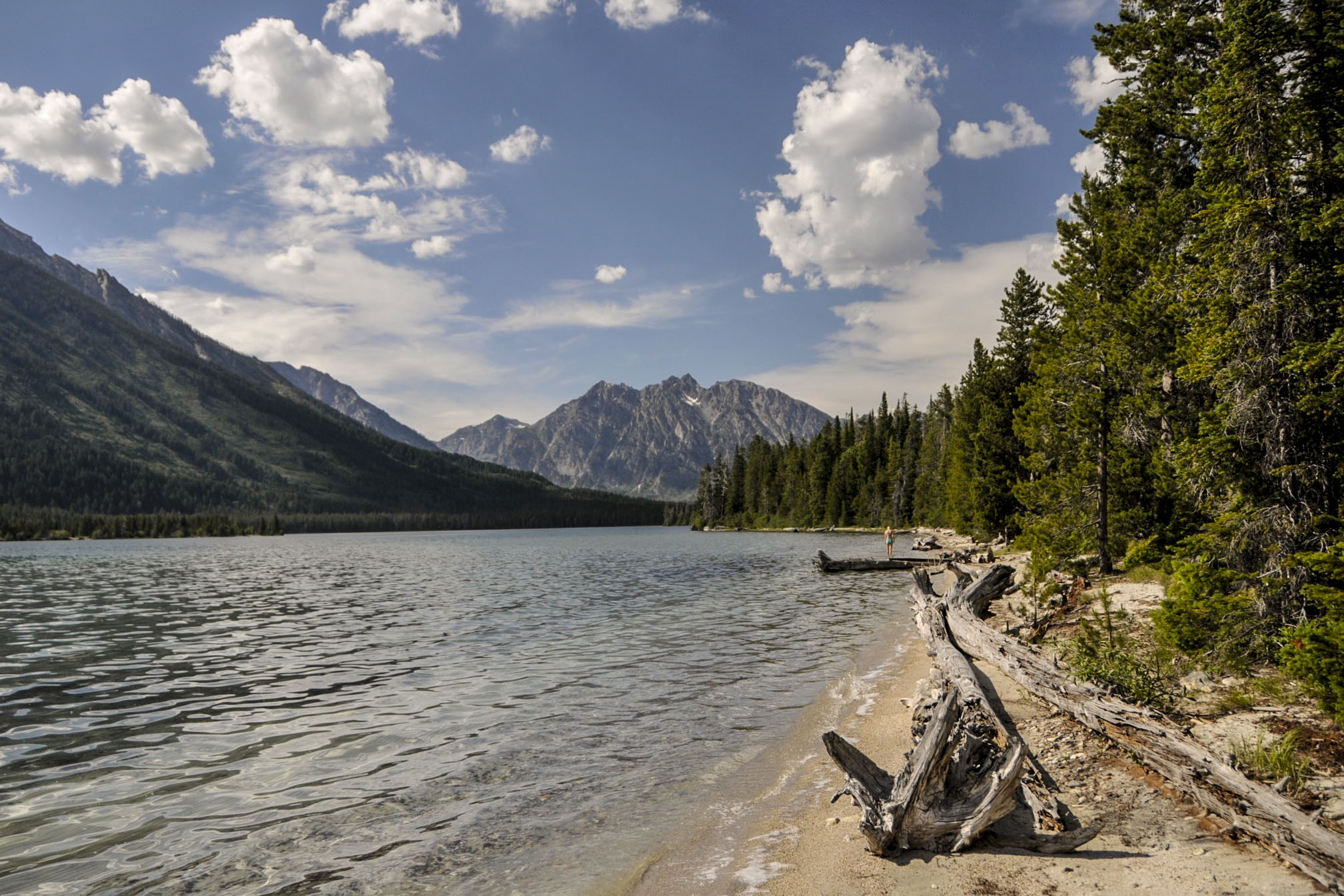
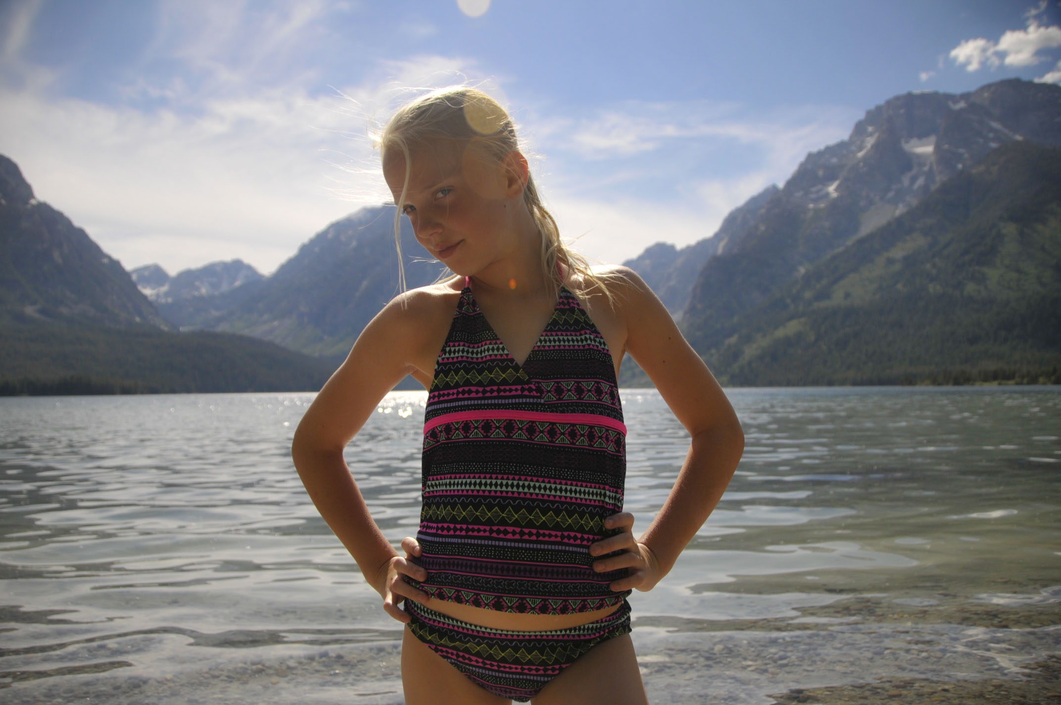
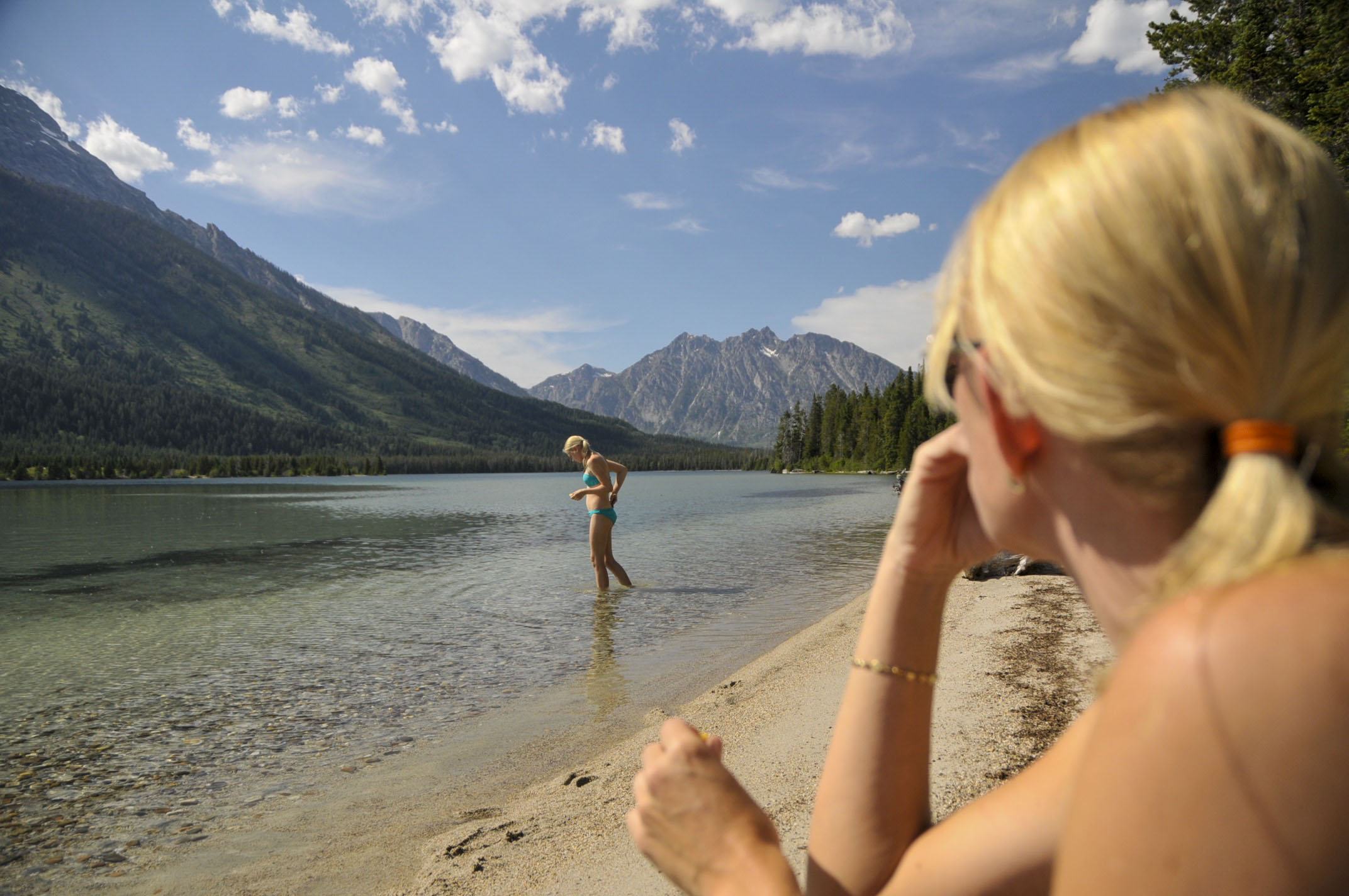
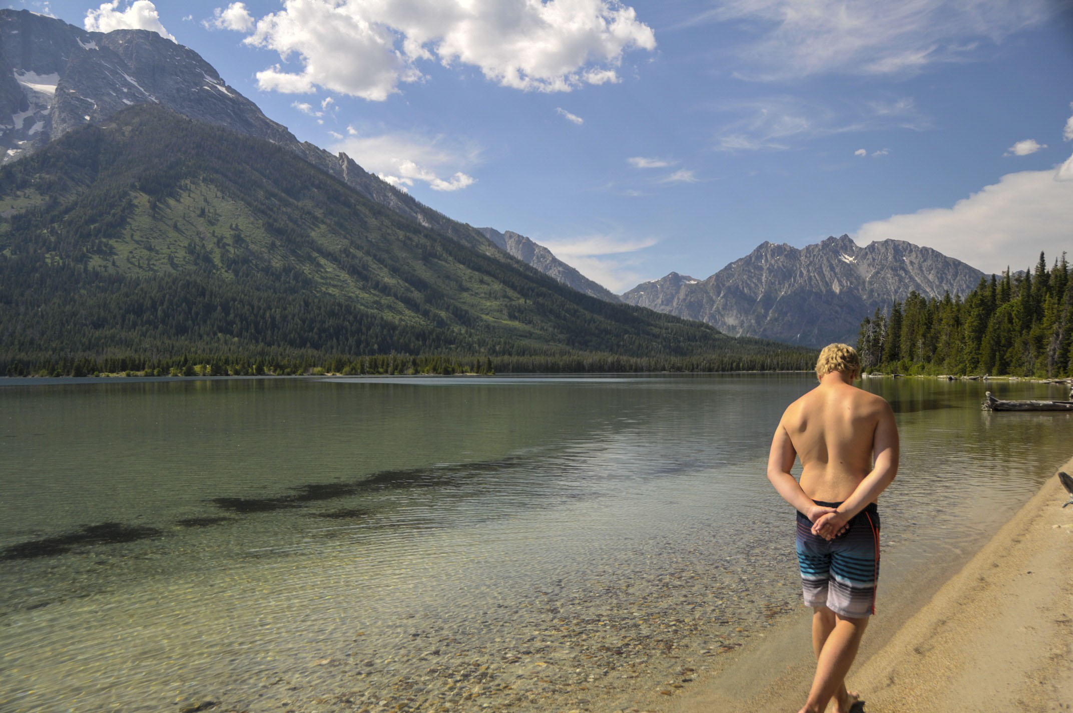
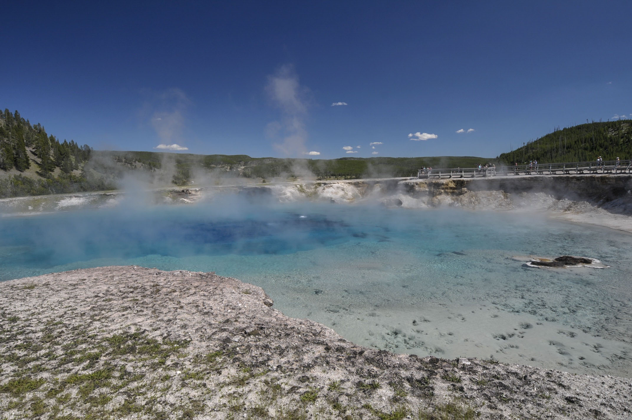
BUT . . . I bet only one visitor will have swam here this summer . . .

jordan mountain lake-a

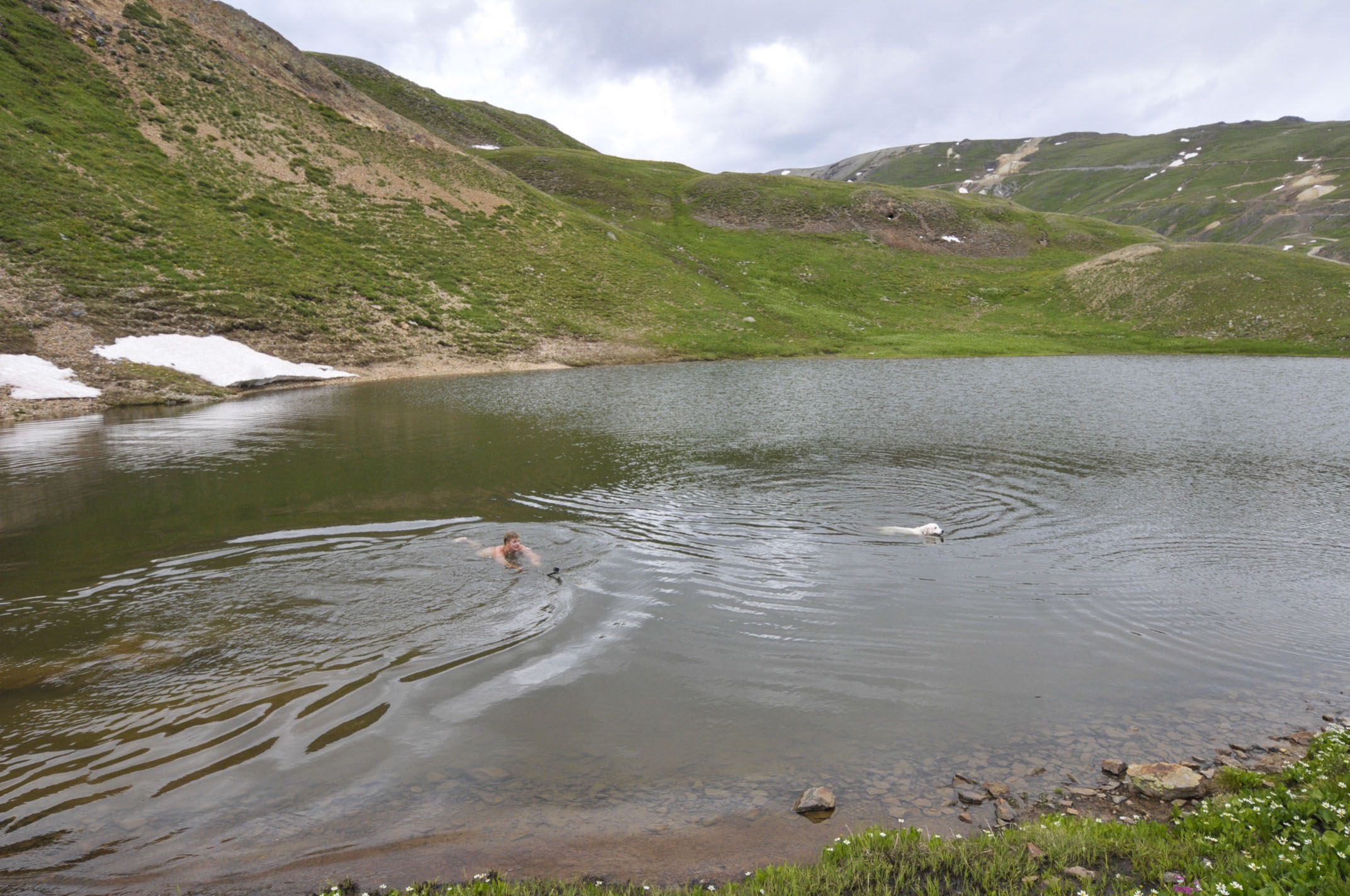
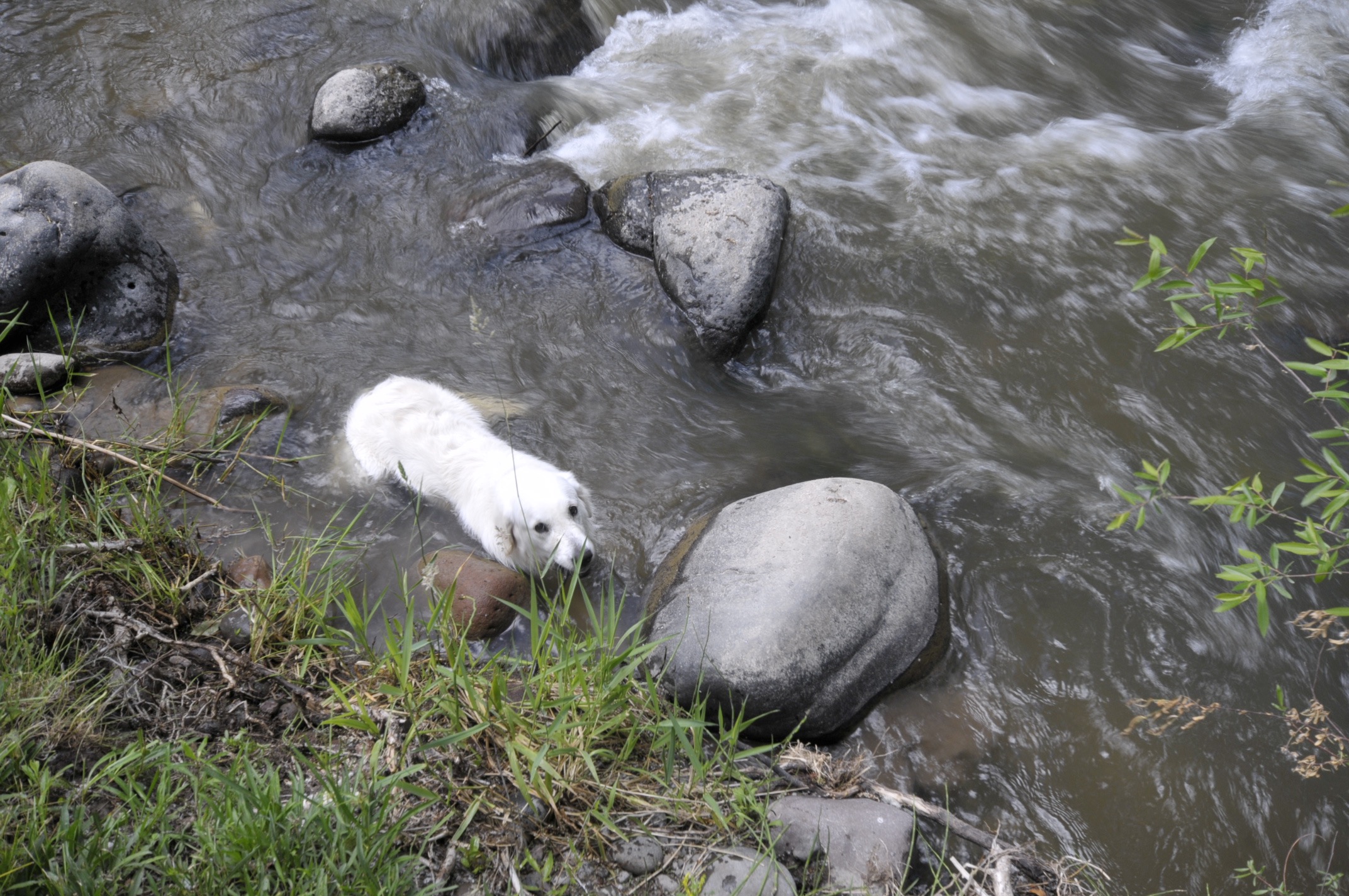
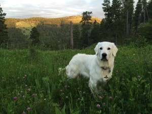
This lake is comprised of snow-melt. What temp do you suppose it is? We snapped this pic of two rarely seen polar bears swimming here. One had obviously shed his winter coat.


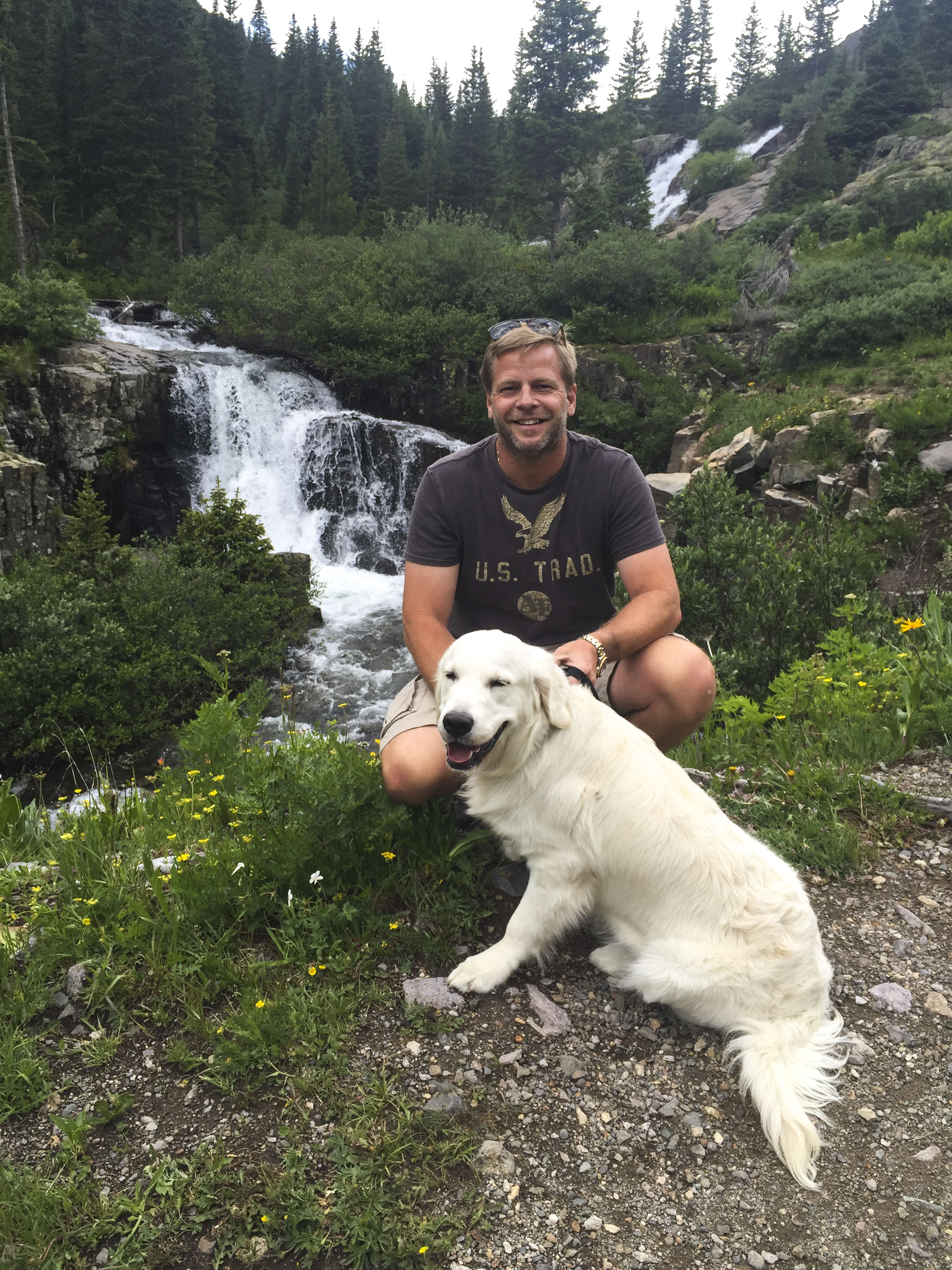
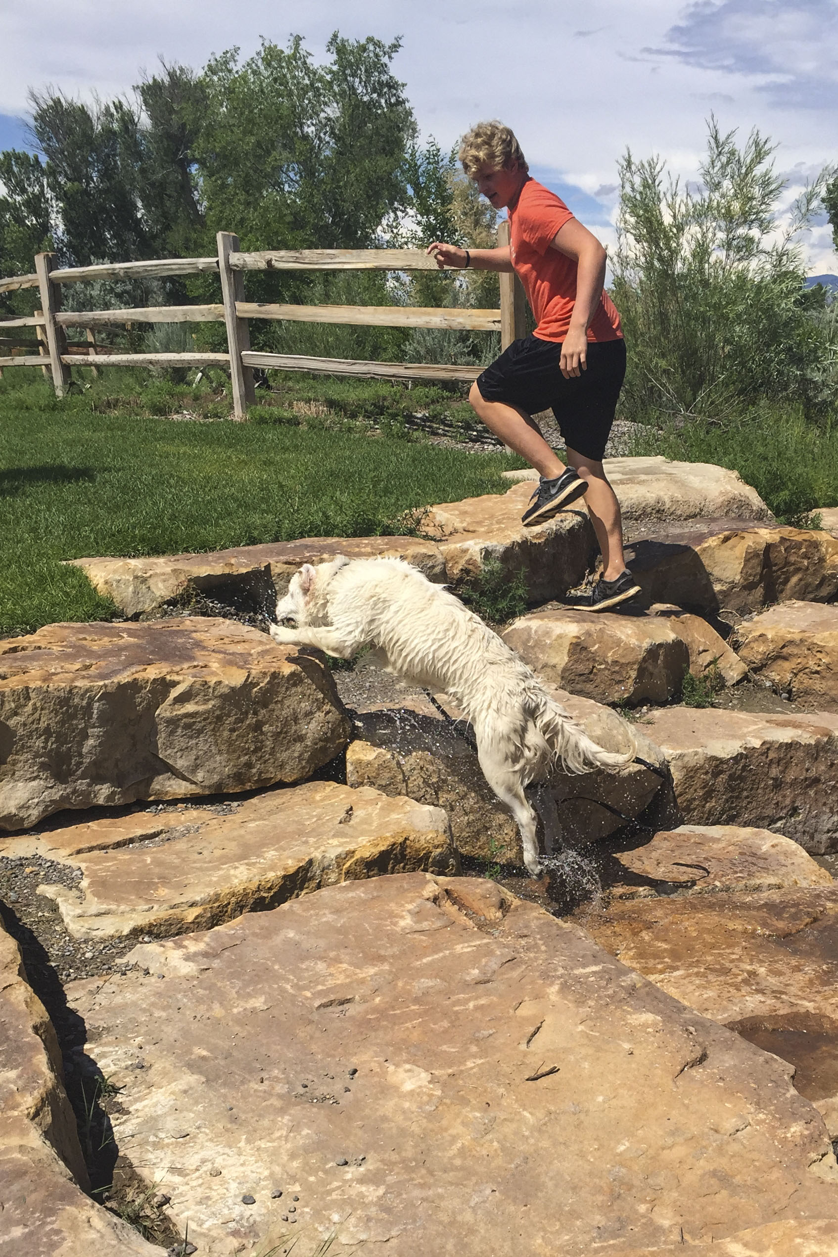
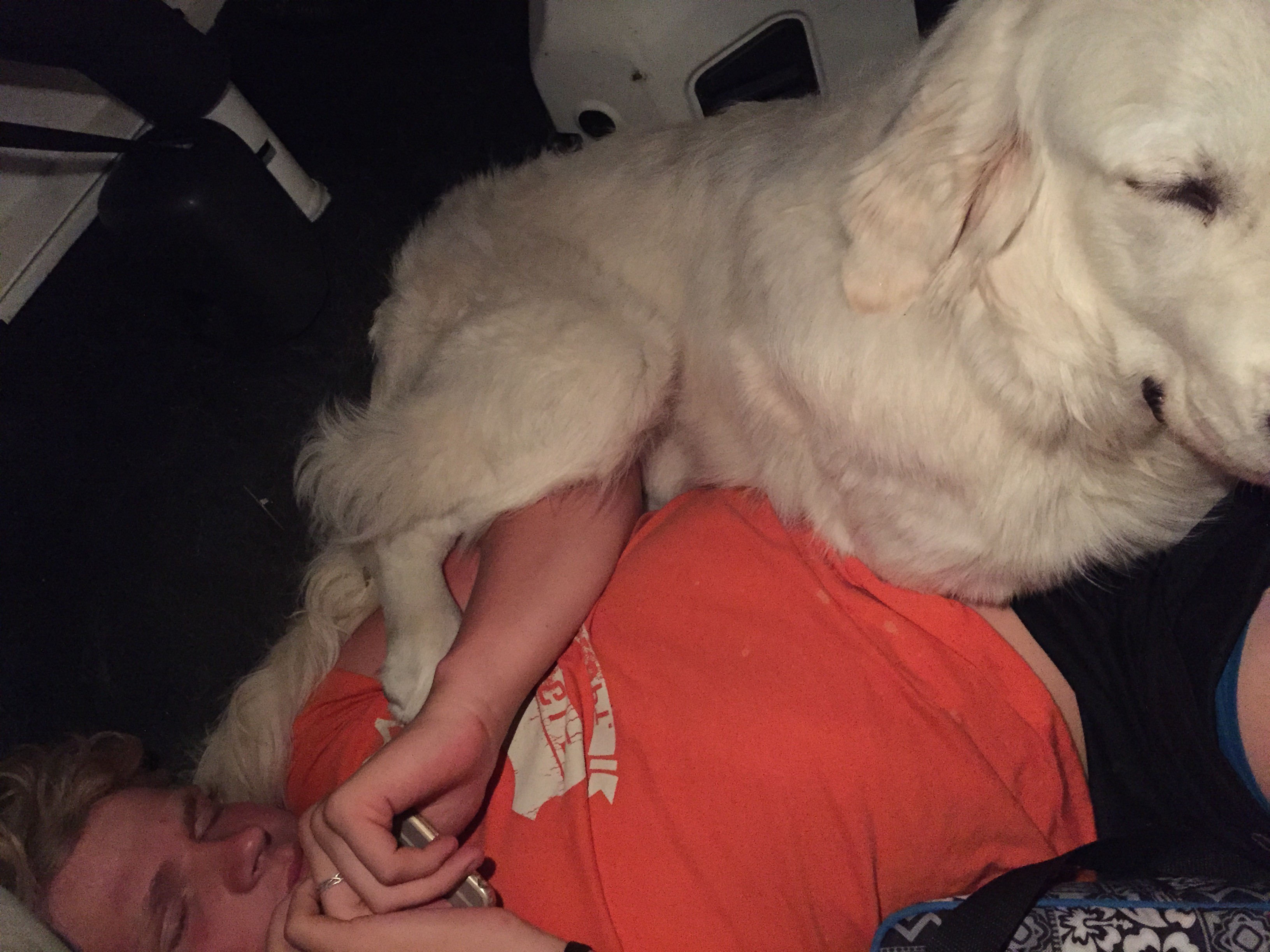
The other one, after shaking all over the fully-clothed members of the family, rolled around in the snow–obviously in pure ecstasy!

Photo Jul 12, 2 11 24 PM-a  Photo Jul 12, 2 11 15 PM-a  Photo Jul 12, 2 07 24 PM

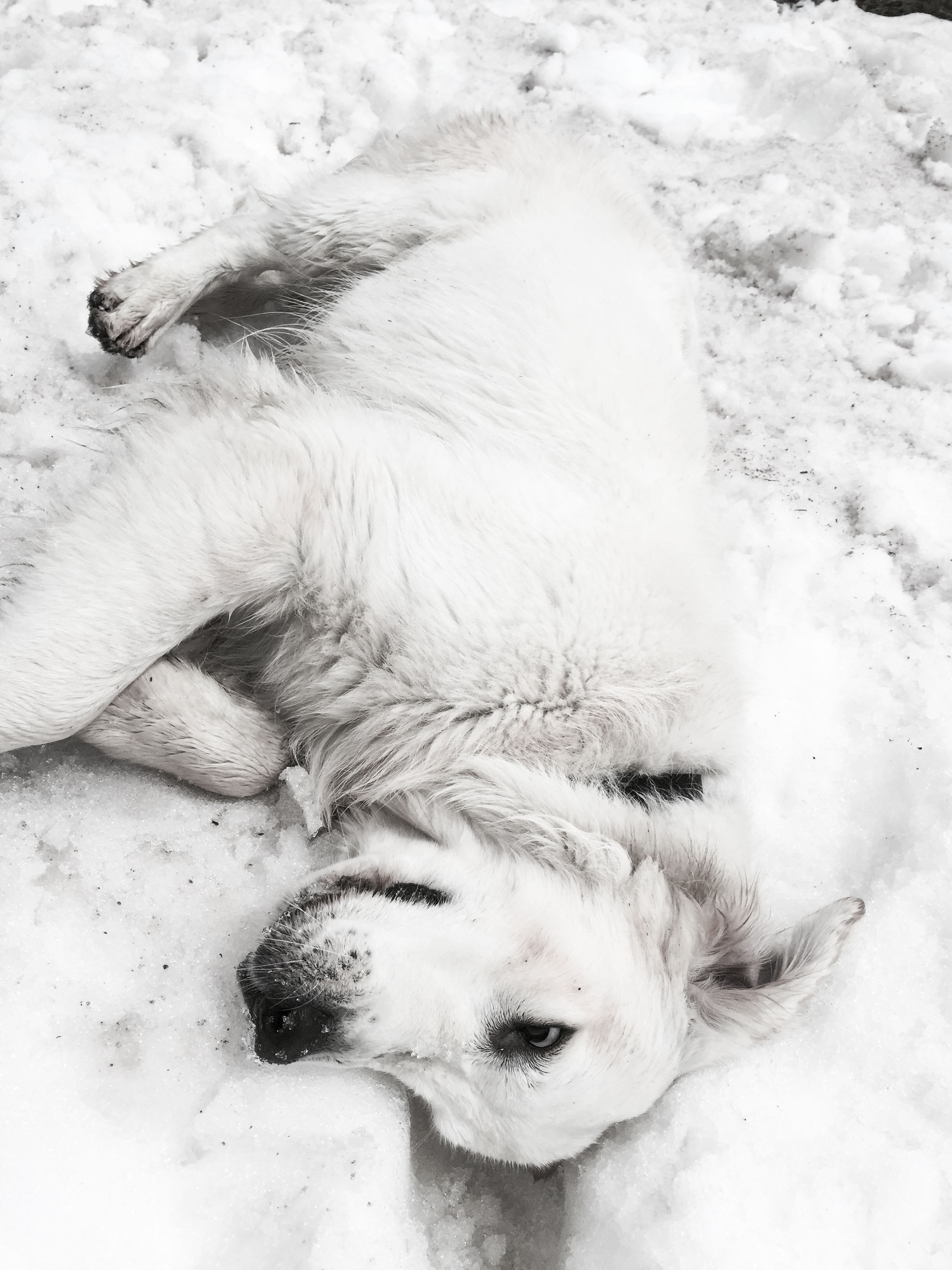
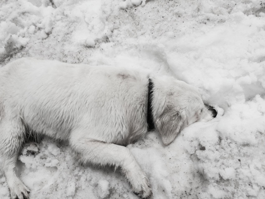
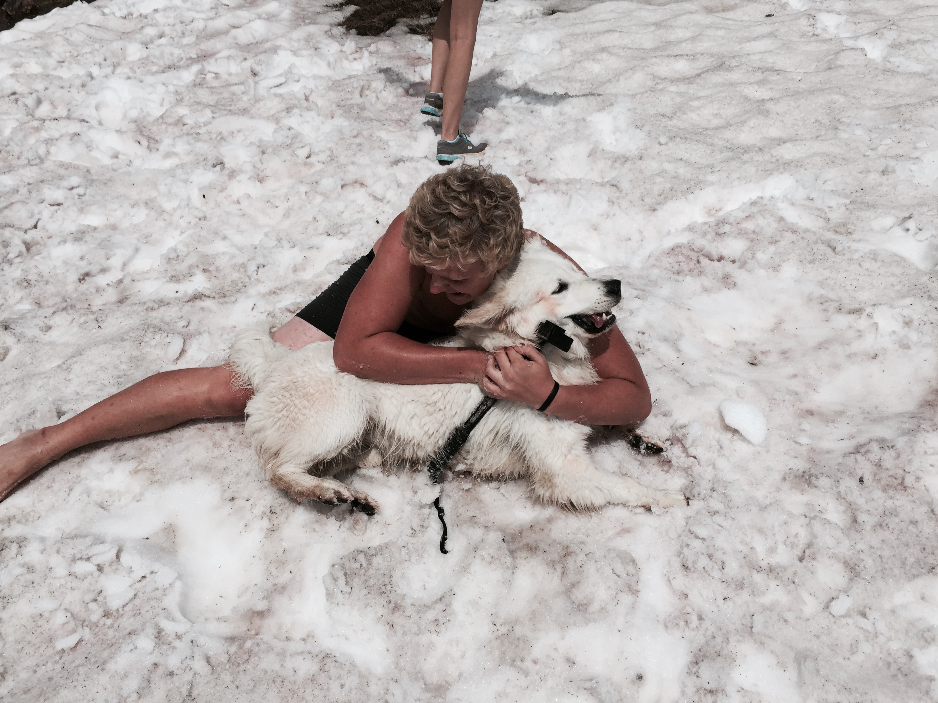
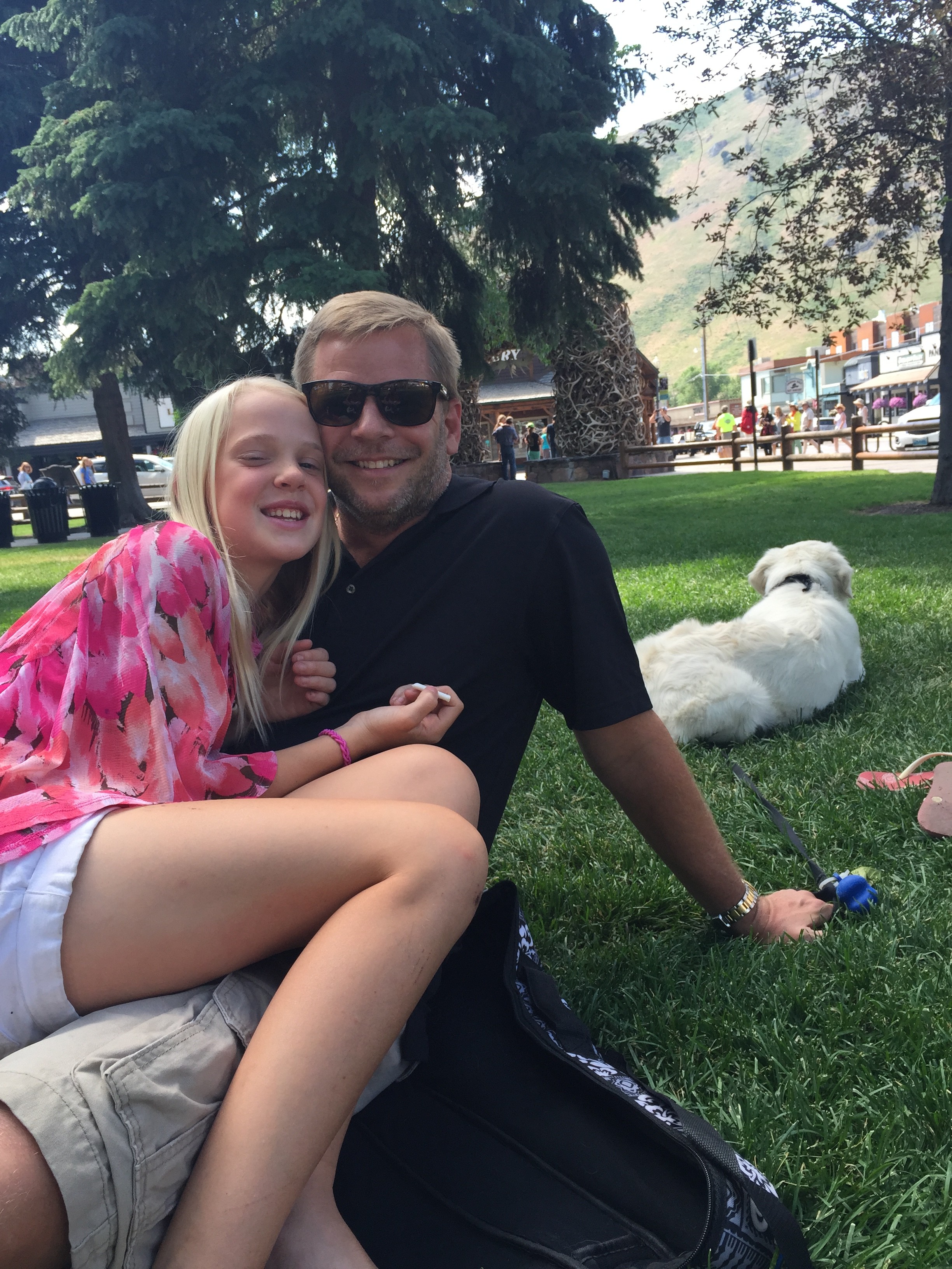
Mom may be the one who feeds, bathes, grooms, and baby-talks this furry child, but clearly a dog’s best friend is his BOY–especially one who shares his affinity for rolling in the snow. 🙂

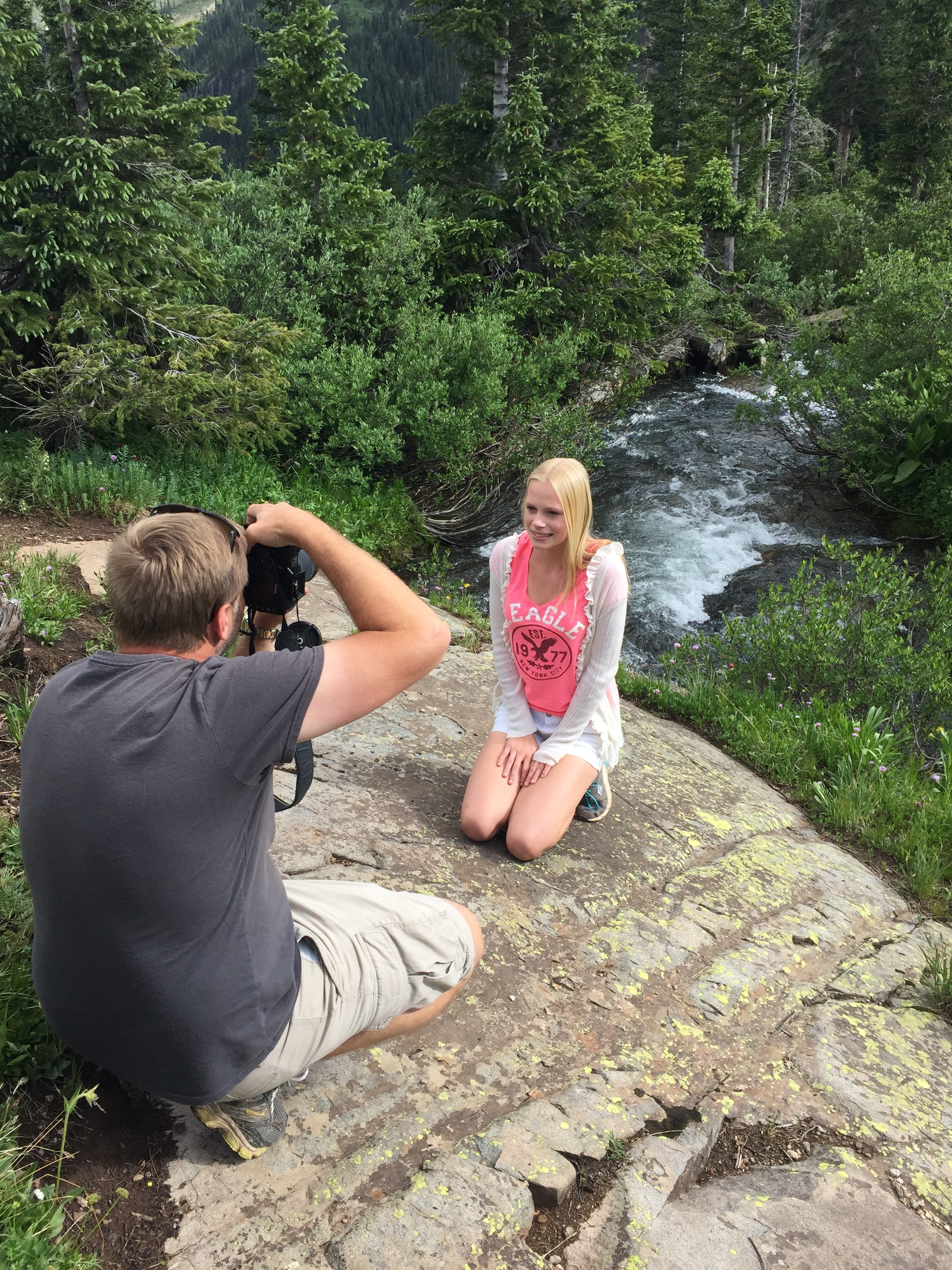
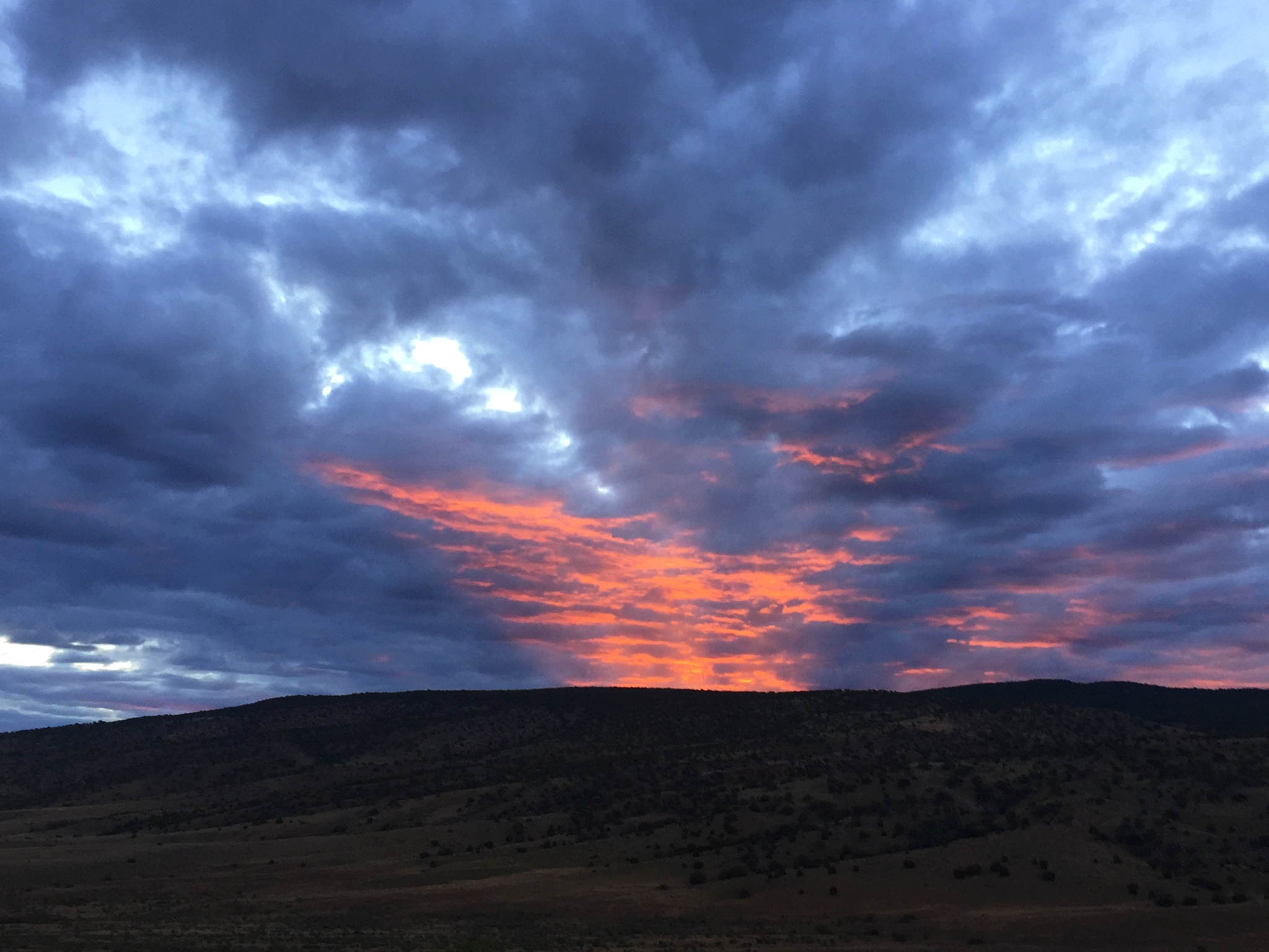
(Below) Testing out this site for a getting some footage for Carlye & Jordan’s music video.

Day 4 - 4  C&Jsinginsnow

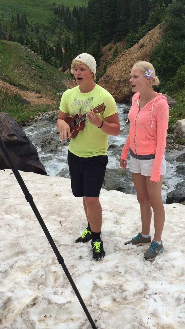
(shhhh . . . this is a sneak peak for you faithful blog followers.)


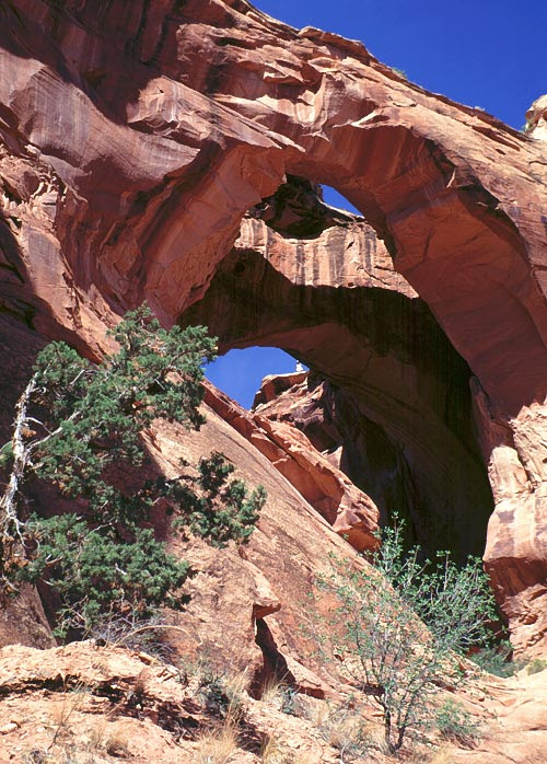
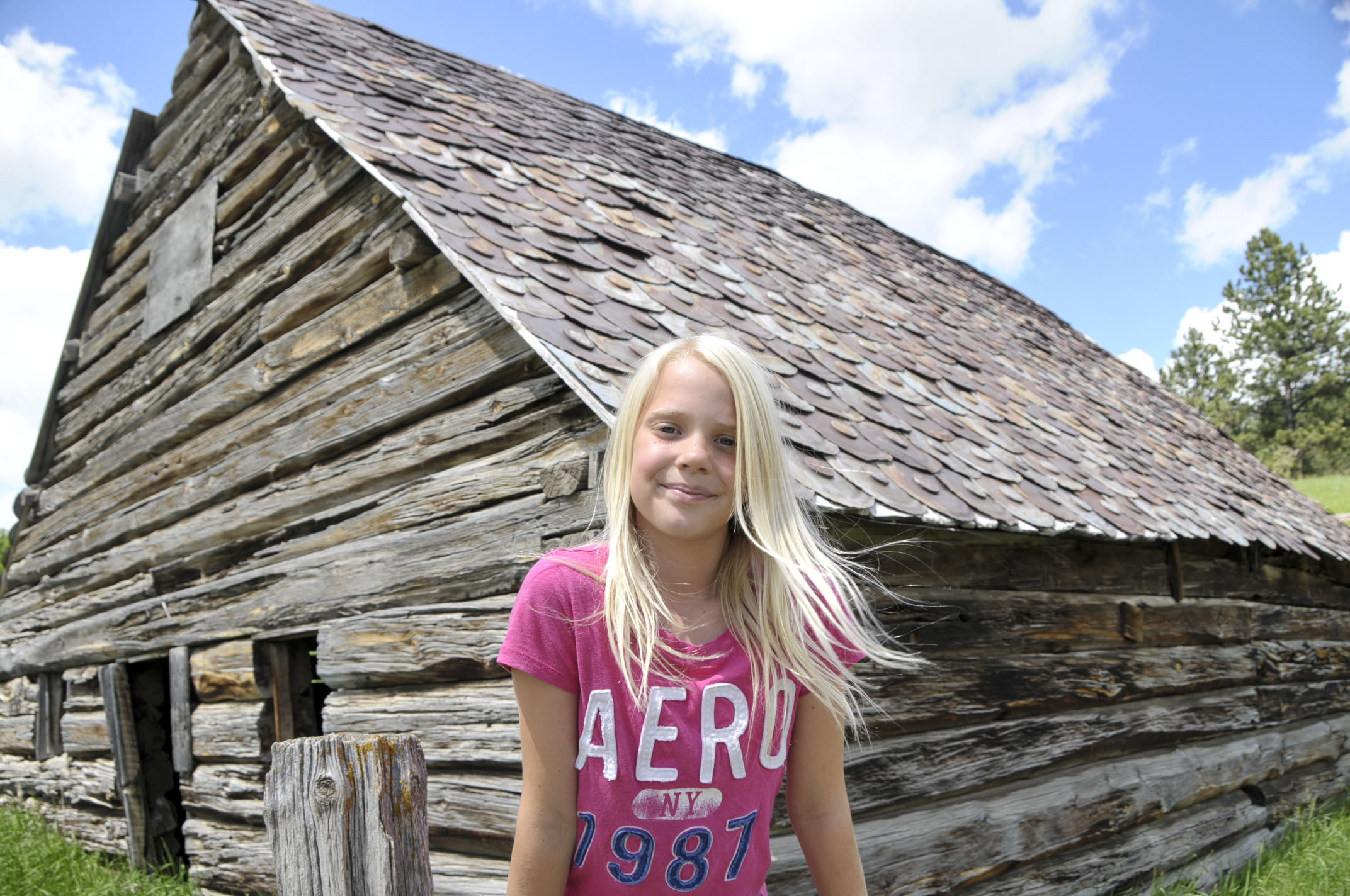
Animas Forks—Ghost town . . .

. . . was built to house prospectors and their families. At one point, 80 people called this home. But most of the winter, 5 feet of snow made it impossible to get out and do much. They made tunnels to get to each other’s homes, and stories abound of having to reach out the upper story windows to get snow to melt for drinking water, washing, and cooking.

Jarred & Rochelle have been coming here since our teen years. Couldn’t locate those pics, but we dug up ones from when Jordan, Carlye, and Alyssa were little . . .

anamis forks window shot 2007-a

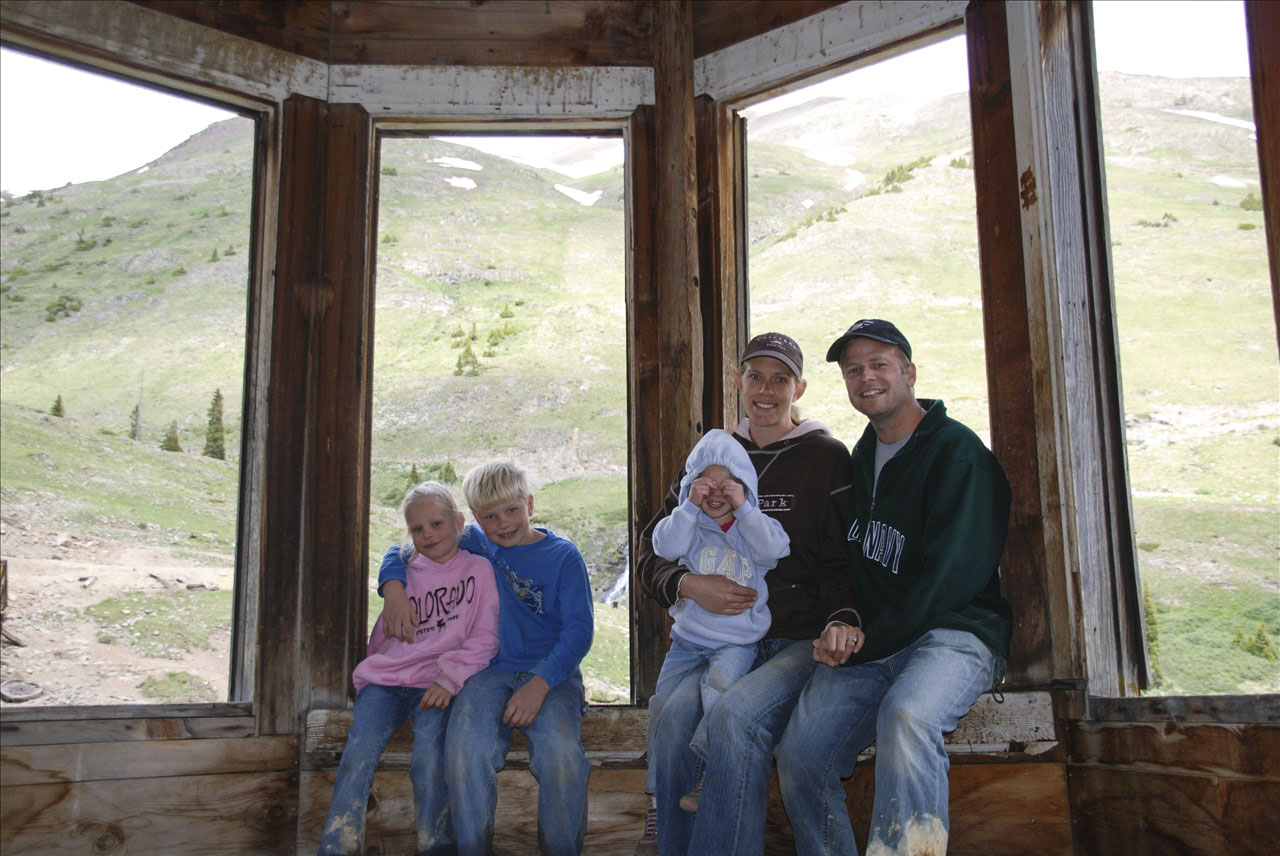
Animas Forks 2007 when Jordan was 8, Carlye 6, Alyssa 3, and their parents looked barely older than teens!


Animas house 2009

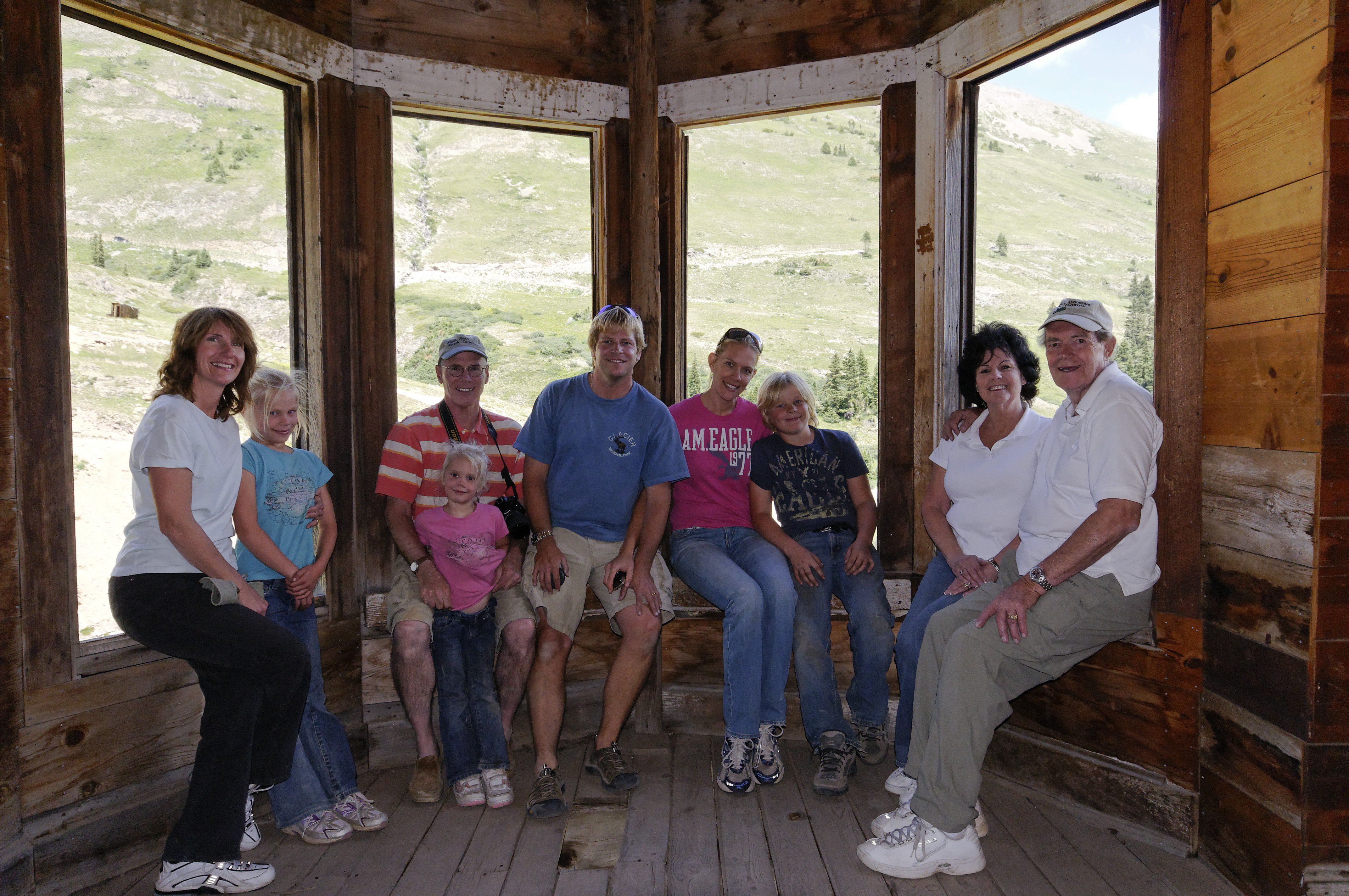
Animas Forks 2009–with Poppie & Amma, and Uncle John/Aunt Barb (Poppie’s sister)


animas forks 2011-a

Animas Forks 2011 (Nice shades, Carlye!)


DSC_4326-a

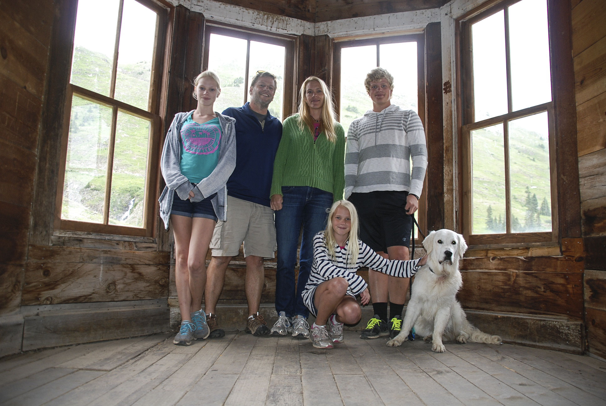
Animas Forks 2015–The old Dawson house is being “restored” which means there were no window sills to sit on because they had just put glass in windows for the first time in 25 years.


cave ouray

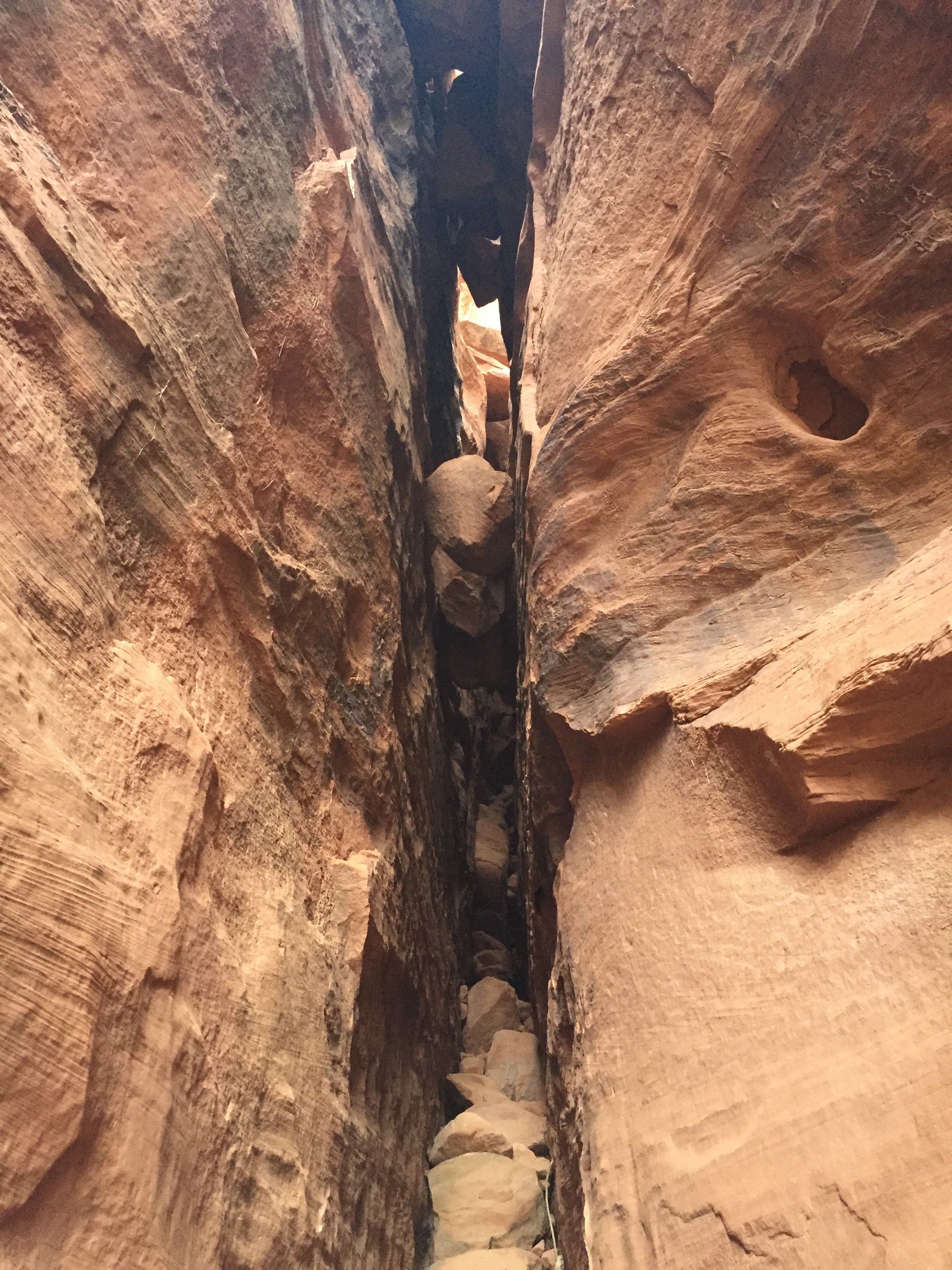
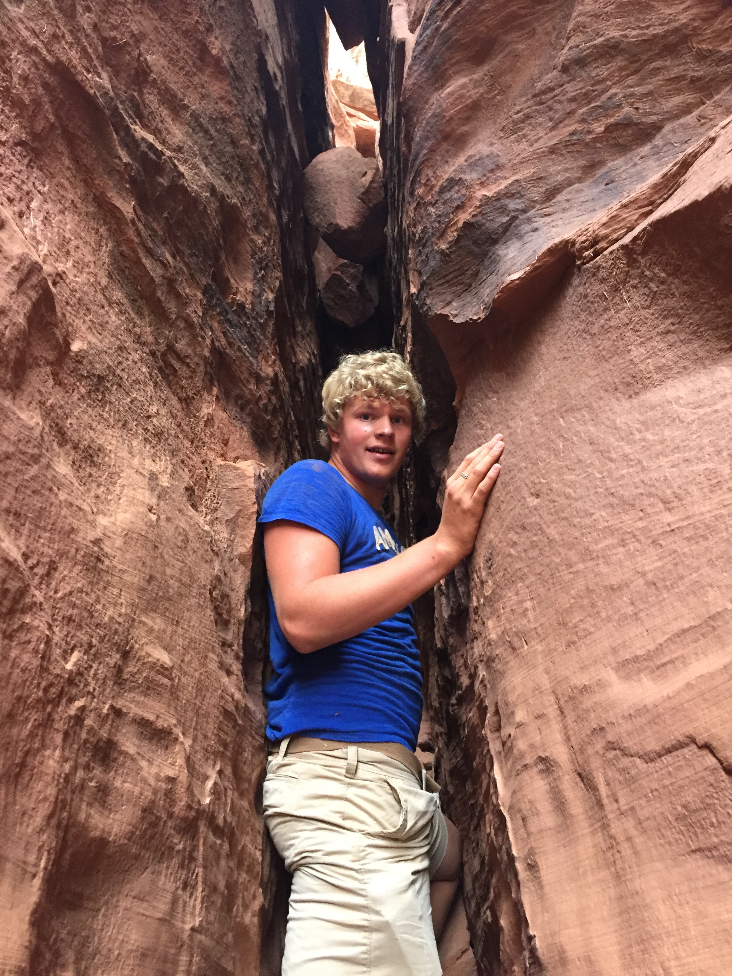
I remember spelunking into this shaft many many years ago and coming out muddy! The mining shafts have been barred and gated since we first began visiting the area. Makes it safer, but way less  . . . well, exciting dangerous. (Spoken now as parent of a teen explorer.)

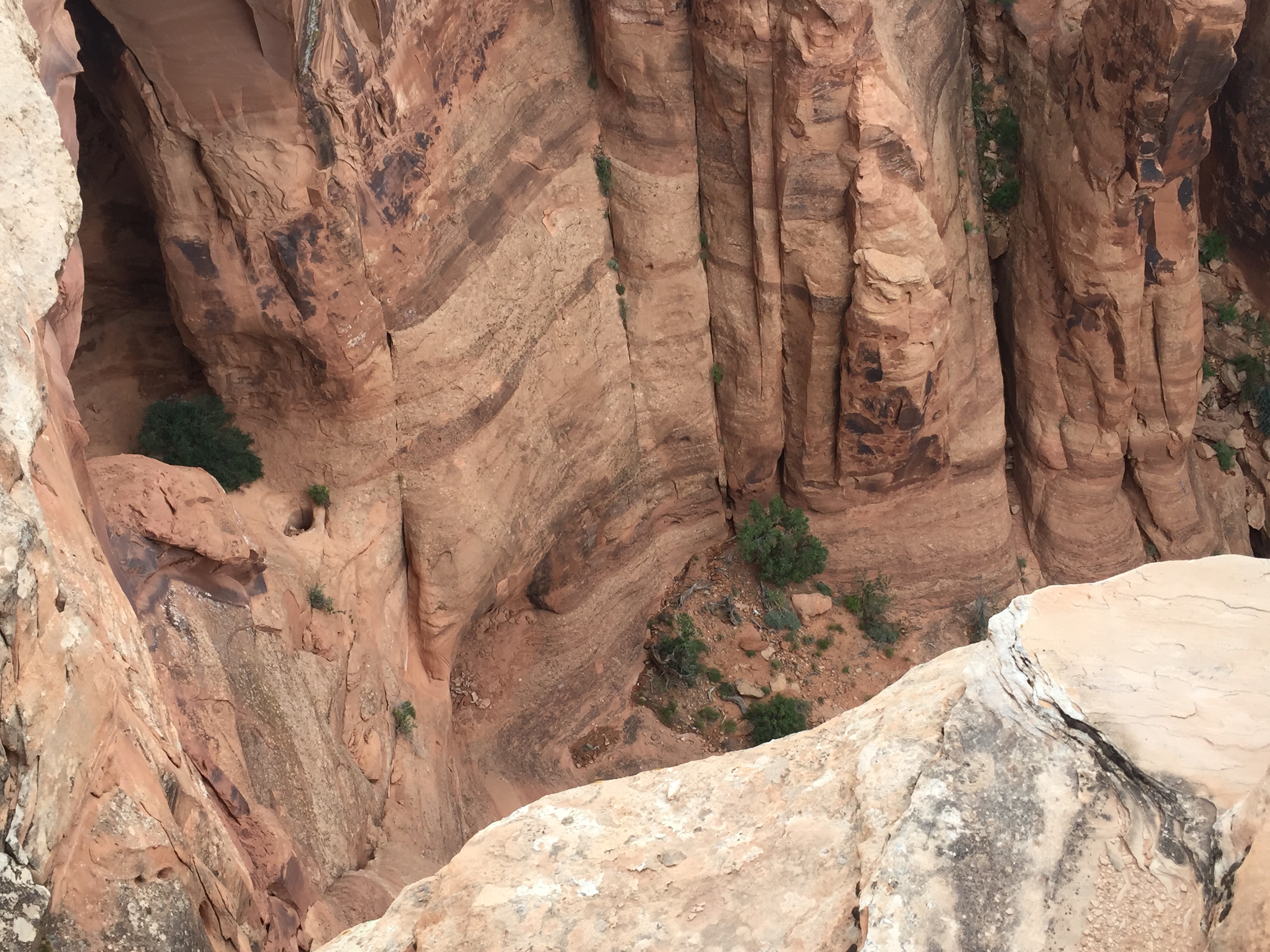
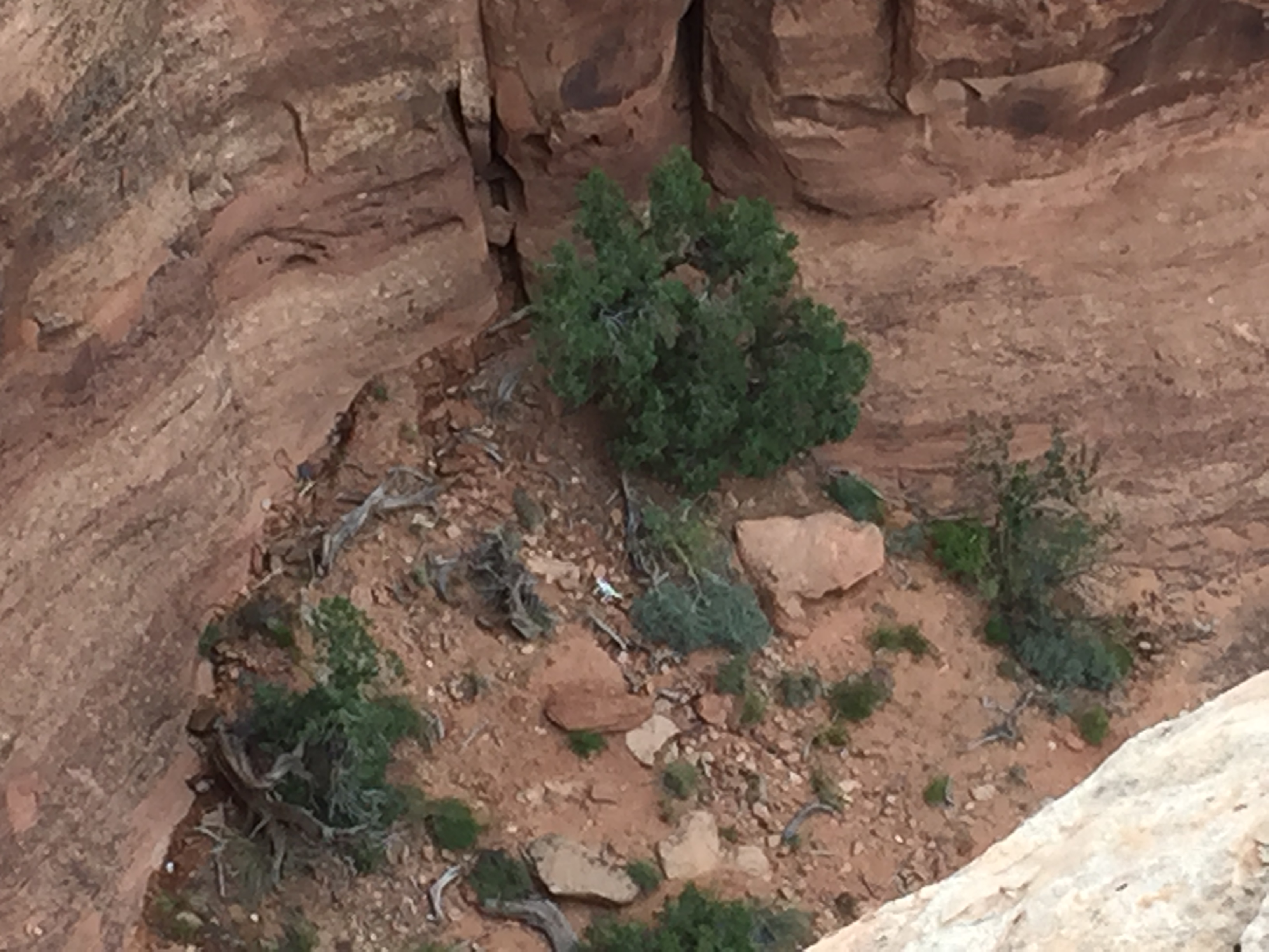
Moving on to the next breath-taking view at California Pass on our way to Hurricane Pass. The plan was to cross this pass and head down into Corkscrew Gulch . . . (FYI: these passes are very high points that cross over very high ridges leading from one valley floor to the next. It’s a bit like being on a roller coaster in slow motion!)

Photo Jul 12, 11 58 28 AM-a


California Pass

(above) About to cross the pass at 12, 160 feet . . .

. . . then down through California Gulch . . .

. . . up again to Hurricane Pass (below).

lake como-a

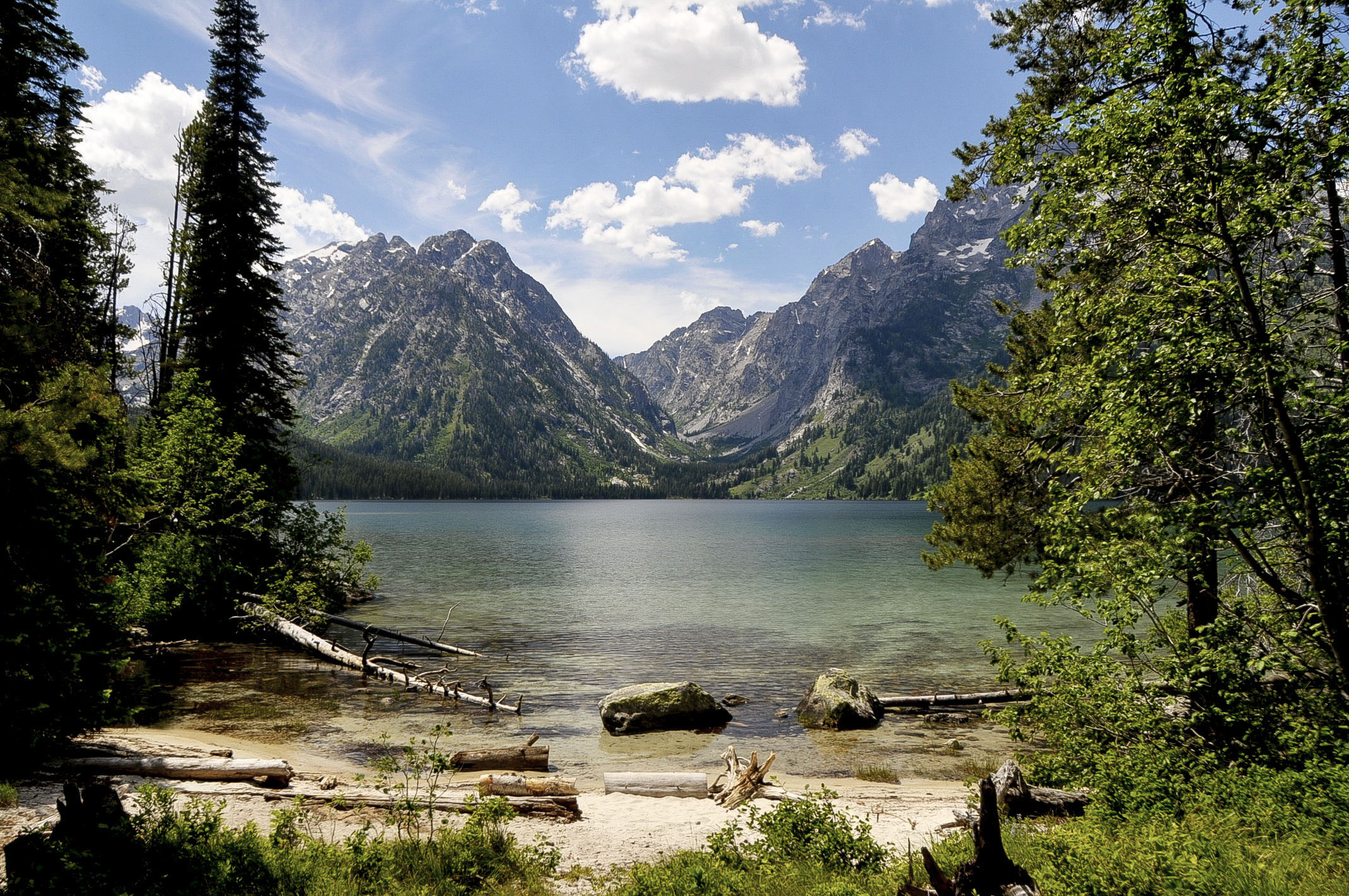
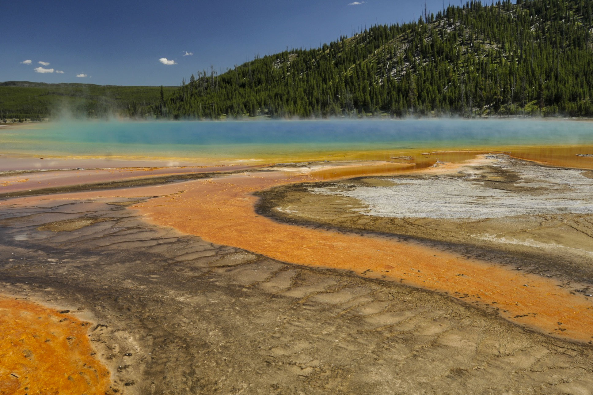
The very blue Lake Como, visible from Hurricane Pass, is a popular photographed site. (This is the first time I’ve ever seen it with ice & snow on it!)

Move around in the picture to get a feel for standing on Hurricane Pass

bubble


snow bank ouray-a

There was quite a lot of snow up here!

marmots playing-a   Photo Jul 12, 3 56 26 PM-a

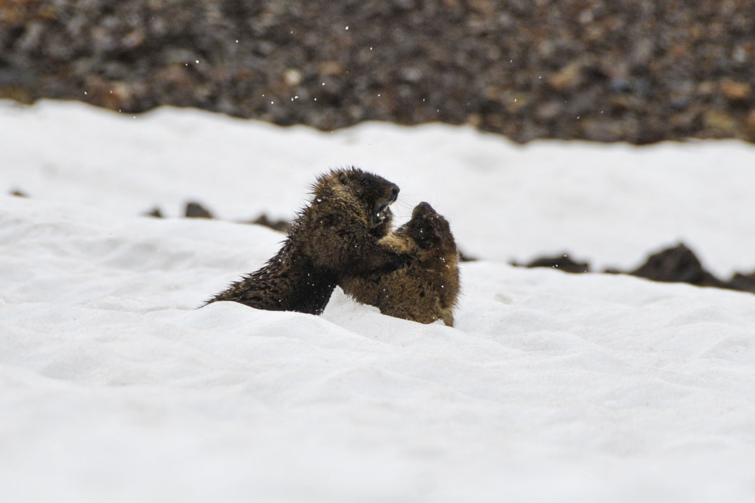
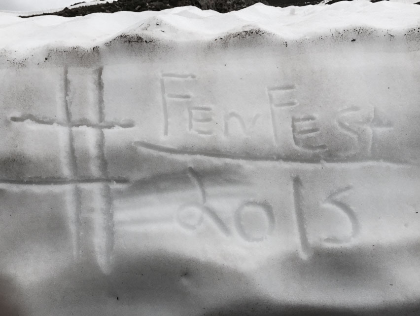
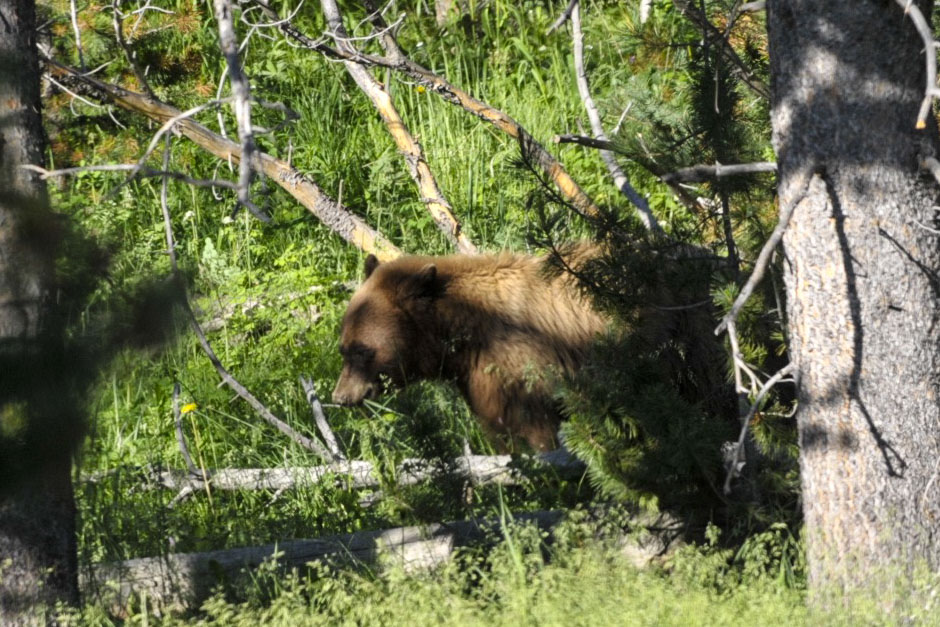
Marmot brothers fight in the snow. #FenFest2015 Making memories . . . and sharing 🙂


Day 3: A Day of Rest & Play at the Hot Springs

The water comes bubbling out of the ground around 130-140ºF. It’s contained now-a-days in a 3 concrete pool that are mixed with cold water to maintain 3 different temps. The cool pool–86º provides swimming laps, a twisting slide, and this cool obstacle race . . .

Day 3 - springs 1-a   Day 3 - springs 4-a

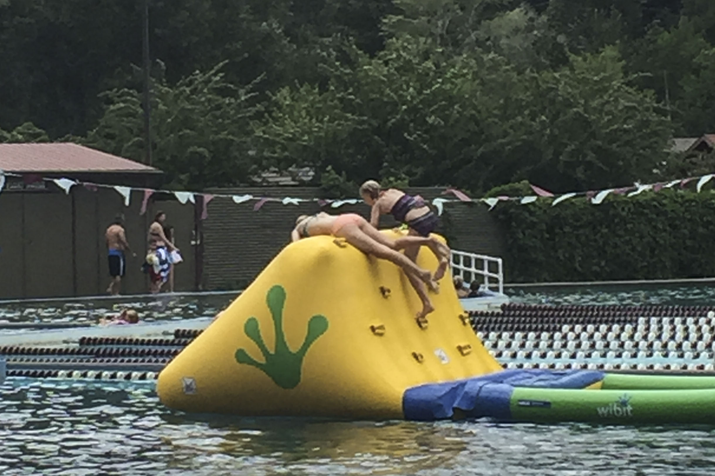
Carlye and Alyssa were kneck-n-kneck most of the race!

It’s open 10a.m.-10p.m. Other than 2 10-minute walks back to the RV for lunch and dinner, the kids spent the entire day here! (Mom joined them for most of it. 🙂 )


Day 4: Last Day of Jeeping to Governor’s Trail

Photo Jul 14, 2 46 00 PM-a

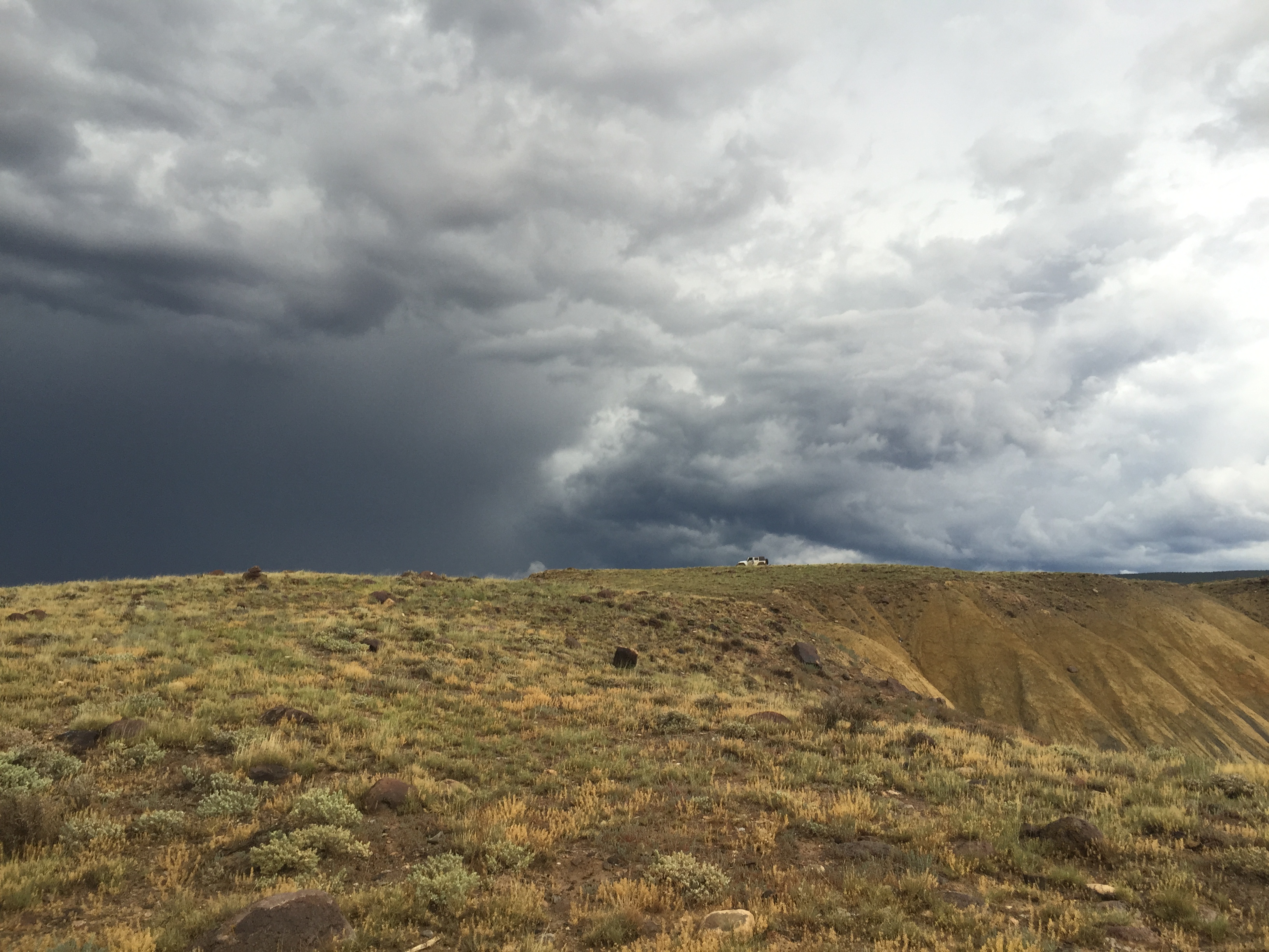
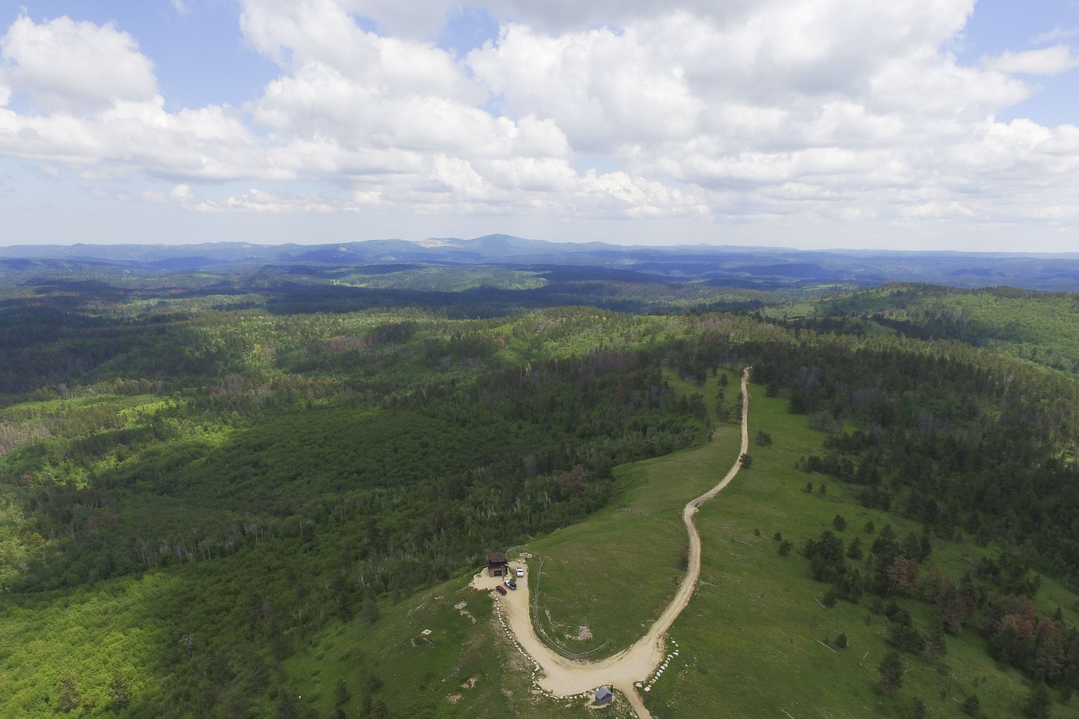
This trail, considered a “red,” is not one I have particularly enjoyed in the past because everything is so narrow and so rough! But, a re-opened mine at the top of the trail has improved the road to make way for commuters in work trucks.


Day 4 - hammock  Day 4 - hammock 2

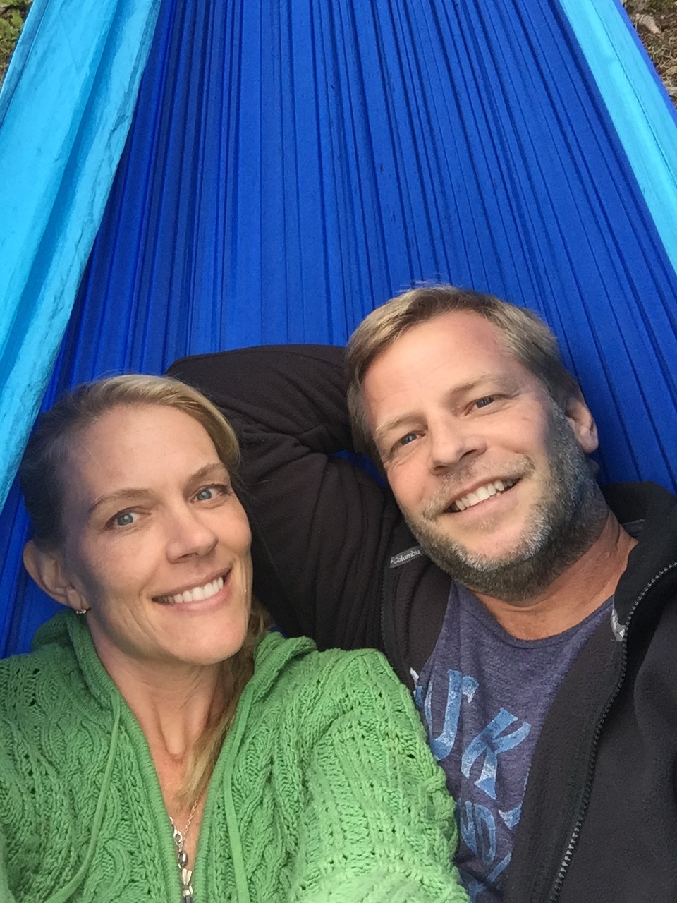
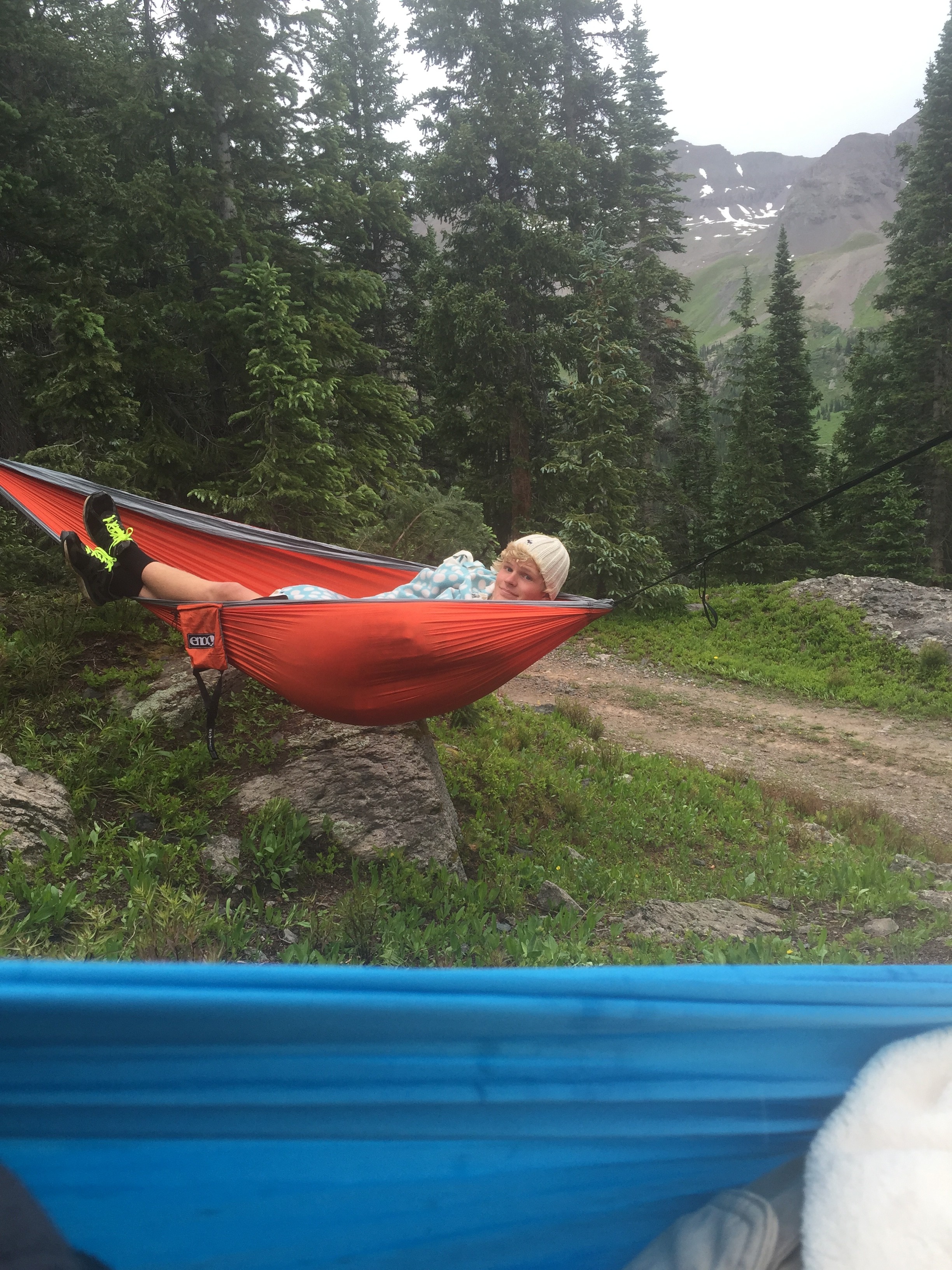
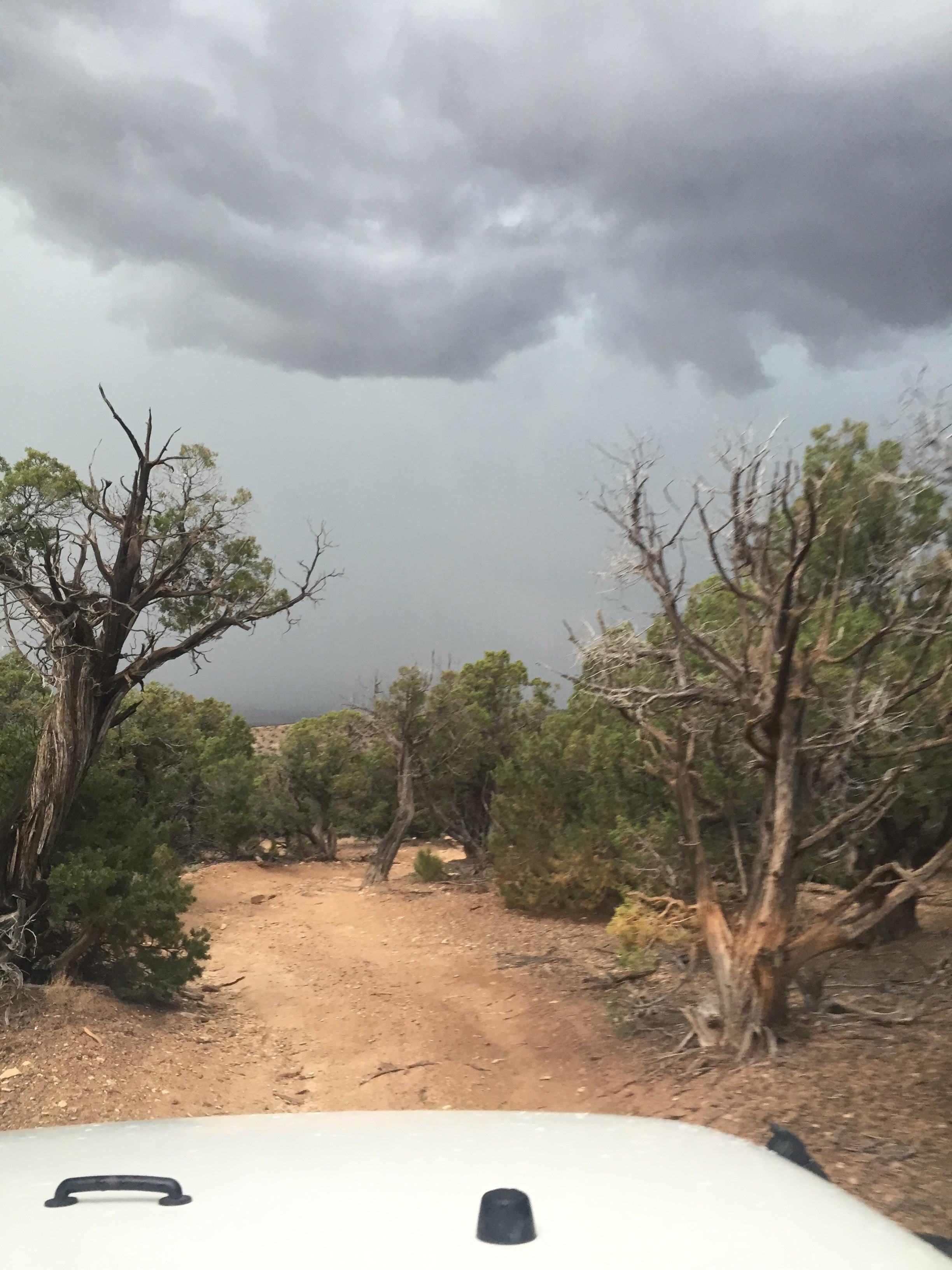
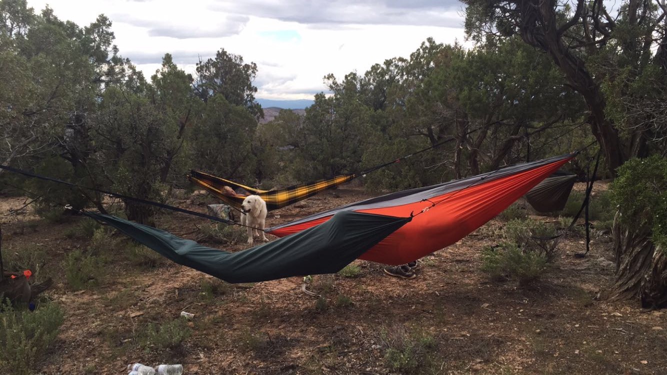
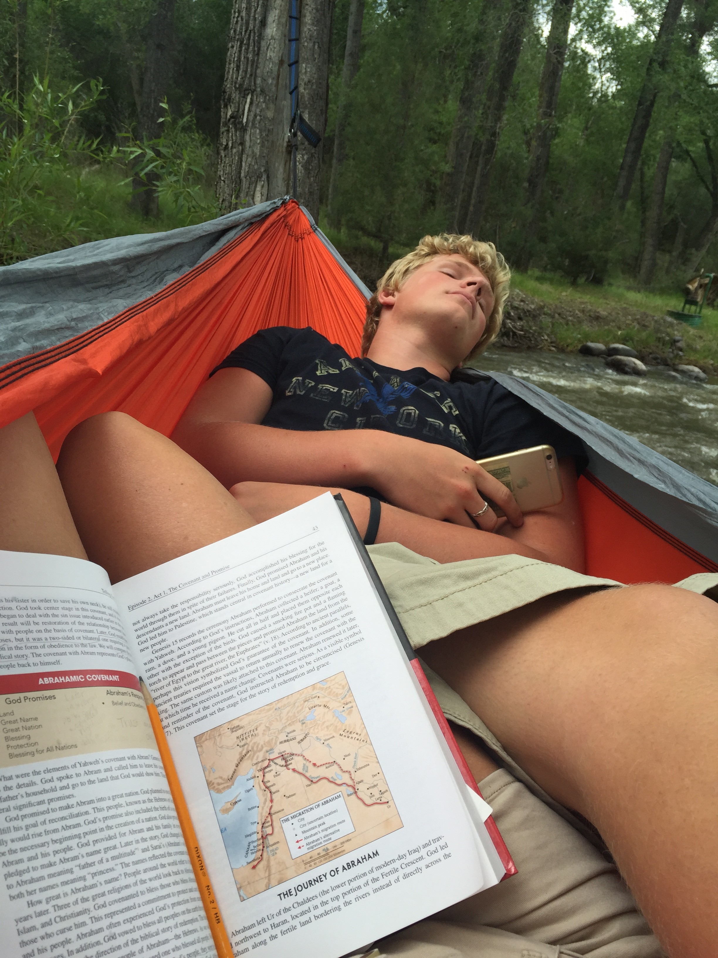
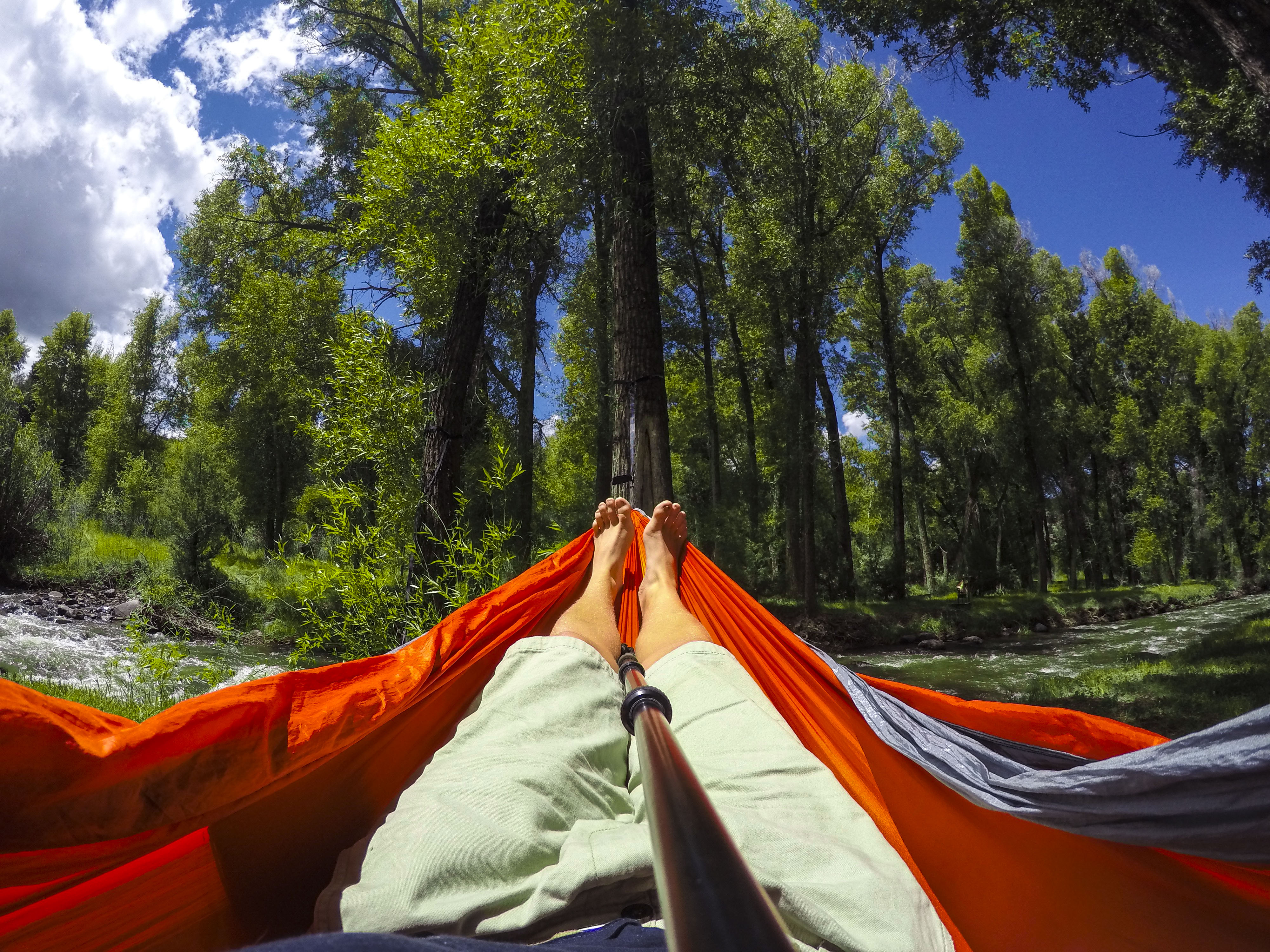
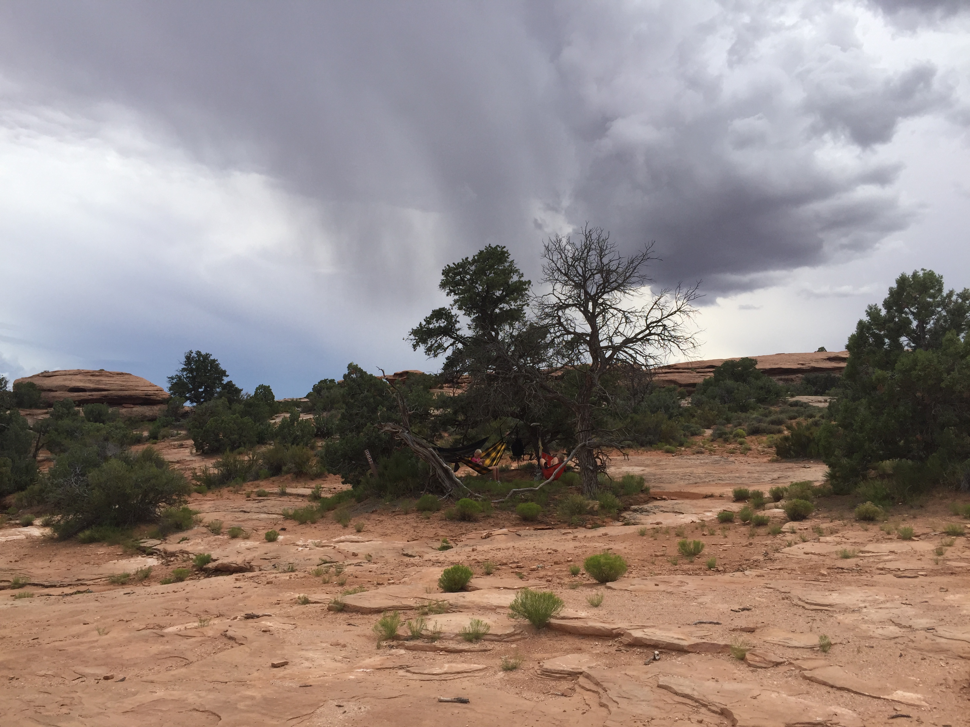
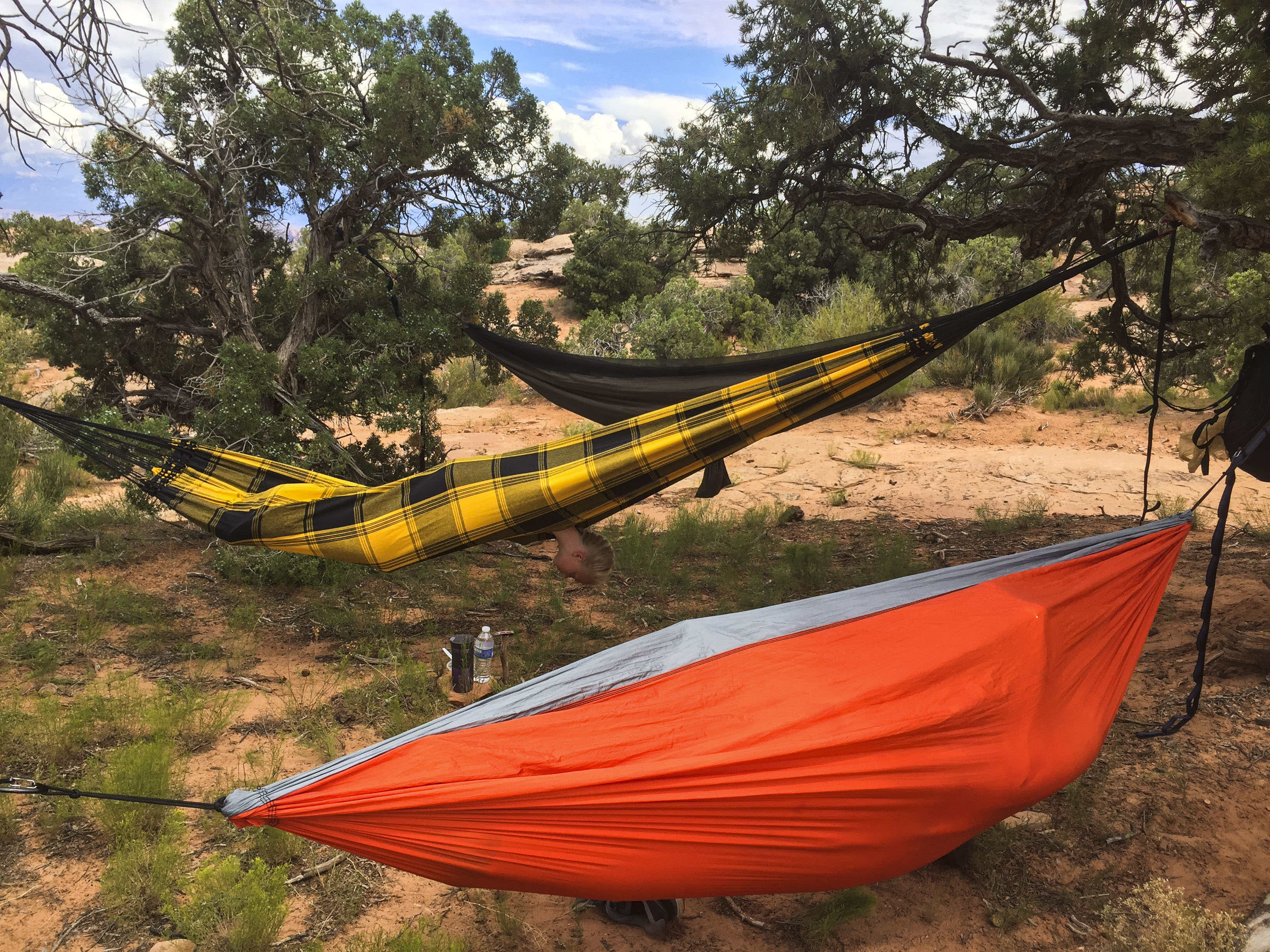
Now with our new-found-love of hammocking, there are other reasons to love this trail. It was cold and wet outside, but warm and toasty in the 2-person hammock. (We could have each set up our own, but . . . 🙂 )


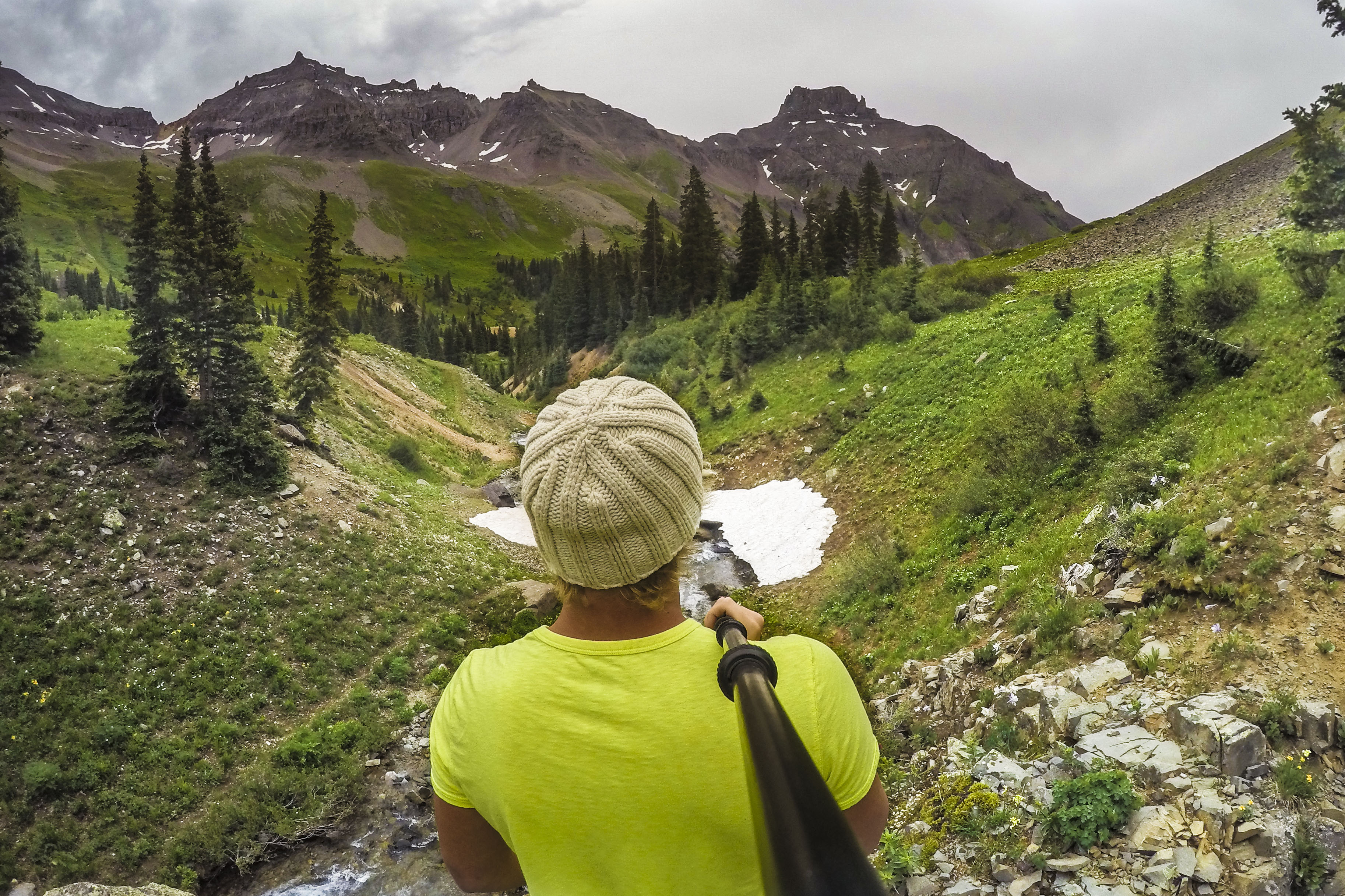
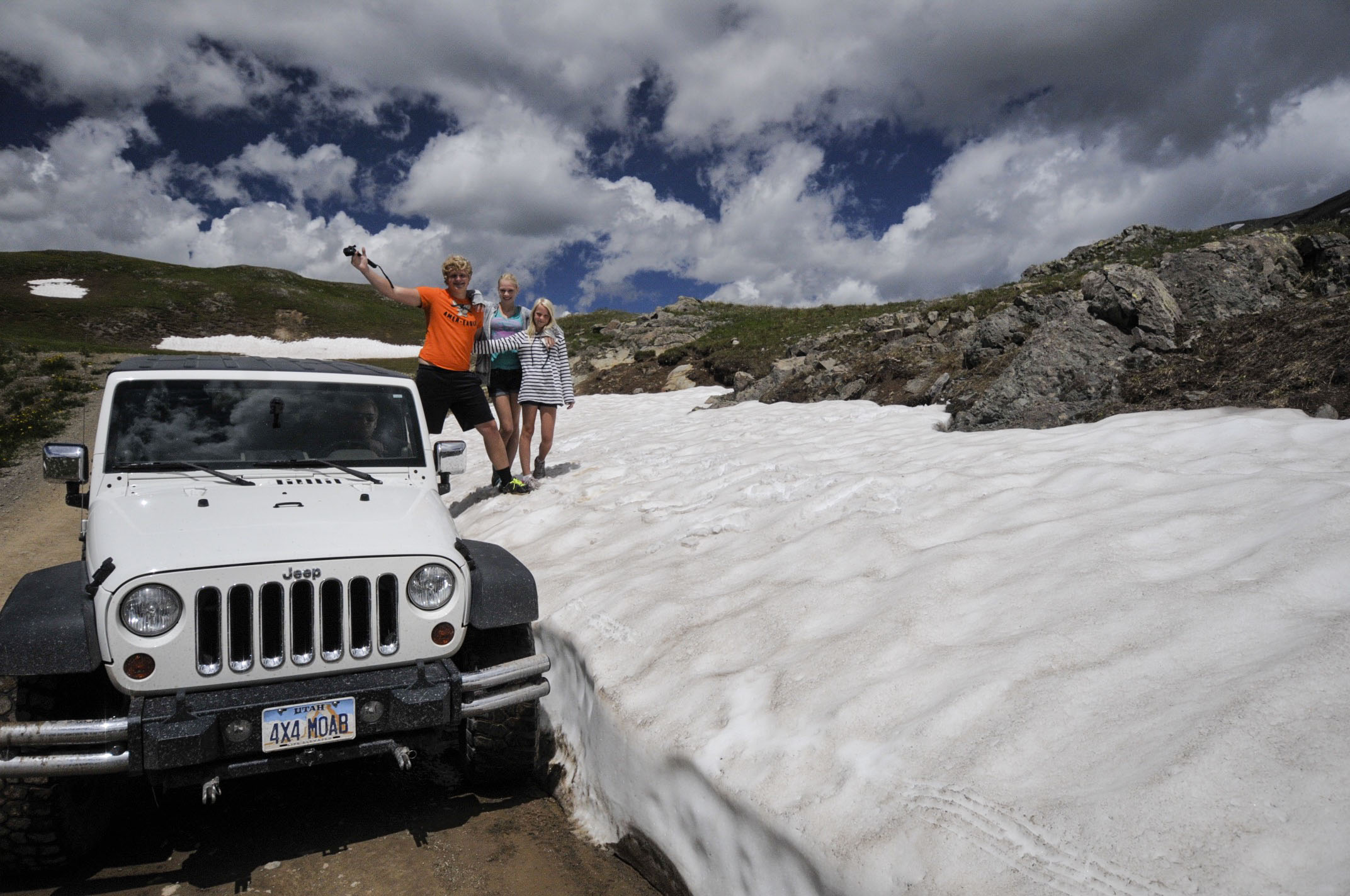
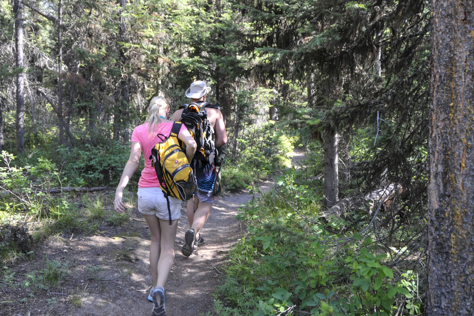
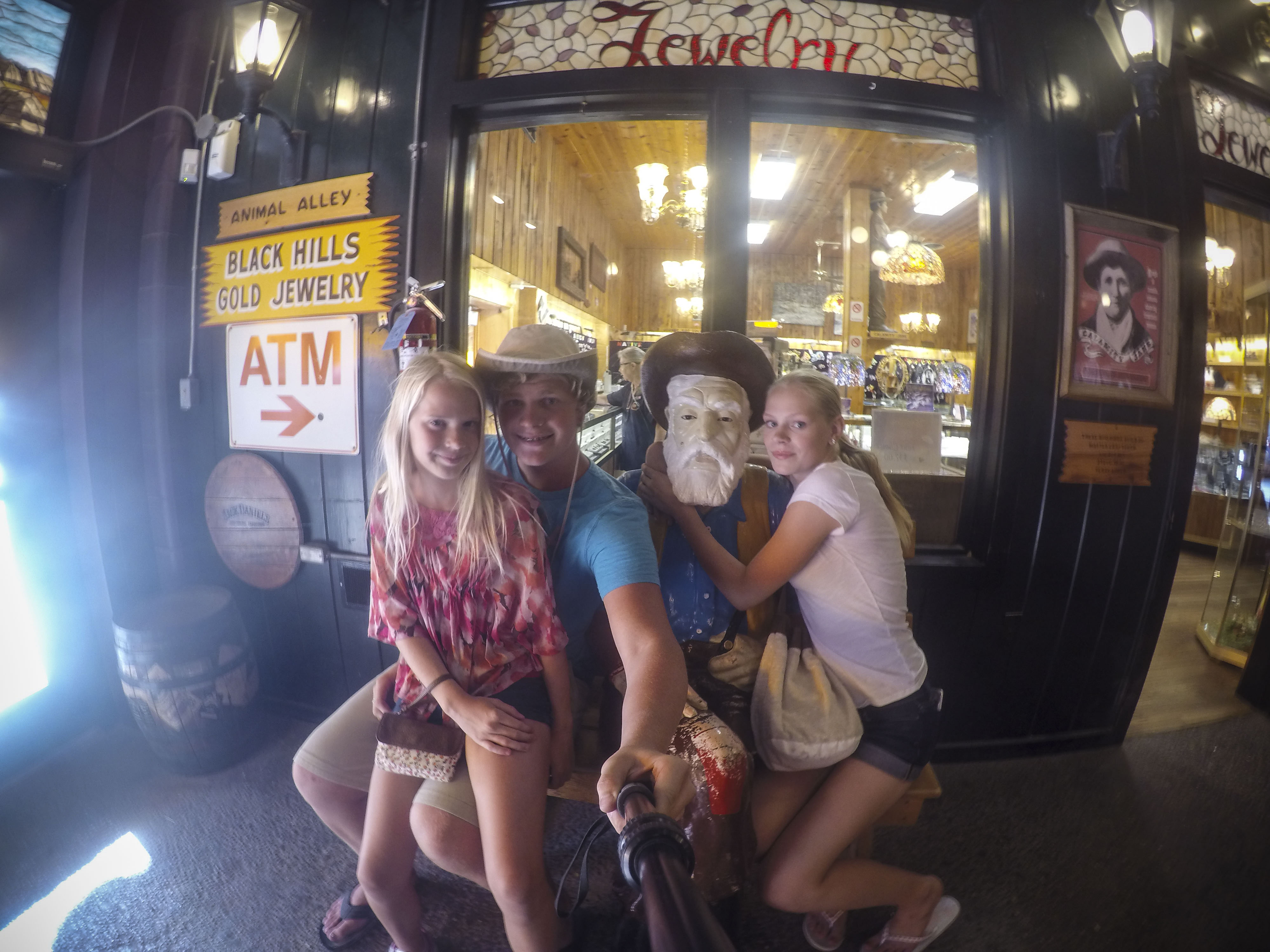
This pic is sort of iconic for our many mountain hikes. Jordan & his selfie stick GoRad pole document the landscape and paths of those who dare to discover it’s secrets.

bubble

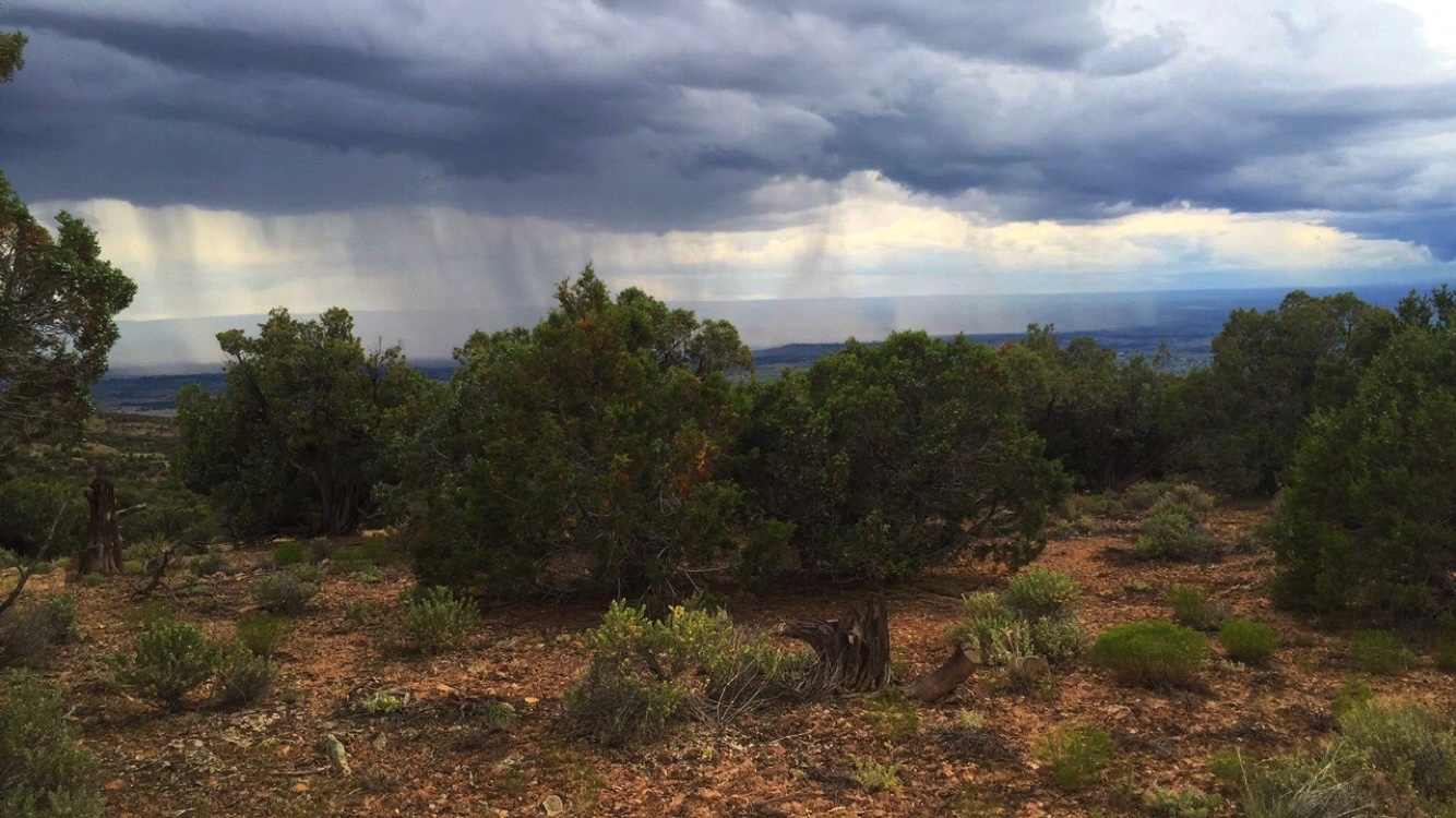
Move around in the pic to get a feel for the view from Governor Trail and the distant Yankee Boy Basin/Twin Waterfalls.

Tomorrow morning we will say farewell to Ouray as we move north to the Denver area.

Day 35-38 Tues-Fri, July 7-10, 2015

Travel from Moab to Montrose, Colorado

Maps-Moab to Montrose, CO

We stopped for the night in Grand Junction to restock supplies in a “big city” then headed to Montrose to try out a new Jeep trail.

But first–a stop at the Montrose Riverside Park facilitated some fun and relaxation.

 J&Csinging-a  Jordan&Dakota-a  alyssamodel-a


Montrose Black Hills ATV/Dirt bike/Jeep Park

This trail was supposed to be a moderate (blue) 6-mile trek over a few rough/steep spots to a ridgeline and then down a dirt road . . . well, things don’t always go the way they are “supposed” to.


We set up the hammocks for a little meditation time. (Dakota, Where did your family go?)

But then we heard some distant thunder and spotted some lightning strikes hitting surrounding peaks. By the time we packed up the hammocks, the rain was pelting us pretty hard.

StormBrewing

That little white Jeep looks pretty helpless awaiting the approaching storm. Jarred took this picture from a place he hiked to looking for a safe way down the mountain. The first wave of rain muddied the clay roads beyond maneuverability. The Jeep was fishtailing and skidding as we worked our way across the ridge line.


MuddyJeep

MudJeepTires

Get a good look at those clay-caked tires. We tried scraping it off, but it didn’t last. There was nothing else we could do but wait out the storm. Then night came. We had no choice but to spend the night in the Jeep right where we were.


SleepingDogs-stuck in Montrose

We tried to sleep. Jordan curled up with Dakota in the trunk for awhile. Needless to stay, no one could sleep. Expecting only a 2-hour trek, we had no food, blankets, or other–ahem–supplies. We did have water–praise God! We huddled together till sunlight broke over the mountain peaks.


SunriseMonstrosefromJeep

Colorado sunrise — finally!

The roads were still clay soup. We asked God to make a way where there seemed to be no way. He answered. We made the decision to go down the side of the least steep slope we could find–over rocks–straight down to the base where we could eventually hook up with the flat road out! It looked scary from the top, but it felt as if angels had carried us down. Amazing! God is true to His Word.

Jer. 33:3 Call upon me and I will show you great and mighty things you couldn’t think of yourself. 

We came rolling into the Montrose KOA around 9:00 a.m. The park manager asked us how was our first night in Montrose. She got a story she didn’t bargain for. 🙂

We spent the day and next evening there, then moved on to a truly relaxing little campground riverside in the neighboring town . . .


Cimarron, CO — Pleasant Valley Campground

Sharing the Hammock  Dakota water

Perfect hammock setup next to the river. Rochelle and Jordan shared the 2-person hammock each doing what they love–reading and texting (or is that sleeping?)

Dakota loved the river experience here. A wise friend recently told me that having a dog helps us to slow down and enjoy the moment. I’m really beginning to understand that on this trip.


There was a little creative work going on in the hammock too. A hammock is a little piece of heaven facilitating rest, meditation, and creativity. We have now acquired 5 of them on this trip, yet still prefer to share. 🙂 You should get one too.


Tomorrow: Ouray, CO

Day 33-34 Sunday & Monday, July 5-6, 2015 Moab, UT

Last Days in Moab

Two towns top the list of Fenlason favorite Jeeping destinations. Moab, Utah is one of them. (The other one is Ouray, Colorado.) This video shows off why!

We extended our stay in the red rock labyrinth set on conquering two final challenges: Dome Rock and Gemini Bridges.

Little did we know what the extra two days held in store . . .

It began like any other day. Mom packed the lunch. Kids gathered the gear. Dad checked the oil, tires, and gas. The entrance to Dome Rock trail began an hour from town–an hour from cell service . . .from ANY services.


   Dome Plateau jeep

Our first challenge was “the steps.” We lowered the air pressure in the tires and the Jeep climbed right up these fellas! (Did I mention we have a really amazing driver!)

Two hours into the trail, something strange happened. Coming down a steep descent, the transmission stopped shifting. The gears would not engage. The wheels stopped moving and we were stuck in “bowl” at an intersection of trails that all went uphill.

Jeep Stuck

What to do? Jordan and Alyssa gathered the hammocks to find a place in the shade. We would wait a bit. Maybe another Jeep would come by and be able to get us help. Jarred hiked up to a higher spot hoping to find a little cell connection. There was none.

Then the boys had a moment of inspiration . . .

Jarred’s parents have been Jeeping in Moab with us in the past; they know the area and where to get help. A text was sent to Amma and the phone attached to the drone. Perhaps up higher–say 400 feet higher–there might be a bit of 4G or LTE if we were really blessed.

Not sure if that worked, but we weren’t waiting around any longer.

after the breakdown-a

We took one last selfie with the Jeep, attached a note on the windshield with our plans to hike out, and took off with a hammock-modified-into-a-backback full of water bottles, and headed out on foot.

Approaching the distant rock formation, we discovered one bar of service and called 911.

Jenny @ 911: “What’s your emergency?”

Us: “Our Jeep broke down 2 hours into Dome Plateau and–”

911: “Are you the Fenlason family?”

Us: “Yes!”

911: “Suzanne Fenlason has already called us and a deputy has been dispatched . . .”

The Hike Out of Dome Plateau-a_1

Last time we were here, Moab was the filming site for much of The Lone Ranger film with Johnny Depp. It’s landscape is desolate, dry, and very rough and rocky. The area sees at least one adventure-related death a year and “Search and Rescue” is sent out on average 100 times a year.

The Fenlason family was their 70th rescue call so far in 2015.

Several hours later, a brave tow truck driver returned with Jarred to retrieve the Jeep.

tow truck-a

The mileage added up and we received a bill for $680 from the Moab towing company. Next morning, the Jeep was fixed for $35 in labor in 10 minutes with a $3.99 plastic piece that had cracked under the 4-wheel drive gear shifter.

Yep. That’s how it goes sometimes when you live a life a epic adventures! 🙂

You would think that we would be begging for a day off–a day of rest–maybe laying around the pool at our campground, or a nice game of Clue around the picnic table. But NO– there was still one challenge left untamed.

Tomorrow: Gemini Bridges . . .

Last Day! It’s gonna be a good day!!

AlyssaGearedUp

Alyssa is a trouper! Getting the gear together: Backback full of waters, hammocks, drone, and ukulele. Check!

Gemini Bridges  Gemini Bridges from drone

[Left photo from below the Bridges on Bull Canyon Trail; Right photo from the drone at 100′]

Gemini Bridges is a popular Jeeping Spot 2 hours from town, but not everybody takes the posted warnings seriously. Four years ago, a boy scout troop took a hike along the top of the arches. One boy thought he could jump the 6ft. span between the arches and fell to his death. Another 19 year old guy drove his Jeep over the arches and plummeted to his death. We weren’t taking any chances.

We simply hung up our hammocks near the famed sight :-


We found a little oasis on the plateau to get settled for a rest. Alyssa had a sweet set-up complete with a “coffee table” rock.

Then we thought we’d get a little drone footage and fly through the arches–something dramatic for the blog.

Like we needed more drama in Moab! The drone came crashing down the walls between the arches.

(This place is reminiscent of the Bermuda Triangle stories!)

IMG_5881  IMG_5882

It landed somewhere down here on a shelf way below the arches, but way above the canyon floor. Maybe you can see the little white crashed drone in the above pictures… The only access would be from Bull Canyon, another hour Jeep drive.


IMG_5883

Bull Canyon is meant more for hikers and small ATVs, but the fearless Jeep crew was on a recovery mission, so . . . onward and downward!

Once the Jeep was at the bottom, there was no easy access to the shelf on which the drone lay.

shimmy

Hmmm…perhaps someone could shimmy up this crevice to the shelf above? J.S.Fenlason to the resuce! All those push-ups and squats really paid off!


Jordan finds drone-a

Victory! See Jordan up there?

The drone was recovered. Pieces of it were strewn along the high rock shelf, but the video card was intact! (The video from that will be assessed and applied to the final video production at the end of the trip . . . we hope. 🙂 )

FYI: There was an error received just before the crash that should be covered by warranty. We shipped it to CA and hope to have it back by the time we get to FL.

Above is the actual crash video! 🙁

The last two days in Moab were a bit more than we planned for. But that’s what makes life (and blogs) interesting . . . all the interruptions.

Next stop: Colorado

Day 29-32 Wed – Sat, July 1-4, 2015

Travel from Jackson, WY to Moab, UT!!

 maps-WY-UT

Moab is one our best loved Jeeping destinations! Despite the incredible heat (reaching 95º by 10 a.m. and 105º by 2 p.m.), the 27% humidity level is a relief from South FL summer weather–no complaints here.

Day 1 Moab Adventure: Travel & Setup

IMG_5810

Young son instantly hung up new hammock and settled in with some uke serenading.

And we actually needed some downtime to grocery shop, check emails, pay some bills, do laundry while the kids enjoyed the RV pool . . . not blogworthy, but these things do happen even on a FenFest2015 trip–haha!


Day 2 Moab Adventure: Southeast mountain/plateau trails

Our first day out on the extreme backcountry trails made for a very happy adventure girl!

We’ve used the same Trail Guide since our first visit in 2008. It tells us the mileage, approximate time frame, and level of difficulty. Green=easy, Blue=difficult, Red=dangerous. Our favorites are the Blue trails, however, today was our first time trying Fins ‘N Things (4X4 Jeep Trail). And despite its Blue rating, it had some very Red spots! Spots that required 35″ tires and suggested having a welder and winch handy, just in case!

Fins N Things  _JDF2681-a

_JDF2694-a  _JDF2697-a

We weren’t expecting this! The white marks on the slickrock tell a tale of the unprepared Jeepers who have scraped the bottom and backside of their 4-wheeled pride and joy maneuvering this obstacle. Will the combined wits of the Fenlason boys get her down safely?

_JDF2699-a  _JDF2701-a

Notice Jarred is alone in the car . . . just in case it flipped!

_JDF2703-a  _JDF2705-a

Success! And we only scraped the back edge of the hitch extension.


Below is the next major obstacle: The pics don’t do this one justice!

_JDF2715-a  _JDF2717-a  _JDF2719-a  _JDF2723-a  _JDF2729-a

Victory for the three brave Fenlasons who rode it out. Notice the girl in the green shirt at the top of the hill? She declined the rollercoaster experience down the scary drop in the name of video documentation. Smart girl 🙂


The drone view of the desolate plateau captured the little white speck that is is the Jeep.


Quick video compilation shows off the diversity of the terrain. (Credit: Jordan Fenlason)


_JDF2742-a  IMG_5814

Chelle with 2 of her favorite boys! 🙂 This one on the right is the MOST favorite!!

Below: Dakota ran through a patch of white-needled cactus plants!

IMG_5816

He was whimpering in pain, but calmed right down and stayed perfectly still as Drs. Carlye, Alyssa, and Jordan tediously plucked long and short needles from the tops and bottoms of his paws.

_JDF2763-a-a

Not an easy task to find white needles amidst white fur, but Dakota was remedied in the end and enjoyed preferential treatment the rest of the day 🙂


Carlye Snapple 2  Carlye Snapple 1

And now it’s time for a commercial break from our sponsor:

Snapple may be only 5% real fruit juice, but it sure tastes good when you’ve been hiking at 6,000′ elevations. Whether you’re in flowering meadow . . . or gazing at a far-distant mountain peak . . . Snapple makes a beautiful addition to all your adventure memories. So snap some Snapple selfies from your refreshing adventures and be sure to hashtag them #snapplesupersensationalselfiesnappingadventures

bubble

Move mouse over this 360º bubbli picture to experience the thrill of riding the ridge of  Moab red rocks!


_JDF2730-a

Check out more personal photos on Instagram #Fenfest2015

Day 2 Moab Adventure: Chicken Corners (Blue rating)

_JDF2786-a

This angle was a bit of a balancing trick for the Jeep and for us!

_JDF2787-a


This remote canyon wall presented a surprise photo op. Click to enlarge and see the nimble rock climbers hanging on for dear life! (Well, they DO actually have proper lines and gear :-).)

Below: The Catacombs of Kane Creek Canyon

_JDF2832-a

The climb up to this opening into the cave system cause a gash and bruise to the knee, but it was worth it!


It was so so so hot out there! No one wanted to pose for a picture!!

Honestly, this pic was totally candid after the kids saw Dad setting up the tripod for a family snapshot from inside the catacomb.

_JDF2813-a  _JDF2815-a

But . . . there was the blog to think about 🙂


Jeep Cave HDR-a

View from inside the mouth of the cave opening.


Below: On to Chicken Corners where the views are from a scary height!

_JDF2834-a

Why did the chicken cross the road? To mark this awesome trail to the end of the canyon plateau!


_JDF2844-a  _JDF2845-a

It was a bit too windy to feel safe and stable on this little outcropping, but if the tripod could withstand it, so could the Fenlason family!


Chicken Corner HDR-a

And across the Colorado River on that far outcrop is “Thelma & Louise Point” where a scene from the movie was actually filmed (anybody actually see that movie?).


_JDF2791-a

Lizard hunting is one of the things this threesome looks forward to in UT where some of the most unique species in the US are found. A little sibling teamwork and a fishing-line snare attached to the end of the GoPro pole cinched the conquest.

_JDF2869-a

This handsome yellow and green spotted fellow is a “collared lizard.” Suggested names range from the Greek word for rock “Petra” to the Indian name “Found-on-Rock.” The name is forthcoming . . . stay logged-in for the exciting reveal!


IMG_5846-a

Eight hours. Red rocks. 4-wheel drive. Moab, UT. Enough said.


Moab Day 3: Fourth of July

Happy Freedom Day! The Aquatic Center downtown Moab declared Free(dom) Day today . . . Hours of high dives, high slides, and warm water soothed away the rough ridin’ tensions from the last two days. Unfortunately, there are no pictures to show for all that fun.

10:00 p.m. city fireworks displayed in the field just behind the RV park. With waffle ice cream cones in hand, we walked over for one of the best displays EVER! Fenlason Family Five thumbs up rating!

DSC_4117 DSC_4125

Tomorrow may or may not be our last day here. No one really wants to leave this COOL western town!

Stay tuned . . . 🙂

Day 27-28 Mon & Tue, June 29-30, 2015

Jackson Hole, WY

The popular little ski town lies just south of Grand Teton N.P. and was experiencing higher-than-normal temperatures today! This green space in the center of downtown found us relaxing and simply enjoying each other.

Jackson Hole Park - antlers-a

family in the park

Jordan broke out the ukulele and Carlye sang along much to the delight of other park patrons. After some success in the park they moved their performance to the street corner where Jordan put down his uke case for some tips.  We were all amazed when 45 minutes later they had made $47!


J&R&DakotaJacksonPark  Alyssa&Dad Jackson Park

Jordan&Carlye singing Jackson Park    Daddy-Alyssa

Sometimes you just gotta stop and smell the grass . . . and just relax . . . Sigh


And other times you’ve got to get moving! Rock climbing is a popular sport here in the mountains, and this park had some pretty serious training going on for kids of all ages. Alyssa made it to the top in record time–barefoot! 🙂 (She obviously received that gene from her Daddy who took rock climbing courses in college during his time at ORU.)

Alyssa-RockClimber


Butterflies  Giant Geode

The varied natural beauty of the Jackson/Teton area is astounding. Artisan shops abound in Jackson Hole. This Geode is almost as big as Alyssa–But it’s value doesn’t even come close!


Wildlife on road sign

We’ve seen everything on that sign while we’ve been here! (Check that off the Bucket List.)

Onward and southward to Moab, UT where the temps will reach 105º all week!

Day 25-26 Sat & Sun, June 27-28, 2015

Grand Teton National Park is just south of Yellowstone, and is completely different in topography and vistas.

Teton welcome sign-a

Day 1:

After quickly settling into our campsite at Colter Bay RV & Campground, we set out on a lakeside hike.

Leigh Lake Hike

Starting at the south parking lot near Jenny Lake, we hiked north past String Lake (not named on the map) to the crystal clear waters of Leigh Lake.


_jdf2588-a  _jdf2577-a

These hearty hikers were in good spirits &  ready for the 7 mile round-trip trek.


Leigh Lake displays some pretty white sand beaches just ready for swimmers who are missing the Atlantic Ocean. (Photo Credit: Jordan Fenlason)


Private and pristine!


_jdf2571-a  _jdf2557-a

Teton Beach Babes 🙂

_jdf2552-a  _jdf2581-a

Jordan was not only hunting for rocks, he was searching for a large horsefly that he could make into a pet. Yes, that is a leash made from a strand of his sister’s hair. The poor fly flew round and round in circles until . . . well, that’s enough of that story.


We swam in the glacier-formed Leigh Lake at the end of northern route, and dried off on the trek home. I’d like to know the actual water temp, but my guess is near 70ºF. Not too bad for a lake above 6,800 feet!

Once the sun went down, the kids made a new friend from Wisconsin and drafted him to play cards with them. 🙂

Kids and cards

Good Night . . . The boys need their sleep for tomorrow’s adventure!


Day 2:

THIS is what we came to the rugged Teton Range for! The mountain hike!

Jarred & Jordan tested their natural abilities against  the 16 mile / 9 hour hike to Amphitheater Lake.


Smart guys–checking the billboard, maps, and info on recent bear attacks. Sorry to say there were no Starbucks stops listed on the map up the mountain.


6:00 a.m. Jordan was eager and ready! The goal lay within the peaks ahead.


Taggart Lake early morning

9:00 a.m. the boys were met with Taggart Lake . . .


. . . then Bradley Lake . . .


Hiking to Amphitheater

. . . and a few hours later, Taggart and Bradley Lake are in the distant past.


Amphitheater Lake

Success! 12:00 Goal reached:  Amphitheater Lake 9,698′ elevation. Great place to stop for lunch . . . Starbucks sure would be great up here though.

Onward to . . . (it’s a surprise)!

Day 22-24 Wed-Fri, June 24-26, 2015

Travel from Deadwood to Yellowstone National Park! …Finally! 🙂

map-Deadwood to Yellowstone

This stop along the highway should be a national park unto itself!

But it’s just a stop . . . along the very windy, mountainous route through the Big Horn National Forest in Wyoming. Our brakes were telling us they needed a rest. It was the perfectly timed stop, perfectly out of our control.

shell waterfall

Shell Falls tumbles 120′ over gorgeous granite. (photo credit: Carlye Fenlason)


This amazing drone footage looks like something out of NatGeo, right?


(above) This is part of that windy, mountainous road through Bighorn National Forest, and down past the Yellowstone River heading into one of our favorite parks . . .


Yellowstone sign  165957059-a

[And our 2007 visit on the right]


no drone-a

. . . which prohibits drones!


So here it is; what we’ve all been waiting for . . .

Old Faithful  geyser 7-a

. . . “Old Faithful!” true to form was erupting about every 90 minutes today. “Bluebell Pool” steaming hot!


geyser 6-a  colorful geyser carlye a

“Grand Prismatic Spring” is the largest pool in Yellowstone. It gets the Fen Fam five thumbs up for the most beautiful too.


red geyser  clear blue geyser a

Liquid sulfur is yellow–and smells like rotting eggs.  “Sapphire Pool” would make an amazing backyard pool (at a lower temp of course).


white tower  blue geyeser 2a

Limestone and calcite bubbling from this fountains by the North Entrance create constantly changing terraces. Much of the the landscape around the water features will be different the next time we return.


Behold the glorious handiwork of our Creator God . . . the many colors of Yellowstone!

dsc_3987-a dsc_3990-a dsc_3965-a

dsc_3967-a dsc_3964-a dsc_3961-a

dsc_3958-a dsc_3986-a dsc_3962-a


The animals of Yellowstone:

grizzly-a_1  black bear-a-a

Yes! We got a glimpse of a Grizzly and a Black Bear! (And between our many cameras, we actually got something better than a Sasquatch shadow to show for it.)


buffalo-a  Jordan dog

So many bison in this park–everywhere! We couldn’t believe the rare sight of this half polar bear/canine mix and his companion.

fox-a  cayotte carlye a

This elusive fox wasn’t quick or slick enough to escape our Nikon; neither was the coyote.

elk group-a  elk closeup

Elk were not afraid of humans; one even posed . . . and I think I see a smirk forming.

rochelle alyssa geyser-a

All that steam was great for our skin and hair 🙂


little grand canyon carlye

“Little Grand Canyon of Yellowstone” has some impressive falls. This “Lower Falls” is 308 feet high (2x the height of Niagara actually), and at peak runoff when the snow is melting it pushes 63,500 gal/second!


flowrers carlye a

More wildflowers here than in any of our travels thus far (Photo Credit: Carlye Fenlason)

Onward and southward tomorrow to Grand Teton N.P. only 2 hours from here.


Day 20 & 21 Mon & Tues, June 22-23, 2015

Travel from Custer, South Dakota to Deadwood, SD

So, we thought about driving the 9 hours to Yellowstone today . . . but the drive past many streams, waterfalls, and lakes strewn throughout Black Hills National Forest enticed us to stay longer.


deadwood sign

Deadwood is famous for the 1876 gold rush that brought a flood of prospectors, gunslingers, and saloons to the area. (Alyssa was determined to get gold the easy way by taking the hunk of gold from the sign.) It was once dubbed “The most wicked city in America.” Supposedly the HBO series Deadwood is pretty true-to-life.


The Fenlason family ate lunch at the saloon where Wild Bill Hickok was shot and killed. Live reenactments of gunslinger showdowns spontaneously occur throughout the downtown.

Wild BIll shot Restaurant

(above) Saloon Number 10 in downtown Deadwood, SD where Wild Bill was shot on August 2, 1876.


jeep trail and field

We took off in the morning for some crazy Jeeping trails through the Black Hills National Forest. Inside this 1.2 million acres of protected forest, streams, and meadows lie more than a few private homesteads that were granted before it became preserved. Every once in awhile we would happen on a maintained section of road with a fence, some cows, and interesting buildings (most still in use).


 Dakota by cabin

Deadwood Flowers-Carlye

Wildflowers are in bloom everywhere because of the abundant rainfall so far this summer!

(Photo credit: Carlye Fenlason ©)


Jordan is quickly becoming a master at videography, and–more importantly–editing all the footage to produce a memorable experience for those who’ve lived it and those who wish to do so 😉


Jeeping took us deep into the forest and up mountain passes over the state border into Wyoming. Cement Ridge contains one of the highest peaks in this area (6,600 ft. above sea level). The fire lookout is manned everyday by a ranger who can see more than 25 miles in all directions and spot wildfires started by campers and/or lightning. We had no cell service anywhere on the Jeep trails, but at this lookout, we had full bars LTE! The kids thought this would be great job . . . 🙂


family view2 

“Cement Lookout” . . . aerial view (see the little brown lookout tower in the pic on the right?) You can’t tell from the pics, but the road runs up a ridgeline with steep embankments on each side. So steep, in fact, that Carlye did not want us to let Dakota out of the Jeep! But he knew better than to jump off a cliff . . . Dakota prefers meadows of wildflowers as you can see below.


waterfall jordan deadwood  waterfall jordan deadwood 2


Alyssa Cabin Dakota1

This old barn was shingled with aluminum disks with some stamped lettering that we could not decipher. The ranger at the fire lookout had informed us that cyanide was (still is) used to leech the gold out of the rocks in these “black hills.” The disks were the lids from the cyanide cans! Great way to “reduce, recycle, reuse!” Pretty artsy shingles too (click on the pic to enlarge).

Tomorrow we head toward Yellowstone via Cody, WY.

Good bye Dakota Territory.

Day 19 Sun June 21, 2015 Father’s Day

Happy Father’s Day!

The Beaver Lake Campground, where we also stayed 8 years ago, has this super slide for its campers! But that’s not the even the best part about it. What do the kids remember most about staying here? The tame wild-bunnies that roam the grounds. Here, we’re 30 minutes from Mount Rushmore (see the old blog for pics) and other sites below.


We didn’t plan on going to Custer State Park, but our GPS lead us astray (unthinkable, I know!)


(above) Apparently, here Bison often hold up traffic, delight in mud baths, and roll with laughter at each other’s jokes.


Wildlife abounds!

(Deer photo credit: Carlye Fenlason)


So . . . our real destination was Wind Cave National Park

WindCaveSign1 

Feelin’ frisky after a cold front came through last night–only 71ºF today!


Wind Cave National Park is the 6th longest cave system in the world (3rd in the U.S.) with 168 miles of mapped tunnels so far. Unlike many caves that were formed by fast-moving water, this limestone cave has unusual formations formed by slow-moving water.


Next stop: Crazy Horse National Monument. Can you see the Indian Head carved into the granite?

CrazyHorse2_1 

This is a privately funded endeavor to provide a tribute to the Lakota Indians and their most famous chief.

Work began in 1948 by a man and his wife who had 10 children. The children are continuing the work. Eventually the carving will include the whole body sitting on a horse as seen in this model/statue. The head is already half the size of the entire carving on Mount Rushmore!

Drone view from 500′ up.


Two of Jarred’s adoring fans on Father’s Day 🙂


As we post this day’s blog, we sit in wonder of the most incredible Father of all–Our Father God! Thank you, God for freedom to adventure and explore the earth you made for us!


Tomorrow . . . Deadwood and yellowstone.

Days 17-18 Fri & Sat June 19-20, 2015

Travel from Wisconsin through Minnesota to the Badlands of South Dakota with an overnight stop in a Walmart parking lot.

maps-Wi-SD


This land is your land; this land is my land; NO! It’s Dakota Territory! 🙂

Dakota in Dakota


No trip to SD is complete without a stop at the famed Wall Drugs. The billboards offering “Free Ice Water” and “5¢ coffee” can be seen roadside beginning 350 miles out! They opened in the 1930’s and still sell lots of nostalgia today. (Best 5¢ coffee ever btw . . . so worth the stop!)


Now you believe in jack-a-lopes, right?


The Badlands are an incredible piece of God-art. Imagine you were a pioneer 150 years ago . . . and you’ve been traveling through the flat grassy plains of southern Minnesota and South Dakota, then suddenly! Jagged rocks jutting out of the prairie floor greet you. Welcome to the Badlands!


Below are two pics by the entrance sign. This first one is from today. The second is from 8 years ago! As you can see, not much has changed 🙂

[First pic 2015 – Second pic 2007]


Amazing photo op!

(above Photo credit: Jordan Fenlason)


It was 90-something degrees (felt like a FL summer day!)


Jordan jumped out of the moving vehicle and ran like a mountain goat to capture this rare pic.


Below: We ran out of water wandering the alluring paths of the Badlands . . . the exit pics are worth a thousand words. (2015 & 2007 respectively)


I guess we’re good for another 8 years. Check back in 2023 for another Badlands photo update.

Days 15-16 Wed & Thur June 17-18, 2015

Travel through the U.P. of Michigan to Wisconsin

map-Mi to Wi

Crossing the Mackinac Bridge is always a breathtaking experience!

MackinacBridge.jpg

It’s the 5th longest suspension bridge in the world; longest in the U.S.


We climbed the amazing viewing tower located on the shore of Lake Superior, took a family selfie and…

FamilySelfieMackinac MackinacBridgeLookoutTower

…a drone shot with the bridge in the background. Jarred and I climbed this very same tower 23 years ago when we were dating.


We stopped for Michigan-famous pasties (pass-tees) filled with beef, potatoes, and onions wrapped in a flaky crust–a Yooper classic! (Can you figure out what a Yooper is?)

Next stop: House of the Rock

TheHouseOnTheRockSign  livingroom

Legend says that the builder of this whimsical engineering feat was influence by his father’s ideas learned as a student of famed architect Frank Lloyd Wright. The very low ceilings, walls, and floors were completely covered in red shag carpet. Dim lighting, low couches, and crazy collections of just about everything made this a very unusual kind of photo op!


Dollhousesgunscrown&armor

turquoiseglass tusks

We went through the place a pretty brisk pace and saw everything in about 4 hours (including a lunch stop). I (Rochelle) could have spent an entire day there!

Our campsite at Governor Dodge State Park was serene and relaxing.

DodgevilleCampsite

A short video clip of highlights from the first two weeks (Credit Jordan)


Long day of driving ahead tomorrow . . . heading for the Badlands of South Dakota.

Days 8-14: Wed-Tue, June 10-16, 2015

Travel from Port Huron, Mi to East Jordan, Mi

Map Port Huron to E Jordan

We arrived Wednesday evening to our beautiful RV spot on the East Jordan Bay of Lake Michigan (compliments of Scott & Cheri Scheer)

First day there was busy as we help as “staff” of a Jordan Valley Barn Wedding (Rochelle’s parent’s weekend business). This is a Friday afternoon wedding we helped with . . .

WeddingBarnBarnlights

Rochelle’s sister and brother and their families joined us out at the farm . . . that made 15 kids (Kim & Ray have 10; James & Jordan have 2; we have 3. That makes a whole lotta cousin fun :-).


The Scheer family celebrated their own family wedding on Saturday June 13, 2015 . . .


CarlyeAlbieKiss

Carlye Scheer & Albie Bartolemao (see lots of Scheer family wedding pics on instagram#bartobash2015)


ScheerAdults8 Jarred & Rochelle @ the Castle

Wedding kids Alyssa-Daniel

Lots of family togetherness made for great smiles, laughs, and pictures!


DCIM100MEDIADJI_0162.JPG
Tubing @ Dixon Lake – photo via the drone

Some of the most fun was tubing at Dixon Lake . . .

Dixon Lake, Gaylord MI
Skiing on Dixon Lake, Gaylord MI (Drone pic)


Finally figured out how to get some drone video footage posted!! YEAH!! (Credit to Jordan for the edit)


And Jordan enjoying a little mudding with the cousins… (Credit to Jordan for the edit)


Oley Lake, Gaylord MI

Our 7 acres on Oley Lake that we have listed for sale. Interested? 🙂


RVJeep

All hooked up and ready to exit Michigan and head west!

I want to take this moment and thank Mom and Dad Scheer for hosting all of us and making this week very memorable!

Days 6-7: Mon & Tue, June 8-9, 2015

Travel to Port Huron, Michigan located just over the Canada/USA border

Map 3 to Port Huron MI

The hard part of being in Canada was also the best part. ATT charges $1/minute for calls, .50/texts, and $20 per 1mb data. Airplane mode for a day and a half brought our family that much closer 😉

Now…back in the USA…We stayed at the most amazing KOA campground.

WesternStore

It had its own Western store complete with an fudge shoppe, ice cream & candy store, pizza place, and Town Hall with crafts and games . . . tennis courts, 2 pools, and multiple playgrounds! WOW!


StoneFamily

We had a little downtime to enjoy all these amenities and even took in a movie at the Town Hall. Alyssa created this lovely “Stone Family” as well. Oh! The things that you can imagine when faced with free time and no television 🙂


JordanGear

Jordan got us all geared up for our field trip to Lake Huron


JarredCarlyeTakingPic CarlyeLighthouse AlyssaDakotaLighthouse

I had lived in Michigan for 13 years and had never visited Lake Huron before. The water temp was 55 degrees today. My feet were so numb I ran across the rocks lining the shore without even feeling them.

Huron is the 2nd largest of the 5 Great Lakes and is 750 ft. deep at its deepest. The Great Lakes contains 1/5 of all the world’s surface fresh water.

Yes, I love facts and history 🙂


Port Huron Lighthouse

Port Huron lighthouse taken from the drone (above and below).


Jordan’s first drone video edit…

Next stop: East Jordan, Mi for a Scheer family wedding.

Days 4-5: Sat & Sun, June 6-7, 2015

Days 4-5 Travel from Asheville, NC through VA, WVA, PA, & NY to  Ontario, Canada and Niagara Falls
maps-nc-ny

Love traveling in the motorhome because we can stop whenever and wherever . . . like at The New River Gorge in West Virginaia


DCIM100MEDIADJI_0154.JPG

We released the drone to fly all around it and along the river. This is a still shot from the drone (video to be released later).
The New River Gorge Bridge is the longest single arch bridge in the world. 3,000 feet across the top of the road.


New River Gorge Bridge-Jarred
Cost $37 million to build in 1977


Did you know “Virginia is for lovers”?
Click on the pic to enlarge and read it for yourself 🙂
Virginia is for Lovers


Next stop: NIAGARA FALLS

After much deliberation and counsel from Trip Advisor, we drove across the Peace Bridge, through customs and settled on the Canadian side of the amazing Niagara Falls.
Entering Canada
FYI: Yes, we needed passports to enter Canada. No, they did not search the RV or ask any questions about pets, or fruits/veggies we were carrying (unlike when we entered the great country–I mean state–of California 5 years ago and they confiscated all our fresh fruits and veggies).


Dakota and Alyssa loved the RV Park playground and soft grass

alyssa rocket  Dakota stick


But we were here for this main attraction . . . Niagara Falls!

Niagara

(left) “American Falls” (right) “Canadian Falls”

family selfie Niagara Alyssa at Niagara

2FallsBoat

(above photo credit Jarred Fenlason)


“Maid of the Mist” boat tour for those who want to be one with the Falls 🙂

FullSizeRender

(photo credit: Carlye Fenlason) Ah…the rainbow


Interesting story: The only person to involuntarily go over the falls and survive was a 7 year old boy who fell overboard when his boat was in an accident. Only wearing a regulation orange life vest and his swimsuit, he survived the drop and was rescued at the bottom by the Maid of the Mist.

Ps. The drone was not welcome here 🙁

Tomorrow: Back to cell phone service and the good ol’ USA

Day 1-3: Wed-Fri June 3-5, 2015

Welcome to the Fenlason Family Travel Blog 2015!


Although there have been many FenFun WestFest travels since 2009, this is first time the travels have made it to the blog in six long years. The children have grown into teens and the cute five year old has become a beautiful 11 year old.

We invite you to join our travel experience through the Appalachians, the Rockies, Canada, and many places in between.

For us, this is a journey of epic travel documentation: We have two Nikons, 5 iPhones, the flying drone, the GoPro, and joining us on his inaugural journey–Dakota our 8 month old English Cream Retriever!
Dakota 8 months old

We are relying on Proverbs 3:5&6 as God directs our paths.
See us on Instagram #FenFest2015.


Day one Map: Jensen Beach, FL to Asheville, NC
map-fl-nc


Traveling in the Winnebago makes for amazing family bonding as each member was glued to their iphone (hear the sarcasm?). That all changed when we met up with the Rasku cousins . . .

(above L to R) Jordan F, Taylor R, Carlye F, Jacob R, Megan R, Alyssa F, Sam R


(below) A cloud rolled in over the hiking trail atop the Blue Ridge Parkway in Asheville, NC
sunset hike w/ cousins


(below)The trailhead at “Craggy Gardens”
Craggy Gardens (Blue Ridge Parkway)

Dakota Hike in mist


(below) Success at the top! Amazing sunset (our favorite type of pic)
Sunset Alyssa
As we look forward to a new travel day tomorrow, we sadly say goodbye to Jarred’s Sister & Family in NC and head for the far North–Canada!


WELCOME to 2015!

Welcome to our 2015 summer family travel blog!

Join our family this summer (2015) as we take an 8-week RV trip across the country. We hope you can feel the love in our family adventures, for with Love, all things are possible.

[This blog places the last written post, latest in date and newest in experience, on top. Posts below are from our 2009 FenFun WestFest.]


Day 62-64: Thursday-Saturday July 30–August 1, 2009

Thursday morning we woke up to see another rainy day and we made the decision to head home.

The map below shows our 3-day,  2,078 mile route from Denver to Stuart, FL.  We took the northern route out of Denver so we could see the beautiful state of Nebraska–one of two states we haven’t been in out west.

We would like to thank everyone for reading our blog.  We feel blessed to have such great family and friends.

And a special thanks to you who left comments on the blog–you know who you are 😉

I must say . . . there’s no place like home.

Return route

We will continue the blog at such time as we embark on yet another adventure.  To be continued some time in the future . . .

Praise God from whom all blessings flow!

Visited States Map through 2009

Our motor home “Visited States Map” through 2009 (maybe an East Coast trip will be next).

Day 61: Wednesday July 29

We packed up–in the rain–and left Garden of the Gods to head (hopefully) to drier weather in Aurora, CO.  We stopped at Focus on the Family headquarters in Colorado Springs and played in their amazing kids’ area.  The kids rode the 3-story corkscrew slide, performed a puppet show, and ventured through the wardrobe door into Narnia.  The bookstore there is amazing.  Our family gives this stop 5 thumbs up!

Jordan on the Focus on the Family three story indoor slideCarlye on the Focus on the Family three story indoor slideAlyssa on the Focus on the Family three story indoor slide

The kids on the Focus on the Family three story indoor slide

Lion, Witch, and the Wardrobe

Threatening dark clouds greeted us as we arrived  into Cherry Creek State Park  in Aurora, CO.  The downpour began about an hour after setting up camp.  Jordan was determined to have our own campfire tonight no matter what the weather.  So . . . we roasted hot dogs and made smores while holding umbrellas.  Jordan faithfully held the biggest umbrella over the fire itself–desperate weather requires desperate measures!

Enjoying a camp fire regardless of the weather - Cherry Creek State Campground in Aurora Colorado

Enjoying a camp fire regardless of the weather – Cherry Creek State Campground in Aurora Colorado

Our last night together

Our last night…

We think we’ll head east tomorrow.  Although we actually prepaid another night here, the rainy weather has forced us to reconsider our plans.  And we know paradise awaits us in Stuart, FL (It’s lobster season after all!)

Route Day 61

Route Day 61 (From Colorado Springs to Aurora)

Day 60: Tuesday July 28th

Wow… 60 days in a motor home with 5 people and a dog and we haven’t hurt each other yet!  (well… at least seriously) 🙂

It rained and rained and rained . . .but the kids didn’t care.  They made friends at the playground and introduced the new kids to their lizards.  The lizards were a hit and the group created a 6-part play with the lizards center stage.  See video clip for a sampling 🙂

We joined John & Suzi and John & Barbara for dinner downtown Manitou Springs at the famous Stagecoach.

Rainbow at Manitou Springs Colorado

We saw a double rainbow over downtown Manitou Springs.

Carlye admiring the purple flowers

Carlye admiring the purple flowers.

All of us at the restaurant

Posing in front of the fireplace at the Stagecoach Restaurant.

Later we joined another family’s campfire–it was too wet to start own after dinner.  Tomorrow we will head towards the Denver area to get a little closer to the airport as the Briggs fly out Thursday morning.

Day 59: Monday July 27

Today I got up at 6:00 AM to hike Mayflower Gulch while Rochelle and the kids went sightseeing around downtown Leadville.  Mayflower Gulch is in the Ten-mile Mountain Range and is abundant with wildflowers and small creeks with the mountains framing it in.  Once you arrive in the gulch after a 45 minute hike up the tree covered trail you are greeted by the remains from an old ghost mine–The Old Boston Mine.  I hiked about 8 miles, but it goes much further.  Hiking at an elevation of 11,500 feet is a little different than in Florida!

Mayflower Gulch near Leadville Colorado

Mayflower Gulch looking at partial remains of the Old Boston Mine.

Mayflower Gulch FlowersMayflower Gulch Flowers

Wildflowers on the mountain side at Mayflower Gulch. (right) Columbine.

Mayflower Gulch from Fletcher Mountain

View from the hike on Fletcher Mountain–I came from the far side of the forest area.

Old Boston Mine Site in Tenmile Area

Mountain range shot through the old ghost mine remains.

I got back at noon and met up with Rochelle and the kids.  The girls found some great deals downtown.  Carlye bought a beautiful purple princess dress for $5 at a church thrift store!  She wore it the rest of the day.

We packed up and left for Colorado Springs, a 2 1/2 hour drive through the mountains.  We went through two mountain passes, saw an antelope (first one I’ve seen in the wild) and a coyote.  We got to Colorado Springs and checked into Garden of the God’s Campground.  This is Rochelle’s favorite campground–2 heated pools & hot tubs, central fire pits, spacious playground, large 25 cent arcade & game room w/ pool tables, puzzles, and board games.  We stayed here two years ago & couldn’t wait to get back.

Garden of the Gods - Colorado Springs COGarden of the Gods

Garden of the Gods’ red rocks glowing in the late afternoon sun.

These rocks are soooooo much fun to climb!

Balancing Rock - Garden of the Gods - Colorado Springs CO

Jordan, Carlye, and Alyssa try to hold up “Balancing Rock” so it doesn’t squish the rest of us 🙂

Carlye & Alyssa playing on the Garden of the Gods rocks

“Alyssa!  Meet me in hideout 2258!”

Alyssa fell 3x and scraped up her hands climbing up & down the rocks, but she would not give up following her big sister Carlye as they discovered (& gave code names to) many different “hideouts”   in the rocks.

When the sun set, we took a quick drive to the old town of Manitou Springs.  Here they have 10 mineral water springs where carbonated water freely flows throughout the city and is provided for free to the public through these ever-flowing fountains (below).

Manitou Springs Colorado

Jordan (who doesn’t like the taste) was happy to capture the water from Shoshone Spring into his empty bottle and give it out to the rest of us.  We’ll explore this town some more tomorrow in the sunlight.

Route Day 59

Route Day 59 (Leadville, CO to Colorado Springs, CO) from B to A.

Day 58: Sunday July 26th

This morning brought an impending cold-front of thick clouds which dispensed rain, hail, and lightning.  By mid afternoon we were enjoying 54 degree mountain weather.  Not a great day for family hiking.  So we did the “tourist thing” and toured the Matchless Mine and the National Mining Museum.

Matchless Mine in Leadville ColoradoMatchless Mine Leadville

The Matchless Mine is located just 3 miles from the main part of town.  The history books proclaim the wealth and extravagance of the Tabor family was due to the prosperity of the Matchless Mine.  Horace Tabor bought the mine for $117,ooo in 1878 and produced silver totaling $14 million (approximately $332 million in today’s dollars!)   When Tabor married “Baby Doe,” he was 50 and she only 25 (both their 2nd marriage).  She wore a wedding dress which cost $7,000 (in 1878 money.)  Their first child Lilly was Christened in a $15,000 gown and her diapers were held together with solid gold diaper pins.  Among many of their philanthropic endeavors they built the $700,000 Tabor Opera house which still stands in Denver.

Baby Doe Tabor's homeInside Baby Doe Tabor's Home in Leadville Colorado at the Matchless Mine

In 1893 the silver market crashed.  Horace died in 1899 and his wife was reduced to living alone in this shack (above).  “Baby Doe” stubbornly held on to the romantic notion that the Matchless Mine would produce again, but died penniless in 1935 frozen to death during a 5-day blizzard.

Alyssa and Carlye at the Matchless Mine

While the adults stood around the tour guide, the two girls wandered off and found a place to rest.

Alyssa at the Matchless Silver Mine in Leadville Colorado

(above) Here pictured is Lilly Tabor in front of the actual Matchless Mine circa 1886 (5 years old).  We thought she had a striking resemblance to our own cute little 5 year old.

Next we headed downtown to the National Mining Hall of Fame and Museum.

National Mining Hall of Fame and Museum in Leadville ColoradoMining Museum

This place is much larger than it looks from the front and contains four floors each with a different mining theme.  The lower level held a large replica mine (pictured above–Carlye kissing “Jack”  the hard working miner’s mule while Alyssa pets him).

Leadville Mining MuseumLeadville Mining Hall of Fame and Museum

(left) Replica train carrying silver ore through 1880 Leadville. (right) Real samples of minerals and gems found in mines throughout the country.

Girls getting icecream

Every kid wants ice cream on 54 degree day, right?  These Florida kids have totally acclimated to mountain weather.

Enough wood?

Think it gets cold in Leadville during the winter??  It’s only July, but as every Michigander knows–you’ve got to cut wood while the sun shines.

Exploring the mines of LeadvilleAbandoned Silver & Gold Mines

(left) The lingering cold front weighs heavy on the distant mountain peaks.  (right) One of many abandoned homes near obsolete mines.

Mines in Stumpville by LeadvilleJordan & Amma looking for cool rocks

(left) More wreckage from old mines.  The last one closed in 1985 and some are actually in the process of reopening.  (right) Amma & Jordan look for pieces of broken pottery & glass near a home site.

Abandoned Leadville Silver Mine

The setting–heavy clouds, warm rays of late afternoon sun, and 100 year-old structures–make an ideal photo op!

Leadville Colorado

You can get a great buy on this old truck–but you’ll have to tow it all the way home.

We found a great local pizza place an had a fun dinner out with Jarred’s parents and Jarred’s aunt & uncle.  We’ll have one more chance tomorrow morning to hike this area (hoping for clear skies) then we’ll head to Colorado Springs.

Day 57: Saturday July 25th

We got up early and drove the 4 hours to Leadville, Co in 78 degree sunshine.  At 10,200 feet above sea level, it is the highest incorporated city in the US.  Leadville was the second largest town in Colorado (Denver was #1) during the last 3 decades of the 1800’s.  At it’s peak (in 1893) it was home to 60,000 people–half worked in the more than 500 silver mines in the area.

Harrison Street - Downtown Leadville Colorado

Downtown Leadville–still the hub of business for the 1,500 year-round residents.

Alyssa in an antique store

Princess Alyssa had to try on the vintage hats & gloves in the amazing 2-story antique store downtown.  The girls oohed over a wedding dress dating from 1880 that cost $1,500.

Alyssa on mainstreet

Beautiful flower boxes dotted the downtown–Alyssa thinks every flower is a “rose” and she always took time to “stop and smell the roses.”  She also thought we should buy that little car (which was for sale behind her to the right of the pic) b/c it was just her size 🙂

Street shootout in Leadville Colorado

After dinner, we enjoyed an 1880’s stlye shootout between the legendary sherriff McDoogan & Doc Holliday (of  “O.K. Corral” fame).  “McDoogan” (above) performed a thickly Irish-accented monologue about life in Leadville during the late 1800’s and the complete lawlessness of the area.  Jordan sat in the very front seat and asked a lot of questions.  The average life-expectancy wa 45 years old, there were as many saloons & brothels as there were churches, and you’d find any good Irish Catholic at mass on Sunday even if he’d shot someone Saturday night.  Interesting stuff, huh?

Day 56: Friday July 24th

Today we had to move to another RV park in Ouray because they had no space for tonight.  They told us the last week in July and first in August are the busiest time of the whole year.  We checked into “4 J’s Campground.”  We have stayed here a few times before.  We can walk to downtown and to the Ouray Hot Springs Pool (Rochelle and the kids favorite).

Jordan - Ouray Hot Springs PoolCarlye at Ouray Hot Springs Pool

Alyssa at the hot springs poolKids enjoying the warm hot springs.

Jordan, Carlye, & Alyssa having a blast at the Ouray Hot Springs Pool.  The hot springs pool is approximately 750,000 gallons and there are three temperature levels: 1) cool enough for lap swimming; 2) intermediate, good for resting; and 3) hot tub temperature.

Below are a few pictures I took just after sunset.

Red Mountain Creek - Ouray ColoradoDeer amongst the Poplars in Ironton Park

(left) Red Mountain Creek – Ouray (right) Deer amongst the Poplars in Ironton Park

Crystal Lake - Ouray Colorado

Crystal Lake

Million Dollar Highway at Night

Million Dollar Highway at Night

Tomorrow we are leaving Ouray and heading to Leadville (not because we want to, but because all the RV Parks are full!)  Next time we need to reserve a place earlier…

Day 55: Thursday July 23rd

Ouray has earned the much-deserved reputation as the “Jeeping Capital of the World”.  Jeep roads, rated from easy to difficult, traverse a variety of terrain from extreme high mountain passes and rugged winding roads to areas of spectacular wildflowers that blanket the ground throughout the spring and summer.

Today we got up early excited about jeeping in the San Juan Mountains!

Engineer Pass Ouray ColoradoReady to have some 4-wheeling fun!

Our Rubicon headed to Engineer Mountain through the Engineer Pass.

Alpine Loop Trail… a little rougher than the roads in Florida but the Rubicon handles it without a problem.

This is when we pray that someone isn’t coming from the other direction.  These are all two way roads…

Carlye and Alyssa picking a few flowersWildflowers on the Engineer Pass

We stopped at a field of wildflowers so the girls could pick a few (OK… and so I could take some pictures)

Abandoned mine off Engineer Pass

This abandoned gold mine is just off the trail.  We actually found this on our last trip here in 2007 and could only go in a little due to mud and water in the mine.  This time we brought boots and flashlights so we could explore a little more.  We decided to only go in about 100 yards after people warned us about possible bad air in the mine.

Carlye and Alyssa eating lunch on the RubiconWashing our boots in a creek

The girls are having lunch on the jeep (left).  Cleaning our waders after going into the mine (right).

Climbing Engineer Mountain

We continued on Engineer Pass to “Oh Point” on Engineer Mountain.

View from California Gulch TrailOn Corkscrew Trail

Amazing long range view!

View of “Oh Point.”  And… no… we weren’t about to fall off the cliff as Alyssa said.  🙂

This is the life!

On top of Engineer Mountain on Oh PointOh Point on Engineer Mountain

On top of Engineer Mountain about 11,800 feet in elevation.

Abandoned Gold Mine

Beginning of a gold or silver mine.

Tailings from an abandoned mine

Above you see gold mine tailings on the mountain side.  They are everywhere–left over from the gold rush.

Below is the Animas Forks ghost town.

Animas Forks Ghost TownAnimas Forks

One highlight on the Alpine Loop is the historic mining town of Animas Forks, named for the three forks of the Animas River, which flows through the townsite. Animas Forks is tucked away twelve miles northeast of Silverton, Colorado, at 11,200 feet — more than two miles — above sea level.   Silver was first discovered in the Animas Forks area in 1875.  In 1884 the town had a population of 400 during the summer and it dropped to 12 men, 3 women, and 20 dogs during the winter.  In the lake 1880’s it had a peak population of 1,500, but was nearly deserted by 1901.

Alyssa having fun in an abandoned buildingAnimas Forks Ghost Town - Ouray Colorado

Kids playing in the ghost town buildings

Inside a home in Animas Forks ghost town

We are on the second floor in a bay window of one of Animas Fork’s wealthy residents homes.

Animas Forks Ghost Town near the Alpine Loop

This photograph is out the window of a home in the Animas Forks ghost town.  I took six pictures and combined them together to the the proper exposure of both inside and outside of the 1880’s abandoned home.

Heading back on Corkscrew Gulch to return our Rubicon. 🙁

Mountain Lake near Poughkeepsie Gulch

Beautiful turquoise color mountain lake near Hurricane Pass.

We all had a amazingly fun time and didn’t want to go back…

Day 54: Wednesday July 22nd

Welcome to Ouray, Colorado the Jeeping capital of the world!  Today is a high of 74 degrees thanks to an elevation of 7,792 feet.

Downtown Ouray Colorado

Ouray, Colorado is one of our favorite little towns.  It sits in a bowl-shaped canyon surrounded by rugged mountain peaks reminiscent of the Swiss Alps.  The year-round population is only 896.  There are no ski runs here, but the natural hot springs have attracted tourists since 1875 when the town was settled by gold miners.

Ouray Colorado

We came here 2 years ago with the kids and 17 years ago on a family vacation while we were dating.  Walking around downtown is always fun.

Poor Bluejay...

Alyssa notice this bird wing sticking out of this car’s grill.  We all thought it was a fake prank, but to her dismay . . . Poor Bluejay.

Ouray Colorado - Switzerland of America

The sign appropriately calls Ouray “Switzerland of America”

(above) John & Suzi and Barbara & John Briggs (Jarred’s aunt & uncle) will be touring with us for the next week.

We had to take them on a little excursion along the Million Dollar Hwy (below).

Idarado Mine on the Million Dollar Highway

The Idarado Mine was a gold mining operation in the San Juan Mountains of Colorado. The remains of the operation as visible from the Million Dollar Highway, north of Red Mountain Pass. The tunnels of the Idarado extend 5 miles west under 13,000 foot mountains to the Pandora Mill near Telluride, a trip of more than 60 miles by highway.

Rubicon Jeep Rental

We picked up our Jeep Rubicon at 6:00 PM and headed out to Yankee Boy Basin.  We’ll have the jeep all day tomorrow too but we just couldn’t wait to get out on those rough trails Ouray is famous for.

Yankee Boy Basin, high in Colorado’s San Juan Mountains, is one of the premier wildflower locations in the West.  The huge meadows of Columbine, Indian Paintbrush, daises, and bluebells surrounded by towering peaks is truly an inspiring location.  It is only accessible with a four wheel drive vehicle.

Driving to Yankee Boy Basin via Camp Bird RoadNear Yankee Boy Basin on Camp Bird Road

View from Camp Bird Rd on the way to Yankee Boy Basin.

Waterfall in Yankee Boy Basin

As you enter the basin you are welcomed with this waterfall.  It is actually the waterfall that is used on the Coors can and has been used in Chevrolet commercials.

Yankee Boy BasinFlowers of Yankee Boy Basin at Sundown

This is peak wildflower time at Yankee Boy Basin.  These pics were taken at Sundown

Waterfall in the basin.

Jordan, Carlye, & Alyssa on the jeep at Yankee Boy BasinCarlye enjoying the flowers in the basin

Jordan, Carlye, and Alyssa were so excited to ride around in the topless jeep.  Their favorite part was climbing in & out of the backseat windows.

flowers_yankee_boy_basinflowers_yankee_boy_basin2flowers_yankee_boy_basin3flowers_yankee_boy_basin4

flowers_yankee_boy_basin5flowers_yankee_boy_basin6flowers_yankee_boy_basin7flowers_yankee_boy_basin8

flowers_yankee_boy_basin9flowers_yankee_boy_basin10flowers_yankee_boy_basin11flowers_yankee_boy_basin12

Wildflowers of Yankee Boy Basin

Evening in Yankee Boy Basin - Wildflowers and Stream

It was a magical evening in Yankee Boy Basin as the sun set over the 14,000 foot Mt. Sneffels.

No one wanted to leave this area, but there would be no “Day 55” to write if we attempted the treacherous (4 wheel drive–high clearance vehicle) road back to camp in the dark.


Day 53: Tuesday July 21st

This morning before we left Silverton we ran back into a few stores so Jordan could buy the cap gun he had been eying and Rochelle picked up a flower bracelet.   Then we hit the Million Dollar Highway one more time to head into Ouray (pronounced “You-Ray”)–our destination for the next several days.  Ouray is the jeeping capital of the U.S.  We’re excited to get up onto the mountain trails!

Downtown Silverton Colorado

Downtown Silverton Tuesday morning

Million Dolloar Highway

Our motor home traveling on the Million Dollar Highway to Ouray.

After settling into our KOA campground Rochelle ran into a hail storm while grocery shopping with the kids.  It was 74 degrees when we entered the store, but it was 54 and raining & hailing when we attempted to exit!

Video of the hail storm in Ouray

Ouray Graveyard

Sunset shot of a cemetary in Ouray.  I was looking for a place to photograph this amazing sunset… it was setting quickly so I pulled into Ouray’s cemetary for this shot.  Although I was hoping for a nice mountain sunset picture, I think this photo has an interesting dramatic effect.

Day 52: Monday July 20th

Today we left Gunnison and headed high into the  San Juan mountains to a town called Silverton.  It is one of the highest towns in the nation at 9,318 feet.  We like that as it means cooler weather.  🙂

Silverton was established in 1874 & quickly swelled to 2,000 residents who came to strike it rich in silver.  Now the town has a year-round population of only 548 people.

We arrived at our RV Park and settled in then went and explored downtown.

Silverton Colorado Downtown

Silverton has a quaint downtown with shops geared towards jeeping, hiking, rock hounding, panning for gold, and other similar activities.  There are also general merchandise stores, restaurants, and one small (expensive) grocery store.

After spending a couple hours downtown we took a drive on the “Million Dollar Highway” which cost $1.2 million to build back in 1929.  It is characterized by steep cliffs, narrow lanes, hairpin S curves, and a lack of guardrails.  This is also the road we had to take to get to Silverton in our 35 foot motor home pulling the van… fun, fun.

Red Mountain

Red Mountain (caused by the iron in the rock)

Silverton Colorado on the Million Dollar Highway

The “Million Dollar Highway” provides million dollar views from its many switchbacks.  This pic is from a viewpoint just before the descent into Silverton, CO.

We are excited to rent a jeep and explore the mountains.

Route Day 52

Route Day 52 (Gunnison CO to Silverton CO)

Day 51: Sunday July 19th

Today we took a day trip up to Crested Butte.  It’s about a 45 minute drive north from Gunnison into the mountains.  The temperature was about 15 degrees cooler than  Gunnison… no complaining here!

Crested Butte ColoradoCrested Butte Main Street

Originally a coal mining town of the late 1800’s, Crested Butte is a quaint ski town in the winter and a mountain biking paradise in the summer.  In fact they claim to be one of the places mountain biking was started (as recorded in their Mountain Bike Hall of Fame).   The bikers load their bikes onto the chair lift, get off at the top, and ride down the mountain.  That would be fun… maybe next time when the kids are a little older.

Crested Butte ColoradoCrested Butte Retail

We discovered the Sunday farmers market in the morning then had fun walking through all the shops and photography galleries.  The main street is full of historic buildings constructed in the 1880’s.  Look at the building on the top right.  Can you imagine building a retail store ten feet wide today??

Carlye and Alyssa Walking in Crested ButteDowntown Crested Butte

The girls walked their “pets” all over town.  Summer is short here & the people really celebrate the season.  The wild flowers were everywhere and last week there was actually a wildflower festival.

Jordan, Carlye, and Alyssa

(above) This bench is made from car parts–functional artwork.

Silver Queen Express Lift to the Summit TrailJordan on the ski lift

(above) We rode the lift up to Mt. Crested Butte.  From where the lift dropped us off we hike 45 minutes up an amazing steep & rocky trail to the summit.

Riding the Silver Queen Express Lift to the Summit Trail…

Our hike to Summit TrailRochelle & Alyssa on Summit Trail

(above) These Alpine hikers aren’t worried about the weather one bit despite the warning sign.

Chipmunk on the trail eating a cherryA Pika on the trail

Chipmunk eating a cherry pit Carlye handed him (left)  &  a Pika–kind of like a rather large hamster (right)

Jordan & Carlye sticking their heads in the snow to cool down.

Jordan & Carlye sticking their heads in the snow to cool down.

We finally make it to the lookout near the peak.

We finally make it to the lookout near the peak.  It was super windy, but we were quite heated from the strenuous hike–Alyssa yelled skyward, “Thank you God for this wind!” Felt like we were in the Austrian Alps.  Anyone feel like yodeling?

We headed south back to Gunnison and ended the day at American Legion Park where about 400 people had gathered on the lawn to enjoy a live blue grass concert.  Alyssa spent most of her time there making friends with all the dogs in the park.  It started to rain (cold front coming through) as we departed . . . perfect timing.  Tomorrow we will head futher south, and higher into the mountains, to Silverton, CO.

Day 50: Saturday July 18th

This morning we went to the Gunnison Saturday Farmer’s Market and sampled fresh-baked bread, local honey, cookies, and lemonade.  Jordan got lots of attention from his pet on his shoulder.

Gunnison's Farmers Market

And the girls got a few stares and chuckles from people who momentarily thought the stuffed pets were real.

Cattlemens Days in Gunnison Colorado4-H Auction in Gunnison CO

We were pretty lucky to be in town during the 109th annual “Cattlemen’s Days” rodeo.

The kids were amazed at how much people were bidding for  these 4-H animals.  They started thinking this might be a great way to raise some money . . . the fort in our backyard is sitting empty right now so . . .

One cow weighing  1,178 lbs. was purchased for $4.78/lb.

This sow (above right) sold for $11/lb.  Interesting stuff, huh.

Cattlemens Days Rodeo in GunnisonRodeo during Cattlemens Days

We arrived 40 minutes early to get these great seats.  The rodeo MC proclaimed the USA the best country in the world and our best freedom–the freedom of religion.  Then He prayed a mighty powerful prayer and closed it in the name of Jesus!  Gotta love country style.

Day 49: Friday July 17th

Today we left Vernal, Utah and drove to Gunnison, Colorado.

But we just couldn’t seem to escape the craziness of all the dinosaur madness of the past two days.

Z, Grip, & Blink enjoying the warm dashboard as we travelZ, Grip, & Blink having some fun thanks to Jordan

Z, Grip, & Blink enjoying our trip on the warm dashboard (left).  They had some fun (I think) riding the dinos thanks to Jordan & Carlye.

Dinosaur Colorado

We made a stop as we passed through Dinosaur, Colorado… how fun is this!  🙂

We stop to see the dinosaurs in Dinosaur, ColoradoCarlye kissing the Dinosaur Colorado dinosaur

We parked our motor home in the middle of the road (Dinosaur, Colorado isn’t quite as busy as Seattle was) to get some shots with the ugly dinosaur that Dinosaur, Colorado chose as their dino landmark.

We were able to get a last-minute spot at a “member’s only” RV Park that had a huge indoor pool, outdoor mini golf, playground, and “teen center” where everyone in the family was actually welcomed.  We played outside til it was too dark . . . and Rochelle tired of Jordan beating her at mini golf 🙂

Route Day 49

Route Day 49 (Vernal, UT to Gunnison, CO)

Day 48: Thursday July 16th

Today was a great and relaxing day.  We drove about an hour north to Flaming Gorge National Recreation Area and toured the dam’s visitor center (Rochelle loves visitor’s centers).  Next we went to down from the dam into the Green River.  Jordan & I fly fished while the girls relaxed in the river.  It was in the low 90’s.  Perfect weather for a cool river.

Jordan & I flyfishing the Green River in UtahFlyfishing the Green River from the Flaming Gorge UT

Jordan & I fly fishing the Green River.

Utah’s Green River, which flows from Flaming Gorge Reservoir, is one of the finest trout waters in the United States. The river consists of a trout population averaging 6000-8000 fish per mile. It flows through a deep beautiful canyon whose walls rise from the banks over three hundred feet strait up in many areas. Large brown, rainbow, cutthroat and hybrid trout all flourish in this big-tail water fishery.

Flyfishing for Rainbow and Browns

I guess the 6,000 – 8,000 trout per mile all went around my artificial flies and grasshoppers…  I didn’t catch any fish, but I watched about six nice brown trout get landed.  The average trout caught is 16 inches.  Maybe next time.

Carlye at the Green River, UT

Carlye acted as “tour guide” leading Alyssa & Rochelle down paths in & out of the river.

Alyssa tubing in the Green River

What we thought was a deflated beach ball at the bottom our big beach bag turned out to be long-forgotten floating tube.  It became the highlight of the kids’ day at the Green River.

Jordan and Alyssa relaxing on the Green River

Jordan discovered the current would float him right to the safety of the boat launch–he provided lots of fun for his sisters!

Carlye & Alyssa playing at the Green River

Rochelle took all the pics today that’s why she isn’t in any of them.  It was a great relaxing family day in Utah!  Tomorrow we’re not exactly sure where we’ll go.  It’s SO HOT everywhere around here . . . Alaska sounds pretty good 🙂

Day 47: Wednesday July 15th

This pink dinosaur welcomed us to the city limits of Vernal, UT.  It had an odd affect on our family (as you can tell from the picture below) we all started feeling a little savage.

Vernal Dinosaur

Actually it made us all feel a little goofy and we made it our goal to get a picture with many of the dinos we found on our way out to Dinosaur National Monument.

More Dinosaurs in Vernal, UT

The “Iwannahuggysaurus”

More roadside dinosaurs in front of closed storefront

The “Ohmyneckhurtsasaurus”

Dinosaur at Dinosaur National Monument Visitor's Center

The “Wheredoifitmybrainosaurus”

Entering Dinosaur National Monument

One more more National Park under our belt!

Looking for dinosaur fossils in Dinosaur National MonumentMorrison Formation Dinosaur fossils

The kids are looking at fossils in the Morrison Formation.  Here paleontologists discovered fossils representing 10 different species of dinosaurs, ranging in size from about 7 inches to 76 feet!    Jordan’s right hand is on a fossil leg bone from a dinosaur embedded in the rock face.

Turtle Rock - Dino National Monument

“Turtle Rock” in Dinosaur National Monument Park.  I wonder where they got this name from…

Lizard petroglyphs in Dinosaur National Monument

On this rock face you can see some petroglyphs.  The easiest to see is the lizard in the center.  They were supposedly made 1,000 years ago by the Fremont Indian Tribe.  Did you find the lizard yet?  Hint: The black was etched away to create the white image of the lizard.

Split Mountain

“Split Mountain”  so named due to the Green River splitting it in two.  This terrain is representative of most of south eastern Utah (remember Days 5,6,&7 Moab,UT–Canyonlands & Arches N.P.)  I never would have thought red dirt and rocks could be so enchanting.

Earning their Junior Ranger Badges as well as their Junior Paleontologist BadgeKids in the visitor's center

(left) The kids getting their Junior Ranger Badges and Paleontologist Badges after completing two ranger books each about the park and dinosaur history.

It was a dry and dusty day.  On the way back into town the local bank sign read 96 degrees.  Tomorrow we’ll appreciate the heat more as we hang out by the river in Flaming Gorge.

Day 46: Tuesday July 14th

Today we left Idaho Falls and drove to our RV Park in Vernal, UT–Dinoland KOA.  On the way we stopped at a rest area and Jordan & Alyssa caught a Mountain Short Horned Lizard.  They were soo0 excited… until we read in Jordan’s A to Z Lizard Care book that they don’t eat well in captivity.  They reluctantly decided to let him go.

Mountain Short Horned Lizard

We arrived in our campground with just enough time to play on the playground with some new friends & take a swim in the heated pool.

Route Day 46

Route Day 46 (Idaho Falls, Idaho to Vernal, Utah)

Day 45: Monday July 13th

Today we left our RV Park at Glacier National Park around 11:00 AM and headed to Dinosaur National Monument and Flaming Gorge in Northeast Utah.  We passed up Yellowstone and Grand Tetons, both amazing National Parks, as they were on our 2007 itinerary.

On the trip we had fun stopping every few hours at rest stops and playing freeze tag.  It was extremely windy, so much so that two other motor homes had their awnings blown open while driving!  At one rest stop Jordan had to get out his kite, but it was blowing too hard even for a kite.

We drove until 9:00 PM and spent the night in a Walmart parking lot.  Exciting day for the blog 🙂

Route Day 45

Route Day 45 (Coram, MT at Glacier National Park to Idaho Falls, UT)

Day 44: Sunday July 12th

Today Rochelle & I went on a hike in Glacier National Park while the grandparents (Poppi & Amma) watched our kids.

Hike: “The Loop”  Highline Trail to Granite Park Trail

Distance: 11.6 miles

Rochelle at the start of our 11.6 mile hike on Highline Trail

Rochelle at the trail head near Logan’s Pass (1.5 hours from the West Glacier park entrance)

Narrow paths and steep dropoffs require a cable for stability

The narrow paths and steep drop-offs require a cable for security.

Highline Trail - Glacier National Park

Before long we learned where the Highline Trail got its name.  The path is only a couple feet wide and winds along the edge of the Garden Wall.  The Continental Divide runs along the ridge to our left (not pictured).  At this point we’re  just a couple hundred feet directly above Going To The Sun Road.

Waterfalls in Glacier National Park

One of many waterfalls on the hike.

Rochelle hiking through snow in July

Rochelle hiking through the snow–no one warned us about this, but we did hear that some of the roads and trails opened only a few days before our arrival.

Marmot on Highline Trail - Glacier National ParkMountain Goat on Highline Hike

We saw lots of wildlife.  Above are a marmot (left) and mountain goat (right).  See videos below:

Marmot on Highline Trail – Glacier National Park – Wyoming

Mountain Goat on our hike in Glacier National Park

View from Highline TrailViews from Trail - Chalet

Views from Trail (left).  You can see the Granite Park Chalet in the distance (right.)  This chalet can only be reached by hiking a moderately strenuous 7.6 miles from Logan’s Pass or a very strenuous 4.0 mile 2,200 foot ascension (depending on the entrance.)  They have a large dorm-style lodge which rents a bunk for $80 per person!  You need to book almost one year in advance to reserve your spot–sorry, no WIFI service or cellular reception.

Trail ViewsGranite Trail

On Granite Park Trail headed down the mountain–2,200 descent over 4 miles.

Flower and butterfly

We got down at 5:45 after hiking 11.6 miles in 5 hours.  It was a fun, exhilarating, and exhausting hike–can’t wait to do it again . . . next year 🙂

Tomorrow we will head east and south to Idaho Falls, ID

Day 43: Saturday July 11th

Today we slept in a little then headed to Glacier National Park.  First stop: Apgar Visitor’s Center where we picked up the kids Junior Ranger books.  We checked out the gift shops then headed to a lakeside picnic area for lunch.

Picnic on McDonald Lake - Glacier National Park

We joined a 2 hour Ranger-led hike (it ended up being just our family & the Ranger) and discovered the names of native wildflowers, trees, and wildlife.  The Ranger came equipped with bear mace and every time she approached a hill or curve in the trail would lead with a loud “Hey-Ho,” which we mimicked even louder, to ward off any bears.  They have both grizzly’s and black bears in the park.

Ranger hike with kidsRanger led hike

The ranger, a volunteer for the summer, showing the kids how beavers make their homes and teaching them about the plants, flowers, and trees.

Next we continued east driving “Going To The Sun Road” towards Logan Pass.  We stopped many times for short hikes along the way.

Moose at Glacier National ParkMoose in Glacier National Park

We enjoyed watching this moose look for food.

The moose puts his head under water to forage for food.

Mountain Goat and KidMountain Goats

Mountain Goats - Glacier National ParkYoung Mountain Goat

These sure footed Mountain Goats reside at high elevations and are only found in North America.  They can be aggressive.  We watched a mother and kid goat roam for food.  Getting close to them was a little tricky.

Big Horn Sheep in Glacier National ParkBig Horn Sheep

These Big Horn Sheep can weigh up to 500 pounds!  The males have the curved horns.  Females have horns, but are smaller with only slight curvature.

Big Horn Sheep on the street

This must be one of those new energy efficient “two-sheep power” vehicles Obama is rebating.

Mountain Goat

“STOP!  Don’t do it!  You have too much to live for…. tomorrow is a new day!”

McDonald Lake in the late evening

We ended the day with a sunset gaze at McDonald Lake.

We didn’t see any glaciers . . . rumor has it they are disappearing and by 2020 (only 11 years away) there will be NO MORE glaciers left here.  Maybe they’ll rename the park “The Park Formerly Known as Glacier.” When we left the park at 9:00 p.m. there was actually a line of cars still entering (as they get 2 million visitors a year).  We’ll have to come in May next time 🙂

Day 42: Friday July 10

Today we left our overnight stop in Idaho and drove to Coram, Montana at the West entrance to Glacier National Park.  We left at 8:00 AM and pulled in by 2:30 PM (7.5 hour drive losing an hour changing time zones.)

North American RV Park - Glacier NP

Girls having fun at the RV playground.

After settling in we went into the park to visit the visitors center (it was closed.)

Glacier National Park, Montana

Glacier National Park West Entrance

Lake McDonaldLake McDonald from Going to the Sun Road

We thought about taking an evening dip in crystal clear Lake McDonald–the “Going to the Sun Road” travels along the lake for about an hour inside Glacier National Park.  We opted for going out for pizza instead 🙂

Route Day 42

Route Day 42 (from West Idaho to Coram Montana – Glacier National Park)

Day 41: Thursday July 9

This morning we left Forks, WA to head to Glacier National Park in Montana.  On the way we stopped in the historic town of Port Townsend along the northern coast of the Olympic Peninsula in Washington.  The town, established in 1851,  is one of only three remaining Victorian-style seaports.

Port Townsend catching crabs

We went to Fort Worden State Park (former US Army fort) and watched people catch crabs (Stone and Dungeness) from the pier, walked the beaches, and saw the historic Point Wilson lighthouse (below).

Port Townsend - Point Wilson Lighthouse

Point Wilson Lighthouse activated in 1879.  Since 1976 is has been automated and closed to the public.

Carlye on driftwood

Carlye on a large piece of driftwood.

After Port Townsend we headed east and ended up stopping around midnight just over the Idaho border.  We slept in a Cabela’s parking lot.  Thank you Cabela’s… although I’m sure  we’ve more than paid for the nights stay with all our Cabela’s purchases. 🙂

Route Day 41

Day 41 Route (Forks, WA to I-90 just inside Idaho)

It was sad to start heading east again… but I don’t think further west was a good option.

Day 40: Wednesday July 8

This morning we left Port Angeles, WA and headed to Forks, WA.  Forks is a small town in Northwest Washington near the Pacific Ocean and is also about 45 minutes from the Hoh Rain Forest in Olympic National Park.

Lake Crescent

On the way we stopped and had breakfast at the clear emerald green Lake Crescent (on the north side of Olympic National Park.)

Kids working on their Junior Ranger badges for Olympic National ParkKids take the Junior Ranger oath with the Ranger in Olympic National Park

Jordan, Carlye, & Alyssa are hard at work to earn their Junior Ranger badge for Olympic National Park (left)

They take the Junior Ranger oath & receive their badges with the ranger (right)

Olympic National Park - Hoh Rainforest

The Hoh Rain Forest receives about 200 inches of rainfall each year and is the only coniferous rain forest in the world.

Hoh Rainforest in Olympic National Park, WashingtonHoh Rainforest in Olympic National Park, Washington

The lush & verdant Hoh Rain Forest in Olympic National Park, Washington

Hoh Rainforest on the Mosses TrailJordan hiking the Mosses trail in Olympic Hoh Rainforest

Hiking the Hall of Mosses Trail in the rain forest.  Yes… it did rain all day in the rain forest.

Hikng the HohHiking the Hoh

Carlye & Alyssa just had to climb all the fallen trees.

Rochelle, Carlye, & Alyssa on the Hoh River TrailRochelle, Carlye, & Alyssa on the Hoh River Trail

Rochelle, Carlye, & Alyssa on the Hoh River Trail

Hoh River Trail - Olympic National ParkTaking pictures in the Hoh Rainforest - Olympic National Park

Taking pictures in the Hoh Rain Forest – Olympic National Park on the Hoh River Trail

Rialto Beach - Forks Washington

After leaving the rain forest we went to our motor home for dinner then went to Rialto Beach on the Olympic Coast where we picked up a lot of amazing rocks.

Route Day 40

Route Day 40 (Port Angeles, WA to Forks, WA)

Day 39: Tuesday July 7

Today was a great and fun day.  We started by getting up early (as compared to the last few days) and headed to the tide pools at Salt Creek Recreation Area for low tide.  As the tide recedes, the water and sea life gets temporarily trapped in the rocks.  We had a blast looking at the fish, crabs, mussels, starfish, & plant life.

Alyssa holding a large starfishCarlye holding an intersting plantlife attahced to a rock

Our brave little Alyssa was actually very reluctant to hold this monster seastar (left).  Carlye carried this “weapon” (seaweed that permanently had attached itself to a rock) around all day–never know when a killer whale might appear.

Starfish, sea urchins, sea enemyLarge and small starfish

These “seastars” were everywhere.  They were heavy and rough feeling, but pliable.

Carlye holding a large starfishStarfish at Salt Creek Recreation Area

Carlye loved getting her hands on anything and everything that was alive (left).  In the distance lies the Pacific Ocean (living up to its name today–“peaceful”).

Starfish as the tide is coming back inMany different types of starfish

We found several different kinds of “seastars” including the 22-limbed “sunflower star” on the far right.

Jordan show off some starfish he collected and released

Jordan found many baby starfish and had fun letting random strangers hold them and take pics.

Old tree at the Olympic Park Visitor's CenterFriendly deer in the visitor's center parking lot

This cross-section reveals a tree 650 years old found here in Olympic N.P. (left).  This friendly deer crossed the Hurricane Ridge Visitor’s Center parking lot to say hello (right).  He’s one of many deer we say today.

Hiking Hurricane Ridge TrailHiking Olympic National Park on a cold day in July

Our favorite hike of the day along the ridge line.  See the clouds rising up in the valley (right)?  We drove and walked through thick cloud patches throughout the day.

Hurricane Ridge hiking trailOlympic National Park - Hurricane Ridge Trail

The Cascade Mountain Range, still snow covered, lies in the distance.  At an elevation of more than 5,000 feet, we hiked this mountain side trail lined with beautiful wildflowers.  Mount Olympus (off to the right, not pictured) is the tallest peak at 7,963 feet high–almost 1.5 miles above sea level.

Alyssa watches three deer on the trail right below usOur hike at Obstruction Trial - Olympic National Park

A doe with her twin fawns (left).  Alyssa used every bit of self control in her 5 year old body to NOT run after them.  The kids are quite the troupers hiking up and down mountains in 50 degrees today.

We ended the chilly, drizzly day with a roaring campfire back at the rv park where Jordan discovered that if you place a stone in the fire, it will glow red and become almost transparent from the intense heat.  And that concludes todays lesson in volcanology.

Day 38: Monday July 6

Today we left Bellevue, WA and drove 3.5 hours west to Port Angeles, WA.  Port Angeles is located at an entrance to Olympic National Park and on the Strait of  Juan de Fuca.  We found a great campground in the woods.  This kids had fun playing on the playground and riding bikes with other kids.  After dinner we took a hike around the Elwha Dam (this will be the first dam in U.S. history to be removed in order to enhance a salmon run.)  Next we drove to the waterfront to watch the sunset.  We could see Canada across the water.

Our motorhome in the park

Alyssa in front of our motor home.

Kids in the RV park playround

Kids playing at the RV park’s playground.  Notice Jordan’s crash helmet.  Carlye can give one mean spin!!

Route Day 38

Route Day 38 (Bellevue WA to Port Angeles WA)

Day 37: Sunday July 5

We extended our trip to Seattle for another day… just too much to do here!  This time we drove into the city and found a parking garage for only $8.  Much easier than taking the bus.  After parking we walked to the monorail and took it to Seattle Center.

Monorail ride to Seattle CenterStreet performers dressed like statues

Monorail to Seattle Center (left) Two street performers acting like copper statues (right)

Ferris Wheel ride in Seattle CenterSpace Needle

We all took a ride on the Ferris Wheel (left)  Another, but not the last 🙂 picture of the Space Needle.

Alyssa & Carlye look at dogs begging for money (or food)

Not only people beg for money in Seattle… who could resist these homeless Chihuahuas (Carlye donated a dime).

Jordan up to mischief

OK… so you’ve just visited your umpteenth Starbucks in Seattle and your looking for a little excitement!?!?  Well Jordan provided us with some great entertainment.  (Warning:  Don’t try this at home.  We will not be responsible for any actions taken.  These are professional mischief makers.)  Here’s what to do:  1.  Get a box of those harmless (but loud) snap and pops.  2.  Place them on the sidewalk outside the window.  3.  Sit in Starbucks and sip on your coffee until and unexpected unfortunate pedestrian steps onto one.  4.  Repeat steps 1-3.  This provided entertainment not only for us, but other Starbucks patrons.

One last stop into the original StarbucksView of downtown Seattle from our parking garage

One last visit to the first Starbucks (left) View of Seattle from our parking garage (right)

Kids at the Kerry Park playgroundGirls on the slide at Kerry Park - Seattle

The kids had fun playing in the lower level of Kerry Park while I was taking pictures.

Photographers at Kerry Park for the full moon shoot

All the professional (or serious) photographers were at Kerry Park in Seattle to shoot the full moon against the Space Needle.  The moon was due out at 8:30, but hid in some low clouds…  Even though no one got the shot they came for (and some drove a few hours to get here), we all got great sunset and evening shots of the city.  See my two below:

Seattle just after sunset from Kerry Park

Seattle just after sunset as the warm sun reflects from the buildings… a magical time of the day.

Seattle just before nightfall in Kerry Park

Seattle just before nightfall when the sun has set and a faint blue color lingers in the sky.  If you visit Seattle, don’t miss this view from Kerry Park!

Kerry Park full moon shot - Seattle

Finally the full moon shows itself from the clouds, but it is already too high in the sky to get the shot everyone wanted.

Downtown Seattle shot from the 12th Ave bridge

Downtown Seattle around midnight shot from the 12th Avenue bridge.

Day 36: Saturday July 4

Happy Fourth of July!  In remembrance of all those wonderful Fourth of July celebrations at Dixon Lake, we made taco salad for lunch and played on the playground at the RV park.  We grilled burgers for dinner and made a “flag” cake with blueberries for the stars and raspberries for the stripes then headed to Bellevue Park for the city’s festivities.

Forth of July Celebrations Bellevue Park Washington

The 2o acre Bellevue Park was filled with thousands of people, dozens of food vendors, a main concert stage, & many activities for the kids.

Despite the crowd, we had a relaxing and fun time playing before the fireworks began.

Fourth of July in the park Forth of July in Bellevue Park

We all played war with the noodlesCarlye doing handstands

We had a great time playing frisbee and fighting with noodles.

Forth of July

Fireworks in Bellevue Park

Firework display was great, but a little short.  I expect this is the case around the country with the current budget cuts.

After leaving Bellevue Park we drove into Seattle to the Space Needle.   We walked around the carnival rides and played on the sculptures around the Space Needle grounds.

Carlye playing on the Space Needle sculptures

Carlye playing on sculptures in front of the Seattle Space Needle.

Space Needle and Ferris Wheel with fireworks

The Seattle Space Needle with the spinning Ferris Wheel at midnight.

Seattle Night City Scape

Then we drove to Alki Beach—the shore opposite the skyscraper-lined bay for some amazing night views of the city.  We finally arrived back to the motor home at 1 a.m.

Day 35: Friday July 3

Today we went into Seattle.  On the advice of the locals we drove to a Park & Ride and took the bus into the city.  Our first stop was the historic Pikes Place Market.  Pike Place market is a large covered market downtown that sells everything from fish, meat and produce to clothes, paintings and tourist trinkets. It is comprised of many different stores including the original Starbucks.  It’s also a farmers market with fresh produce & flowers.

Pikes Place Market

Girls trying on “princess crowns” found at the market.

Kids watching a magician at Pikes Place MarketAlyssa listening to a quartet outside the original Starbucks store

The kids intently watched as a magician performed amazing card tricks.  Alyssa (right) was captivated listening to a quartet outside the original Starbucks  cafe.  They were singing gospel music.  She honestly didn’t want to leave.

Pikes Place MarketSeafood at Pikes Place Market

More sights of Pikes Place Market.  Rows and rows of fresh flowers.  We also enjoyed watching the famous fish throwing at the market.

Jordan with his lizard "Grip"Carlye & Jordan collecting food money for "Grip" the lizard

After getting an idea from watching the other panhandlers Jordan & Carlye panhandle asking for food money for “Grip” the lizard (right).  They did manage to get $1.11!  I think it made their day.  Notice the lizard on Jordan’s shirt (left).

First Starbucks First Starbucks Store

Right across from the abundant flower stands of the open air market that is Pike Place Market lies the first ever Starbucks store established in 1971.  It was jam packed with tourists.

Pikes Place Market

Pikes Place Market

Seattle Museum

Seattle Museum (we didn’t go in… it just looked like a fun picture)

World's Largest Totem Pole (Almost)

On the way to Pioneer Square we passed the World’s Largest Totem Pole (well almost… Seattle “had” the world’s largest totem pole and so not to be outdone, Tacoma citizens hired Alaskan natives to come to Tacoma and build a bigger one.)

Dinner at a seafood restaurant

We had dinner at a great seafood restaurant by the water.  Grilled Salmon… yummy!

Fresh flowers at a discount!

Fresh flowers at a discount!! 🙂  After dinner the Pikes Place Market was closed so Carlye spotted a great deal on almost fresh flowers!

Public Market Center sign Pikes Place Market at sunsetPublic Market Center sign Pikes Place Market at sunset

Dusk at the Market.  Most of the people have left.

Public Market

City Fish Market at Dusk

Seattle from Kerry Park

Seattle from Kerry Park.  Around midnight we drove up to Kerry park to get this city scape night shot.

Day 34: Thursday July 2

Today we arrived in Bellevue Washington (which is about 10 minutes from Seattle on the East side.)  We pulled into our RV park around noon… just in time to meet the glass company.  We pre-arranged to have our cracked front windshield replaced.

Front winshield being replaced

The kids went swimming in the pool as we caught up on bills & laundry.  We’re excited to explore Seattle tomorrow! 🙂

Route Day 34

Route Day 34 (Silverlake WA to Bellevue WA)

Day 33: Wednesday July 1

Wow!  I can hardly believe it’s July!  We spent the day learning about Mt. St. Helens.

Mount St Helens National Volcanic Monument

Mount St Helens National Volcanic Monument

The hour-long drive from the park entrance to the Johnston Observatory (visitor’s center) provided great views the dried mud flows that spread miles and miles of devastation after the initial volcanic blast May 18, 1980.  If you ask Alyssa, “When did Mt. St. Helens erupt?” She’ll tell you, “On my birthday!”  The area has seen incredible regrowth in the last 29 years.

Mount St Helens from the Johnston Ridge Observatory

Mount St Helens from the Johnston Ridge Observatory at 4300 feet in elevation.  If you look close you can notice the steam coming from the top.

Mount St Helens from 6 miles away

Mount St Helens from 6 miles away.

It’s amazing to see wildflowers popping up in the middle of barren burnt mud/rock.

Before the eruption,  warning signs had been coming for months and the side of the mountain had been expanding 5 feet per day as the pressure built.   The initial lateral blast blew noxious gas and pumice 15 miles away at speeds up to 600 mile per hour.   Trees were sheared off their base and many still lay in perfect symmetry side by side on the hillsides as a testimony to the fierce power of the volcano.

Mount St Helens

You can see the clear distinction where the lush forest survived (in the foreground) and the bleak gray beyond leading up to the mountain’s base.  Based on studies of other recent eruptions in other countries, they did not expect the danger zone to be as large as it turned out to be.  Because of this misinformation, 57 people (mostly researchers & others authorized to be there) lost their lives.

Mount St Helens view from Coldwater Lake hikeColdwater Lake Recreation Area hike

Coldwater Lake Recreation Area hike

Jordan hiking around Coldwater LakeAlyssa playing ranger

Alyssa was playing ranger and telling us all about the area.  We asked what type of trees are these and she responded… green.  Good to know!

Coldwater Lake did not exist before May 18, 1980.  It was scooped out of the landscape as huge pieces of the Mt. St. Helens’ summit scathed the earth with incredible force.  The glaciers & snow around the summit melted and caused a flood which filled every available crater including this newly formed lake.  The hike around the lake was so peaceful and the flowers were unbelievably fragrant.

Rochelle, Carlye, & Alyssa at Johnston Ridge ObservatoryAlyssa learning about Mount St Helens

The girls at the Johnston Ridge Observatory Visitors Center

Mt. St. Helens’ height was reduced by 1,000 feet when it blew it’s top.

Mount St Helens

Day 32: Tuesday June 30

We drove 1.5 hours to Mt. St. Helens in the state of Washington and set up camp at Silver Lake Cove RV Resort.  Jordan spent every minute since we arrived fishing and caught quite a few.  They are currently in our refrigerator awaiting their date with the fillet knife.  We took a quick drive to one of the Mt. St. Helen’s visitor centers and got everyone excited about exploring the volcano tomorrow.  Carlye and Alyssa made friends with some little girls in a neighboring rv and even invited one in to watch a movie in our motor home.  Everyone is doing just what they like to do . . . that’s what vacation is for.

Silver Cove RV Resort in Washington

Jordan’s first Washington fish

Jordan's big fish

The award-winning catch.  Mom can’t wait to cook ’em up!  (OK, maybe not our normal dolphin/sailfish pictures, but who’s counting)

Silver Cove RV Park - Mt St Helens Washington

Beautiful sunset in front of our motor home

Route Day 32

Route Day 32 (Portland, OR to Silverlake, WA)

Day 31: Monday June 29

What a day . . . sunny blue skies, 78 degrees, and 55% humidity . . . perfect for exploring the Columbia River Gorge and hiking the water falls.  Sorry to our Florida friends enjoying 90+ degrees and 95% humidity! 🙁  The state park entrance is only 20 min. east of the RV park.  One side of the Columbia River is Washington and the other side is Oregon.

The second highest year-round waterfall in the US is Multnomah Falls.  The upper falls is 542 ft high and the lower is 69 ft high.

Multnomah Falls

Multnomah Falls (Upper & Lower)–morning shot

Multnomah Falls - Columbia River Gorge

Multnomah Falls splashing into the pool–afternoon shot

Next we drove about 4 miles to Horsetail Falls.

Horsetail Falls

Horsetail Falls – Columbia River Gorge

Horsetails Falls - Columbia River Gorge

Horsetail Falls is 176 feet with a pool at the bottom for swimming, but it was too cold for us! 🙂

Hiking up the path from Horsetail Falls we came to Pony Falls.

Ponytail Falls from underneath

This picture is from behind Pony Falls shooting out toward the valley.  (I combined two pictures to get the exposure correct).

We drove a few miles to the next waterfall.  After a short hike up the side of the mountain we reached Wahkeena Falls.  Wahkeena means “most beautiful” in Yakama Indian. Wahkeena Falls tumbles 242 ft. down a mountain side.  The path takes you so close to the falls you can’t help getting wet.  This makes it difficult to photograph.  (Hint keep the lens cap on until you are ready to shoot and have a lens cloth to keep it dry.)  It took me a few shots until I got one without without water on the lens.

Wahkeena Falls

Wahkeena Falls

Jordan climbing a log above Wahkeena Falls

Jordan climbing a log about 20 feet off the ground.

Wahkeena Falls hike along the lush river trail

Continuing the hike up the mountain we followed a lush river trail.

Hiking Wahkeena Falls the the Columbia River overlook

After enjoying the waterfalls we stopped at a local river for some Rainbow Trout fly fishing…

Rainbow trout at the fish farm

We wish… sorry Ken.  Just a little further east we visited the Bonneville Dam & Fishery.  We learned about how they raised and released the Coho and Chinook Salmon.    Quite an amazing process.  After the salmon are released they travel 143 miles to the Pacific Ocean only to return to the exact same spot a few years later… all without a GPS!  Imagine that!

They also had a 70 year old Sturgeon named Henry that was nearly 10 feet long!

Rochelle & Alyssa looking at the fish

Mommy & Alyssa feeding the hungry rainbow trout.

Carlye made the keen observation that the people who run the Fishery were pretty smart to sell us the food  AND have us do the work of feeding their fish.

Tomorrow we will leave the beautiful state of Oregon & head north to Mt. St. Helen’s in Washington.

Day 30: Sunday June 28

Today we took the public train ($free all summer) into Portland (about 15 minutes from the RV park).  First stop: the “Saturday Market” which actually is open Sundays too in the summer.  It’s a mix of flea market, craft show, and artisan fair.  Each booth must be manned by the artist and everything for sale must be hand crafted by the artist.  Rochelle’s favorite booth had fragrant soaps fashioned into the appearance fudge, truffles, and cookies.  Performers, musicians, and food vendors vied for attention.  It felt safe, but reminded me of the Jerusalem market in Israel.

At the Saturday Market in Portland

The Saturday Market (on Sunday)

Downtown Portland Oregon

Watching a street performer playing drums on his buckets as Alyssa showed off her dance moves.

Vendor selling homemade tops at the Saturday Market

All three kids enthralled watching a toy maker demonstrating how to throw an old-style top.  He was selling his three stage tops for $60!

Next stop:  The WORLD’S largest bookstore, Powell’s Books.  They claim to stock every book currently in print as well as many very rare and expensive books.  They also buy 3,000-4,000 used books each day (turning away twice this many) and stock them side by side with new copies of the same titles.  We had fun in the rare book room.  My Dad found and purchased two book of significant family importance that he had always hoped to find.  One book he had been looking for for 30 years!  Even the kids had fun spending most of their time in researching “lizards” in the books about pets.

Powells Books in Portland

Powell’s Bookstore (it takes up a whole city block)

Rare book section at Powells Books

Inside the “rare room” they had this original edition of “House of the Seven Gables” by Nathaniel Hawthorne that was hand bound by Virginia Wolf for only $14,000.  I now know what to look for at garage sales!! 🙂

Sisters enjoying hot chocolate

Alyssa & Carlye drinking their hot cocoa at the coffee shop around the corner.

We walked all around the city and through a park where some of the many Portland homeless slept.  Our friendly little Alyssa was tempted to wake this one man until her eye caught the elephant statue that her sister had climbed.

Curious AlyssaAlyssa in the park at Portland

Entering China Town in Portland OregonAlyssa and Carlye climbing on the China Town entrance

The gateway to Chinatown in Portland guarded with a pair of  lions.

Shopping in Portland - a two for one deal

We couldn’t pass up the buy one get one free deal on these cute blond kids!!

Which way?

Which way next??  Times Square 2,443 miles, Crozet Basin 12,419 (let’s see… at 7 miles a gallon it would cost us how much?  Either way we’ll skip this destination), or the Rose Garden 1.2 miles (yeah now we’re talking).

Smallest park in the world!

OK, take a good look at this little concrete planter in the middle of the road.  What you are looking at is actually in the Guinness Book of World Records.  It is the smallest park in the world!  Honest!!

Here’s the story:

Mills Ends Park is a small (this is obvious) park that was created on St. Patrick’s Day 1948, to be a colony for leprechauns and a location for snail races (as the story goes). It is the smallest park in the world, according to the Guinness Book of World, which first granted it this recognition in 1971. The park is a circle 2 ft (0.61 m) across, with a total area of 452 sq in, in a traffic median which in 1948 was intended to be the site for a light pole. When the pole failed to appear and weeds sprouted in the opening, Dick Fagan, a columnist for the Oregon Journal, planted flowers in the hole and named it after his column in the paper, “Mill Ends”. Fagan’s office in the Journal building overlooked the median in the middle of the busy thoroughfare that ran in front of the building and was then known as SW Front Avenue.  Fagan told the story of the park’s origin.  He looked out the window and spotted a leprechaun digging in the hole. He ran down and grabbed the leprechaun, which meant that he had earned a wish. Fagan said he wished for a park of his own; but since he had not specified the size of the park in his wish, the leprechaun gave him the hole. Over the next two decades, Fagan often featured the park and its head leprechaun, named Patrick O’Toole, in his whimsical column.   And now you know…

The small circle has featured many unusual items through the decades, including a swimming pool for butterflies—complete with diving board, a horseshoe, a fragment of the Journal building, and a miniature Ferris wheel which was delivered by a full size crane.  When we visited all that was there was a half dead banana tree… oh well.

Made in Oregon Sign

Made in Oregon Sign

As you enter downtown Portland on the Burnside Bridge you can’t miss the huge landmark neon “Made in Oregon” sign on a rooftop.  Built in 1940 for the White Satin Sugar Company, it was changed in 1957 to read “White Stag” by White Stag Sportswear. Owners of the Made in Oregon chain re-branded it to display “Made in Oregon” in 1995.  Recently the sign caused controversy as a change in tenancy brought about a proposal to change the sign to read “University of Oregon.”   Just last month is was decided to change the sign to simply display “Oregon.” The deer will stay.  By the way, the deer’s nose goes red during the holidays.

Rochelle was with me when I took this shot around 9:00 PM on a 3 second exposure using a Singh-Ray Vari-ND filter to increase the exposure time.

Day 28: Friday June 26

Today we left Florence and headed up the Oregon coast on Hwy 101.  It is a beautiful scenic highway that hugs the coast meandering through small towns.  We stopped for a few hours in Depoe Bay for a hope to see a Gray Whale.  No such luck… but we had fun looking.

Depoe Bay whale watching

Whale watching visitors center.  They are on the ocean and have three levels of look outs over the water.  They had three whale sightings the day we were there.  Summer is the peak time to see the whales.

Depoe Bay, Oregon

Depoe Bay looking for whales.

Depoe Bay Harbor Inlet

Depoe Bay claims to have the worlds smallest inlet/harbor.  It is only 50 feet wide and 5 feet deep.  It was interesting to watch the big fishing boats navigate the inlet in the waves.  I’ll stick to the St. Lucie Inlet!

Depoe Bay - Seal begging for salmon

As the fishing boats came in they cleaned the Salmon by the water.  Notice the beggars (birds and the seal!)

Depoe Bay

Nice quaint town with fun shops, restaurants, & Rochelle’s favorite… candy stores.

Depoe Bay - eating the traditional fish and chips

Stopped for lunch at a fun restaurant.  Kids ate fish & chips, Rochelle had fish tacos, and I had a crab melt sandwich.  Yummy!!

Route Day 28

We left Depoe Bay and headed to Portland, Oregon spending the night at Camping World.

Route Day 28

Day 27: Thursday June 25

Today is our 15th anniversary!  Rochelle & I spend the first half of the day on our final term papers for school.  Then the grandparents watched the kids and we went out for a night on the town.  We had a great dinner at a nice restaurant then went for a romantic hike up to the lighthouse just before sunset.  It was a fun and much needed date.

Heceta Lighthouse, Oregon

Heceta Lighthouse through the fog.

Florence Oregon CoastOregon Coast

Oregon Coast by the lighthouse

Oregon Coast by Heceta Lighthouse

Good night 🙂

Day 26: Wednesday June 24

Today we took a long morning hike on the sand dunes.  It was a comfortable 70 degrees and sunny.  We hiked to “tree island.”  It looks like a lush oasis in the desert.  While on our hike we watched ATV’s doing tricks and jumps on the dunes.  We also watched the misfortune as one ATV flipped and the driver was hurt.  Rochelle and the kids ran over and prayed with lady.

Oregon Sand Dunes with Tree Island on the right and the Pacific Ocean in the backgroundSand Dunes

Oregon Sand Dunes with Tree Island and the Pacific Ocean in the background

Jumping the dunesatv_accident

We watched as they jumped the dunes (and had accidents.)

Next, we went to the world famous (or at least that’s what the brochure says)  Sea Lion Caves.  They also claim to be the world’s largest sea caves (12 stories tall and the size of a football field.)

Sea Lion CavesOregon Sea Lions

Found from Central California to the Bering Sea, this is their only mainland rookery.  The rest of their homes are on rocks offshore.  In the spring the bulls gather harems of 10-20 cows and keep their families until breeding is done in early July.  The bulls average 1,200 – 1,500 pounds.  Sea Lions live about 20 years.

Inside the sea lion caveSea Lion Caves - Florence OR

This is a view inside the Sea Lion Caves… (we just saved you $11 per adult).  Actually it was a fun experience and one that awakens all the senses… especially smell and hearing (they are very noisy and smelly animals.)

Sea LionsJordan watching the sea lions

Another view of sea lions from a rock outside of the Sea Lion Caves.  Jordan intently watching the sea lions.

After leaving we traveled North on Hwy 101 and found a state park right on the Pacific Ocean.

Oregon Palm Tree

Carlye holding up an “Oregon Palm Tree” which is actually an edible sea plant (although it never made its way to our dinner plate).

Heceta Lighthouse - mile marker 179 Hwy 101

Heceta Lighthouse early evening.  This is one of Oregon’s most photographed lighthouses which cast its first beam of light on March 30, 1894.

Day 25: Tuesday June 23

We got up and headed northwest to Florence, Oregon.  Florence is on the Pacific Coast and has many activities nearby.  Our campground, Woahink Lake RV Resort, is sandwiched between its namesake lake and the Oregon Sand Dunes.  After settling in we took a walk and had a blast playing in the sand dunes!  The sand dunes are a three minute walk from our motor home!

.

Alyssa & Carlye jumping off the dunes!Alyssa barreling down the dunes

Kids (and the parents) having a blast playing in the sand.  Check out Alyssa’s face in the top right photo.

The temperature was around 65 deg.  🙂

Jordan hiking on the dunesMax enjoying his freedom

Jordan & Max enjoying their freedom…

View of our campground in the backgroundMax frolicking through the sand

After climbing the dunes we had a great view of our campground behind us.

Oregon Sand Dunes National Recreation

The wind was whipping through the dunes as it does in the evenings.  The mornings are calm.

Sunset on the Oregon Sand Dunes

These are the largest expanse of coastal sand dunes in North America.   Some dunes here tower upwards of 500 feet above sea level.

Route Day 25

Route Day 25

Day 24: Monday June 22

Today we got up early and drove to Crater Lake National Park.  I was hoping it wouldn’t be anti-climactic after spending three hours driving East from the Pacific Coast (to Grants Pass) and another 2 1/2 hours each way today… But we figured when are we going to be in Oregon near it again?  We have also heard that not only is it the deepest lake in North America, but the bluest.  This was enough to peak our curiosity and tip the scales in favor of the adventure.  I must say… it was well worth it!  If you are in the area, you owe it to yourself to see for yourself!  Not only did we enjoy the beauty of this non-crater made lake (don’t believe everything you hear) but our Florida kids couldn’t be happier playing in the vast amount of remaining June snow.

Crater Lake National Park - Oregon

We finally made it!  (A special thanks to Vanna for modeling the sign)

Crater Lake National Park - OregonCrater Lake - with Wizard Island

Twenty-one square miles of intensely blue water awed us as we looked down from the cliffs almost 2,000 feet tall.  This lake is the deepest lake in the United States at 1,900 feet.

Crater Lake NP

We drove the Rim Drive stopping a t viewpoints along the way.

Crater Lake NP

The name, “Crater Lake” is an anomaly as it wasn’t a meteor at all, but a volcano that caused this natural lake.  Mount Mazama’s eruption about 5,700 B.C. catapulted volcanic ash miles into the sky and expelled so much pumice and ash that the summit collapsed, creating a huge, smoldering caldera.

Poppi, Carlye, & Alyssa hiking Crater Lake NP

Poppi hiking with his grand kids on the only open trail (Cleetwood Trail).  The others are still closed due to lasting winter snow.

Jordan sliding down the snow at Crater Lake NPPlaying in snow at Crater Lake

“Who cares about the lake when we can play in the snow” was the thoughts of our three kids.

guard bird... or so he thinks

Crater Lake National Park guard bird (or so he thinks!)

Crater Lake National Park

This is the natural (unedited) blue color of the lake… simply amazing!  The deep blueness of the lake overpowers the blue summer sky.

The "Old Man"The Old Man - Crater National Park - Oregon

Interesting Fact:  Look above at the picture to the left.  The sharpest eyes may catch a glimpse of something very peculiar on the lake surface, what appears as a very small and whitish dot. Like other objects seen from a distance, however, its size from the rim belies how large it actually is (30 feet long and two feet in diameter.)  This untethered voyager has been observed even before the lake became part of a national park and seems to be as unchanging as Wizard Island.  For just as long this denizen of the deep blue has been called the Old Man of the Lake for this same log has been floating for well over 100 years (in 1896, the Old Man floated just as it does at present.)  …so now you know.

Day 23: Sunday June 21

Happy Father’s Day!

We celebrated with Daddy’s favorite breakfast (french toast) and opened cards and gifts in the motorhome.  Our new campground (in Grant’s Pass, OR) is right on the river, so Jordan fished while the adults read books sitting on the seawall and the girls collected duck feathers.  Later we explored the quaint town (most everything was closed on Sundays) then returned to enjoy one of Daddy’s favorite dinners (Skyline chili and steamed artichokes).  No pics today worthy of posting.  No, Jordan did not catch a single fish, but he sure had fun trying!  Tomorrow we get up early to head to Crater Lake.  It will only be a high 59 degrees and we heard some of the rim road is still closed due to snow.

It was nice Jarred could be with his father today.  A special note to Scott:  I miss & love you so much, Dad!  Love, Rochelle

Day 22: Saturday June 20

Quite spontaneously we decided to pack up the Winnebago this morning and move north.  We stopped in Crescent City, CA for the day and explored this part of the Redwood Forest (Jedediah Smith Redwoods State park) and took the Howland Hill Road (below).   This narrow packed-dirt road is the original logging road used since the 1880s.  No, we did not drive the motor home down this one-lane road.  But we figured what’s the worst that could happen to the van now?

Howland Hill Road

[Howland Hill Road]

We hiked the Boy Scout Trail (below) that took us under monster fallen trees, over babbling brooks, and through lush ferns.  These tree each drink 500 gallons of water per day!

Some interesting Redwood facts:

  • They grow to 300-400 feet high (think: 30 story office building)
  • They take 400 years to get to that height & can live to be 2,000 years old
  • The base is 22 ft. diameter & the bark is 12 inches thick

Boyscout Trail - Jedediah Smith Redwood State Park

[this is one of flat areas of the hike.]

Carlye skywalkingKids hiking in Redwoods

[Carlye atop a fallen Redwood]   [Alyssa bravely leads the way across a rickety bridge]

Hiking in the RedwoodsGiant Coastal Redwoods - Crescent City CA

[Jarred among the giant ferns]                                    [Jordan, are you lost?]

Carlye & Alyssa playing in a Redwood

[So many of the fallen trees as well as quite a few alive standing ones were hollow in the middle.  Their root system is only 10-13 feet deep, but the roots spread out 60-80 feet.]

Crescent City is known for its crabbing industry and *whew* could you smell it.  Reminded us of  the show “Deadliest Catch.”

Crescent City Bay, CACrescent City Marina

Crab Boats - Crescent City CAAlyssa atop crab traps

[It was soooo windy and cold–you can see Alyssa shivering as she bravely climbed atop these crab trap so Daddy could get a photo.]

Warming our Leopard Lizard

[“Z” the Lizard was shivering too, so Jordan thought that he might enjoy the warmth coming from Mom’s coffee cup–and it sure did.]

We left California for Grants Pass,OR and drove on a treacherous, winding, twisting, up and down road that followed the river.  Thank God for Interstates!

Route Day 22

Route Day 22 (Klamath CA to Grants Pass OR)

Day 21: Friday June 19

Today was a down day.  Rochelle & I worked on our term papers while the kids played in the campground hiking trails, playing volleyball, frisbee, and with their new friend.  We ended the night with a very competitive game of bocce balls (girls against the guys) with John & Suzi.  The boys won.

Jordan fishing

Jordan finally gets to fish in the Klamath River.

Carlye, Alyssa, & Jessica (their new friend)

Carlye, Alyssa & Jessica (their new friend) playing frisbee.

Day 20: Thursday June 18

Today we drove to Prairie Creek State Park, one of 5 state parks that fit within the Redwoods National Park.

Prarie Creek redwood near visitor's centerCoastal Redwood

These Redwoods are even more immense in person!

We drove the 10 miles from the visitor’s center to “Fern Canyon” to see where some of Jurassic Park was filmed.  Fern Canyon is one of the most amazing hiking trails in the Redwood National Forest. The drive to the trailhead is worthwhile in and of itself. It opens onto the beaches of the Pacific Ocean after it passes herds of elk (who were actually grazing on beach grasses when we showed up) while winding up and down rolling hills and through a thick forest of immense redwood trees.

Elk at Prarie Creek State Park on the Pacific CoastAlyssa watching the Elk

We had to cross the stream 3 times in our van (water up to 10 inches deep) before parking at the trail head.  The trail itself follows a small stream, winding back and forth until it suddenly opens into a staggeringly beautiful canyon, its fifty-foot vertical walls cloaked in eight species of ferns.

Fern CanyonFern Canyon

Hiking Fern Canyon

Our poor van has suffered so much on this trip.  On the way down the precarious dirt road leading from our last hike in the state park, we slipped off the road into a 2 foot deep drainage ravine next the mountain.  We had no cell service.  So we prayed that God would help us based on His promise to be our “very present help in time of trouble” (Ps. 46:1).  Jordan suddenly got an idea to us our jack to raise up the front tire then place pieces of wood under it like a ramp . . . perfect solution and we were on our way back to the campground in time for hot dogs and smores around the fire pit!

Kids hiding in a giant Coastal Redwood

Notice the three “critters” peeking out of the Redwood tree.

Jordan holding up a fallen Redwood

Jordan caught this tree just as it was falling!

RedwoodsGiant Redwoods

"Big Tree" Redwood State Forest

“Big Tree” is 304 feet tall – 21.5 foot diameter and approximately 1,500 years old!

Evening Campfire

Rochelle & Jordan eating smores at the evening campfire.

Day 19: Wednesday June 17

First morning in a new campground was celebrated with pancakes for breakfast–yum!  John & Suzi joined us for sightseeing along the Pacific coast.  These pictures were taken about 1.5 miles from our campground.

Klamath Beach RoadPacific Ocean - Klamath CA

Hiking the California CoastKlamath Beach Road

From there we hiked to a covert radar station that was built in anticipation of a Japanese attack here shortly after the attack on Pearl Harbor during World War II.  At one point Japanese submarines operated in offshore waters and actually shelled some shipping operations and oil installations off the coast of California and Oregon.  To guard against potential invasion the U.S. Army built these “farm buildings” complete with fake windows and dormers.  It actually housed an early warning radar system!

The last intact WWII Radar Station

We paid the tourist fee to drive our car through a giant redwood tree.  It was worth it! This privately owned tourist attraction allows visitors the opportunity to drive through a healthy, living Redwood tree. The “Tour-Thru Tree” in Klamath, Ca is approximately 725 years old. The opening is 7’4″ wide and 9’6′  high, permitting the passage of all standard cars, vans and pickups. The Tree is 15 feet  in diameter at eye level.

Drive Through Redwood treeTour Thru TreeDriving through the redwood tree

Later we all drove 40 min. to the nearest town with a grocery store, Crescent City, where the highway drives right along the Pacific Ocean.  On our way home, we noticed a big yellow & white tent with a big sign proclaiming the last night of 21 days of a Holy Ghost Tent Revival.  We couldn’t resist checking it out and ended up staying until almost midnight.  We got to make up for 2 weeks of missing church 🙂  Hopefully everyone will sleep in tomorrow.

Day 18: Tuesday June 16

Today was a long 12 hours of driving.  We left Carson City and got on I-80 driving west through the Sierra Nevada Mountains.  One would think that an interstate would be smooth sailing for our motor home… not so.  This was a very rough and bumpy interstate that shook and rattled our vehicle for what seemed like miles on end.  In fact we shook so bad that our locking pin that connects our tow bars to our van somehow fell out.  How a heavy duty locked pin fall falls out is a mystery.  Our tow bar fell to the street and our van was only held on by our safety cable.  With the van swaying back and forth I tried to slow to a stop as the van hit our motor home twice.  While it damaged the van and motor home, we praise God that everyone was safe.  It could have been much worse.

Locking pin that came outOur van damageOur motor home damage

From I-80 (at Sacramento, CA) we headed north on I-5 to Redding CA  Here we embarked on a rather precarious journey west on 299 where the California Coast Ranges meet the Cascade Range.  It is a breathtaking two lane road comprised of hair-pin turns following the river.  To get a straight run for 30 seconds was welcomed sight.  This is where I wish I could have snapped my fingers and been on my motorcycle to enjoy the road…  After about 3 hours of intense concentration we finally arrived at the Pacific Ocean.  As we turned north on 101 and rounded a corner, we found ourselves gazing on the most awing view of the Pacific Ocean.  Another 45 minutes of driving and we found our way to Kamp Klamath nestled in the Redwood National Park between the Klamath River and the Pacific Ocean.  The kids found a “hidden path” through the woods where wild raspberries grew in abundance.  Jordan set his sights on gathering firewood . . . it was only 50 degrees when we arrived at 7:30 tonight.

kids looking out window

Kids looking out window as we approach the coast (the weather suddenly got cooler as we drove through a cloud).

Pacific Ocean - Northern California

Pacific Ocean in Northern California

Route Day 18

Route Day 18

Day 17: Monday June 15

We should have known that the “Gold Dust West” was a casino . . . but we didn’t when we reserved our spot at this affordable RV park.  It got down to 43 degrees last night and only reached 68 today–perfect for our hikes around Lake Tahoe.  It reminds me of the Lake Superior coast in Minnesota–lots of huge boulders lining the coast with a few sandy beaches scattered about.

Hiking at Lake TahoeAlyssa posing at Lake Tahoe

Hiking Lake Tahoe

Some interesting facts about Lake Tahoe:

  • It’s filled with More than 39 trillion gallons of water.  That’s enough water to cover the entire state of California with 14 inches of water.
  • It’s the 3rd deepest lake in N. America at 1600 feet deep.
  • The water is so clear that objects can be seen 67 feet below the surface.
  • The water only reaches a max temp. of 68 degrees, but never dips below 39 so the lake never freezes.
  • So, you can’t swim in it (unless you’re from Michigan) and you can’t ice skate on it . . . this is not Rochelle’s kind of lake.

The view from the lookout was breathtaking

Lake Tahoe at Logan Shoals Vista PointAlyssa at Lake Tahoe

Views of Lake TahoeJordan hiking at Lake Tahoe

Lake Tahoe

The dark clouds rolled in and it began raining so we took a scenic drive down the east side of the lake through some pretty ritzy neighborhoods with homes ranging from $1.2 million to over $4 million.  Anybody want to go in with us on a vacation home here?  🙂

Lake Tahoe at Logan Shoals Vista Point – Beautiful blue and aqua colored waters

Day Trip Day 17

Our Day Trip

Tonight we are actually getting in bed before midnight.  Tomorrow we’ll be up early for the 9 hour drive to the Redwood Forest N.P. near the CA/OR border.

Day 16: Sunday June 14

Today we left Salt Lake City heading west with our final destination of Northern California and the Redwood National Park.  On the way we decided to take a detour and visit Lake Tahoe as we have never been there.  We switched our GPS to Carson City NV.  First, just before leaving Utah on I-80 we stopped at the Bonneville Salt Flats.

The Bonneville Salt Flats is one of the most unique natural features in Utah. It stretching over 30,000 acres.  Thousands of visitors, commercial filmmakers, and of course, high speed auto racers, make the Bonneville Salt Flats a world famous destination.  In 1970, Gary Gabolich’s rocket car, “Blue Flame”, attained a spectacular 622.4 miles per hour.

The actual raceway at the Bonneville Salt Flats is 80 feet wide and approximately 10 miles long.  An interesting fact is that it is impossible to see the end of the track from the beginning due to the curvature of the earth!

Bonneville Salt FlatsBonneville Salt Flats

Jordan & Carlye collecting saltBonneville Salt Flats UT

The kids had a blast playing in the salt.  They each collected a huge zip lock full of salt for “their friends.”

Kaley on Salt Flats

“Kaley… for the last time.  Tell the truth… Did you go on the salt?”

Bonneville Salt Flats

Bonneville Salt Flats – Utah

Route Day 16

Route Day 16 (Salt Lake City to Carson City)

Day 15: Saturday June 13

We met up with John & Suzanne here in Salt Lake City.  Saturday morning–a great day to sleep in, clean the motor home, try to fix the giant crack in our windshield,  and get laundry done.  We couldn’t fix the crack.  But we accomplished the rest while  Poppi & Amma took the kids to the Hill Air Force Base and Aeronautical Hands-On Museum.  They got to sit in the cockpit of a fighter jet and dress up like astronauts.

Kids with Popi

Hill AFBJordan flying the simulator

Later we all toured the downtown of Salt Lake City.   The city is surrounded by mountains that still have lots of snow on the peaks.

Salt Lake City UT

The streets, sidewalks, buildings, and grassy areas were all super clean and meticulously manicured.  The average age of SLC residents is 34 years old.  It’s a very “hip” town with little cafes, coffee shops, and stylish shopping centers.   We went out for dinner at Noodles & More—a new concept in semi-fast food where you pick your type of noodles (or rice), sauce, veggies, and protein (meat or tofu).  We’re thinking we should open one in Stuart.

Day 14: Friday June 12th

Today was a very fun day in Bryce Canyon NP.  Our first stop was Natural Bridge.  Natural Bridge is not a bridge, but actually one of several natural arches found in the park.  It is sculpted from some of the reddest rock (rich in iron oxide minerals.)

Natural Bridge - Bryce Canyon National Park

Natural Bridge – Bryce Canyon National Park

Next we drove to Sunset Point and hiked the Navajo Loop.  Although it is a short & steep (1.3 miles) hike it is probably one of the most scenic hikes we have ever taken.

Thor's Hammer - Bryce Canyon NP

Thor’s Hammer – Bryce Canyon N.P.   These “hoodoos” are pillars of rock left by erosion.

This hike took over two hours of  climbing up and down steep switchbacks.  The final stretch included a 10 minute stroll through “refrigerator canyon” where the rocks were actually cold to the touch.

Navajo Loop HikeSunset Point hike

This pic on the left was actually just an excuse to rest a minute . . . after hiking up the switchbacks in the right pic (click to enlarge it and you can see us smiling from way down there.)

Navajo Loop HikeNajavo Loop Hike - Sunset Point

Bryce Canyon ChipmunkPhotographing the Bryce Chipmunk

Jordan & I taking pictures of this overly friendly (or should I say hungry) Bryce chipmunk.  I got the wide angle lens literally inches from his nose.  Click on the picture (above right) to see a closeup.

Bryce Amphitheater

Bryce Amphitheater

Natural giant amphitheater created by erosion caused by wind, water, & ice.  The elevation at the rim is 8,000 ft.

We left the park around 3:30 and drove to Salt Lake City for the night.  Movin’ right along . . .

Route Day 14

Route Day 14 (Bryce Canyon National Park to Salt Lake City, UT)

Day 13: Thursday June 11th

Yeah!  We slept in today until 10:00.  We were all so tired, but now are refreshed and ready to go.  We left our campground in Springdale, UT and headed for Bryce Canyon National Park.  It is a few hours drive.  The drive was beautiful with lots of lush farms with mountains in the background.

We found a great campground only 1/2 mile from Bryce Canyon National Park.  They only had one space left for one night… just enough.  After settling in we headed to Bryce’s visitor’s center to learn about the park.  The kids got their Junior Ranger workbooks so they could earn their Junior Ranger badge.  They’ve been doing this at the National Parks.  It entails filling out a workbook on the park, listing to a ranger’s talk, picking up trash in the park, and finally taking the Junior Ranger oath.  Fun for them and keeps them entertained.

Entering Bryce Canyon

Bryce Canyon is a lot easier (with kids) then Zion.  Basically it is a 18 mile road with viewpoints.  Most viewpoints have hikes ranging from easy to strenuous.

After the visitors center we headed to a few lookout points to watch the sun set.

Limbe Pine

This picture was taken at Sunset Point overlook.  The small Limber Pine is almost 100 years old.  It looks as if someone was pulling it up out of the ground, but actually they say this shows that the Brice Canyon rim is eroding 1-4 feet every century.

Whoville...

This picture from the overlook kind of reminds me of Whoville from Dr. Suess.  See the tiny trees and formations with the winding road.

That night at 8:30 we attended a “ranger talk” at the visitor’s center describing how Native Americans used astronomy in their everyday lives for crop planting, etc.  After the talk at 9:30 we got to look through high powered telescopes.  They had 4 set up (brought in by volunteers).  We first saw Saturn with its ice rings.  It was incredible.  Did you know that if you lined up 10 earths it would equal Saturn’s diameter?  Next we saw the M13 globular cluster.  This cluster contains over 1 million stars and is 100 light years in diameter.   The next telescope was pointed at the Whirlpool Galaxy (M51a.)  Although somewhat faint, it was complete with its spiral arms.  Lastly we saw the Sombrero Galaxy located in the constellation Virgo.  It was an amazing night.  They say that this is one of the best parks for star gazing.

Route Day 13

Route Day 13 (Zion National Park to Bryce Canyon NP)

Day 12: Wednesday June 10th

Zion National Park Entrance

Today we parked at Zion’s visitors center and rode the tram to different trail heads throughout the park. In 1920 Zion had 3,692 visitors. By 1930 55,000 and in 1990 more than 2 million people visited causing congestion in the park and the need for the shuttle system which opened in 2000. They don’t allow personal vehicles in most of the park. It reminded me of Fort Wilderness @ Disney World . . . everyone waiting for the shuttle on rustic-looking benches along meticulously manicured roads.

Filling up our water Camelbak's

Filling up our Camelbak’s at the visitors center.

The first stop was the hike to Emerald Pools where a beautiful waterfall fell from overhead . . . well at least that’s what the map said… we’re thinking that must be what happens in the rainy season.

Lower Emerald Pool WaterfallLower Emerald Pools Hike

Lower Emerald Pool Hike (1.2 mile easy hike)

See the rushing waterfall above?  Maybe its flowing too fast for my camera to capture…

The second stop was the hike to Weeping Rock where the sandstone has been saturated and water is now seeping from the rock creating a sort of “hanging garden.”  They claim this to be one of the most popular hikes in Zion.

Weeping Rock - ZionWeeping Rock

Our third hike was the most fun as we traveled along the Virgin River while the Canyon walls began closing in on both sides. The trail ended—or rather continued—into the river itself and splashed on both canyon walls. We wanted to continue on with the other adventuresome hikers—some dressed in wet suits—but the kids were exhausted. This river trail continues on for 15 miles into a prime photographic sight called “The Narrows.” Maybe next time when the kids are older…

Riverside walk to the Narrows

Virgin River hike

Riverside Walk – 2 Mile hike until the path leads into the river.

Virgin River running to the majestic Watchman Mountain

“The Virgin River meanders among the commanding presence of Watchman mountain”

This is a classic shot from Zion National Park I had to get.  I visited this location on three occasion taking multiple (ok… over 100) pictures waiting for the right lighting on the Watchman.

When we got back we relaxed at the campground around our first campfire of the trip and made smores—yum!

Zion National Park

A note from Jordan to his friends:  “Hi peeps this Jordan typing.  I haven’t typed on the blog yet so I am happy but I am already out of ideas so peace out!!”

Day 11: Tuesday June 9th

Today we left Page Arizona and drove 2.5 hrs. to Zion National Park.  To get to our campground we have to drive through the East entrance of Zion and exit through the South entrance to a small town called Springdale.  The only issue is the 1.1 mile long Zion Tunnel, built in 1930, that was made for cars of that era and not for 35′ motor homes pulling vans.  We were required to disconnect our van and have a ranger escort.  They actually shut down the oncoming traffic as we drove through.  Going through the Zion Tunnel in an RV… cost $15.  Being escorted through and driving in the center of the road alone… priceless.  (By the way this tunnel was built at a cost of $503,000 in 1930 making it, at that time, the most expensive mile of road in the US.)

Zion Tunnel

Zion Tunnel (our motor home going through)

In Springdale we stayed at a great campground, Zion Canyon Campground & RV Resort, right on the Virgin River (our RV site actually backed up to the river).  It is only 1/2 mile to the park entrance.

Zion Canyon Campground RV Resort

With a river, fire pit & picnic table we are all set!

Zion National Park is the most popular of the five Utah National Parks.  The likely reason for this is the close proximity to a freeway (I-15) and the myriad of adventures in the park.  Visitors come to hike, tube, mountaineer, and simply to be awe-inspired by the mountain grandeur. It’s a great place for photographers too 🙂

After settling in we went to the visitor’s center to get orientated with the park.  Zion is a part of the Colorado Plateau like many other National Parks of this area including Grand Canyon, Canyonlands & Arches.  The difference in Zion is we actually hike (and drive) in the canyon bottom–looking up–as opposed to most other parks where the view is down from the top.

From the visitors center we went on an easy evening hike of the Pa’rus Trail.  It is a 3.5 mile round trip hike along the Virgin River.  Carlye road her bike and I enjoyed taking pictures while Alyssa and Rochelle were having fun together.  Jordan elected to stay at the motor home (he was tired.)  It was a beautiful hike and just as we got to the car to head back it started pouring.  We must have received 1/4 of the annual average 12 inches of rainfall!

Hiking the Pa'rus Trail (early evening)

Rochelle & Alyssa

Virgin River in Zion National Park

the Virgin River (view from a small foot bridge–1 of 5 times the Pa’rus Trail crosses the river.)

Route Day 11

Route Day 11

Day 10: Monday June 8th

This morning I took a photographers tour of Antelope Slot Canyons.  Antelope Canyon is the most-visited and most-photographed slot canyon in the American Southwest.  It is located on Navajo land near Page, AZ.  The canyon was made by the erosion of this sandstone, primarily by flash flooding (in fact a flash flood in this canyon killed 11 people in 1987).  The bright sunlight beams down through the slots and dances off the sandstone walls.

Antelope Slot Canyons

A Navajo Chief walked through as I was taking this picture.

Antelope Slot CanyonsAntelope Canyons

These pictures were taken about 12:00… the best time of the day for artistic lighting.

Antelope Canyon - Colors

When I got back from Antelope Slot Canyons we all went to Horseshoe Bend for the last time.  It was a little unnerving as the kids looked over the cliffs to see the Colorado River.  Fortunately we left with all three kids!! …whew… 🙂

All of us at Horseshoe BendHorseshoe Bend

Our family on the on the edge at Horseshoe Bend

Rochelle and I

Me at my favorite spot

Me at my favorite spot… (but I promise–no more pics of Horseshoe Bend!)

Our hike out...

Our hike out (3/4 mile)

Day 9: Sunday June 7th

I got up a sunrise to take more pictures of Horseshoe bend.  There was too many shadows on the river so I waited until the sun rose to light the canyon 1,100 feet below.  This picture has different lighting from the one yesterday that was taken in the evening.

Horseshoe Bend, Page AZ - early morning

Next we took the Glen Canyon Dam tour and learned some interesting facts like $5 million a year is spent to maintain the dam and the power plant.  But the hydroelectricity produced earns a dollar a second.  How long before it pays back the yearly upkeep and makes a profit each year?  We also learned that if you took all the concrete used to make the dam and turn it into a road, you could make a highway from Phoenix to Chicago!

The Glen Canyon Dam created Lake Powell (2nd largest man made lake in the US).  It took Lake Powell 17 years to fill for the first time!  This is also the Colorado River that flows through the Grand Canyon.

Glen DamGlen Canyon Bridge - Page AZ

Glen Canyon Dam & Bridge (the bridge was made first to bring supplies to the other side for the dam construction)

Carlye and I - Glen Canyon Dam Tour

Carlye & I on top of the dam

Then we relaxed at Lake Powell for some fishing and swimming.  The lake level is almost 100 feet below it’s normal level so it was quite a climb down to the water.  The petrified sand dunes were a fun to explore in between dips in the lake.

Swimming in the Colorado RiverJordan fishing in the Colorado River

Relaxing by the Colorado RiverPlaying on the rocks

Day 8: Saturday June 6th

Today was a great and full day!  We left Moab, UT at 7:00 AM and headed to Page, AZ with a half day detour at the world famous Monument Valley.  Monument Valley is run by the Navajo Nation Tribes.  We drove on a 17 mile round trip self tour (on a very rough dirt road) to see the iconic landmarks.  While I wouldn’t recommend it as a final destination it was a great–“Hey I’ve been there”–stop.

Approaching Monument Valley

Approaching Monument Valley

Monument Valley, UT Monument Valley

No, this isn’t a miniature model… Rochelle & I had fun with some perspective illusions. 🙂

Fenlason's at Monument Valley

It was so windy that my tripod and camera blew to the ground right after this happy family shot.

Monument Valley

“The Mittens” at Monument Valley (finally the sun peaked through the clouds just long enough to take this photograph)

Monument Valley

After leaving the Monument Valley we headed for Page, AZ.  Page is a beautiful city located on Lake Powell.  Lake Powell is the second largest man-made lake (created as a result of the Glenn Canyon Dam).

We found a great campground and the kids are having a blast swimming in the indoor pool, playing on the playground, and climbing the large rock mountain behind the campground.

View of RV Park

View of our RV Park from the top of the petrified sand dunes during Rochelle’s hike w/ the kids.

Page also has the prized Horseshoe Bend I’ve always wanted to photograph.

Horseshoe Bend, Page AZ

Horseshoe Bend, Page, Arizona (just before sunset)

I was so excited to photograph this site!  I actually spent nearly two hours lying on the rock ground reaching my camera and tripod as close to the edge as possible to get this shot.  There are no guard rails… only an 1,100 foot drop to the Colorado River.  It was worth it.  It’s an awesome site to see… the mightiness of God’s creation.

Tamed by the Glen Canyon Dam, the emerald-green Colorado River makes a gigantic bend more than a thousand feet below the overlook, swinging first to the east, then curving back to the west. It’s a spectacular place, where shadows shift by the minute and new details drift constantly into your awareness.

Route Day 8

Route Day 8 (We actually started the day at point B and ended at point A.)

Day 7: Friday June 5th

We finally made it into Canyonlands National Park–the reverse of Arches’ upward topography.  This park is really like a miniature Grand Canyon complete with a river running along the bottom.  We completed 3 hikes–a total of only 4 miles but tough climbs up large boulders.  The kids enrolled in the Junior Ranger program, completed a booklet of questions and answers based on their hikes on the trails and an initial “Ranger Talk.”  They earned a cool badge at the end of the day.

_Canyonlands National ParkKids climbing rocks

Carlye & Jordan

Jordan & Alyssa at Shafer Canyon Overlook

Mesa Arch, Canyonland National Park

Mesa Arch

View from atop Mesa Arch

View from on top of Mesa Arch taken with wide angle lens (three exposures combined together).

Canyonland National Park

Day 6: Thursday June 4th

Today we started out strong heading to Canyonlands National Park.  A mile into the park, the Honda Odyssey’s transmission started skipping and overheated.  While it cooled down, the kids had a blast running up & down the nearby boulders and catching Moab Lizards (see pic below).  Jarred’s parents took the kids to a rodeo after dinner while Mom and Dad relaxed with quiet time to write this blog 🙂

Kid's Moab lizards
Kid's Moab lizards
Alyssa climbed this all by herself!

Day 5: Wednesday June 3rd

Yeah!  No driving the motor home today!

5:00 AM comes early… but this is when Rochelle, Jordan & I got up to go to Arches National Park to photograph the arches as the warm morning sunlight hit the rocks.

"Delicate Arches"

“Delicate Arches”  – the most popular arch in Arches National Park (only accessible by 3 mile hike)

Turret Arch

Torret Arch during early sunrise.

After the shoot we went back to our motor home for some R&R (including a short nap).  Around 3:00 we went back into Arches National Park to take a hike to Delicate Arch.  This is a four hour hike up the side of the red rock mountain.  The whole family went.  Alyssa (5) was amazing… singing and talking all the way up.  The site of Delicate Arch was breathtaking with over 30 photographers already sitting there waiting for the warmth of the sunset as it hits the arch.  Unfortunately the clouds blocked the sun except for a very short 15 second window when I got the shot below.  It was a very fun and rewarding hike.

Delicate Arch
Delicate Arch
Kids at Delicate Arch

Balancing RockBalancing Rock - Arches Utah

Jordan is holding up the 128 foot tall Balancing Rock! 🙂


Day 4: Tuesday June 2nd

Today we left Albuquerque and headed for the only place in the United States you can stand on 4 states (Arizona, New Mexico, Utah, and Colorado) at once–Four Corners.  It is run by the Navajo Nation.  We are each standing in a different state in this picture.

Four Corners

After Four Corners we drove into Moab, Utah and got a campground.  We’re staying here for three nights.  We met up with my parents (John and Suzanne).

Moab Campground

After settling in we left to Arches National Park.  Arches National Park preserves over 2,000 natural sandstone arches, like the world-famous Delicate Arch, as well as many other unusual rock formations.  Here are some of my pictures from this evening.  It was a lot of fun and the kids had a blast hiking all over the rocks!

Arches

Window Arches

Arches National Park – “The Windows”

Day 4 Route

Route Day 4

Day 3: Monday June 1st

Today we drove from Oklahoma City, OK to Albuquerque, NM.  The drive was the best so far.  The air outside was so cool we didn’t need to run the A/C and generator in the motor home.

Near Amarillo in a small town called Groom we saw the second largest cross in the Western Hemisphere.  It is 190 feet tall and you can see it from 25 miles away!  Thanks Ken & Jennifer for the heads up on this or we might have missed it!  🙂

Groom's Giant Cross

We found a great RV Campground just outside of Albuquerque for just $14 (half off with our Campclubusa.com)!  After settling in we headed off to the Historic Route 66.  Albuquerque is the largest city in New Mexico and owes its explosive growth to the economic boom that Route 66 brought during its Golden Age.  So we were on a quest to find an old style hamburger joint and a diner for a old fashion malt.

Griffs HamburgersRoute 66 sign

Huge hamburgers for only $2.25 each!

66 Diner66 Diner outside

We each enjoyed a malt milkshake at the Route 66 Diner.

Westward Motel

Classic Route 66 Motel.

This is an HDR (High Dynamic Resolution) image.  Four shots at different exposures combined into one.  Hope to do more of these on our trip.

Jordan & Carlye

After we had “our kicks on Route 66” we went to Tingley Park. (Sorry… but I couldn’t resist)

Day 3

Day 3 route

Day 2: Sunday May 31th

Drive, drive, and more driving.  Today we drove from 6:00 AM to 9:00 PM.  The kids had fun at a rest stop playing on the construction barriers.  Forget the expensive attractions… just give them concrete to climb on!  🙂

We are spending the night in Oklahoma City, OK.  We found on www.overnightrvparking.com a casino that lets you stay the night free–including water, electric & sewer hookup!  (Please don’t tell them we’re not going to gamble!)

(I promise the pictures will get more exciting)

Kids playing at a rest stop

Day 2 route
Day 2 route

Note to self:  Next time clean off the love bugs while they are still juicy!

West Fest 2009! Day 1: Saturday May 30th

Winnebago Motorhome

Yeah!  Today we left on our home in Stuart, Florida for our out west motor home adventure!

Attack of the Love Bugs!!

After nearly being overtaken by the love bugs we finally made it through our first day of driving.  From Stuart, FL we had smooth sailing on the Turnpike to I-75 in Atlanta and then west on I-20.  We spent our first night in the parking lot of Camping World, Oxford, Alabama.

Jordan Day 1

Traveling day 1

Day 1 route

Day 1 Route (from B to A)